Walking The River Fleet

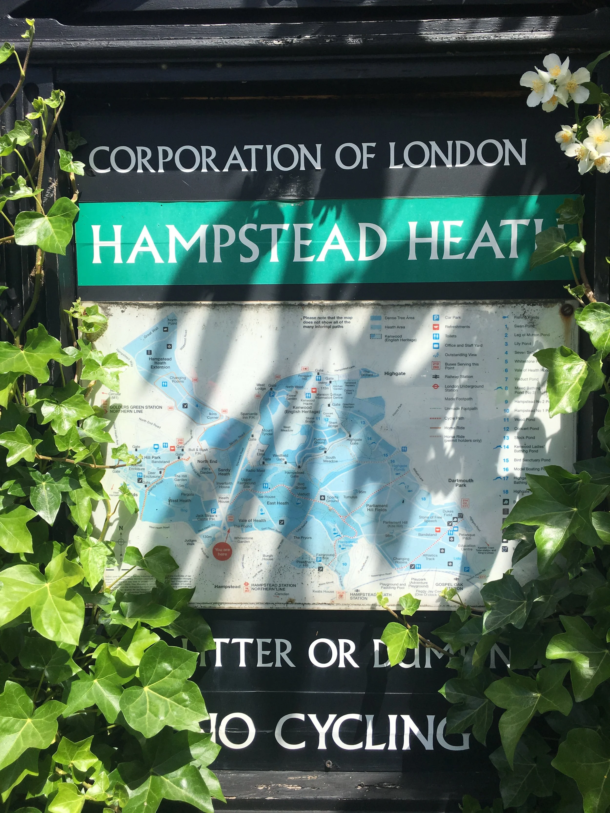
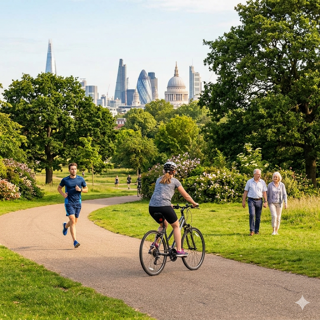
Hampstead Heath
Start: Heath Brow Car Park 12 North End Way, Hampstead, London, NW3 7ES
Finish: Blackfriars Bridge, River Thames, London, EC4Y 0AF
Distance: 10.4 km (6.5 Miles)
Elevation change: +40m / -161m. Net -121m
GPX File: get via Buy Me a Coffee
Other Routes Touched (walk): Jubilee Greenway, Regents Canal Towpath, Thames Path
Other Routes Touched (cycle): CS3, C6
Map: OS Explorer 173 London North
Guidebooks: London's Lost Rivers: A Walker's Guide, London's Lost Rivers, London's Hidden Rivers: A walker's guide to the subterranean waterways of London
Links: River Fleet, Hampstead Heath, Blackfriars
For our latest London lost river trip, we walked the 6.5 miles of the Fleet from Hampstead Heath right down to the Thames. The Fleet is actually London's largest subterranean waterway and used to flow openly through the centre of the city. However, after centuries of serving as a rather fragrant open sewer—famously mocked by writers like Alexander Pope and Jonathan Swift—it was finally bricked over and buried in the 1700s. Nowadays, the only parts of it that are still visible are right near the source up at Hampstead. Despite the lack of an actual flowing river for most of the way, tracing its route makes for a brilliant couple of hours exploring some incredibly interesting places across the city.
We mostly stuck to the route described in Tom Bolton's book London's Lost Rivers. Our main diversion from his path was to veer off to visit Camden Lock about three miles in, and then follow the Regent's Canal down to King's Cross station. The distance works out to be roughly the same, but walking the canal path is much more pleasant than navigating the back roads that strictly trace the old riverbed. Plus, it takes you past the historic gasometers and the spot at King's Cross where the Fleet still silently rushes directly beneath the bustling train platforms.
There is an absolute wealth of London history to take in along the way, including passing the famous Mount Pleasant sorting office, which sits securely over the hidden river, and finishing at Blackfriars Bridge. If you time it right and look closely at low tide, you can actually see the Fleet emptying into the Thames through a grate under the bridge! I will not cover every historical detail here, as Tom Bolton's book is a very thorough guide and well worth stuffing into your rucksack. The Londonist video is also a great primer to watch before you head out.
Getting there and back is pretty straightforward. We parked at Heath Brow Car Park (NW3 7ES), which is right next to the start of the western source at Whitestone Pond. It is a lovely spot—in fact, it is said that the poet Percy Bysshe Shelley used to sail paper boats there—but while it is highly convenient, it is also rather expensive at £20 for the six hours we needed to complete the round trip. Once you reach the Thames, the best route back is via the Underground: catch the Circle or District Line from Blackfriars to Embankment, then swap to the Northern Line up to Hampstead, leaving you with less than a half-mile walk back to the car.


More London posts
If you enjoyed reading this post, there is plenty more to explore across the capital. I have put together a dedicated London Outdoors page where I keep track of all my other adventures around the city. It is a handy index where I group my posts by the different types of places I have visited: including historic boundary lines, canal towpaths, and some surprising urban high points.
The collection covers a bit of everything: from long-distance cycling routes to tracing the underground network on foot, and ticking off another Saturday morning parkrun. If you are looking for some inspiration for your own weekend outings, head back over to the London Outdoors page to see what else I have been up to.