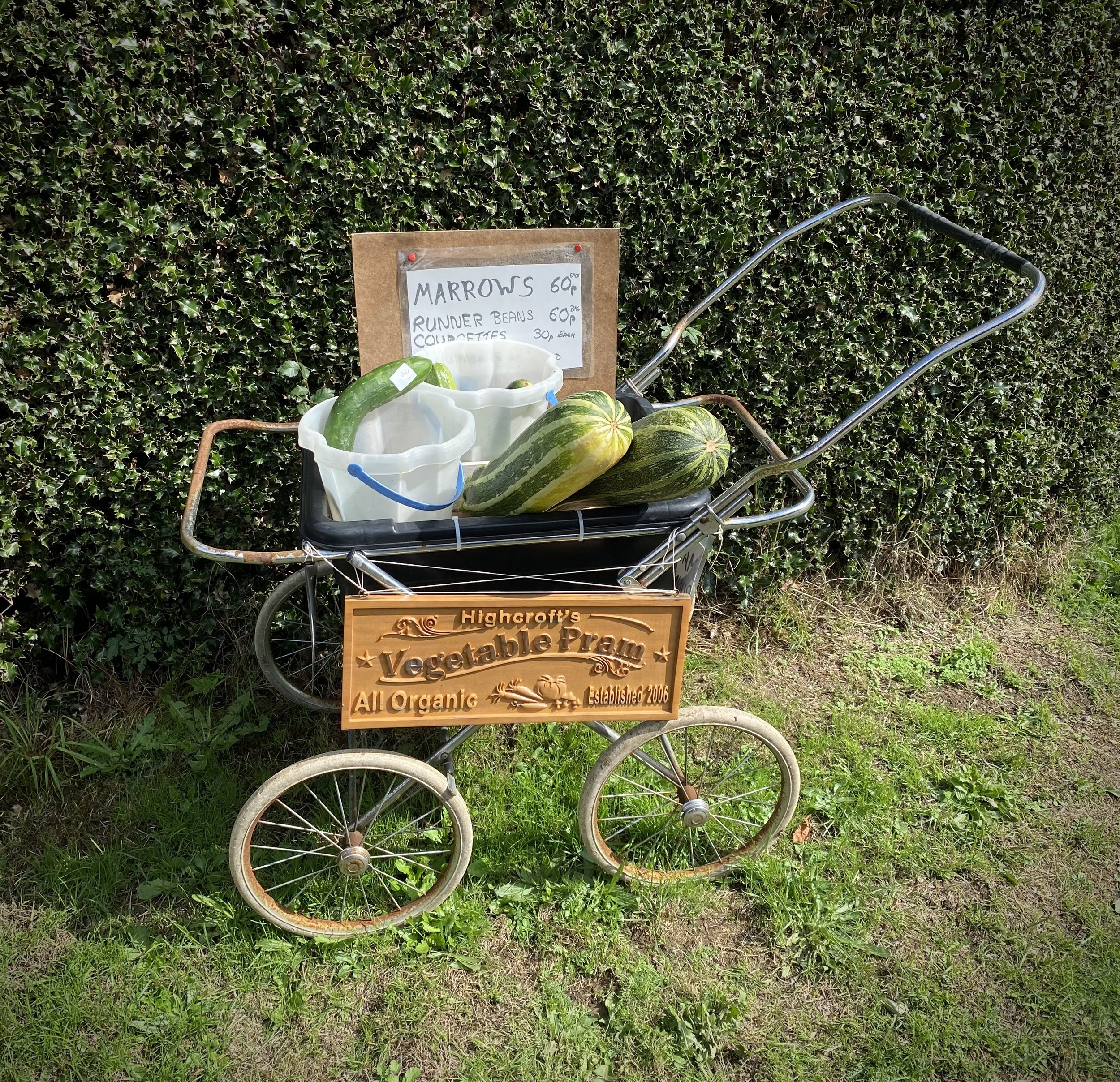
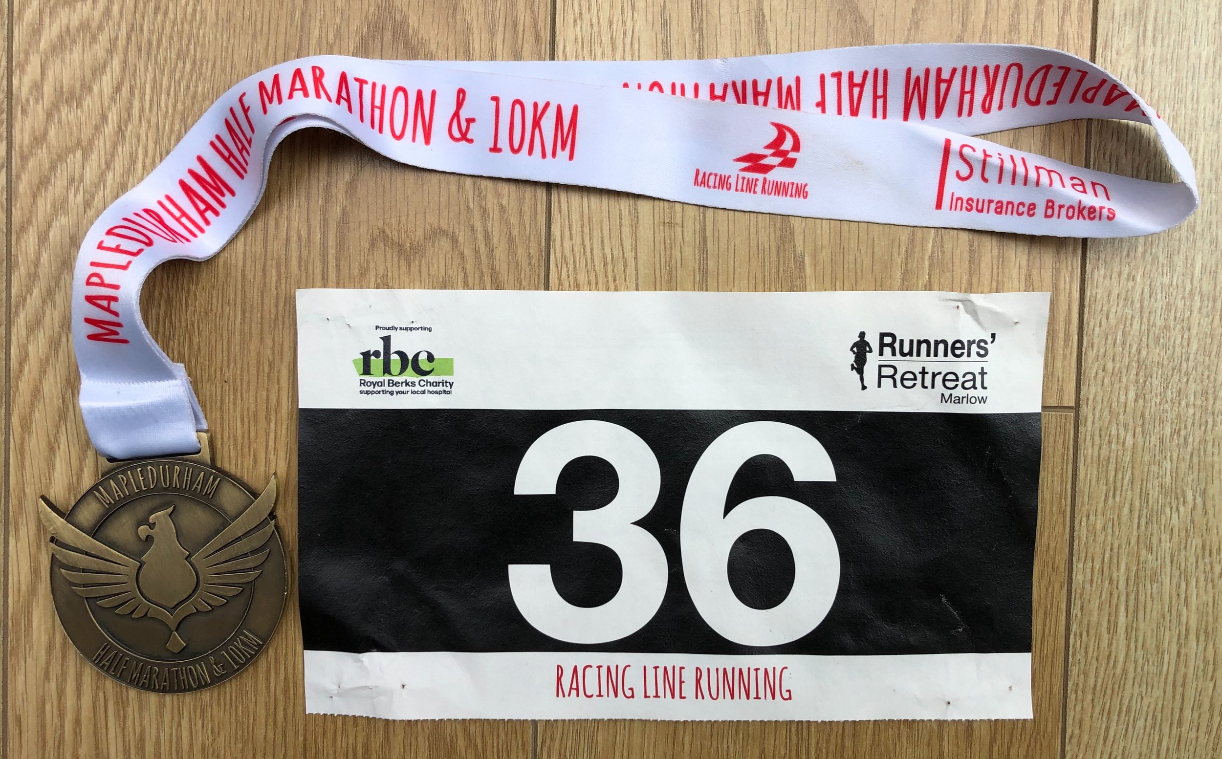
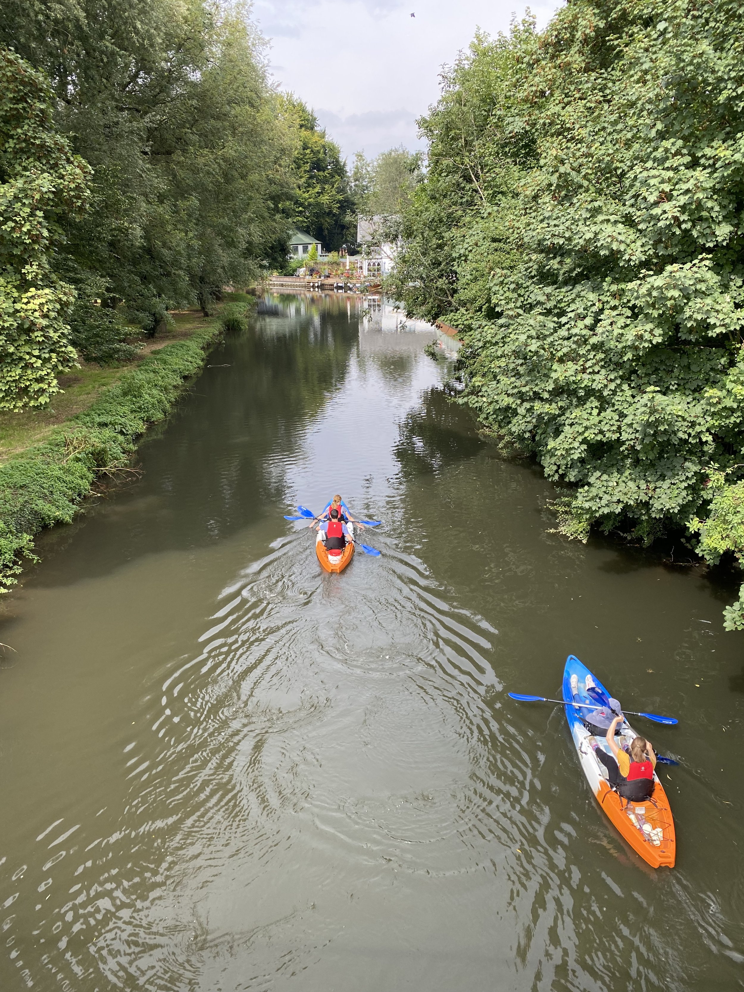
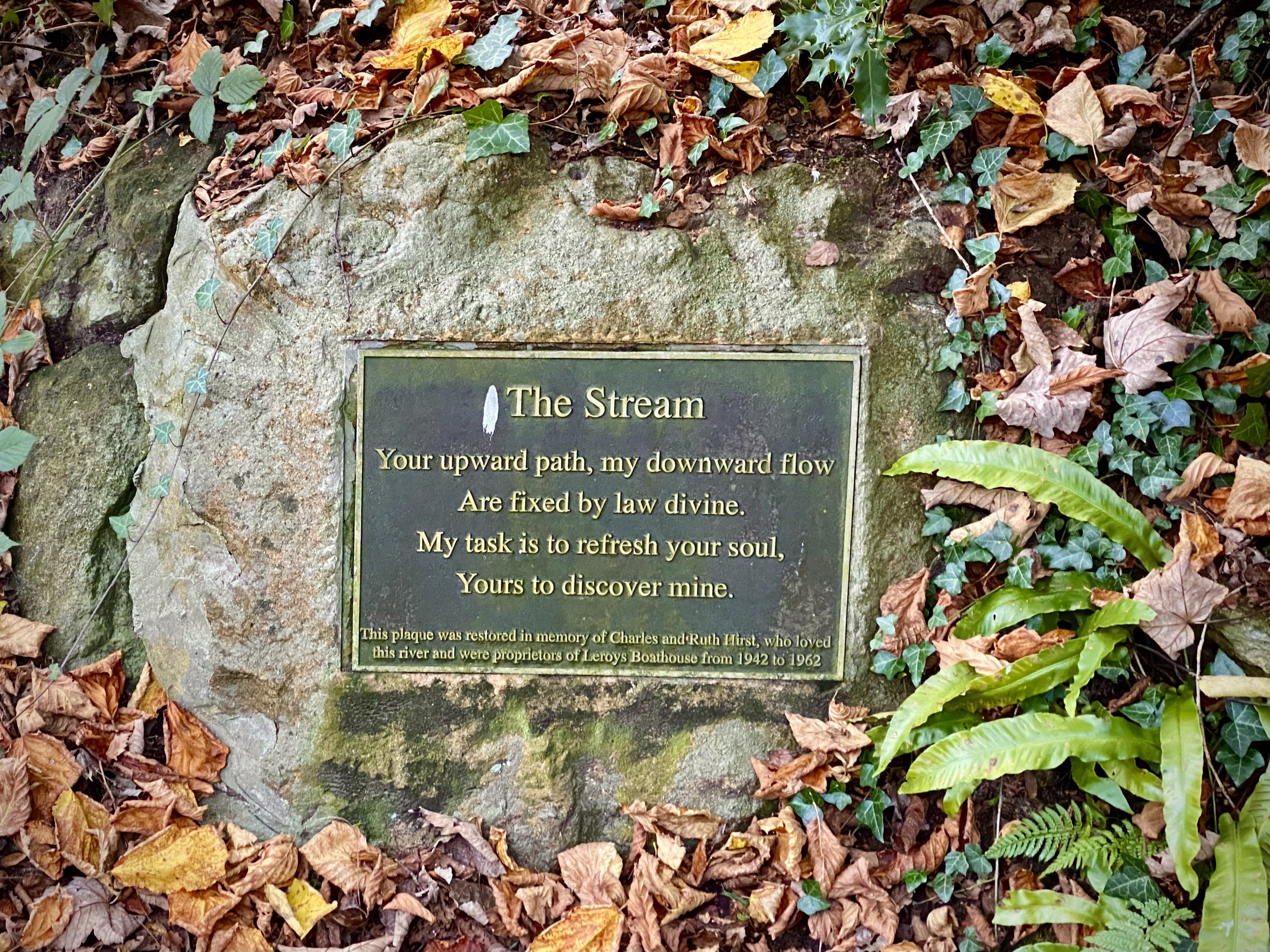
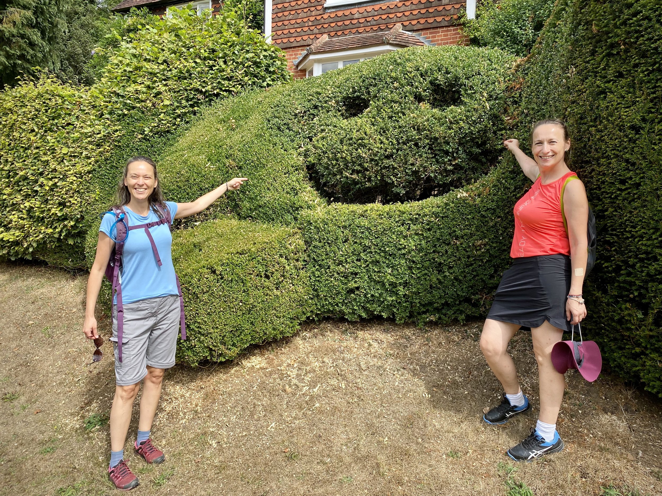
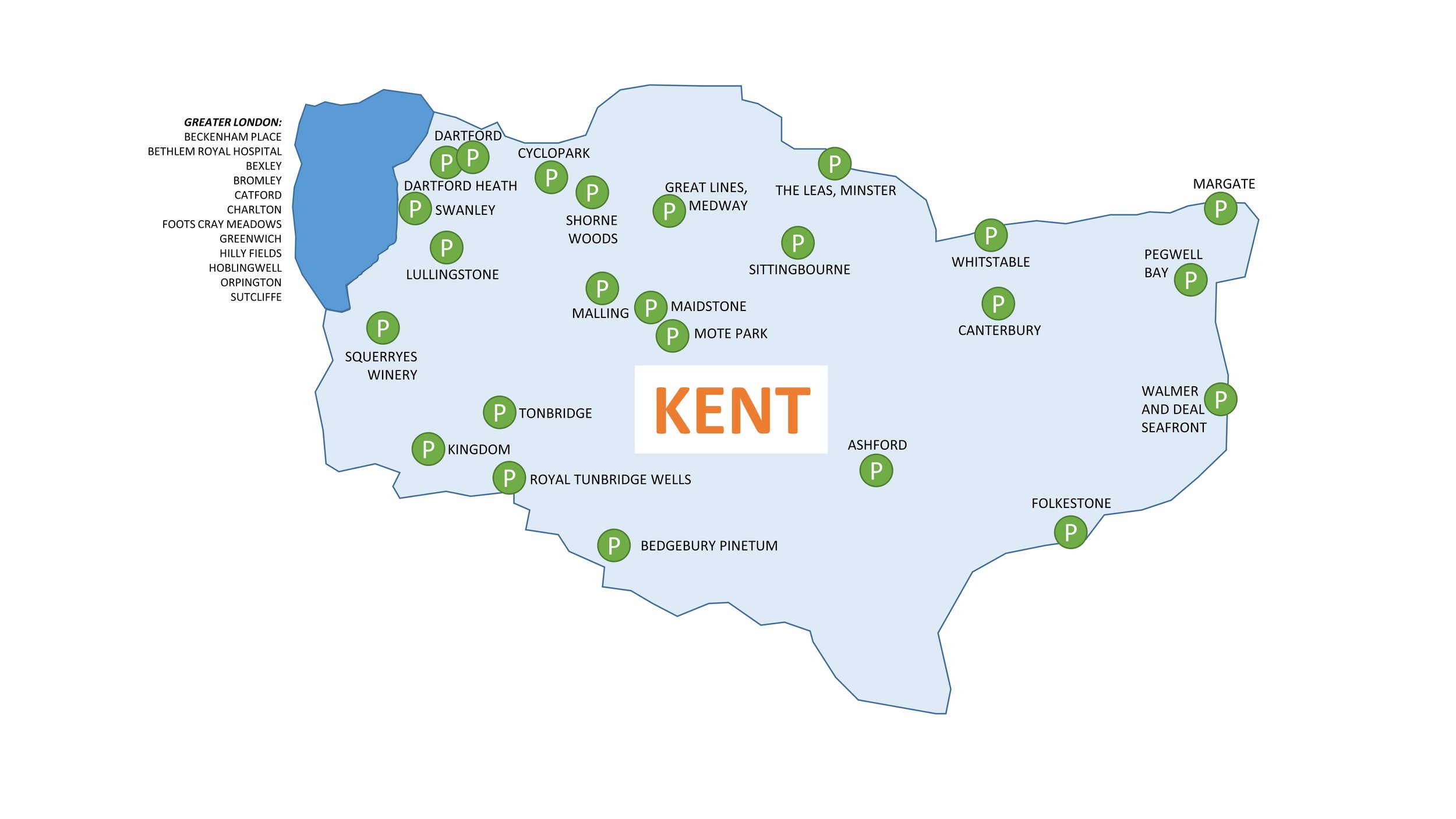
When: October 16th 2022
Where: Frieth Church of England Combined School, Henley-on-Thames, RG9 6PR
Course: Single loop from Freith through Fingest, Skirmett and Hatchet Wood
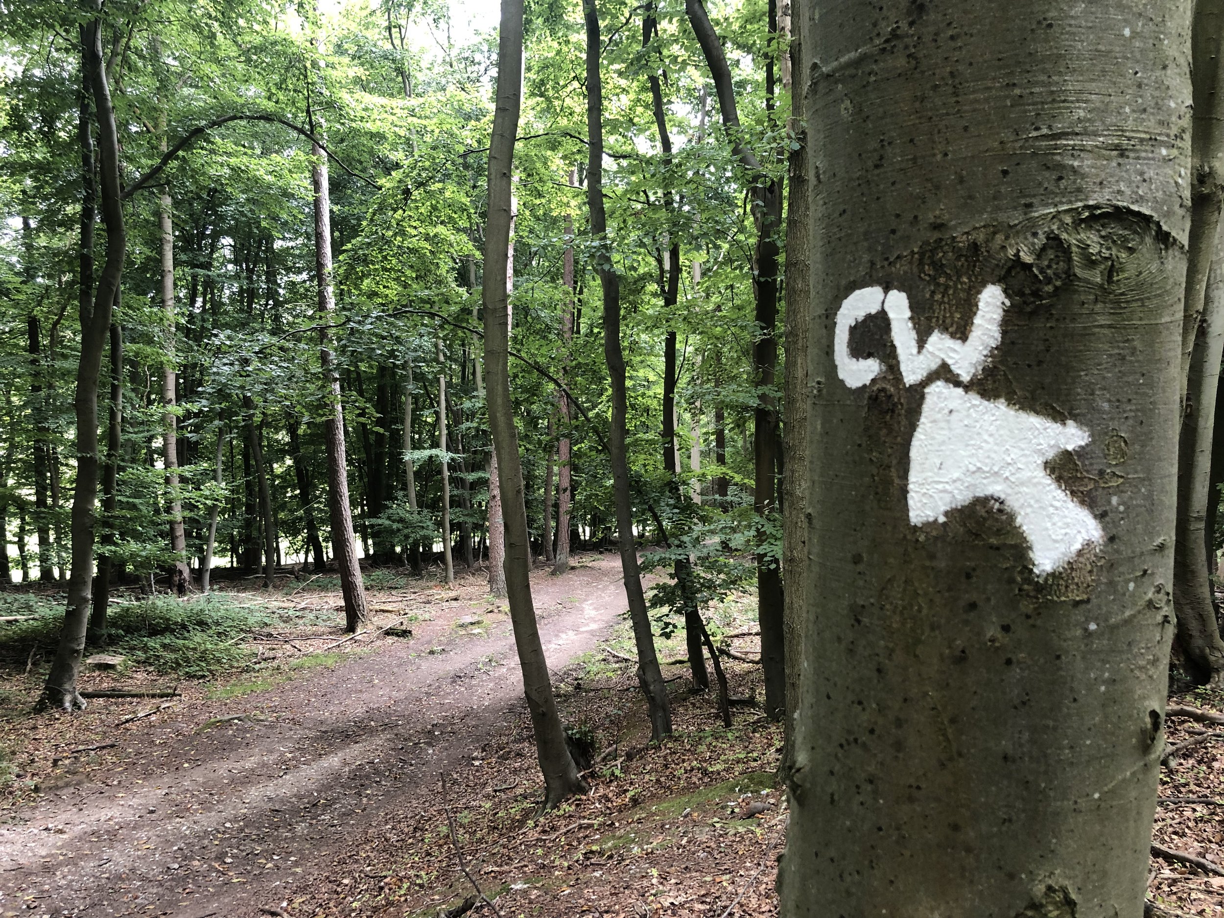
Other routes touched (walk): Chiltern Way
Finish time: 57:52
When: October 16th 2022
Where: Frieth Church of England Combined School, Henley-on-Thames, RG9 6PR
Course: Single loop from Freith through Fingest, Skirmett and Hatchet Wood
Other routes touched (walk): Chiltern Way
Finish time: 57:52

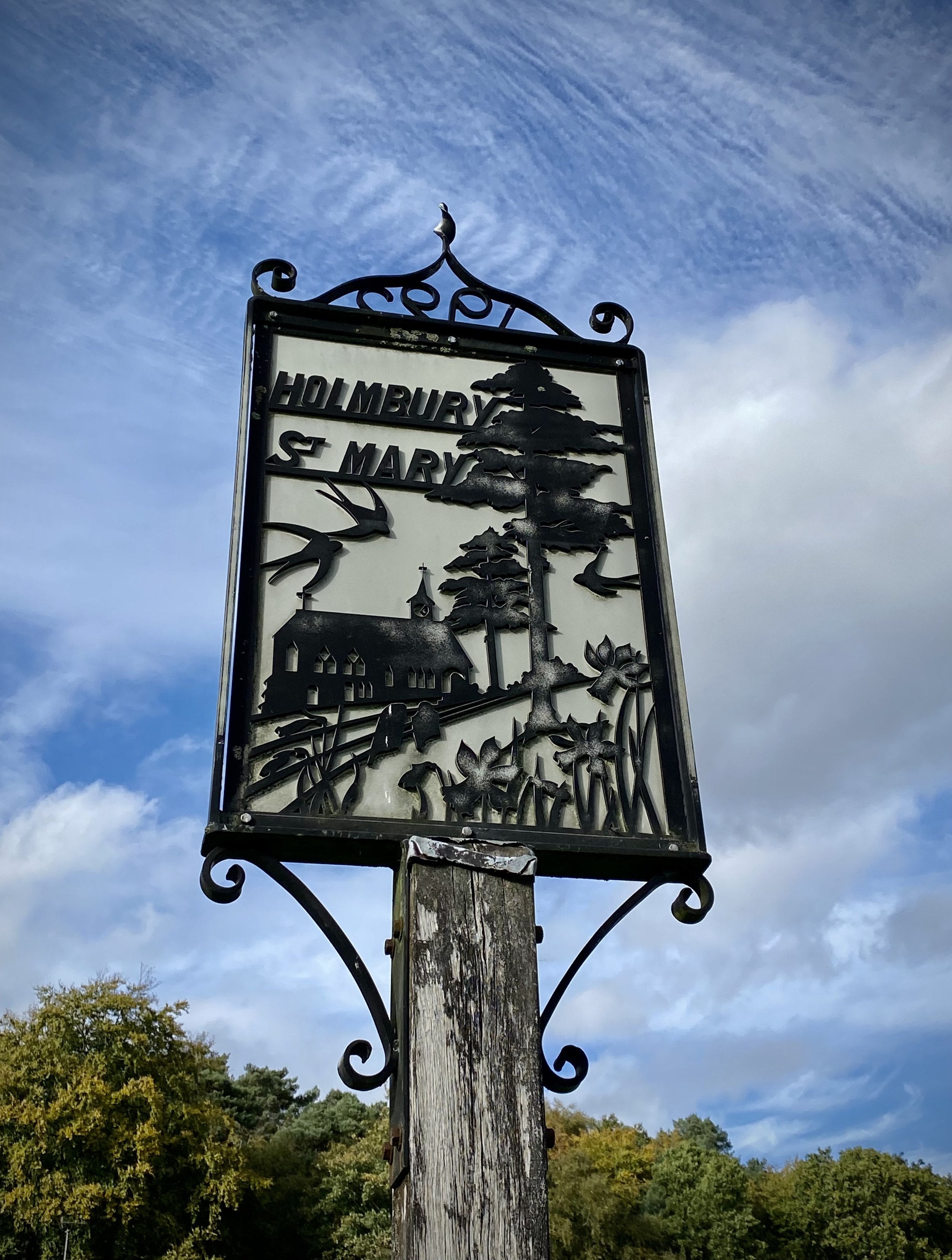
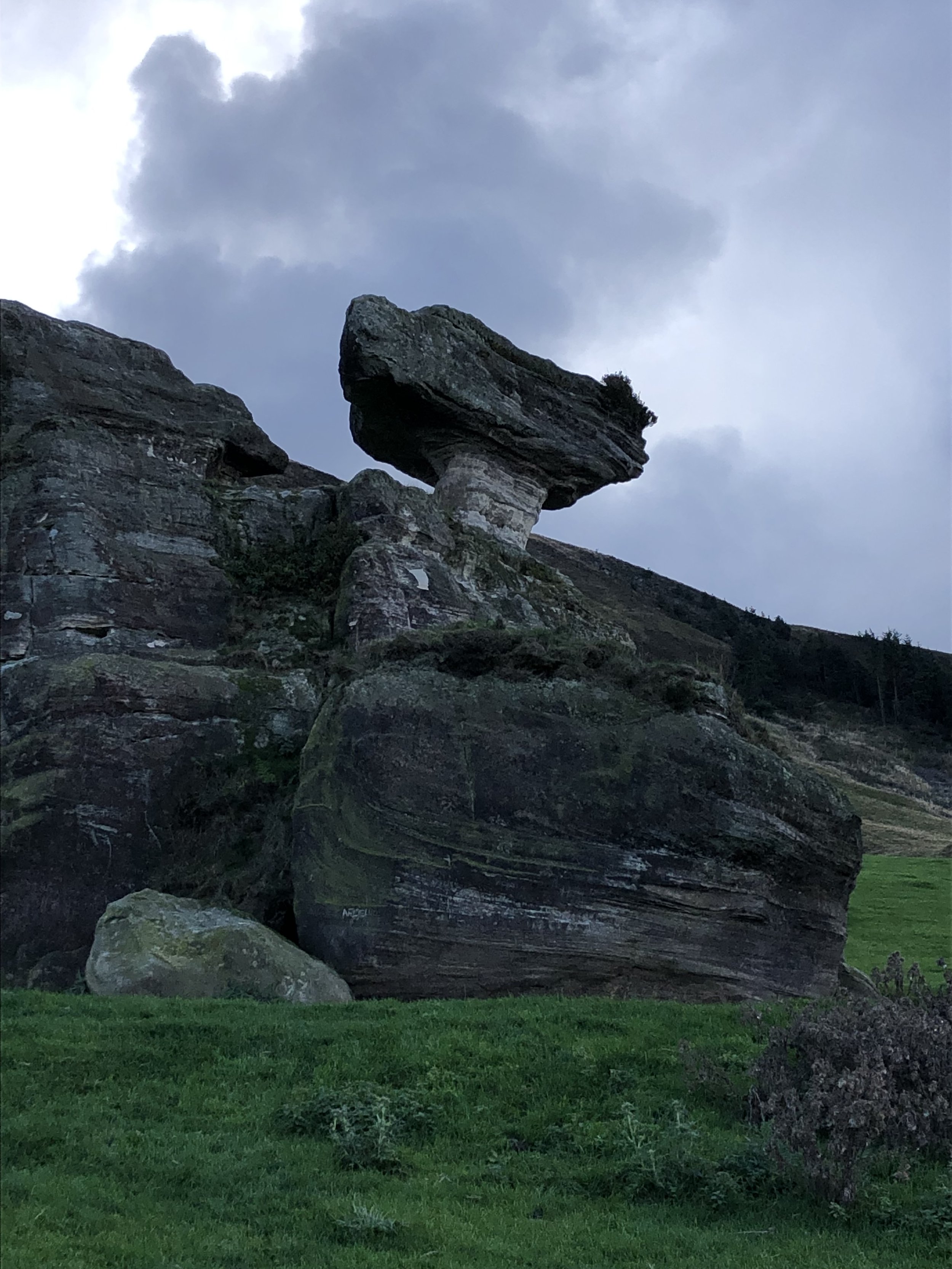
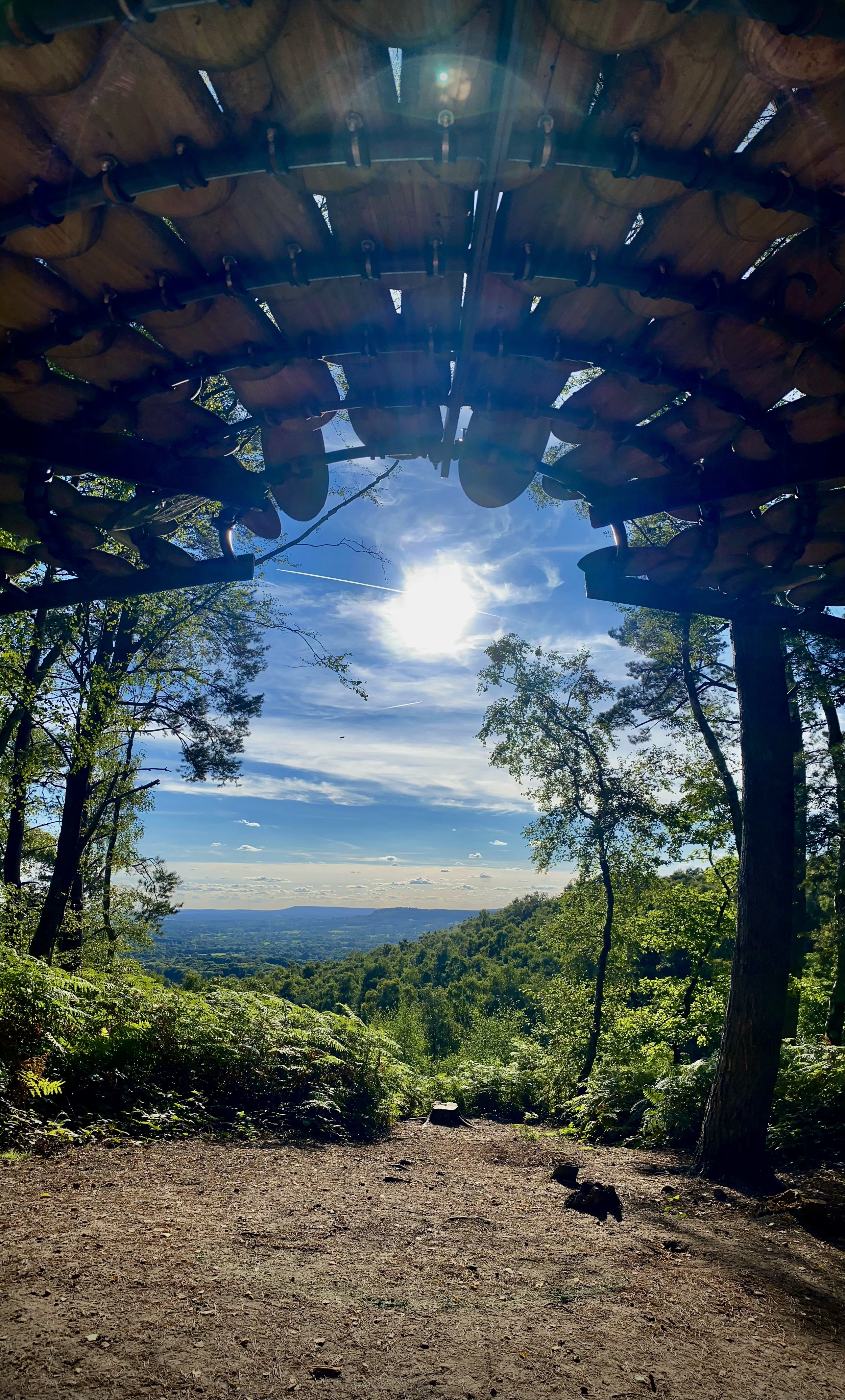
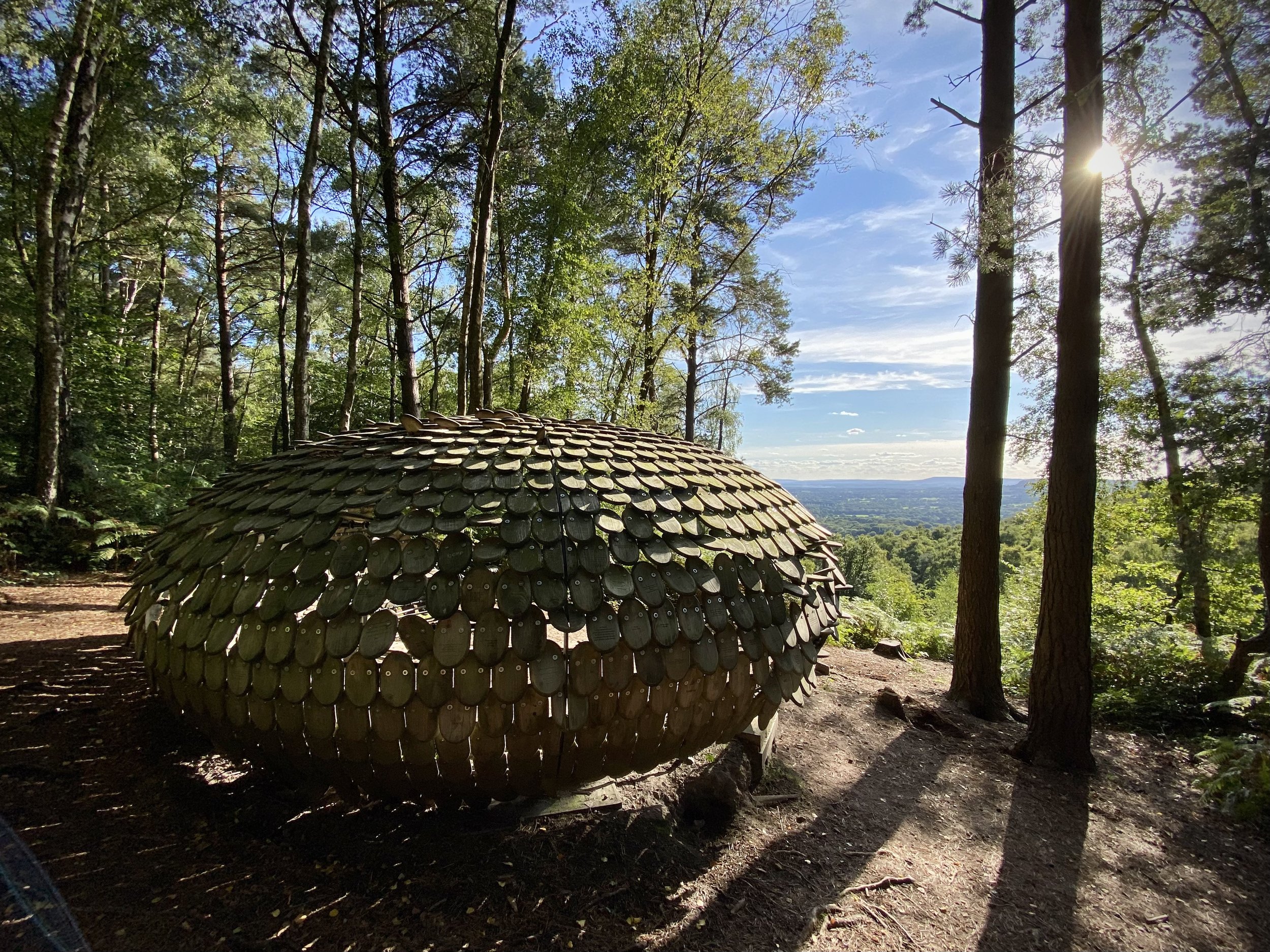
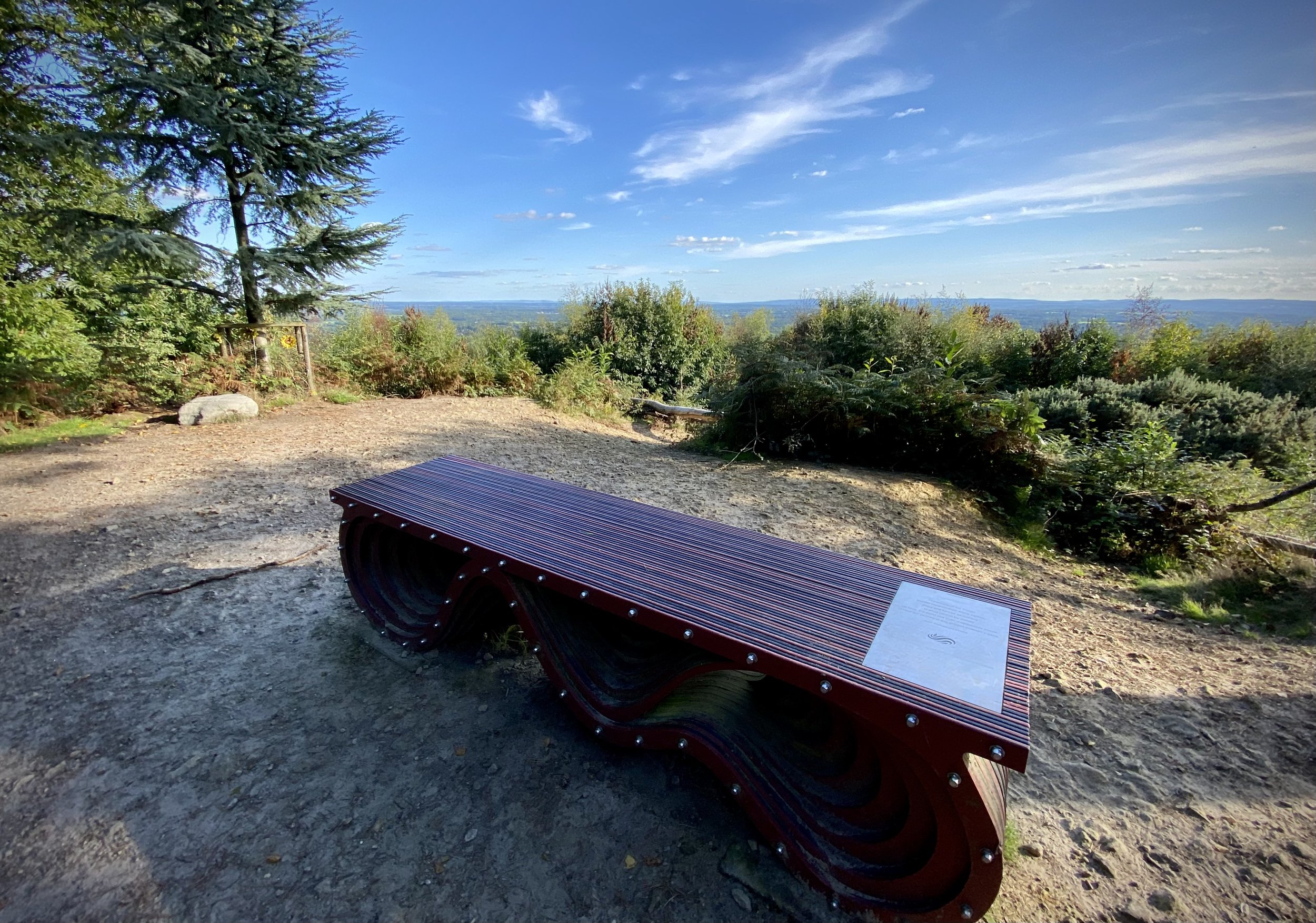
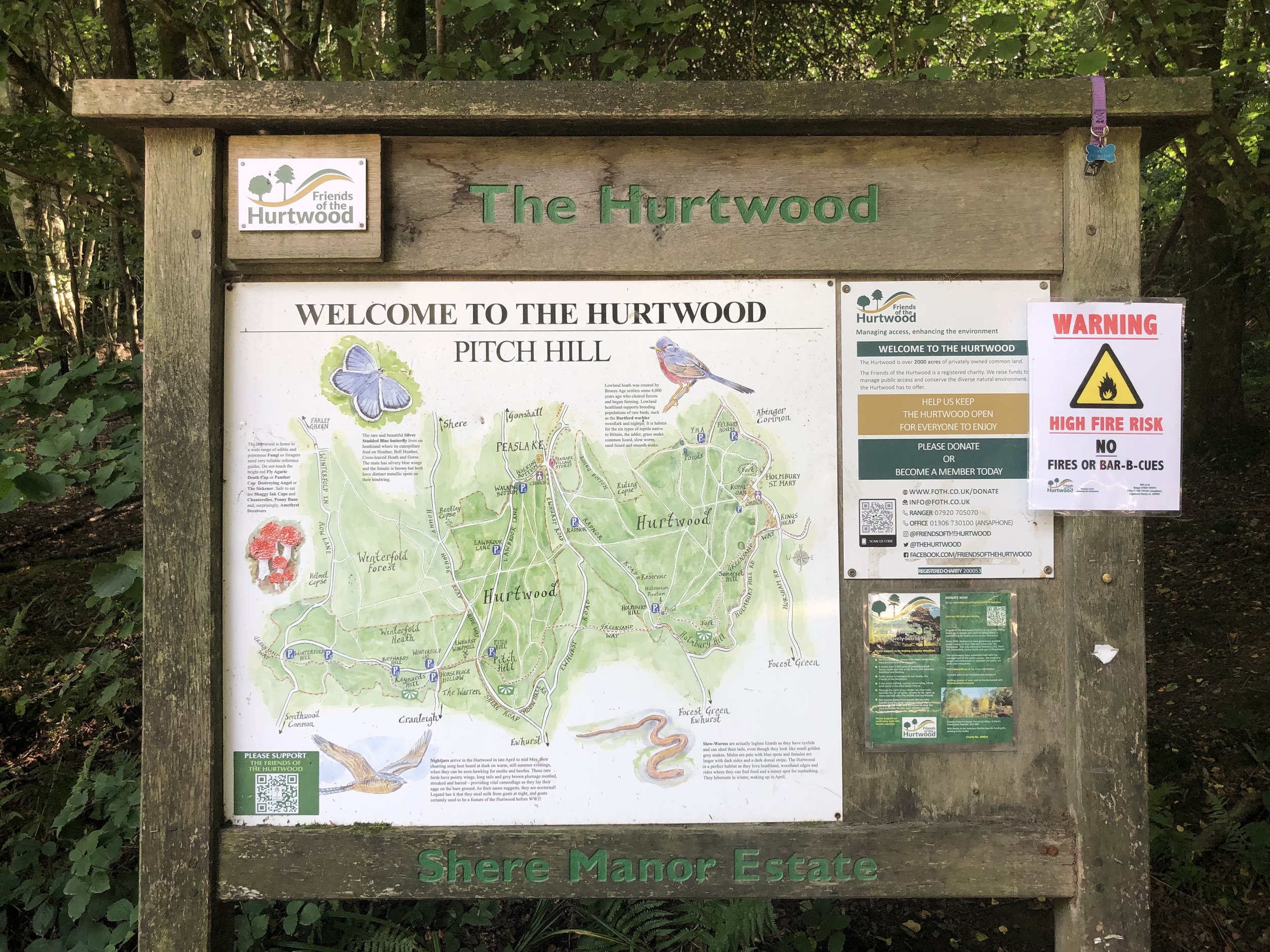
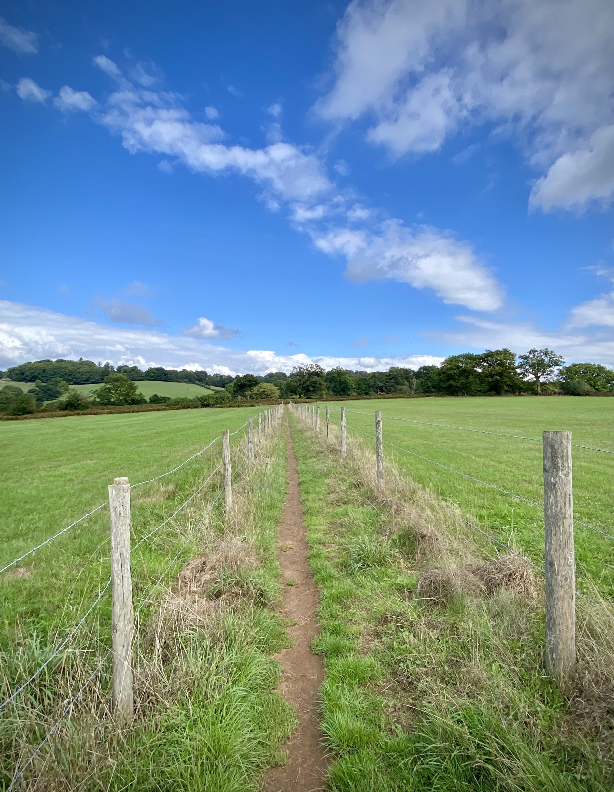
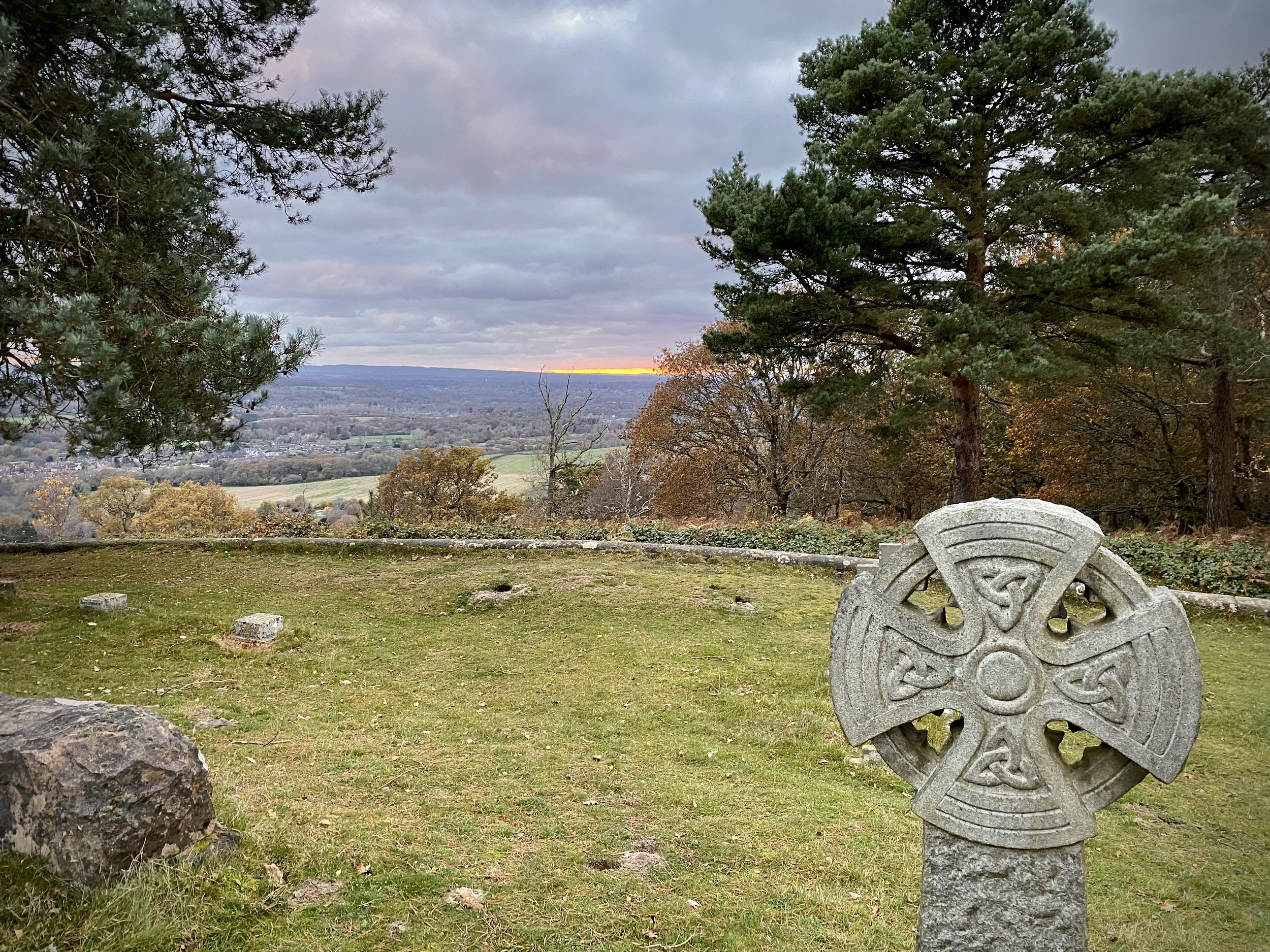
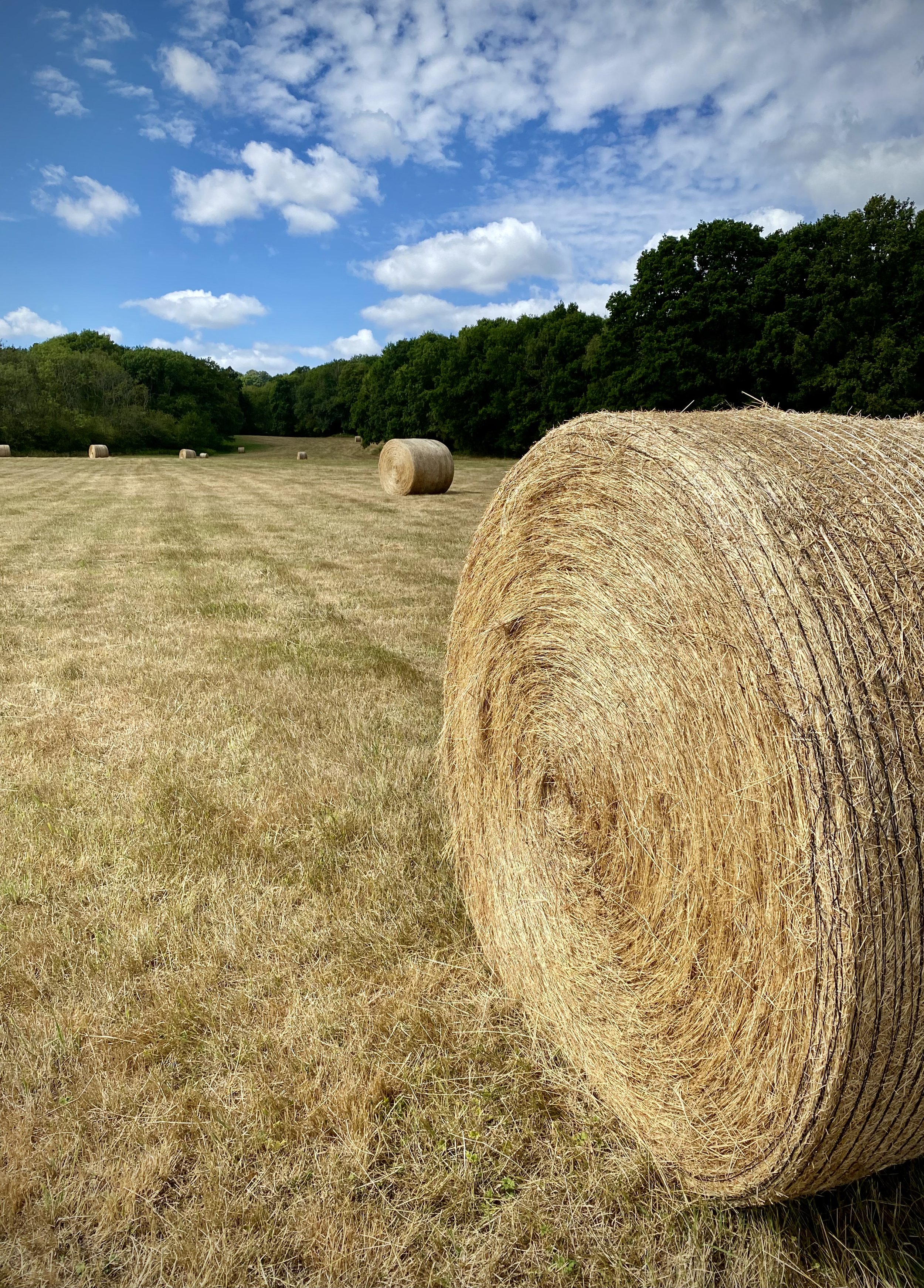
Pitch Hill Viewpoint
Start & Finish: Hurtwood Car Park 3, Pitch Hill, Cranleigh, GU6 7NL
Distance: 10 km (6.2 miles)
Elevation change: +/- 239m
Greensand Way section covered: Pitch Hill Car Park to Holmbury St Mary: 5.25 km
GPX File: get via Buy Me a Coffee
Other routes touched (walk): None
Other routes touched (cycle): Various mountain bike trails in The Hurtwood
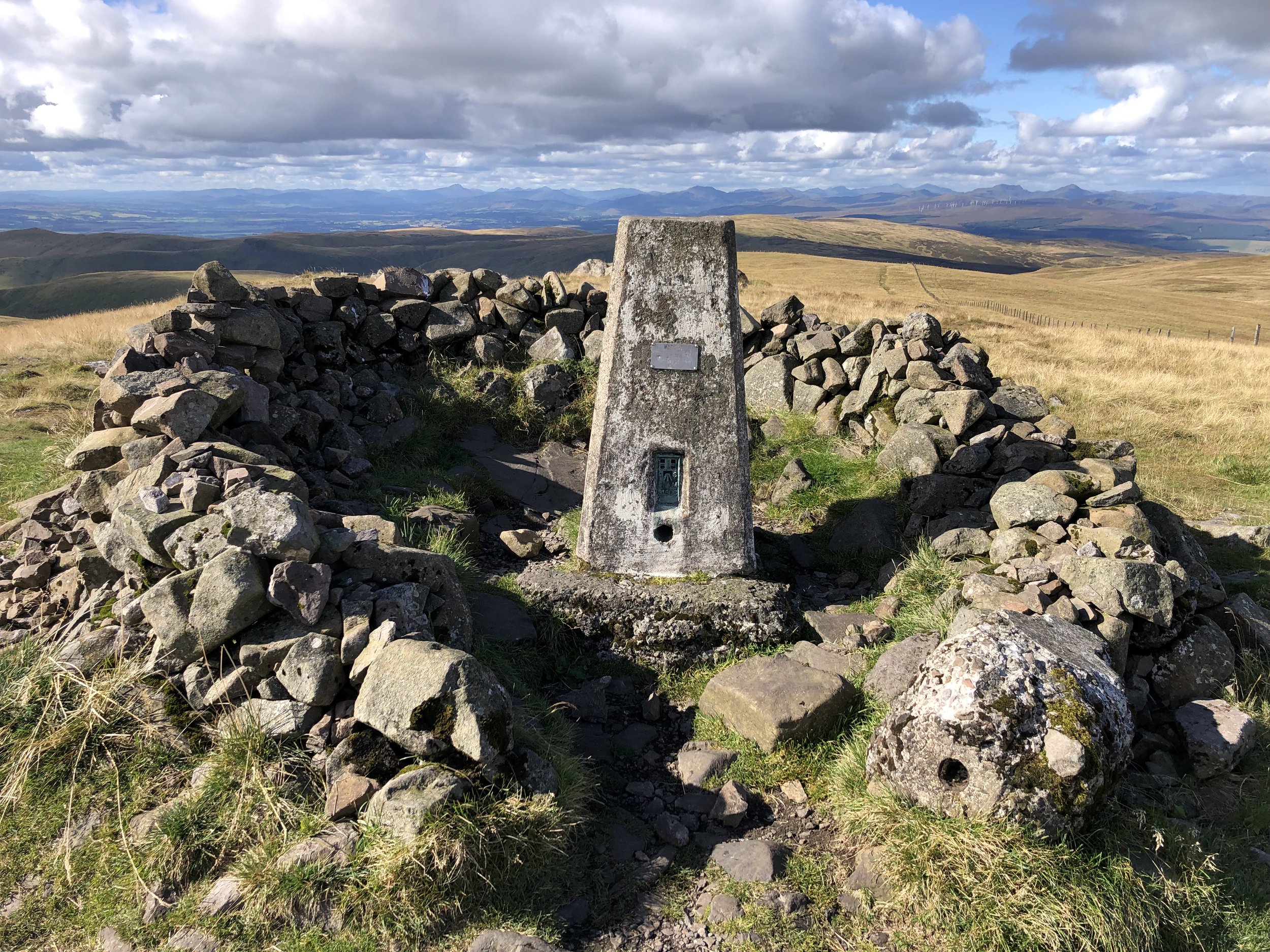
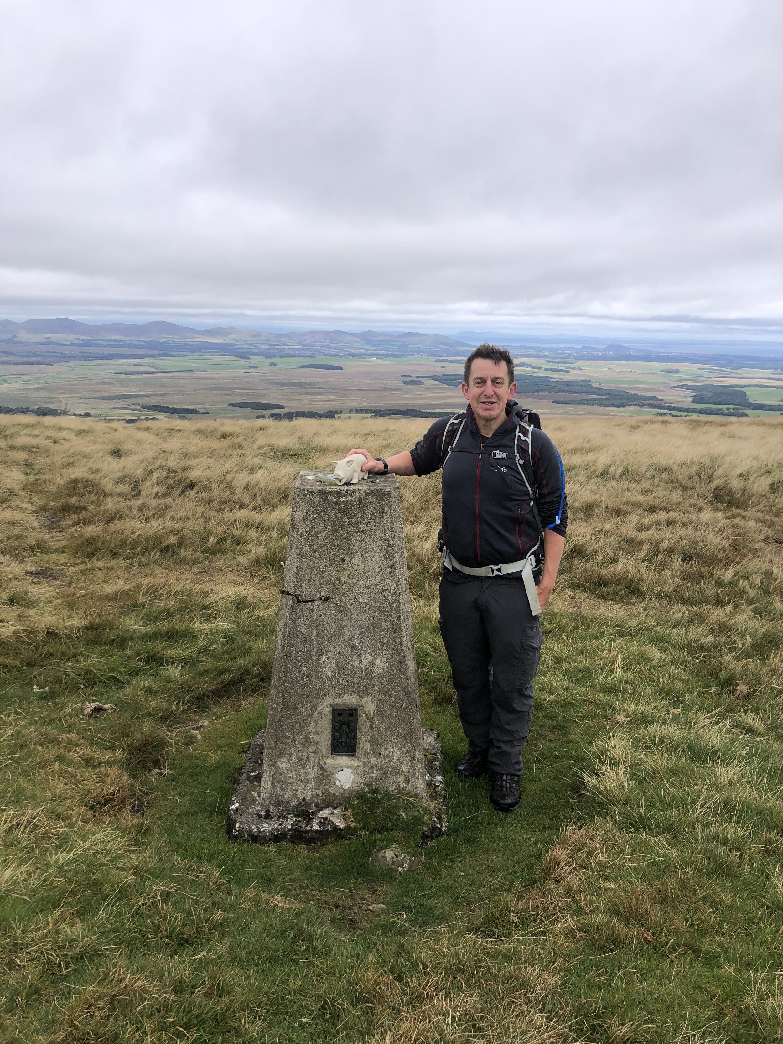
OS Trig Pillar: TP2379 - Coneyhurst Hill
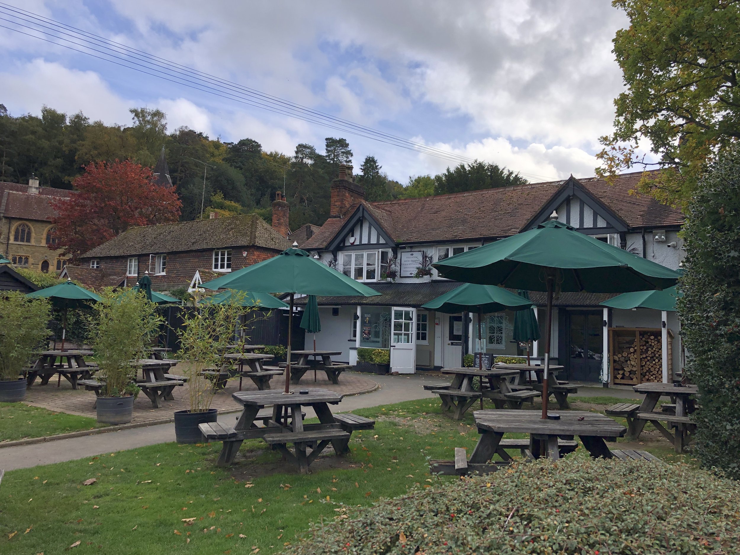
Pubs / Cafes on route: The Royal Oak at Holmbury St Mary (5.8 km in)
Map: Dorking, Box Hill & Reigate Map | Leatherhead & Caterham | Ordnance Survey | OS Explorer Map 146
Links: The Hurtwood, Pitch Hill (Peakbagger), Holmbury Hill (Peakbagger), Holmbury Camp, Holmbury St Mary
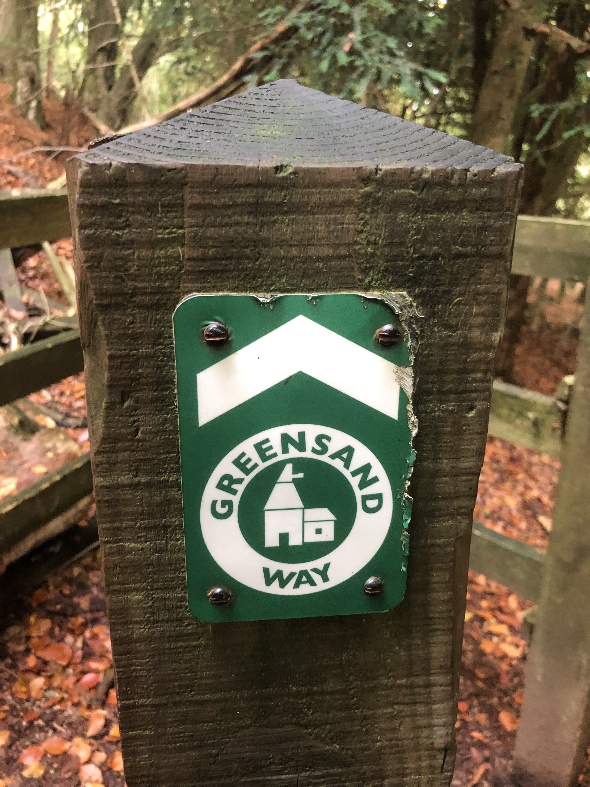
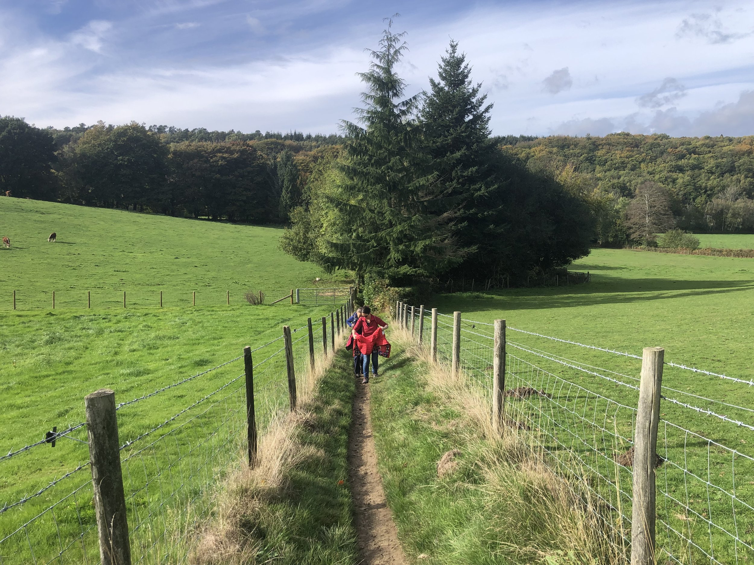
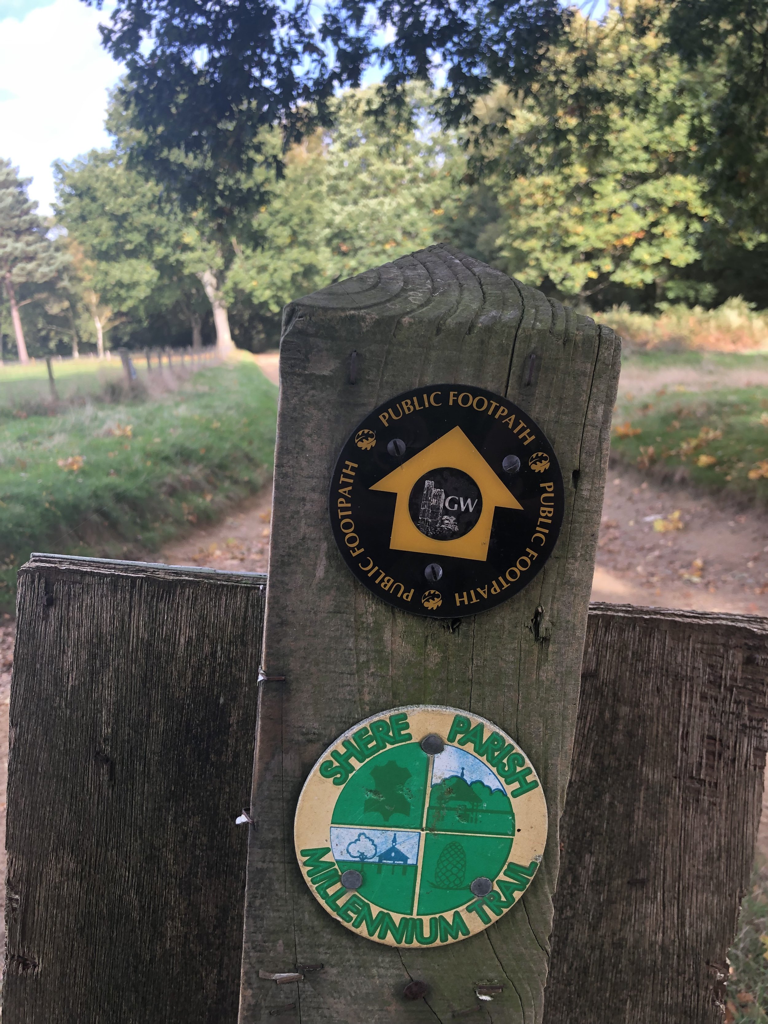
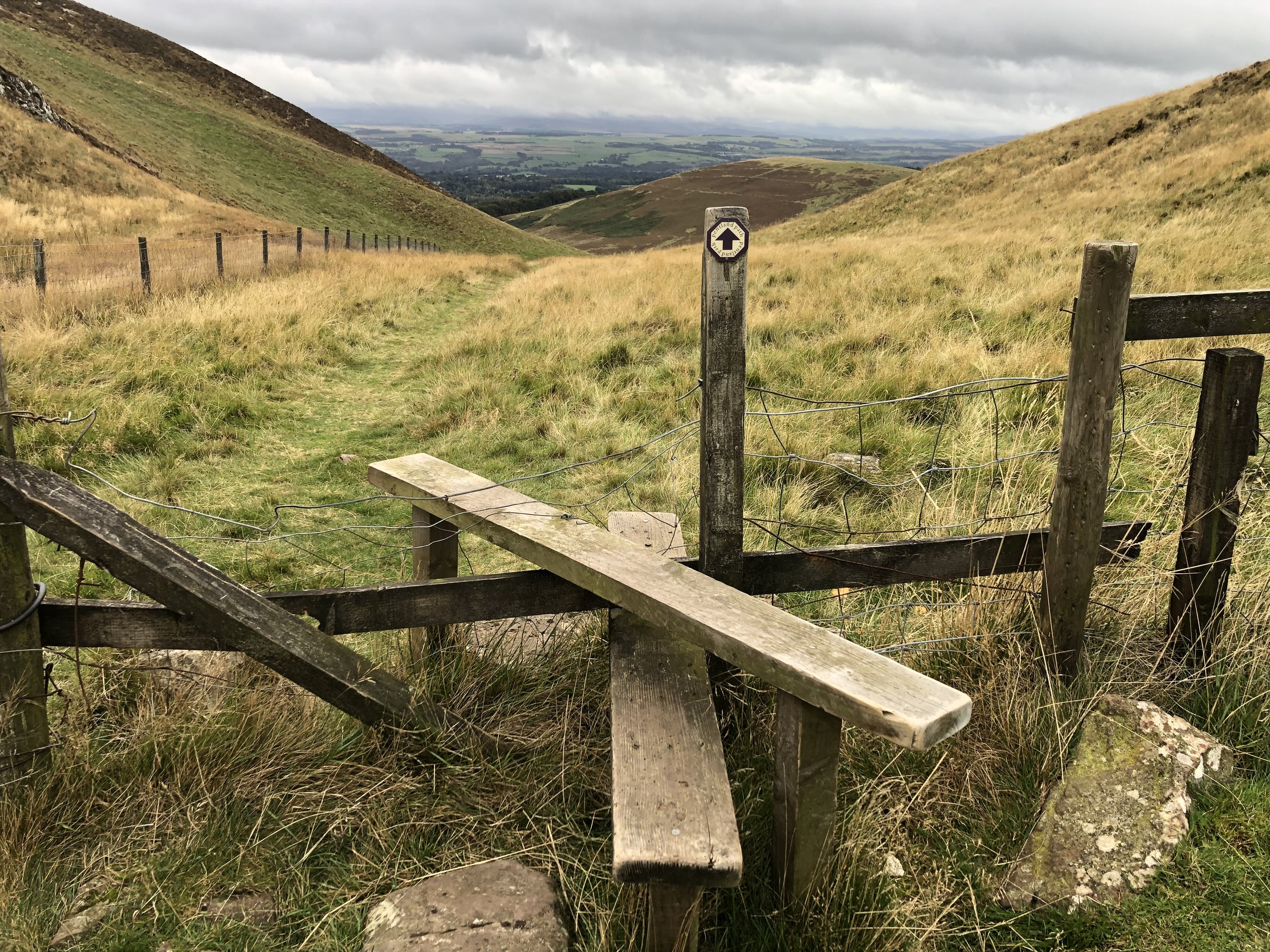
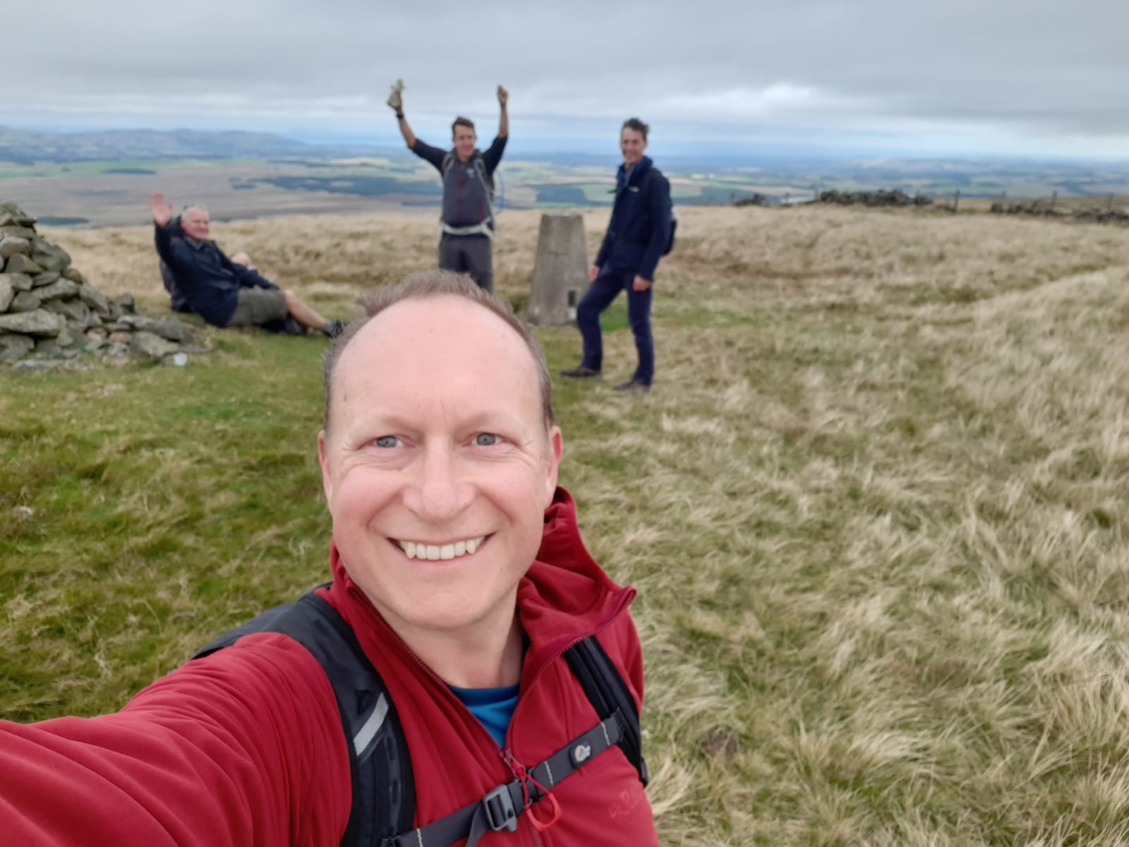
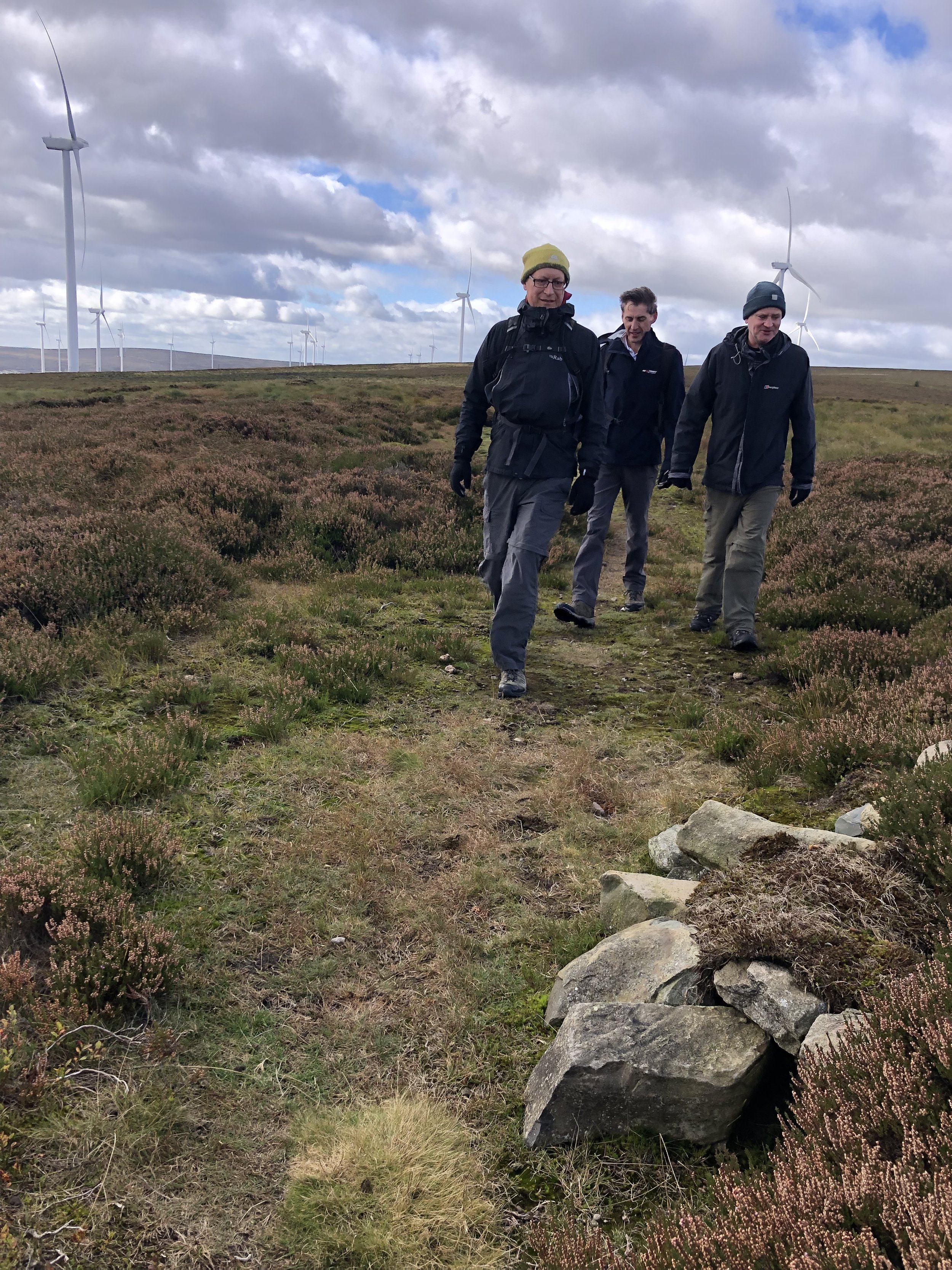
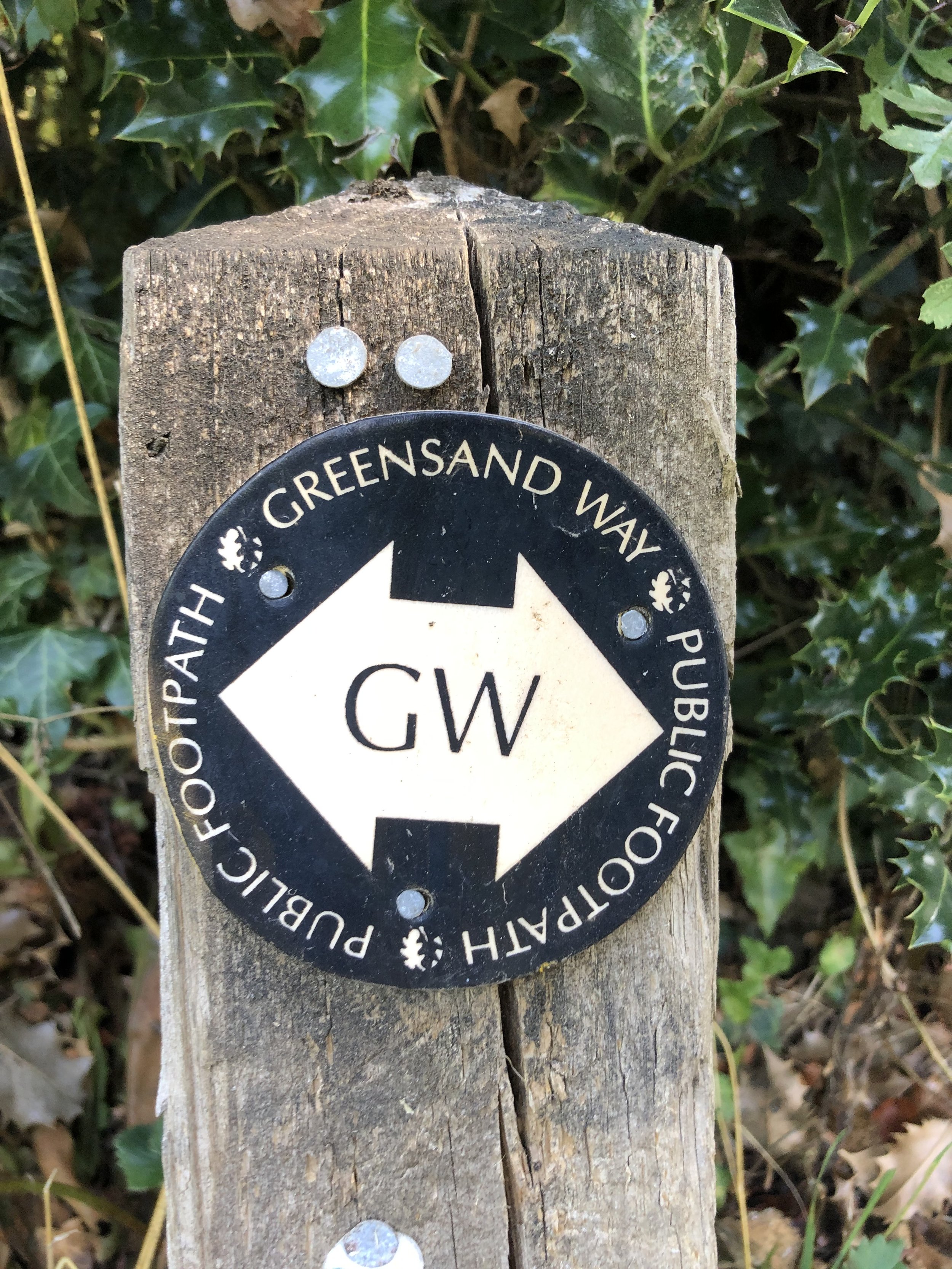
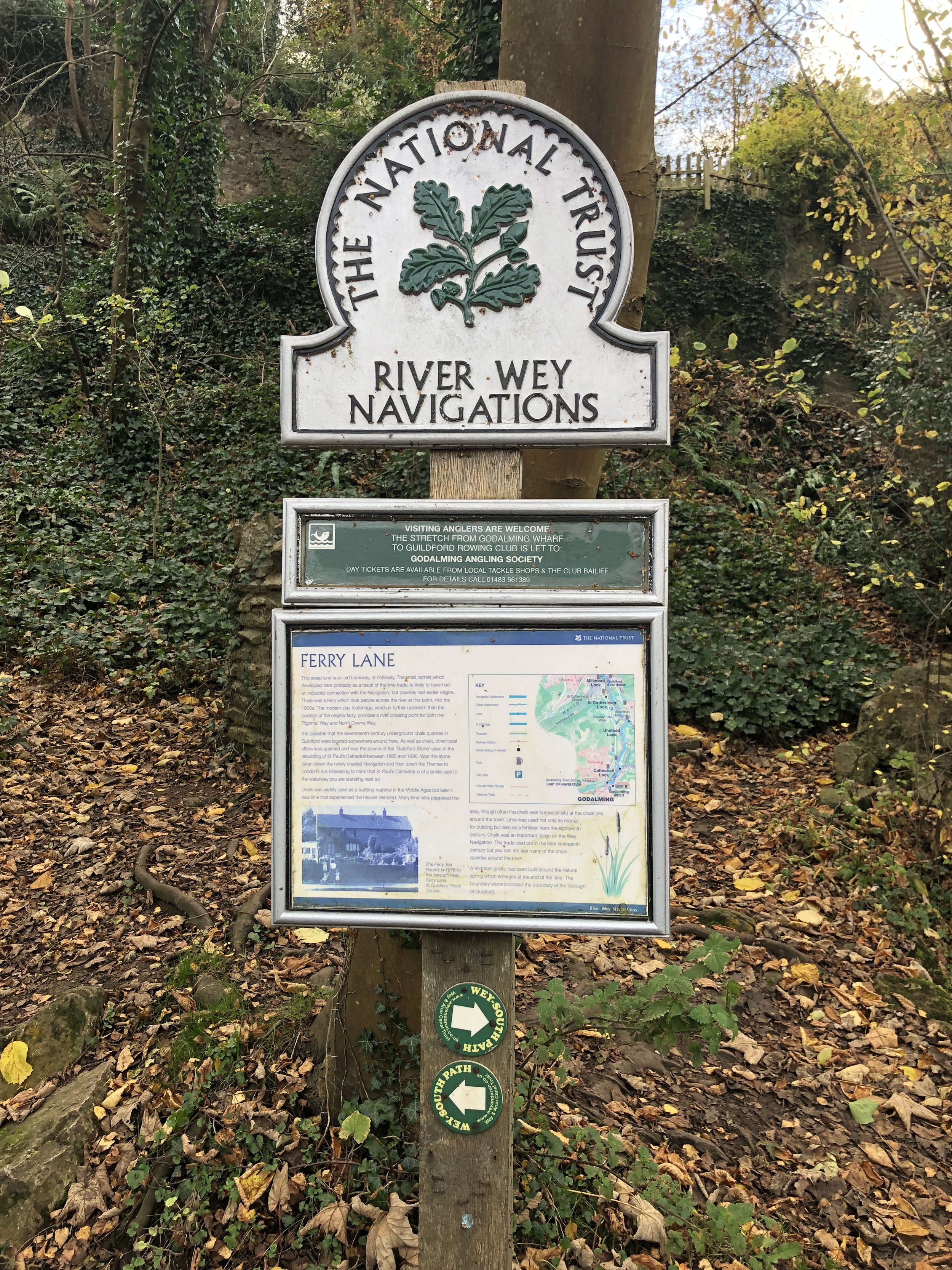
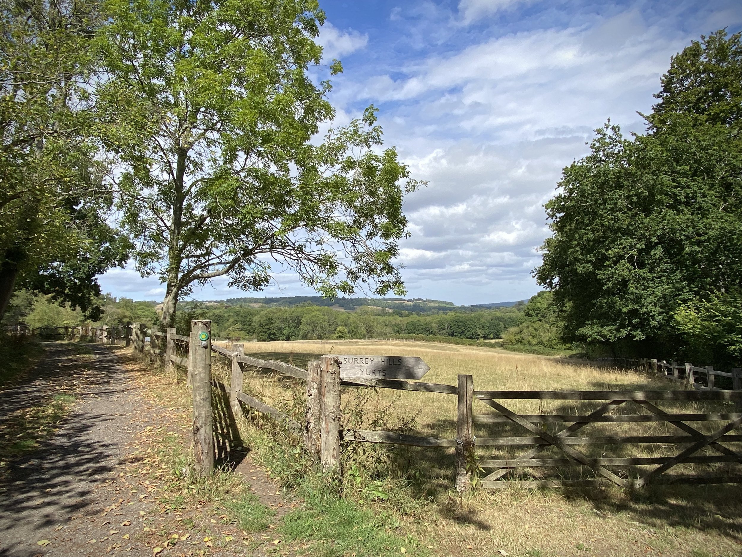
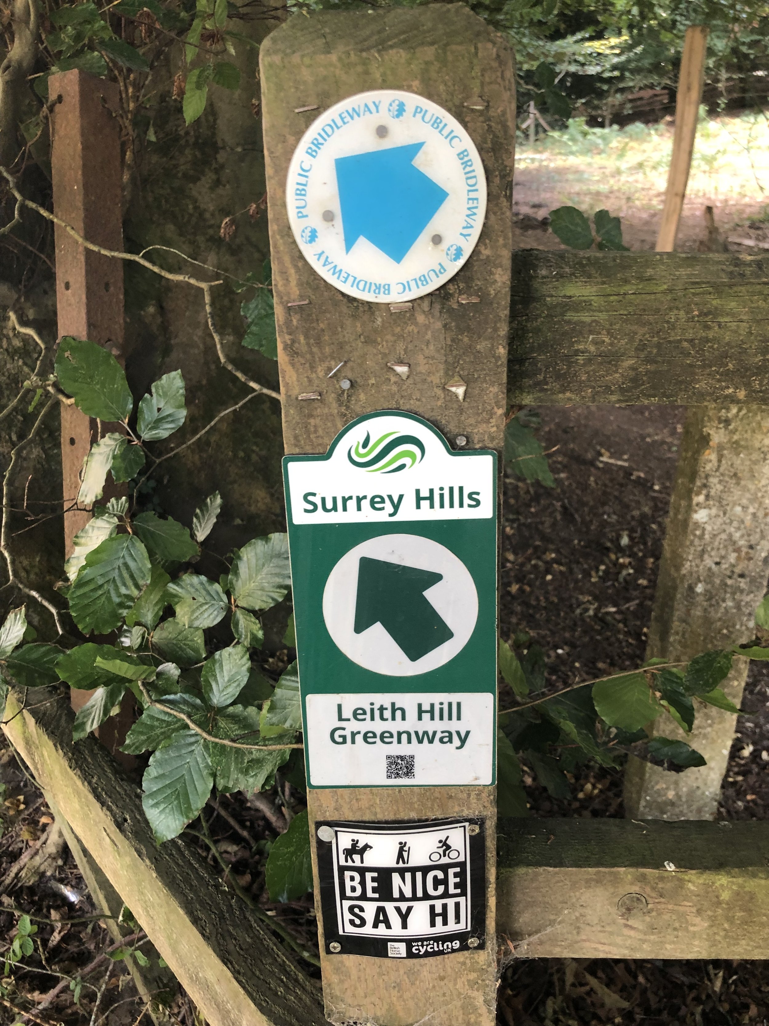
This is the ninth of a series of short circular walks featuring the Greensand Way. The full trail is a long distance path stretching from Haslemere in Surrey to Ham Street in Kent. Our walks take in short sections of the Greensand Way and loop back to the start on other paths. The Greensand Way is well sign posted however you’ll need a map or GPX route to keep on track for the return sections of the loops. The guidance below will help but don’t use it as a fully accurate turn-by-turn guide.
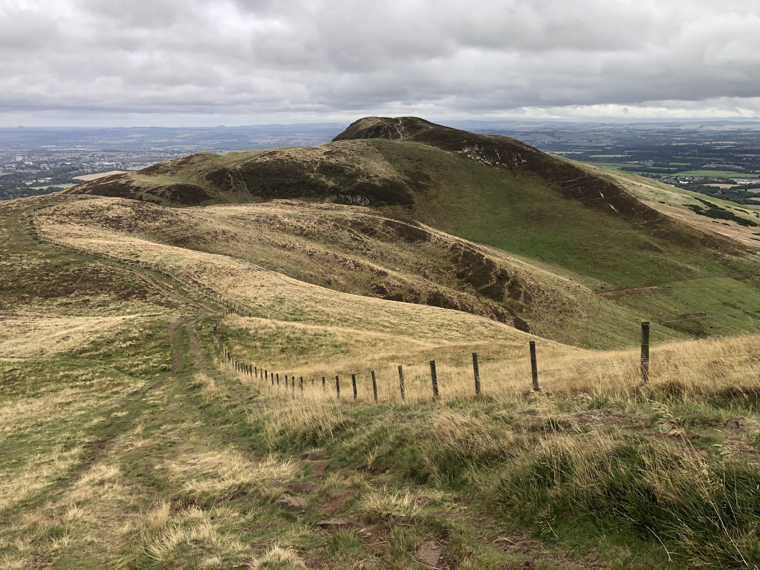
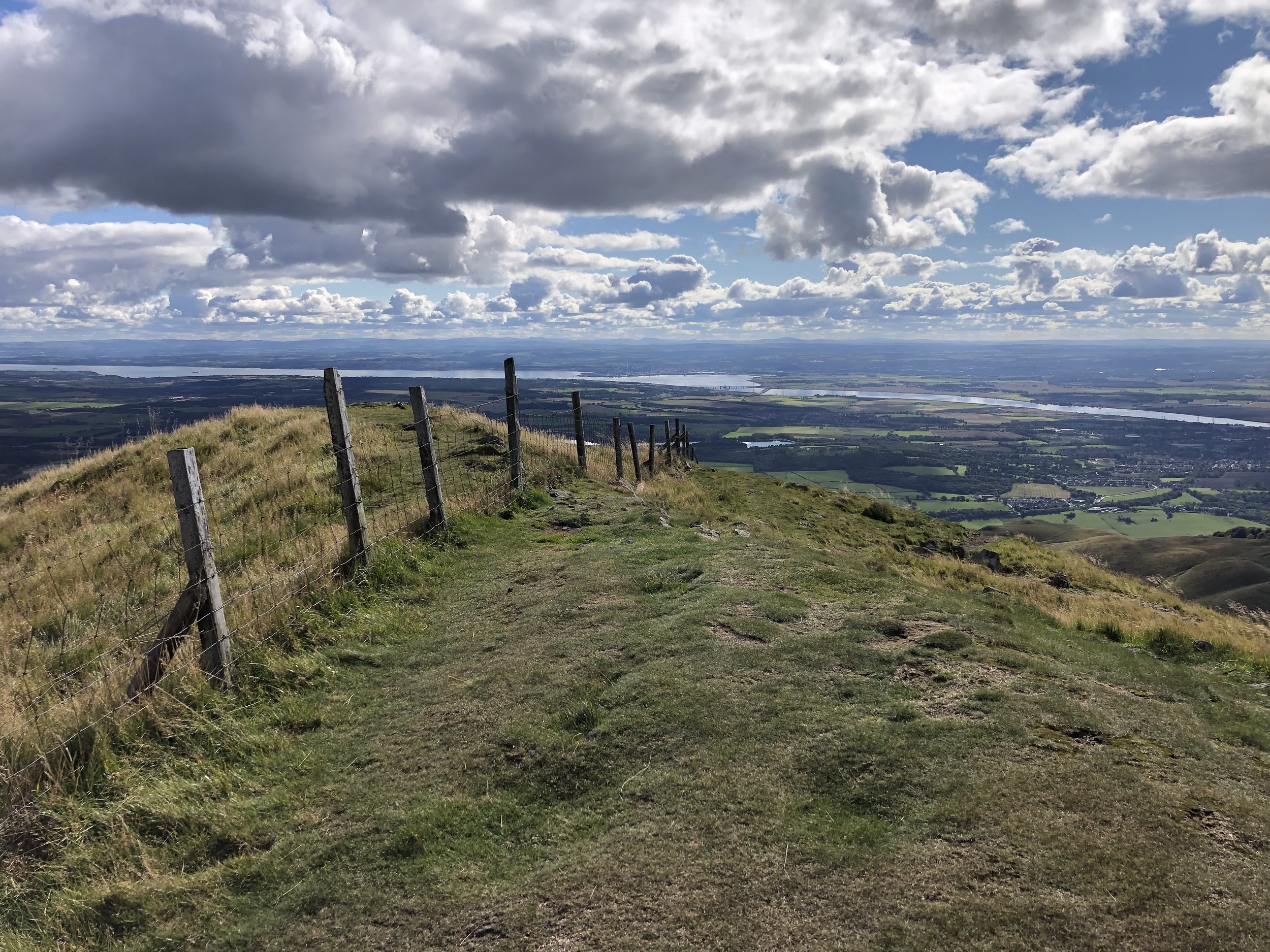
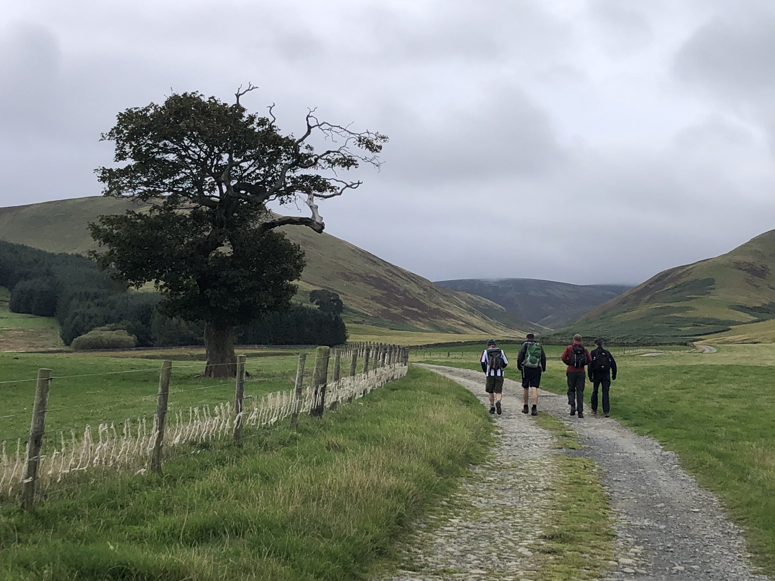
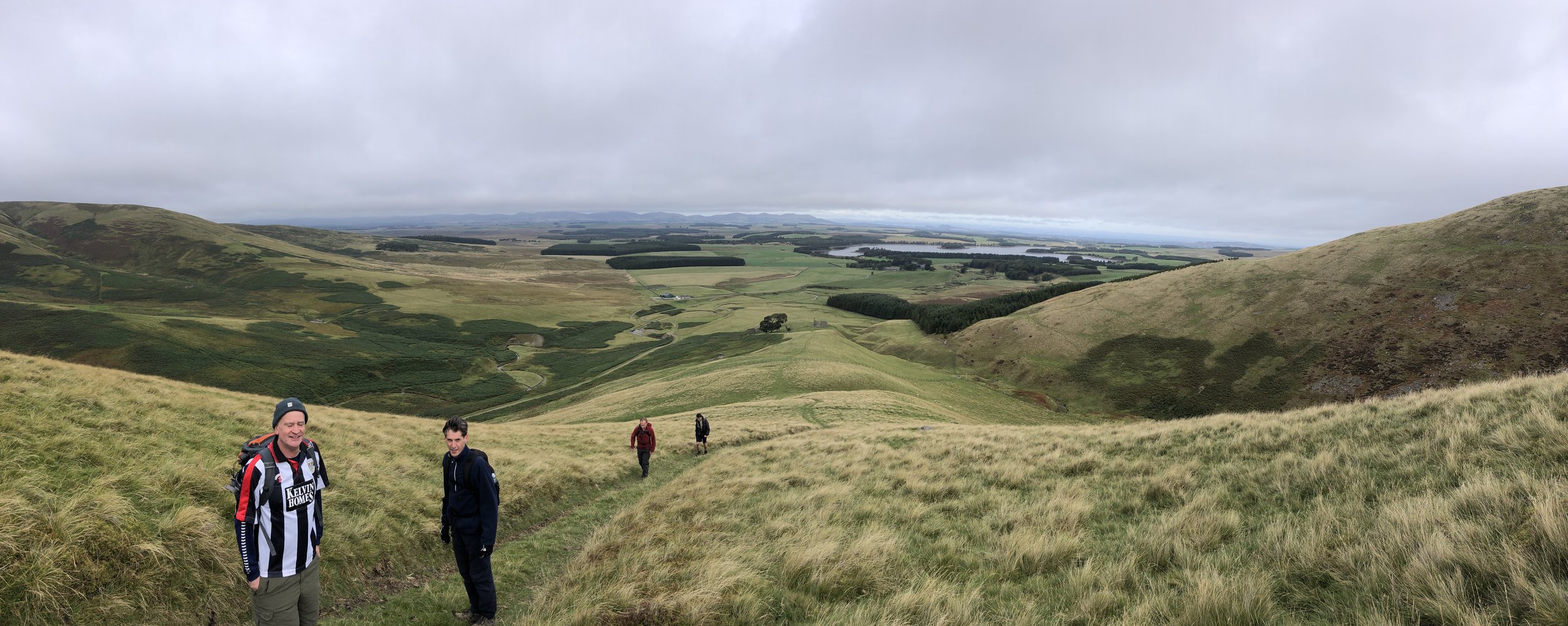
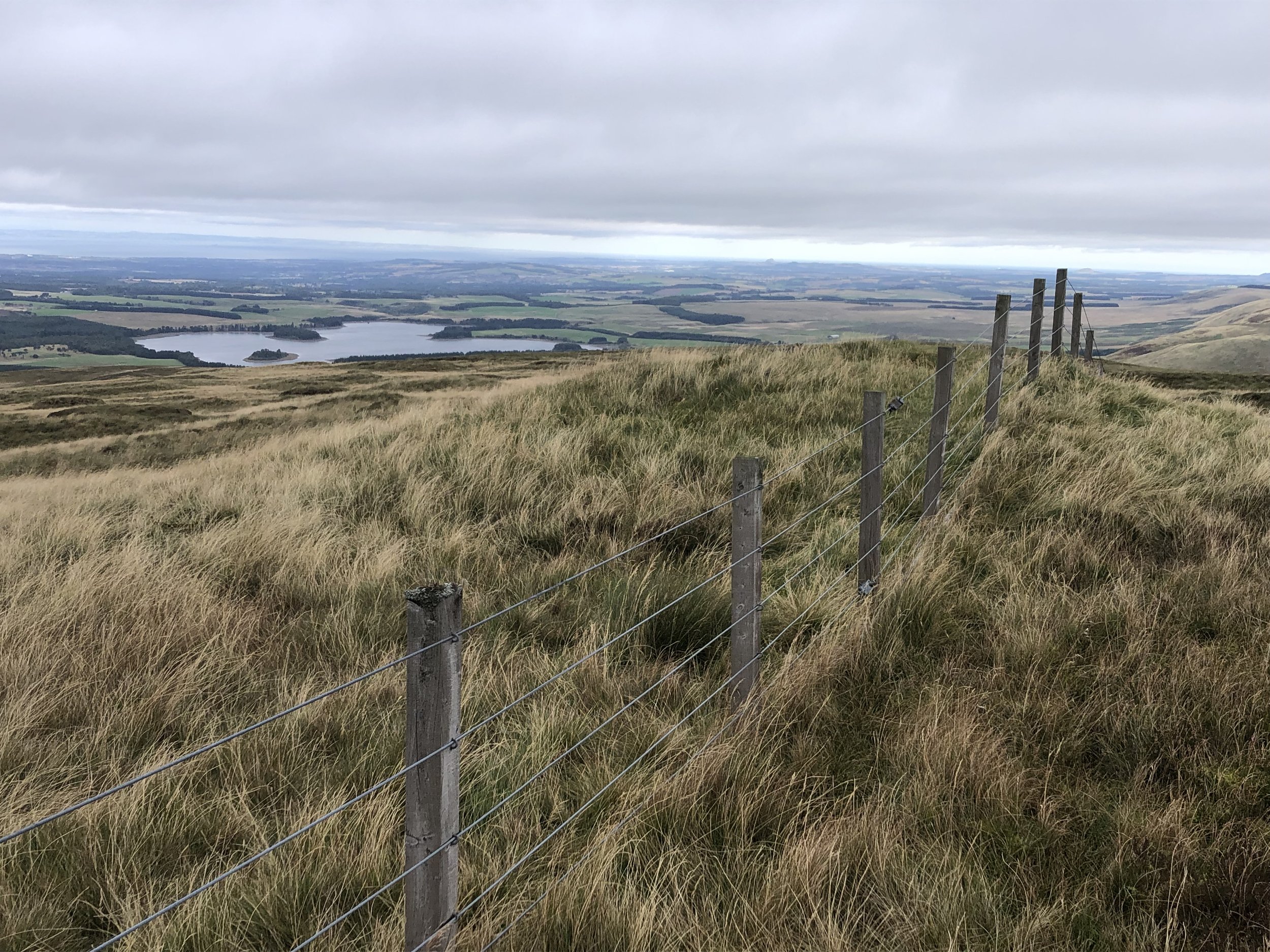
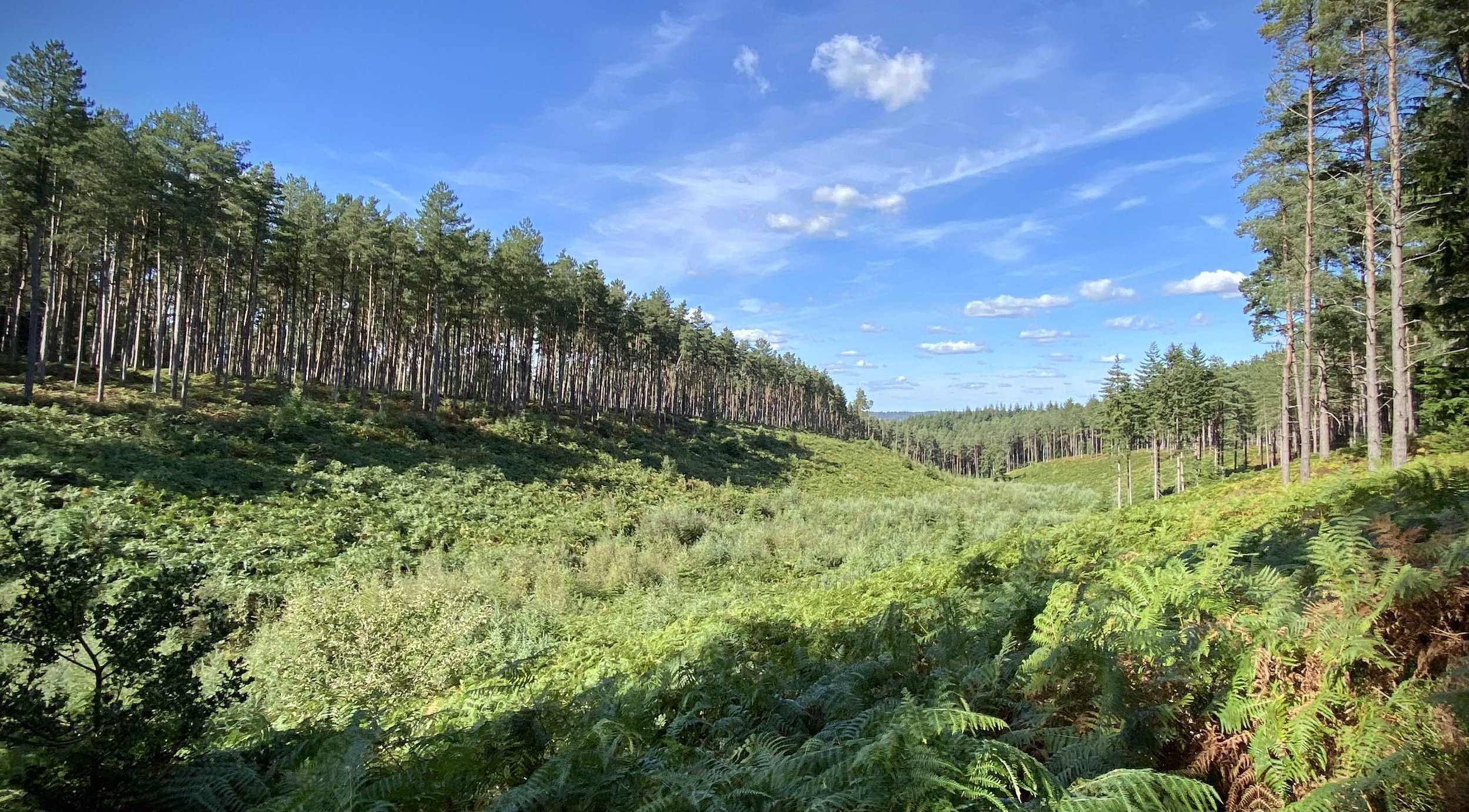
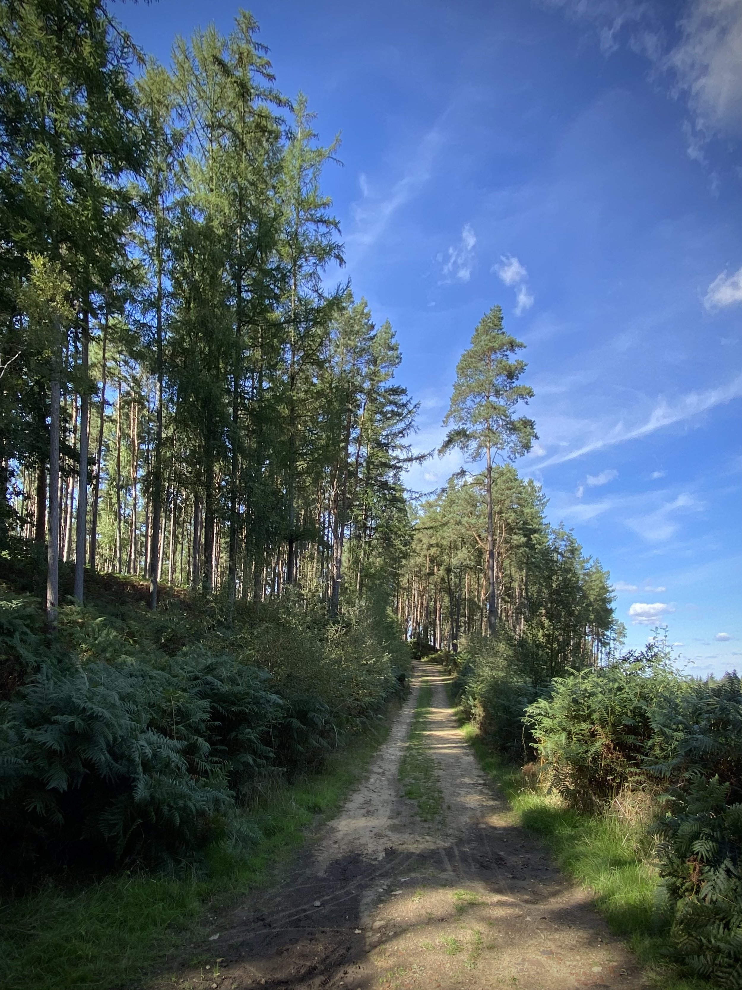
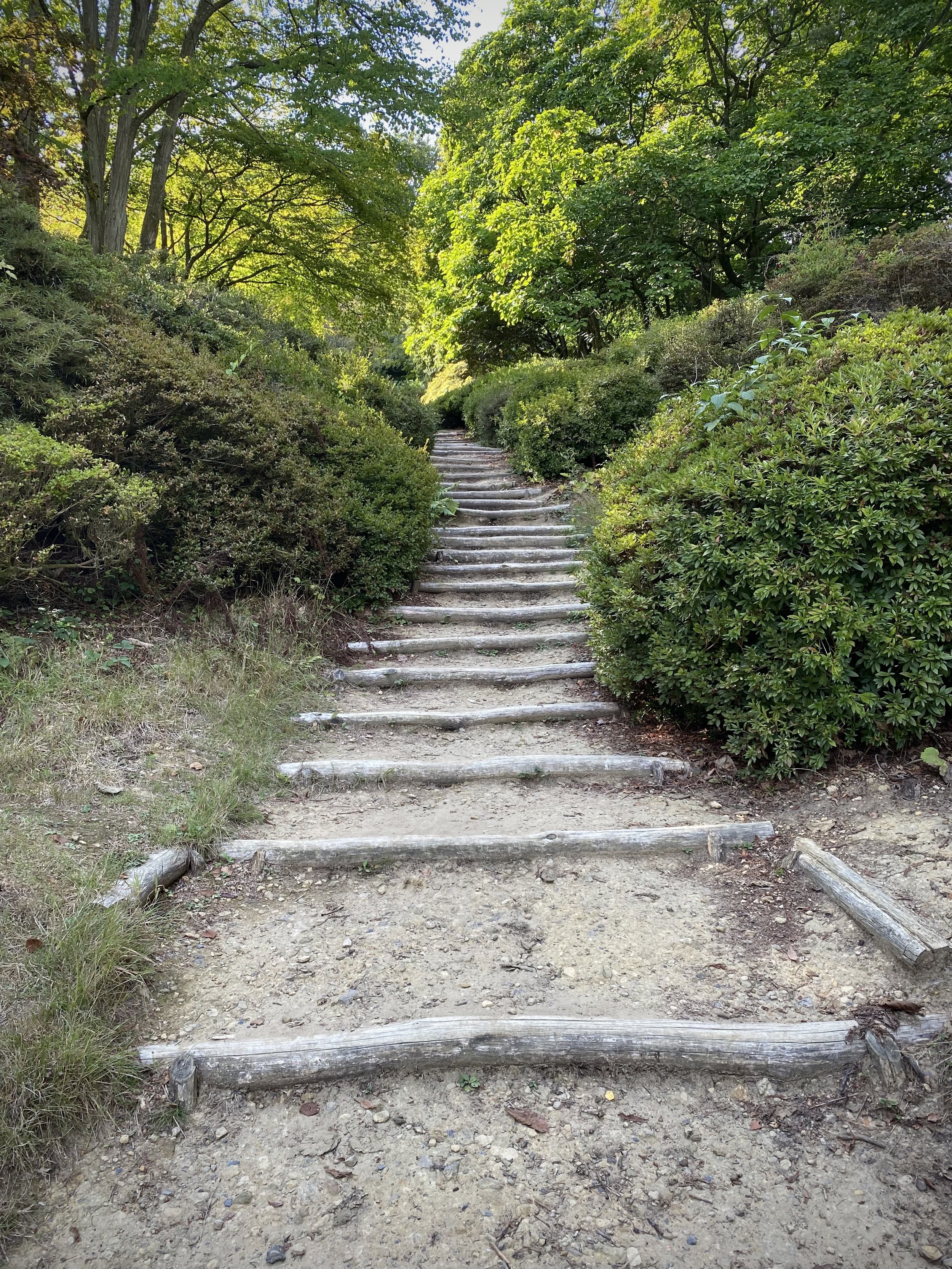
For this section we parked at Pitch Hill Car Park at the far western end of this section of the route. This is the same parking spot as we used for section 8. You can follow the Greensand Way directly out of the south-eastern corner of the car-park, ascending to Pitch Hill summit. For the first half of the walk you’ll be following the Greensand Way signs mostly along the ridgeline through the Hurtwood. Pitch Hill and Holmbury Hill are the 2 literal high points of the walk with great views to the south. At Holmbury Hill you get a clear view over to Leith Hill, Surrey’s County Top and your destination for section 10. After the Holmbury Hill viewpoint you’ll descend through the site of Holmbury Camp, an Iron Age hillfort.
When you reach Horsham Road at 5.25km you’ll leave the Greensand Way and take a left, heading north to the village of Holmbury St Mary. The Royal Oak pub in the village centre is a good place to stop for a mid-walk rest. After the Royal Oak take a left onto Felday Glade and follow it for 200m taking a footpath on the right. The path ascends steeply and takes you back into the Hurtwood. Continue in a westerly direction along trails in the Hurtwood to Ewhurst Road, crossing over, then continuing in a south-westerly direction back to the car-park. There’s a lot of different trails in the second half so a GPX route and/or good map skills is essential.
Previous section: Walking The Greensand Way Part 8 - Winterfold Wood and Reynards Hill
Next section: Walking The Greensand Way Part 10 - Leith Hill and Broadmoor

Descending to the monastery
Start & Finish: Gouverneto Monastery, Chania 731 00, Greece
Distance: 2.8 km (1.7 miles)
Elevation change: +/- 164m
GPX File: get via Buy Me a Coffee
Other routes touched (walk): Katholiko-Stavros
Links: Akrotiri, Agia Triada Monastery, Gouverneto Monastery, Arkoudiotissa Cave
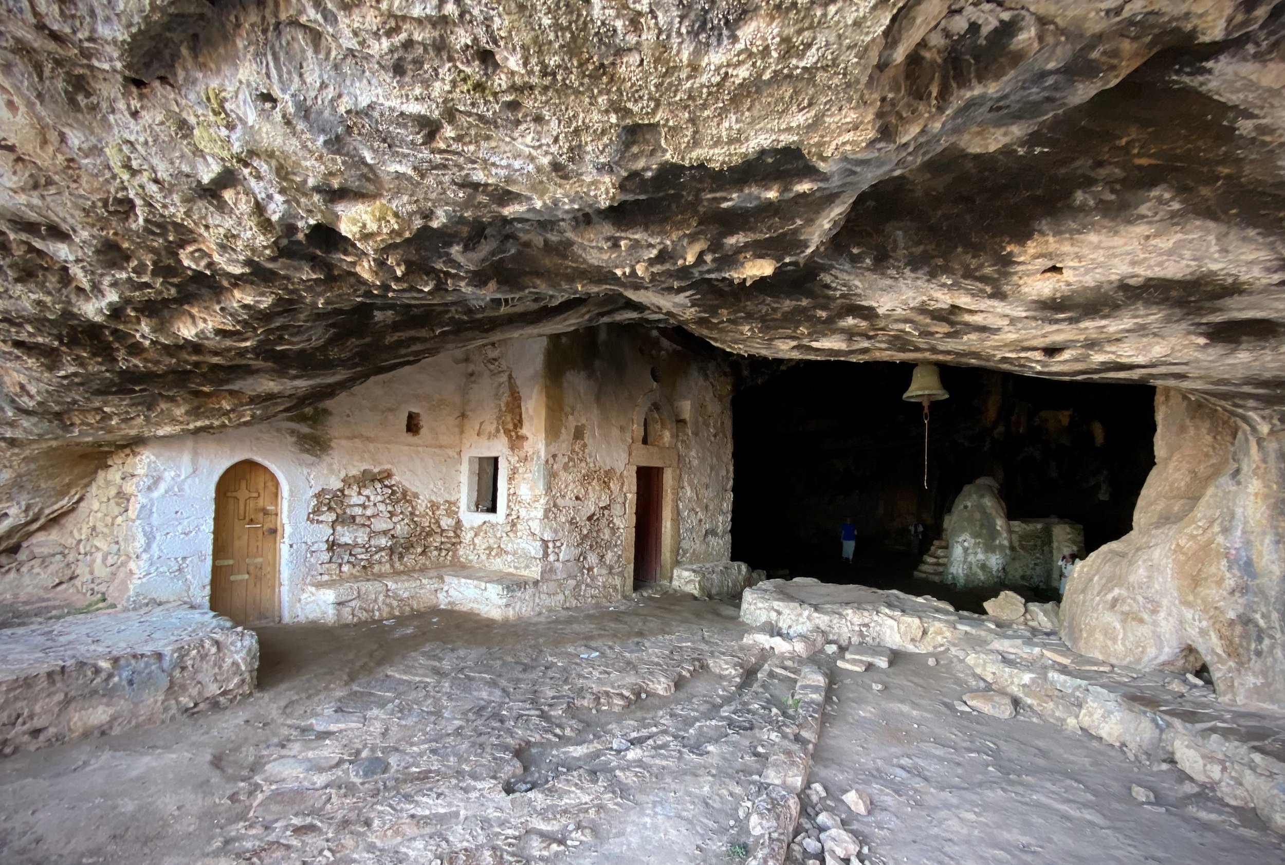
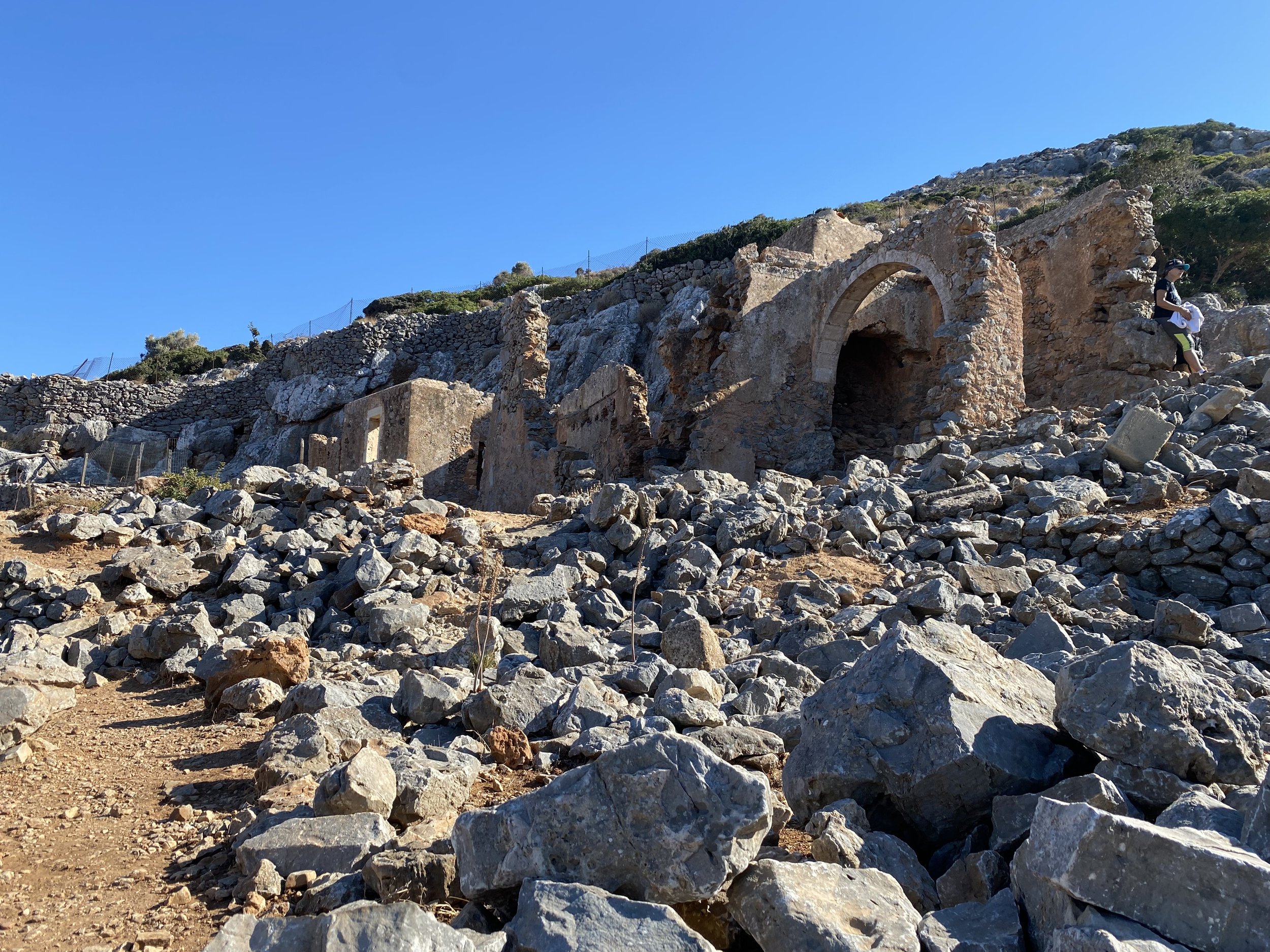
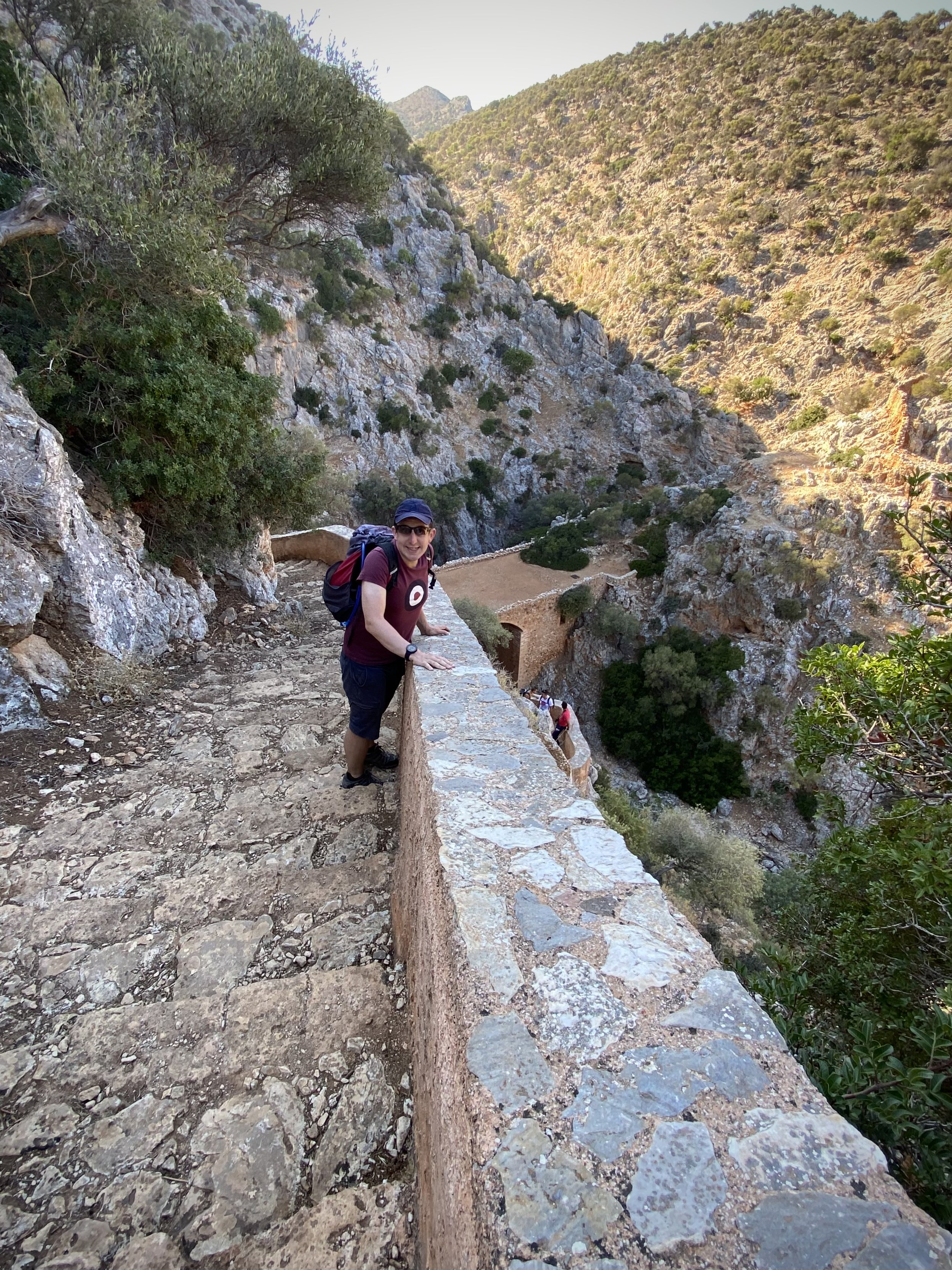
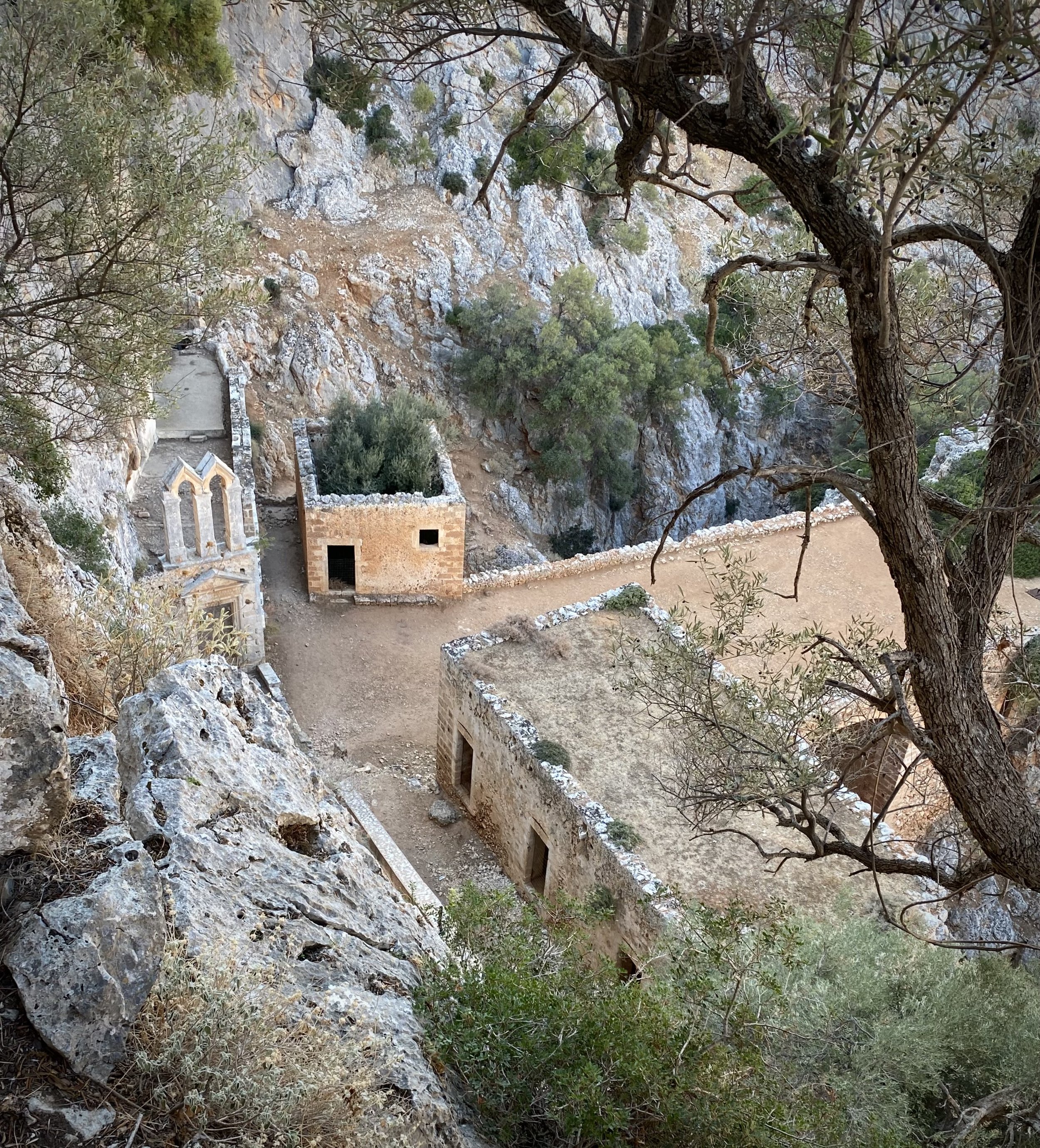
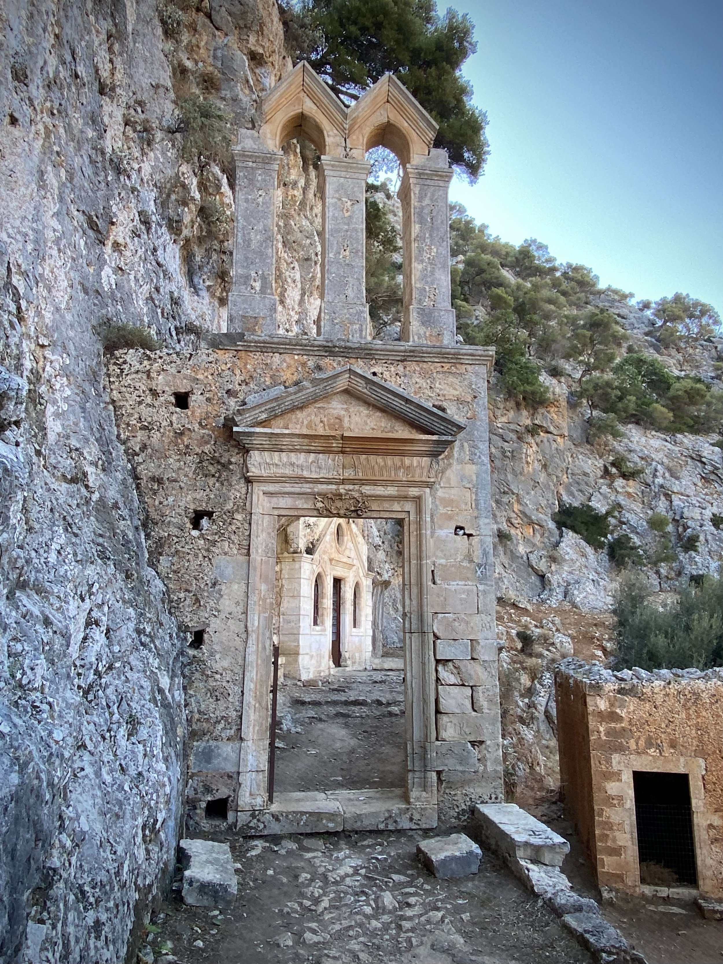
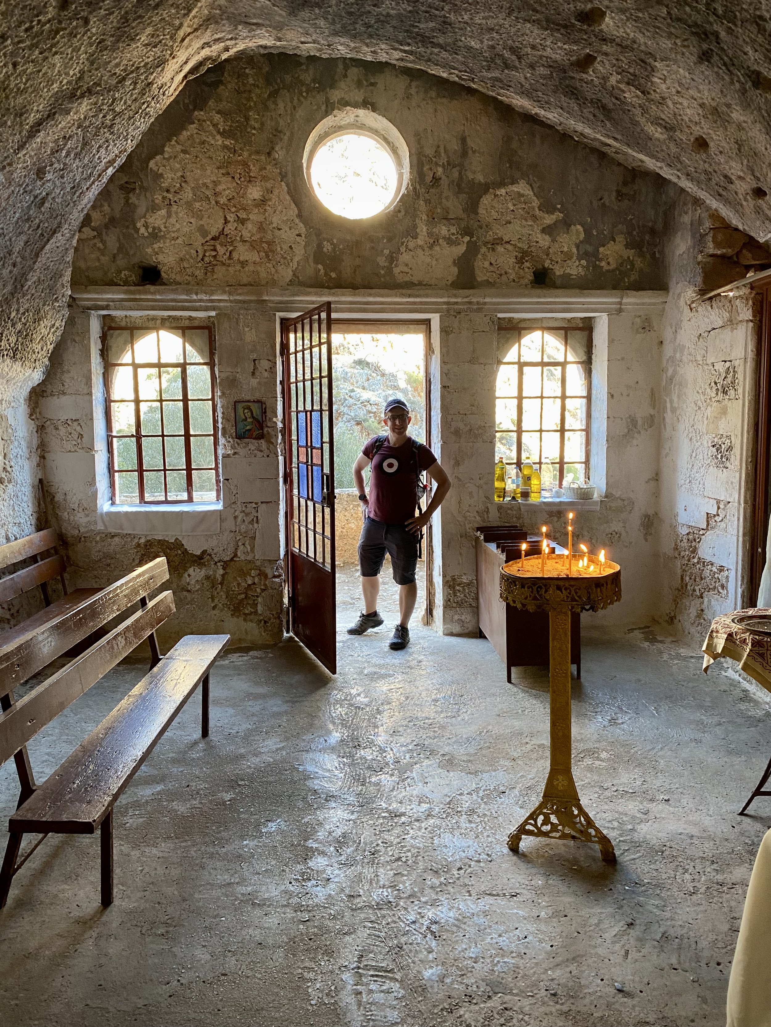
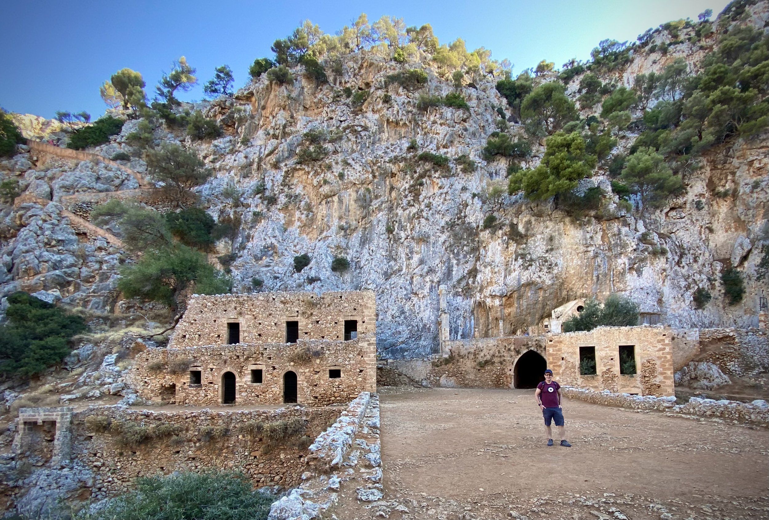
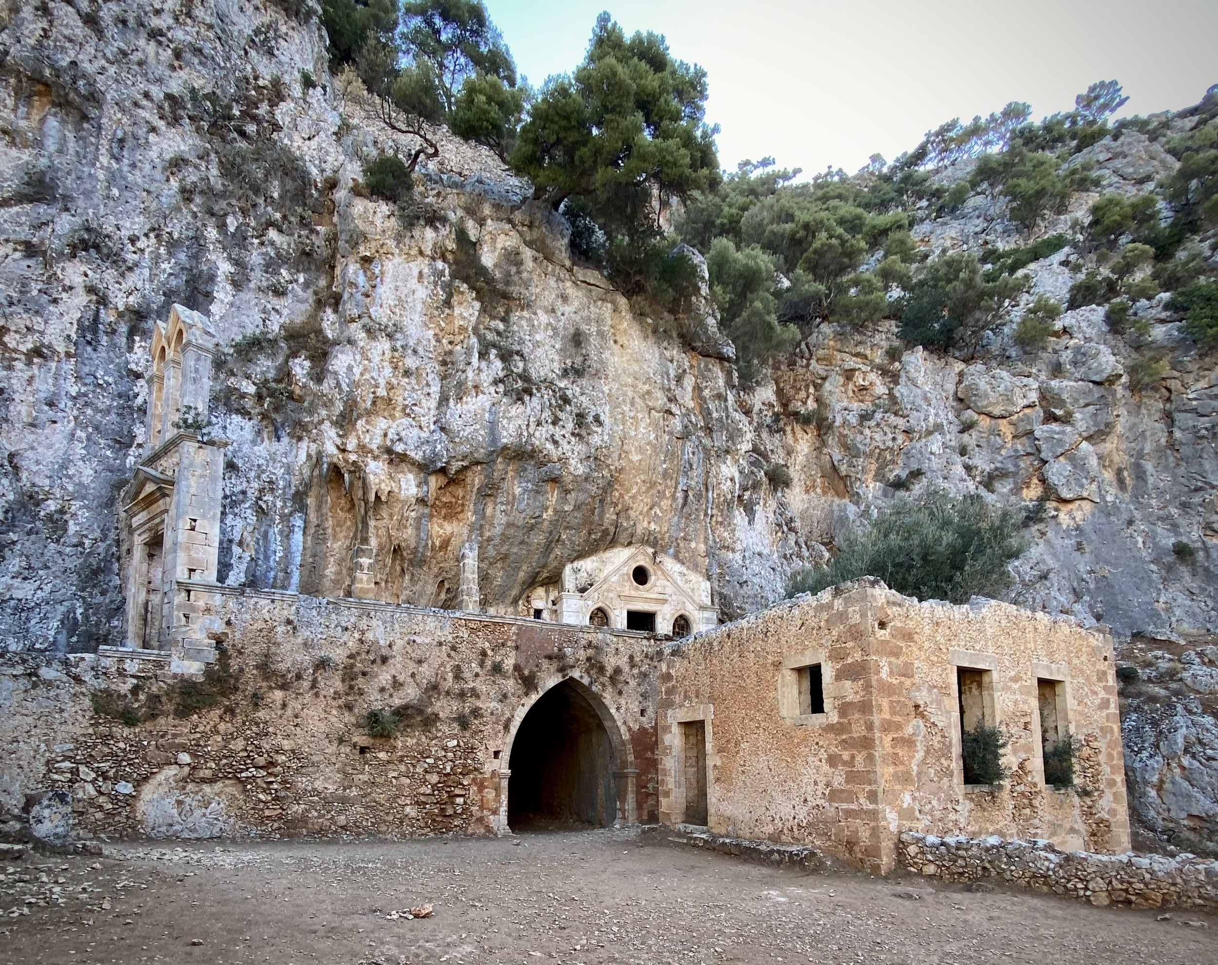
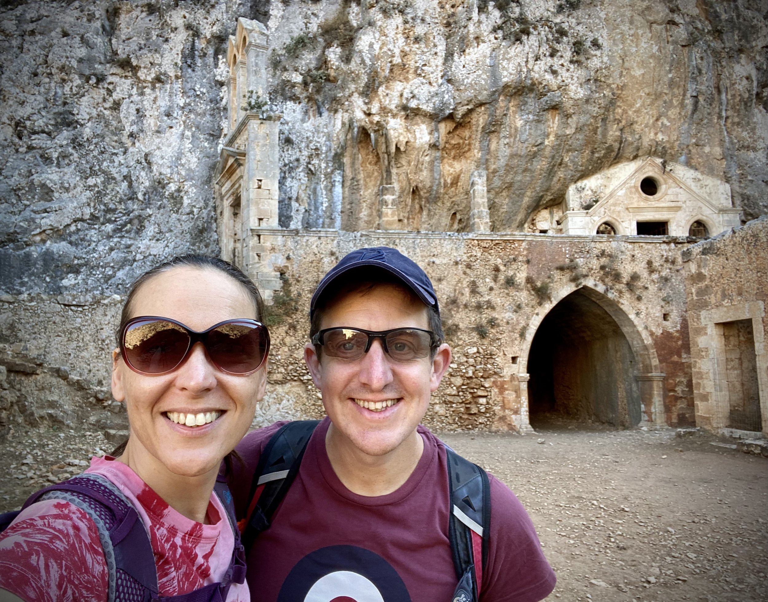
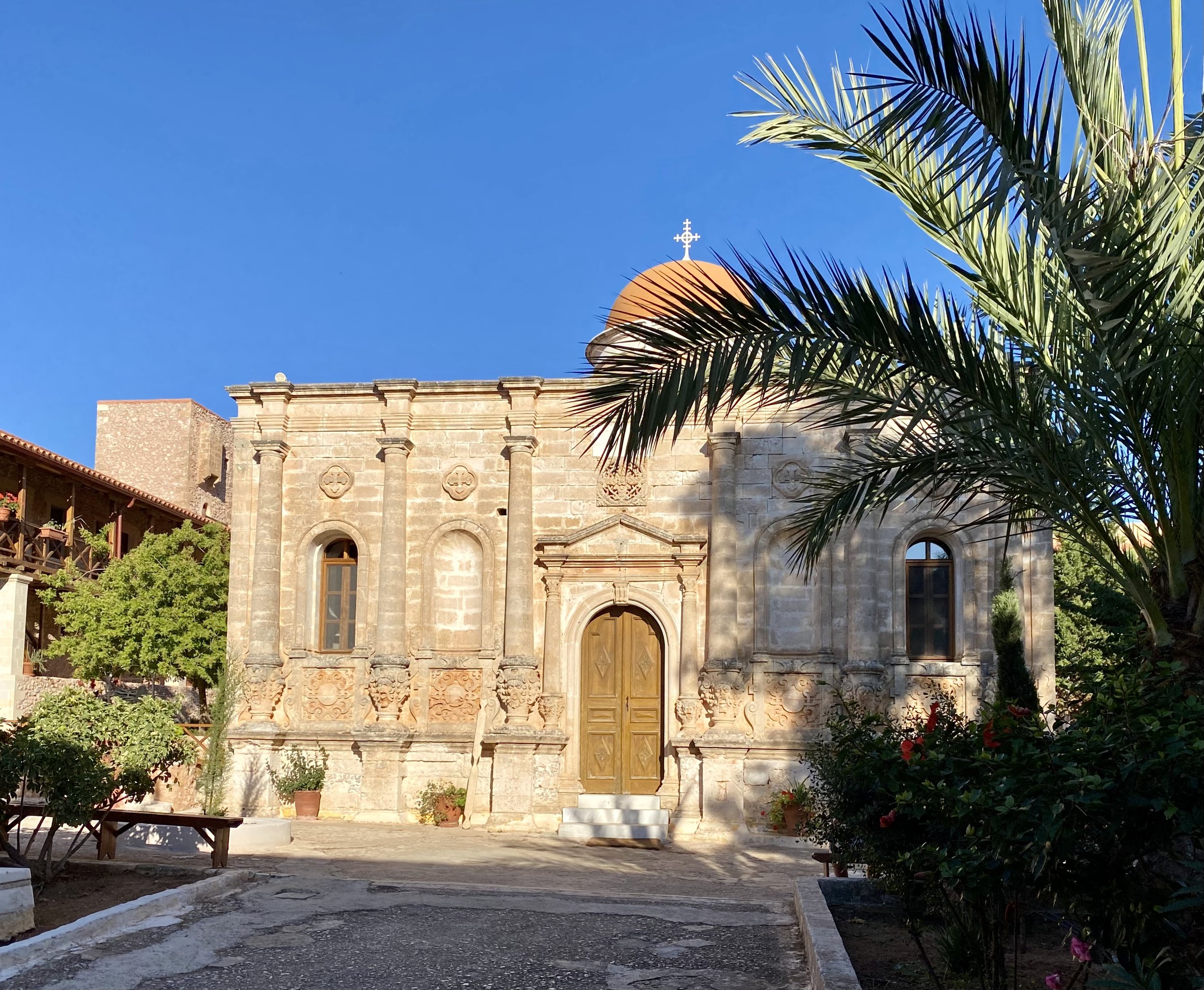
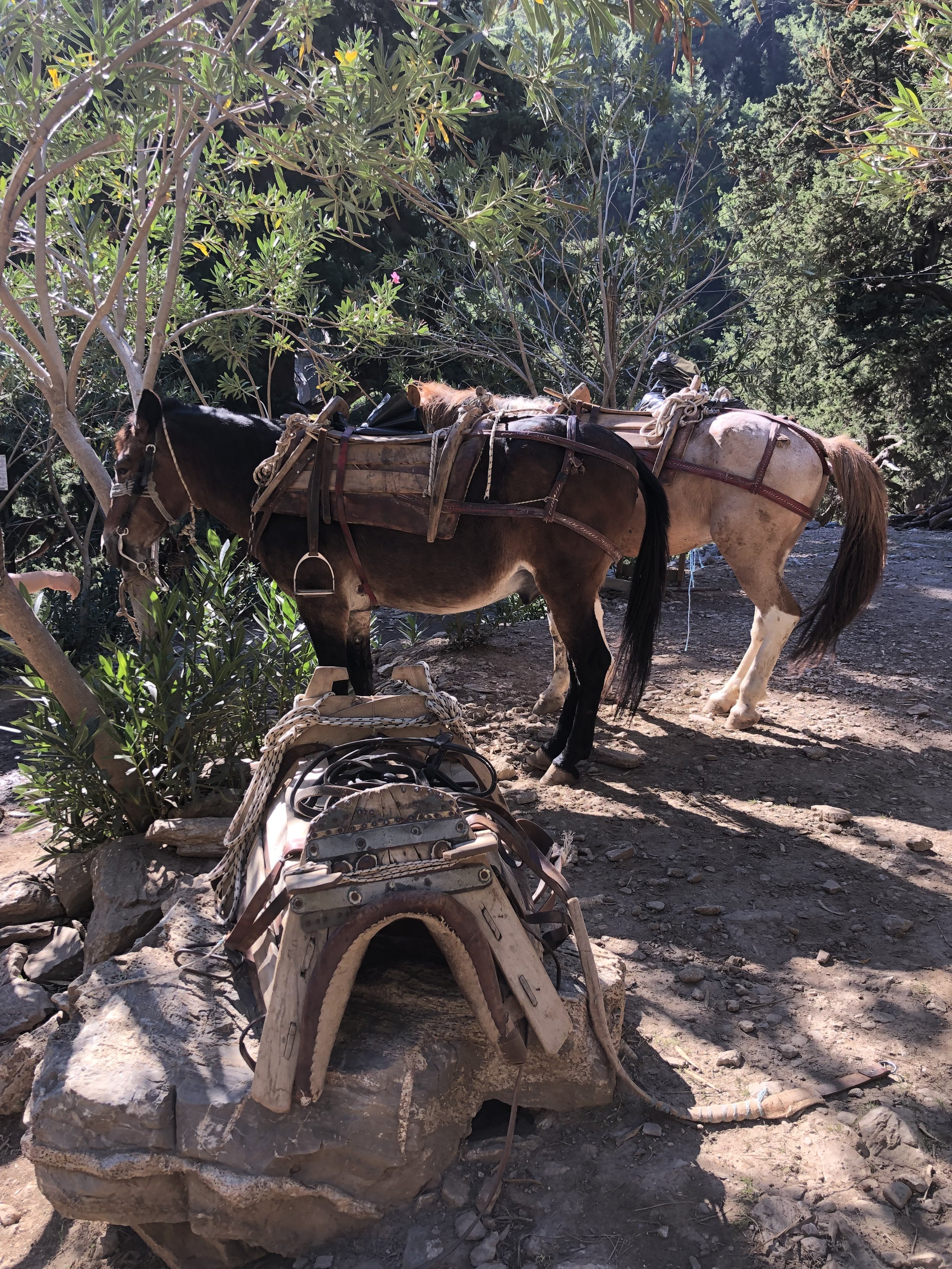
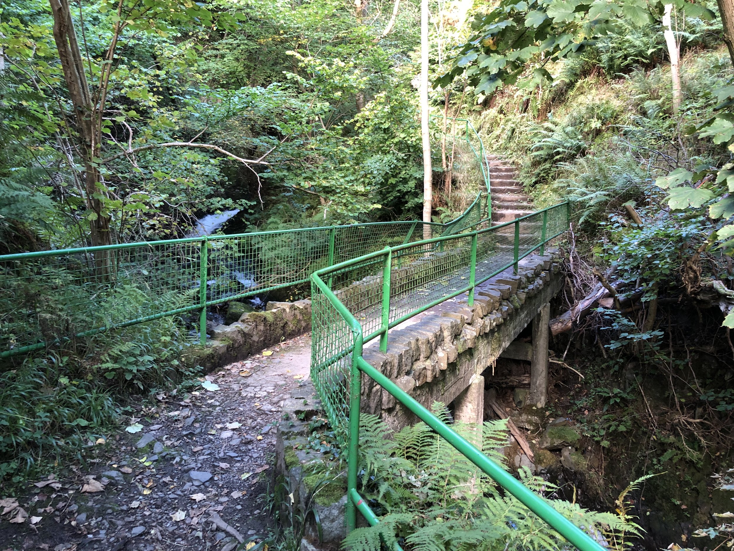
The Akrotiri Peninsular, not to be confused with the one in Cyprus, sticks out of the north coast of Crete to the east of Chania. We took a day trip at the end of our holiday to drive round the edge and visit the beaches. The monasteries in the mountains to the north are worth a visit as is the short but steep walk to the Katholiko ruins. The Katholiko was opened in the 11th century and abandoned in the 16th century due to pirate raids.
To get to the walk, drive to the Holy Trinity (Agia Triada) Tzagaroli Monastery. This is an interesting place to stop and visit the church and museum. From here follow the road for 4.2 km to the car park next to the Gouverneto Monastery. This monastery was closed when we got there so we did the walk to the Katholiko first.
There’s a very obvious path from the monastery down to the ruins. After 1km you’ll reach the Arkoudospilio Cave, also known as the Bear Cave. The name comes from the large bear-shaped stalagmite that is ready to drink water. The legend is that the Virgin Mary turned the bear that was stealing the water of the monks living nearby into stone.
After another 400m you’ll reach the ruins of the Katholiko Monastery. There’s another trail that we considered walking that joins from town of Stavros to the west. Another option is to descend further along the trail to the beach. Both options were tempting but it was a very hot day so an out-and-back from the Monastery to the Katholiko was enough for us.
The Gouverneto Monastery was just opening by the time we got back there at 17:00. We were just in time to observe the service in the church. If you visit note that you can’t enter wearing shorts but you can borrow a skirt at the entrance to cover your legs.

Near the Trailhead.
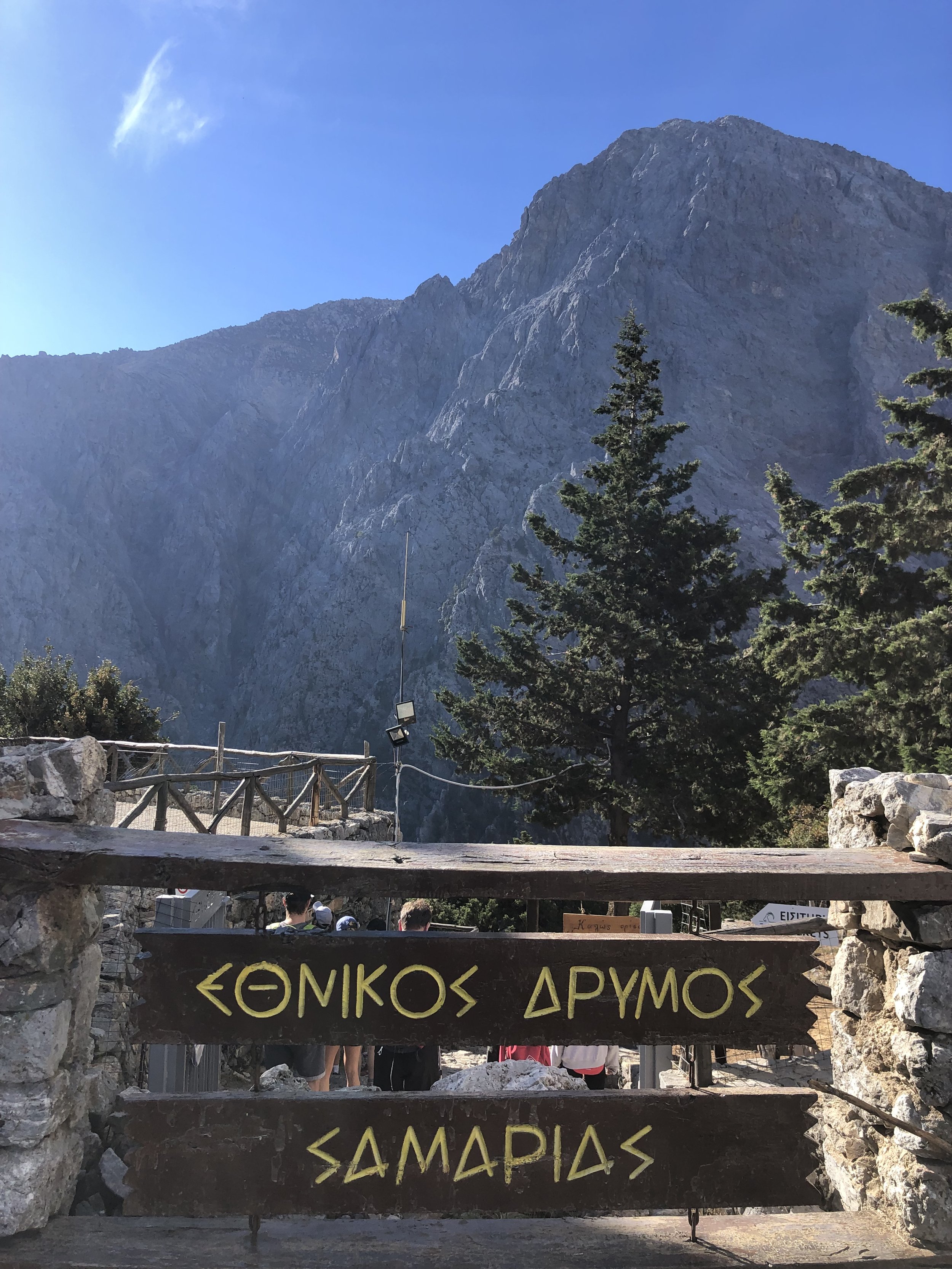
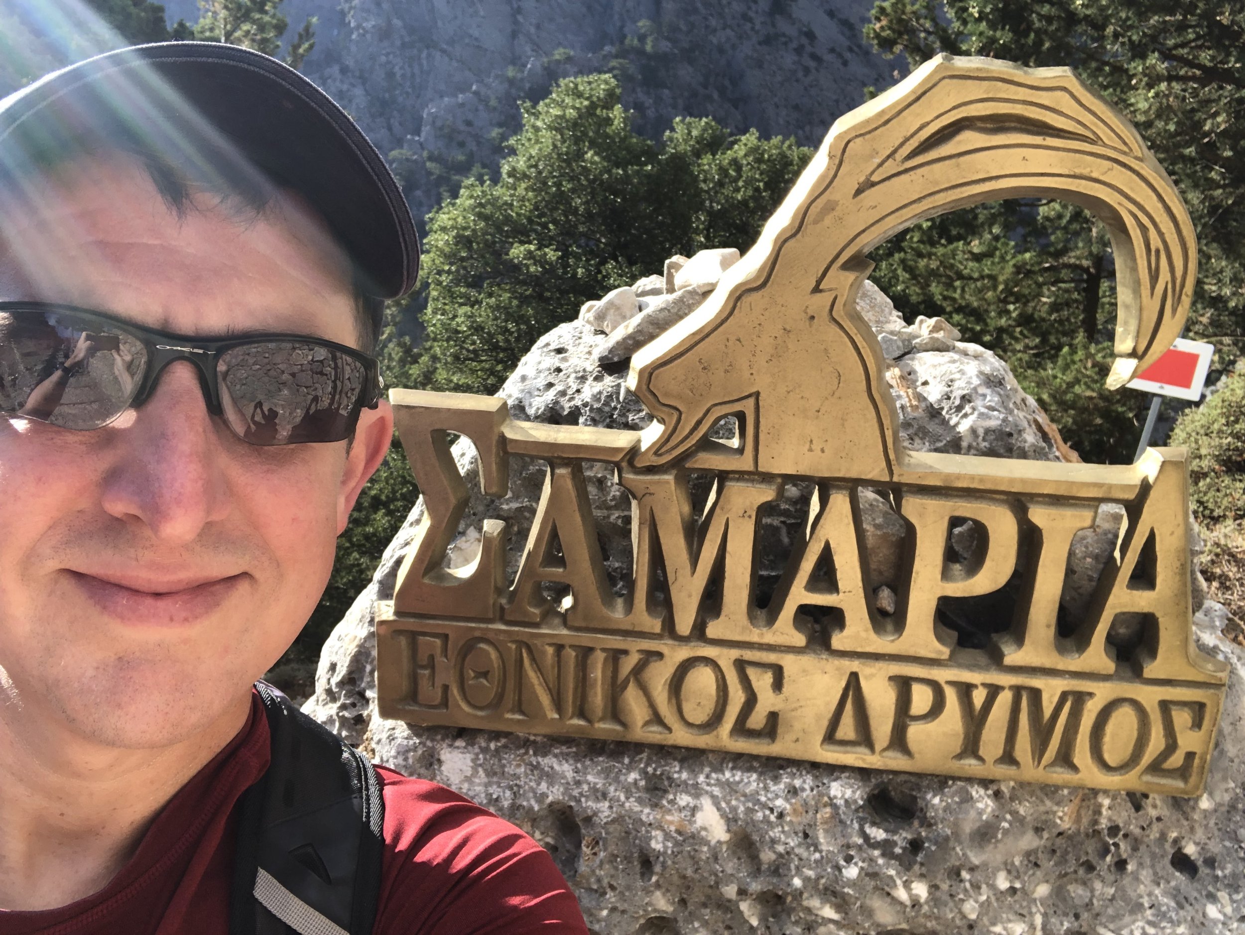
Start: Samaria Gorge Trailhead, Μονοπ. Φαράγγι Σαμαριάς, 730 11, Greece
Finish: Ferry dock, Agia Roumeli, Hora Sfakion 730 11, Greece
Distance: 16 km (10 miles)
Elevation change: +442m / -1,657m. Net -1,215m
GPX File: get via Buy Me a Coffee
Other routes touched (walk): Papoures Trail
Links: Samaria Gorge, Lefka Ori (White Mountains), Agia Roumeli, Sougia
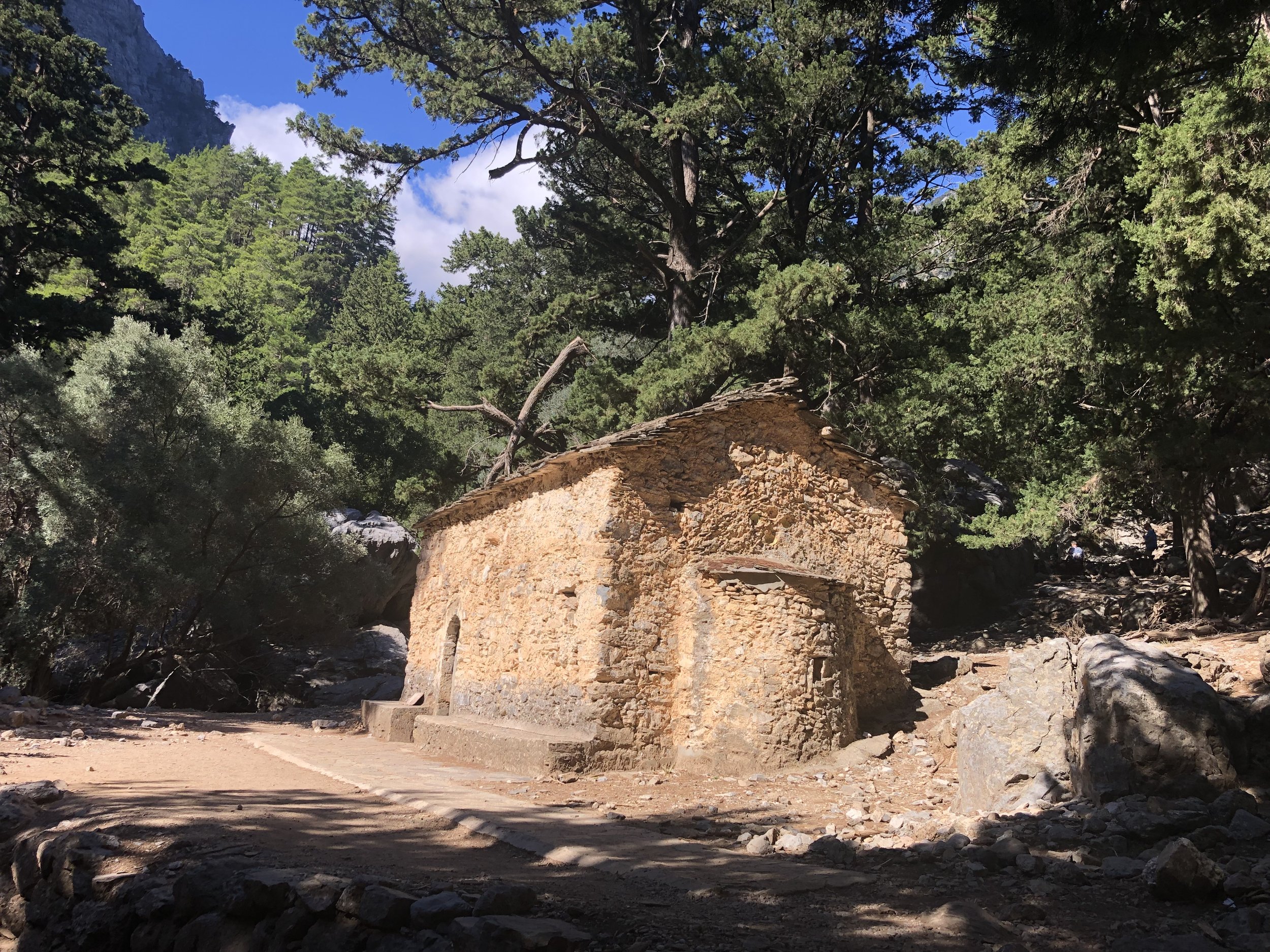
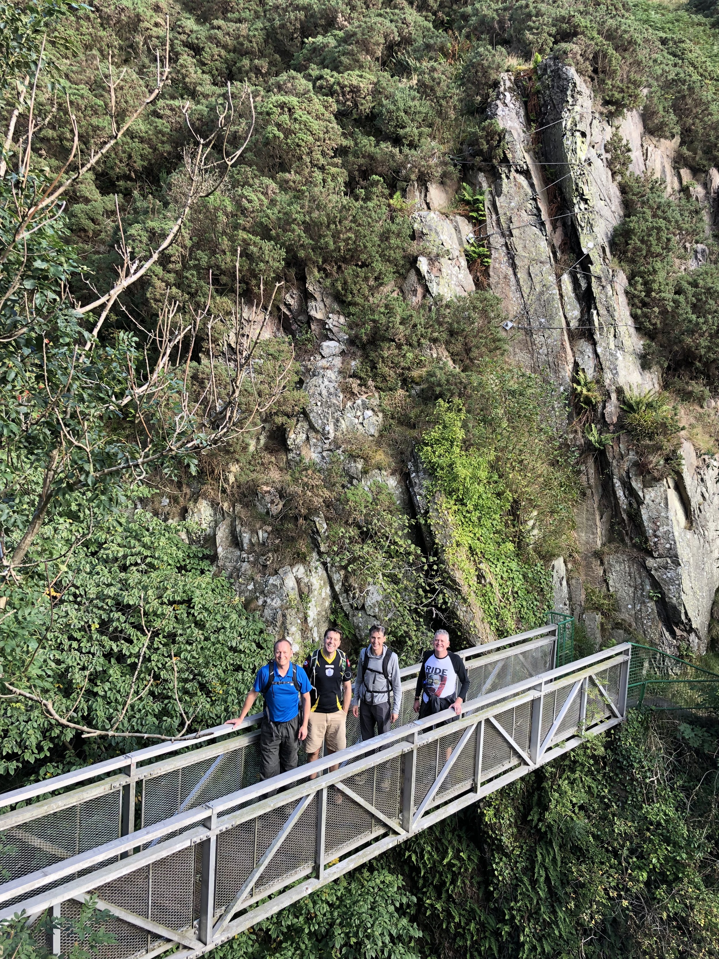
If you’re a fan of hiking and the outdoors in general then Samaria Gorge is a must-do for a trip to Crete. Wife and I had planned to do it together but she was sick for the first half of our holiday. We decided that I should do it alone while she recovered. This turned out to be the right plan as you really need to be on top form to do the trip.
The trailhead is an hour from Chania, the nearest large town. Unless you stay near the start overnight you’ve got at least 2 hours of driving time to get there and back. The gorge walk is a point-to-point from the entrance at 1,230m elevation down to Agia Roumeli on the coast. There’s no road access to the town so you need to get a ferry to Sougia and a bus back to the start. From leaving my hotel (90 mins from the trailhead), I was back 13 hours later.
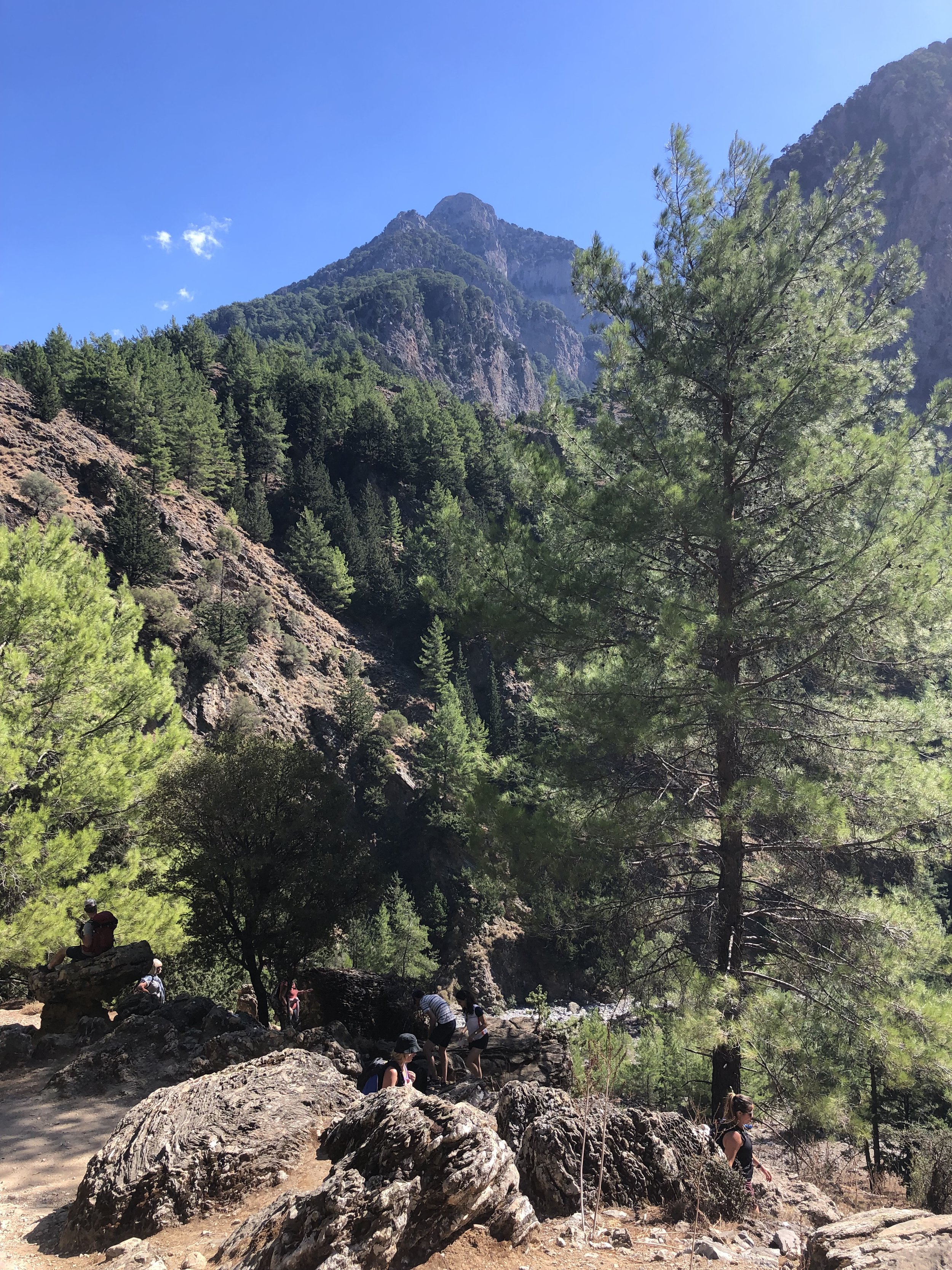
It’s definitely worth it though. The whole of the gorge walk was stunning with photo opportunities at every turn. The first section, a steep descent through pine forest, reminded me of parts of the Inca Trail. The path is narrow and can be difficult to overtake other hikers at times so it’s good to go when it’s quiet. I was there in early October, just out of peak season. My first hour, starting at 10:00, only had a handful of other hikers on it. It got busier when I caught up with a bus party who had spread out a little formed a convoy along the path.
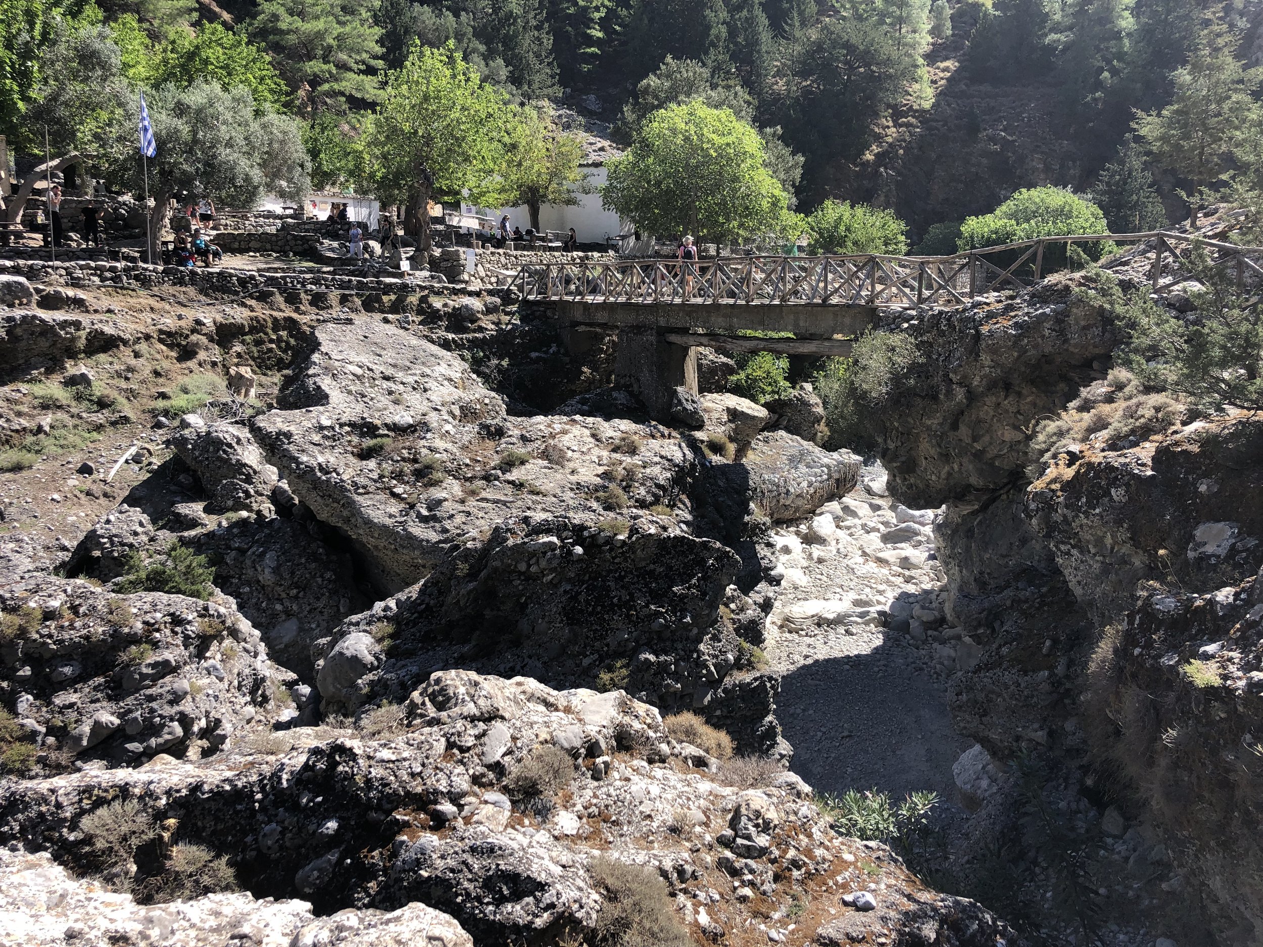
There’s several water and toilet spots along the route. You’ll need to take enough food and your own toilet paper if you don’t want to risk the supplies on the route. At around 7 km in you’ll reach the old village of Samaria which is a great place to stop for a while and have lunch before the final sections.
I found the path to be quieter after the old village. This was probably as I was on a brisker pace than most and only took a short stop for lunch. This second half is less steep and has a different, more barren environment. There were also more people coming in the opposite direction, presumably doing an out-and-back between the coast and the village.
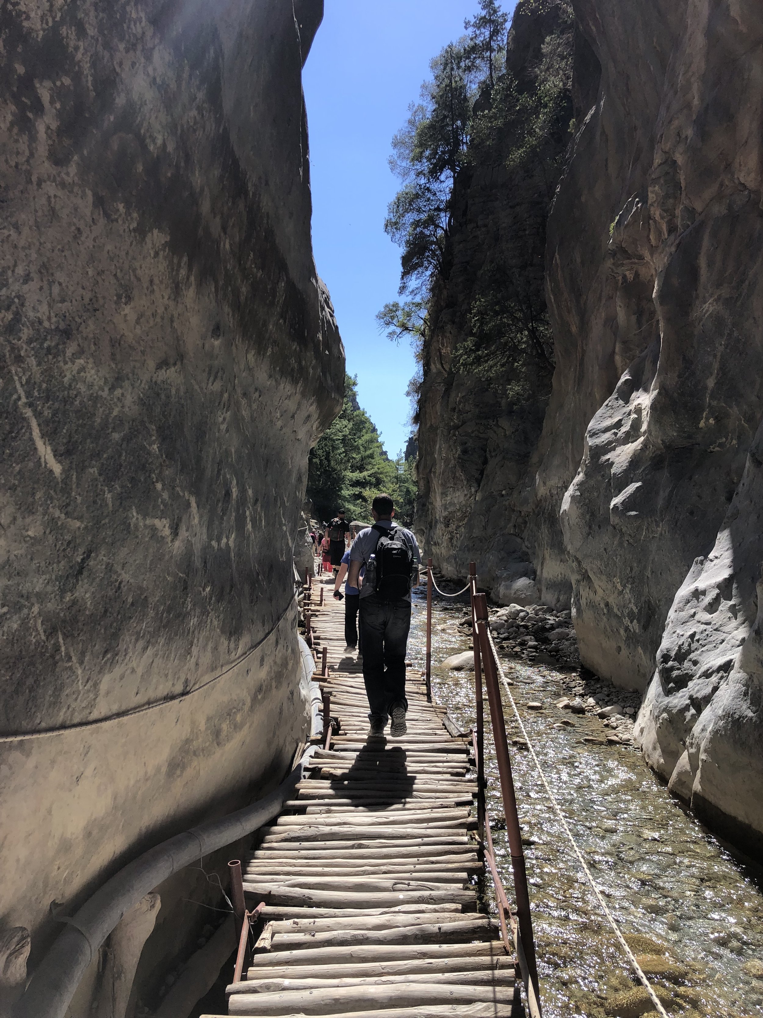
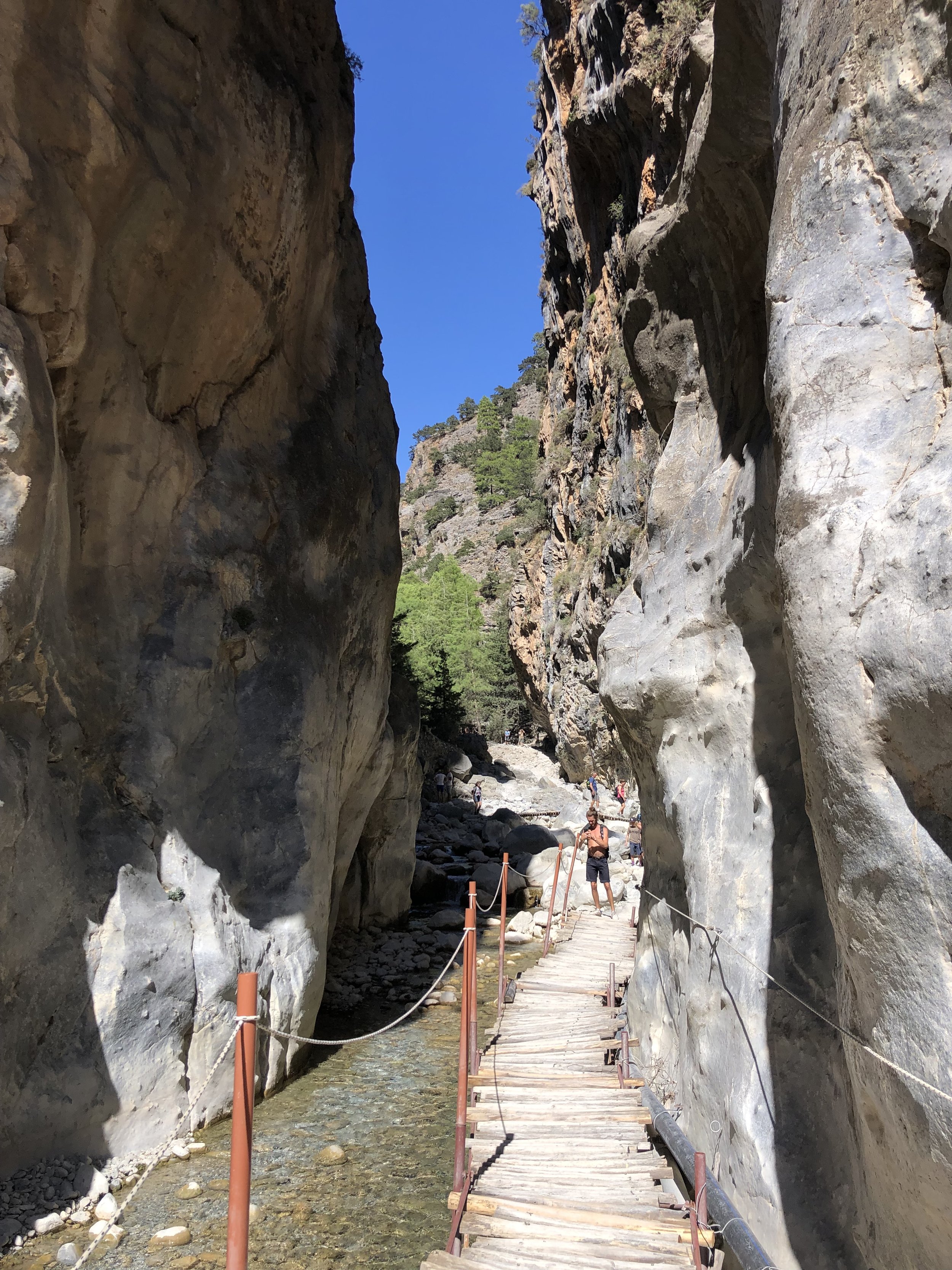
The final few kilometres are a highlight as the route criss crosses the flowing river across rickety wooden bridges. The walls of the gorge close in funnelling you through some tighter, more dramatic sections.
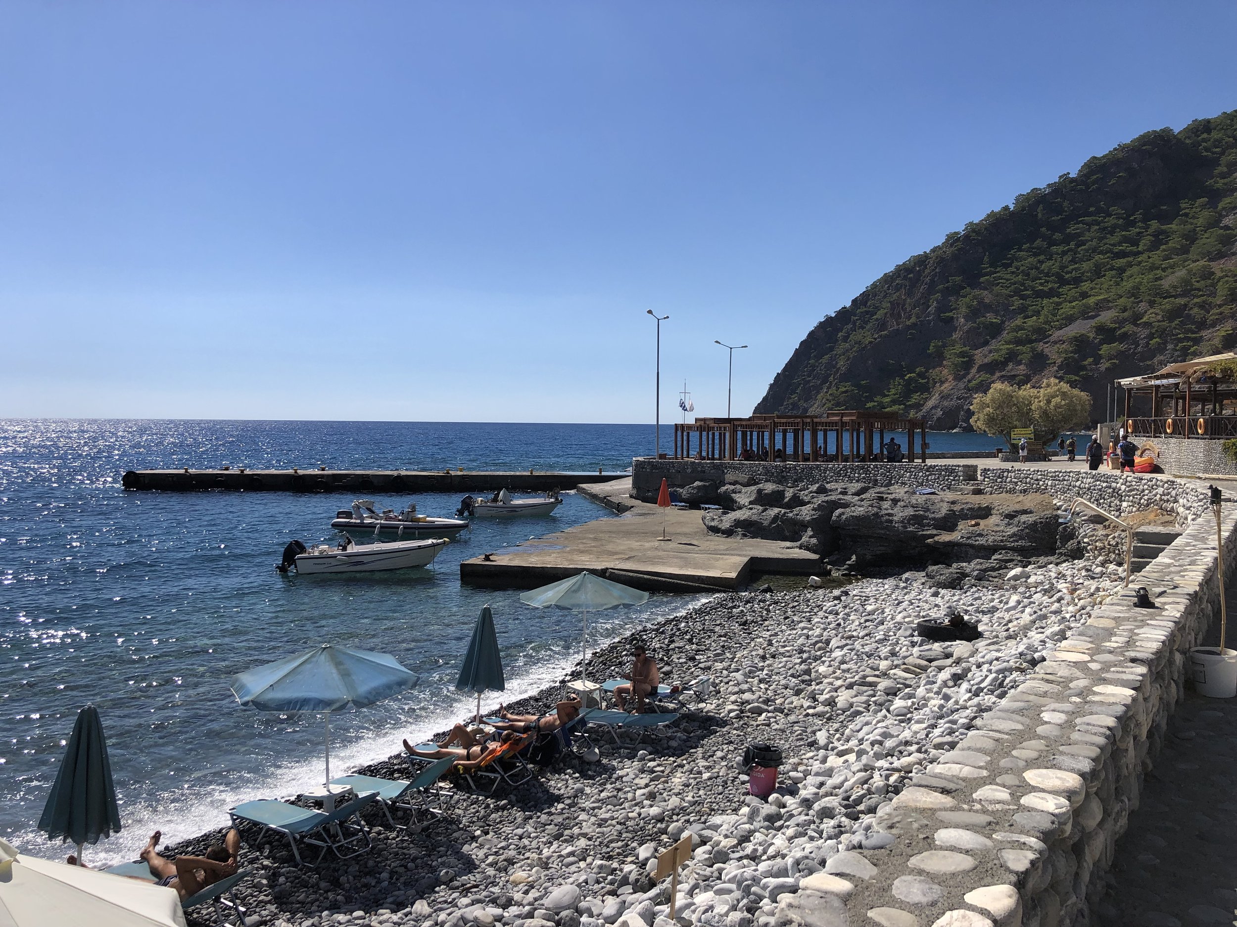
At the end of the walk you’ll find another booth where you give them half of your entry ticket. This is so that they can tally the numbers to check that no one is left in the gorge at the end of the day. There’s a couple of cafes immediately outside the National Park boundary but, unless you’re starving, it’s better to get to the town for food.
From the end of the trail it’s an extra 2.5 km to the coast. There’s a private shuttle bus operating the last 2 km for 2 euros each. As ready for a rest as I was I wasn’t tempted by the bus. I’d completed a 15km gorge walk so I wasn’t going to take a bus for a flat 2 km.
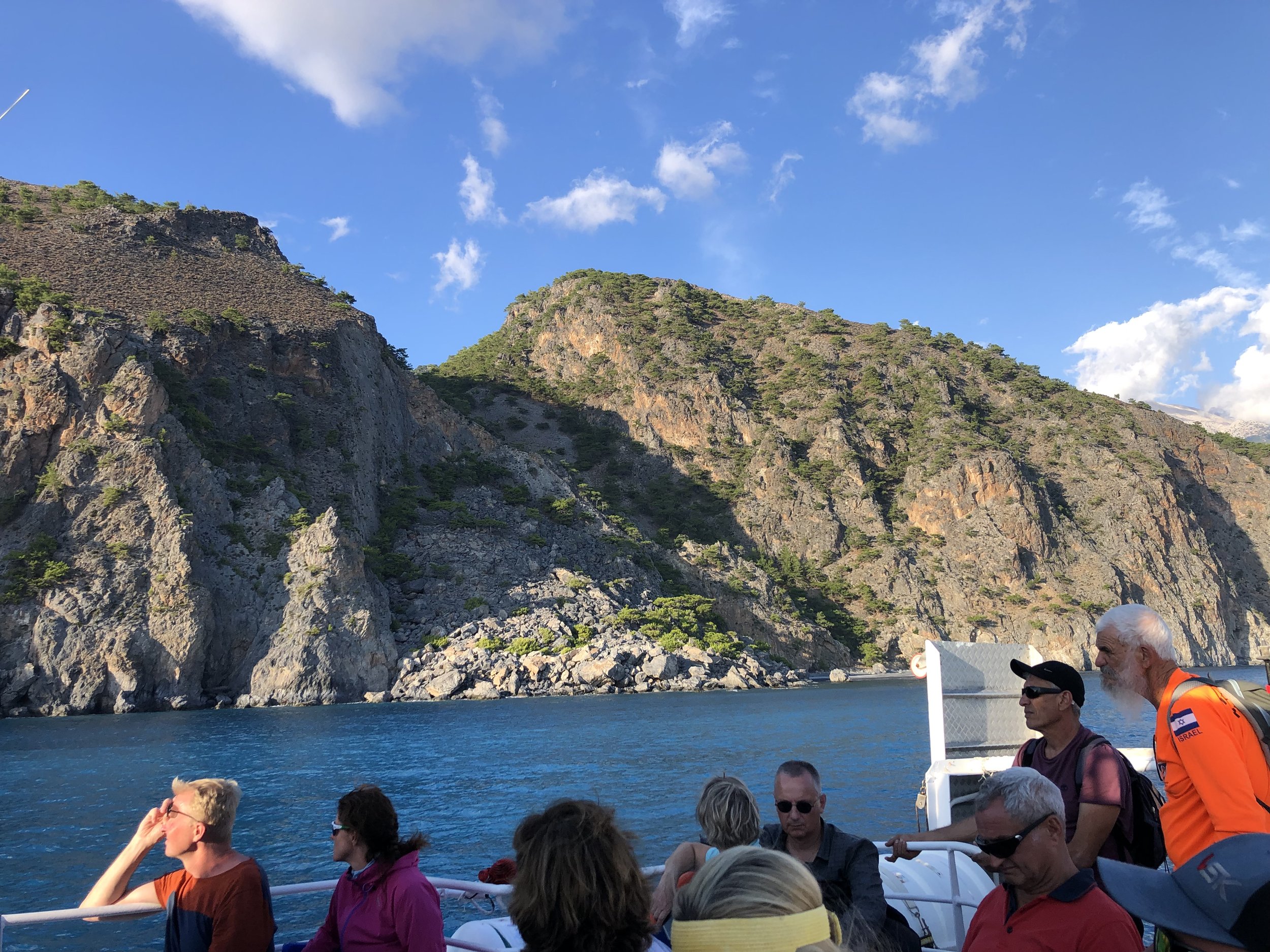
The main option to return to the start is to get a ferry to a Sougia then the bus to the trailhead. Ferries were fairly infrequent when I was there so I had to wait 3 hours for the 17:30 boat. Although the town is small and seems to exist only for the ferries, I was glad of the time for a long, slow lunch and a rest at the end of the walk.
You’ll need to buy your ticket ahead of getting on board but there’s a few options to do so. You can book online, as I did, and get an email confirmation. Alternatively you can buy them at the trailhead cafe or at the ticket office on town’s main street. Don’t expect to buy them on the boat though, as one couple found out when they were left behind by the last ferry of the day.
You can buy your bus tickets either at the trailhead or Agia Roumeli ticket offices or at a small booth in Sougia. Personally I wouldn’t risk leaving it until Sougia so I bought mine at the trailhead. The bus operation is very efficient with several of them waiting near the ferry terminal, departing shortly after the boats arrived.
The ferry takes 50 mins for the larger car and passenger ferry or 25 minutes for the smaller passenger only ferry. The bus takes 50 minutes to return to the trailhead and drops off next to the main car park. Although you can park for free at the side of the road leading up to the trailhead, the car park is safer and saves you another walk at the end of the day back to your car.
If you don’t have a car there’s several options to go with an organised tour. The options were around 40 euro per person as a part of a large bus tour or in in the hundreds per group for a private tour. If you do have a car then getting to the trailhead yourself is by far the cheapest and most convenient option.
My costs for the trip, excluding hire car costs and petrol were:
Parking: 5 euro
Gorge entrance fee: 5 euro
Ferry ticket: 13 euro
Bus ticket: 4.80 euro
Total 27:80 euro

Red = The Samaria Gorge Walk, Blue = ferry route to Sougia, Green = Bus route back to the Trailhead
The Surrey Hills is a National Landscape (formerly Area of Outstanding Natural Beauty (AONB), covering parts of the North Downs and Greensand Ridge in Surrey, England. The area shown in the map below also shows land covered by the Area of Great Landscape Value (AGLV). It is very close to London with the M25 running near or through the northern boundary.
It’s a beautiful part of the countryside with many options for walking, running and cycling. This page is an index of the circular and point-to-point walks that I’ve done in the Surrey Hills.

Walks shown in alphabetical order of the 2-letter abbreviation on the map above. The letter and number in brackets refers to the grid reference. For more details on each, click on the link on the name of each walk.
BC (A6): Banstead Heath Coal Duty Post Circular Walk
Distance: 8.8 km (5.5 miles). Elevation change: + / - 147m
BH (B5): The Box Hill Hike
Distance: 11.2 km (7 miles). Elevation change: +/- 370m
NC (C3): Newlands Corner and Chilworth Gunpowder Mills Circular Walk
Distance: 10.6 km (6.6 miles). Elevation change: +/- 209m
PP (B5): The Prospects of Polesden SCC Circular
Distance: 8.3 km (5.2 miles). Elevation Change: +/- 169m
RC (B5): The Ranmore SCC Trail
Distance: 10km (6.2 miles). Elevation Change: +/-220m
Walks shown in alphabetical order of the 2-letter abbreviation on the map above. Map shows the start point. The letter and number in brackets refers to the grid reference. For more details on each, click on the link on the name of each walk.
DL (C3): The Downs Link
Distance: 61 km (38 miles). Elevation change: +344m / -457m (Net -113m)
GS (C3): Guildford and Shalford Disused Railways
Distance: 9.1 km (5.6 miles). Elevation change: +/- 52m
MG (B5): The Mole Gap Trail
Distance: 9.5 km (5.9 miles)/ Elevation Change: +91m / - 100m
TD (B5): Thames Down Link
Distance: 26.3 km (16.3 miles). Elevation change: +202m /- 241m. Net -39m
Walks shown in alphabetical order of the 2-letter abbreviation on the map above. The letter and number in brackets refers to the grid reference. For more details on each, click on the link on the name of each walk.
CC (A6): Chessington Countryside Walk
Distance: 9.1 km (5.6 miles). Elevation change: +/- 92m
CS (A3): Chobham Common South
Distance: 7.9 km (4.9 miles). Elevation change: +/- 65m
DD (A4): Discover Downside (Cobham)
Distance: 9.6 km (6 miles). Elevation change: +/- 67m
PC (B2) Pirbright Circular
Distance: 6.6 km (4.1 miles). Elevation Change: +/- 45m
RM (C6): The Reigate Mills and Pillboxes Trail
Distance: 7.3 km (4.5 miles). Elevation Change: +/- 71m
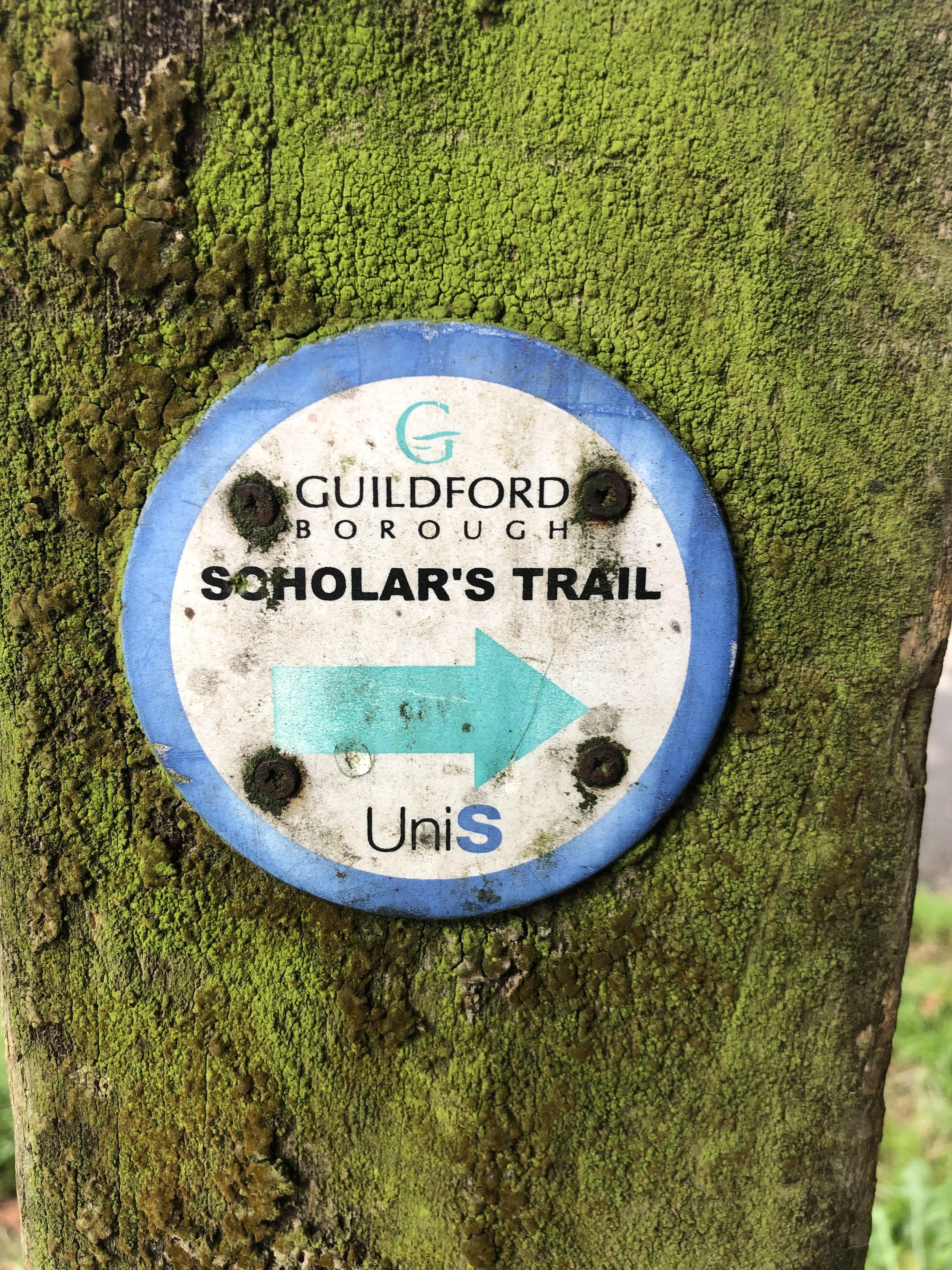
ST (B3): The Scholar’s Trail
Distance: 8.1 km (5 miles). Elevation change: +/- 147m
WL (A3): Weybridge Locks and Levels
Distance: 7.3 km (4.5 miles). Elevation Change: +/- 43m
The full trail is a long distance path stretching from Farnham in Surrey to Dover in Kent. Our walks took in short sections of 10 km to 13 km which we did with a friend over the course of a couple of years when our schedules coincided. White numbers in the orange circles on the map above show the start point for each section.
Section 1: Farnham to Puttenham
Distance: 10.6 km (6.6 miles), Elevation change: +118m / -100m. Net +8m
Section 2: Puttenham to Newlands Corner
Distance: 12.8 km (7.9 miles), Elevation change: +256m / -181m. Net +75m
Section 3: Newlands Corner to Ranmore
Distance: 11.6 km (7.2 miles), Elevation change: +128m / -107m. Net -21m
Section 4: Ranmore to Betchworth
Distance: 10 km (6.2 miles), Elevation change: +192m / -292m. Net -100m
Section 5: Betchworth to Merstham
Distance: 11.1 km (6.9 miles), Elevation change: +206m / -197m. Net -9m
Section 6: Merstham to Gangers Hill
Distance: 11.8 km (7.3 miles), Elevation change: +270m / -140m. Net -130m
Section 7: Gangers Hill to Westerham Hill
Distance: 9.1 km (5.6 miles), Elevation change: +161m / -216m. Net -55m
The full trail is a long distance path stretching from Haslemere in Surrey to Ham Street in Kent. Our walks take in short sections of the Greensand Way and loop back to the start on other paths. White numbers in the green circles on the map above show the start point for each section.
Section 1: Haslemere and Hindhead
Distance: 9.8 km (6.1 miles), Elevation change: +/- 231m
Section 2: Devils Punchbowl and Thursley
Distance: 11.1 km (6.9 miles), Elevation change: +/- 199m
Section 3: Thursley and Witley Park
Distance: 10.9 km (6.8 miles), Elevation change: +/- 163m
Section 4: Witley and Hambledon
Distance: 9 km (5.6 miles), Elevation change: +/- 124m
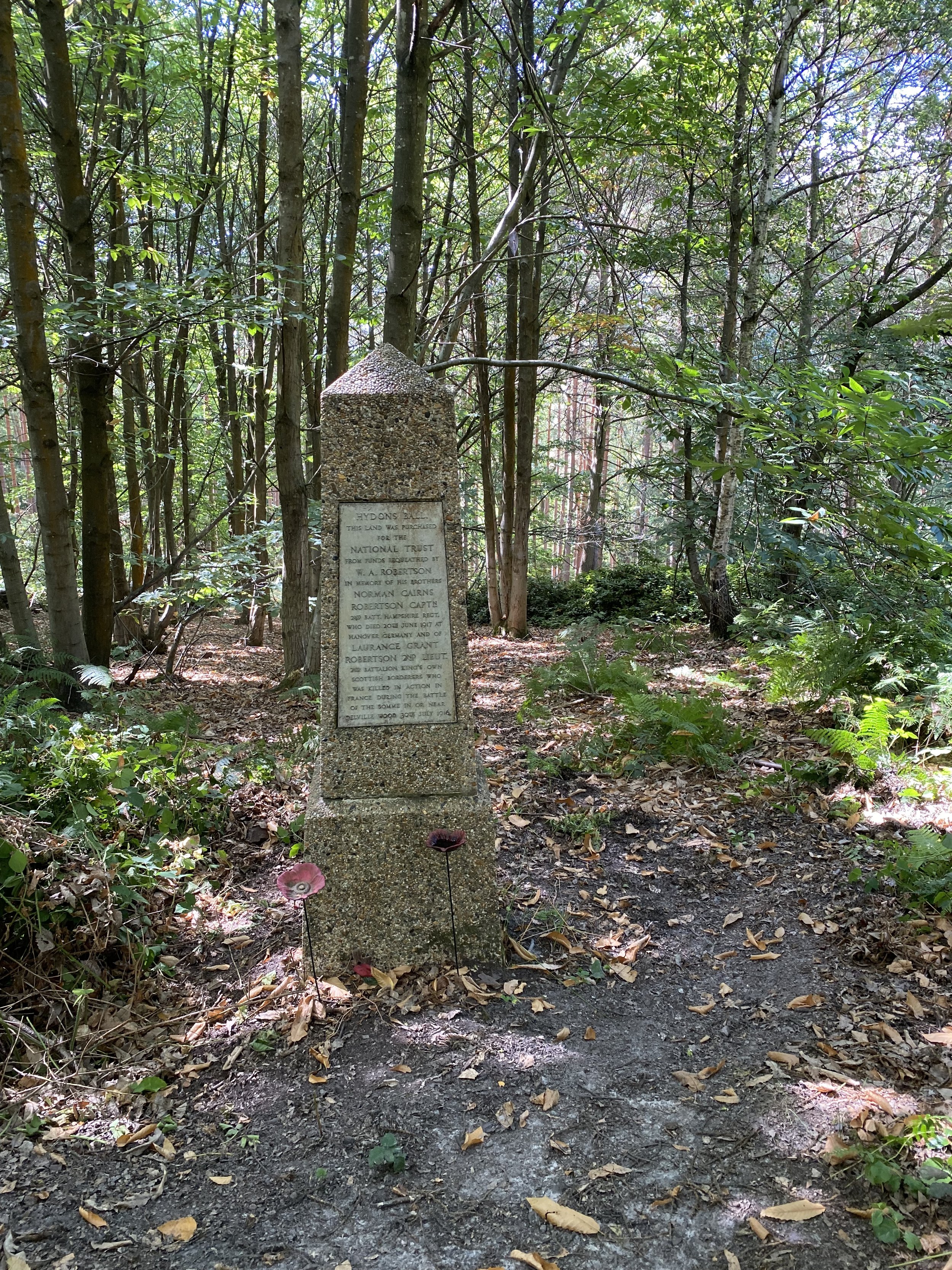
Section 5: Hydons Ball and Holloways Heath
Distance: 9.3 km (5.8 miles), Elevation change: +/- 172m
Section 6: Winkworth and Hascombe
Distance: 10 km (6.2 miles), Elevation change: +/- 179m
Section 7: Shamley Green and Grafham
Distance: 10.3 km (6.4 miles), Elevation change: +/- 107m
Section 8: Winterfold Wood and Reynards Hill
Distance: 10 km (6.2 miles), Elevation change: +/- 204m
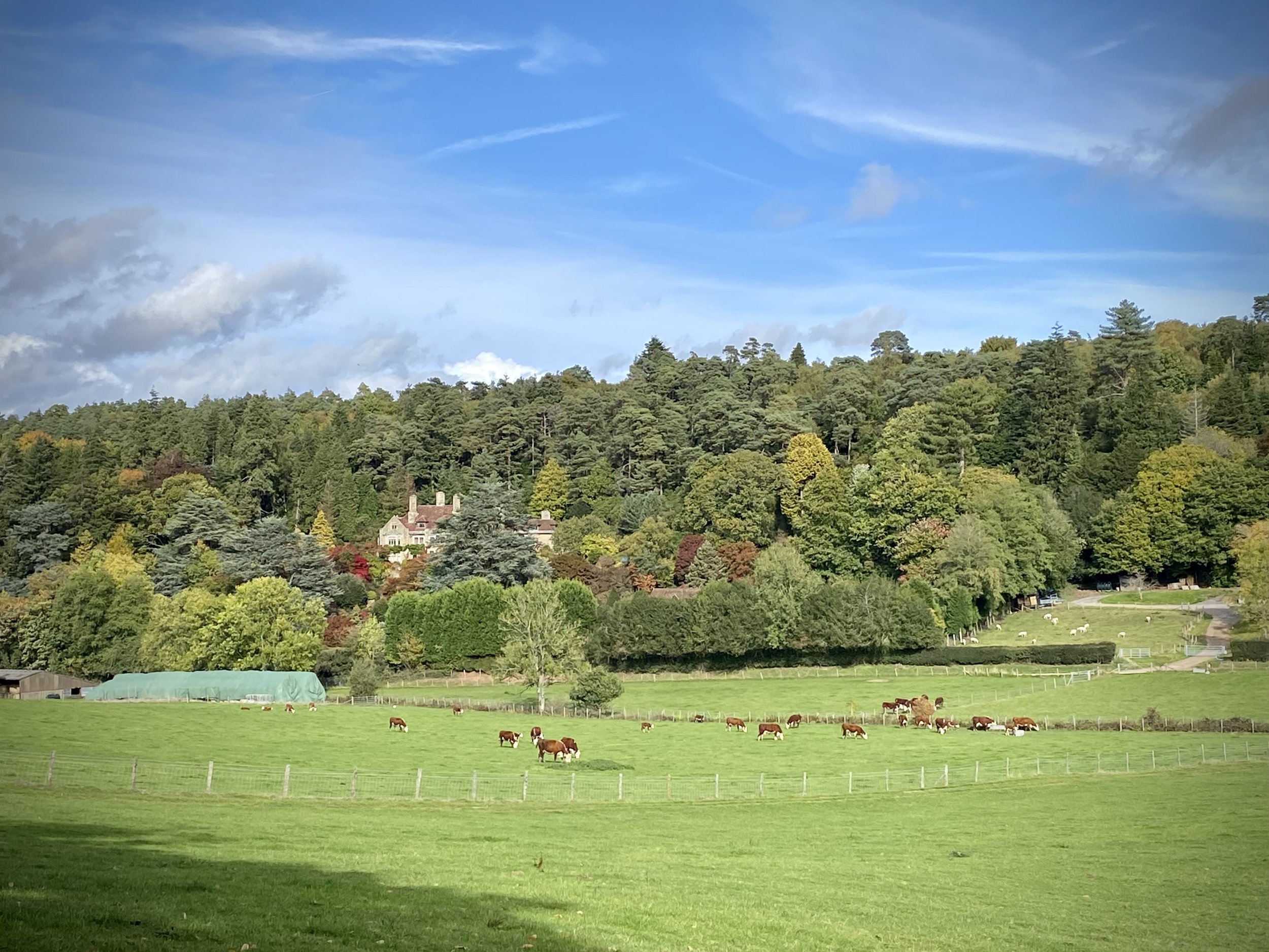
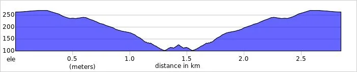
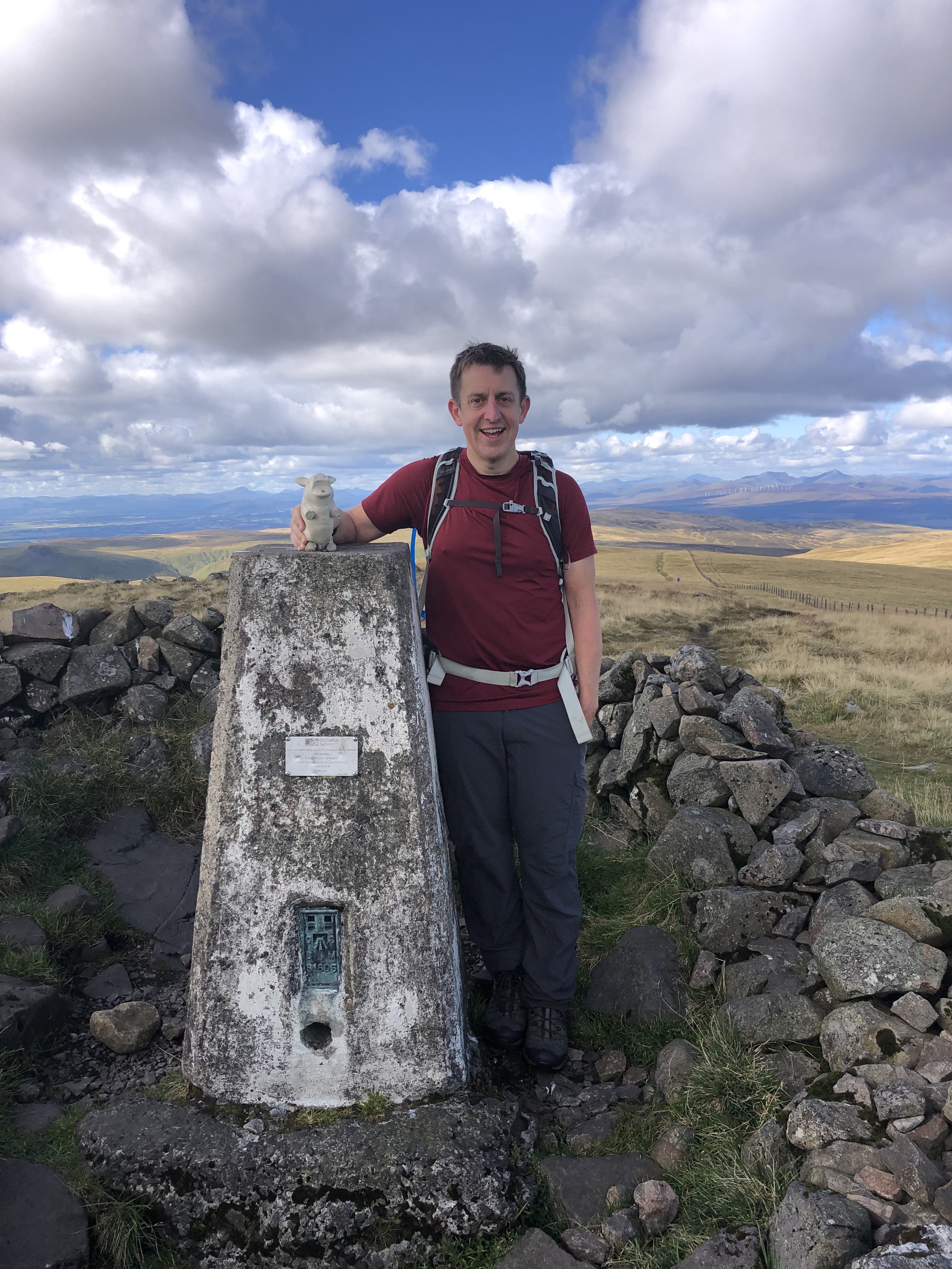
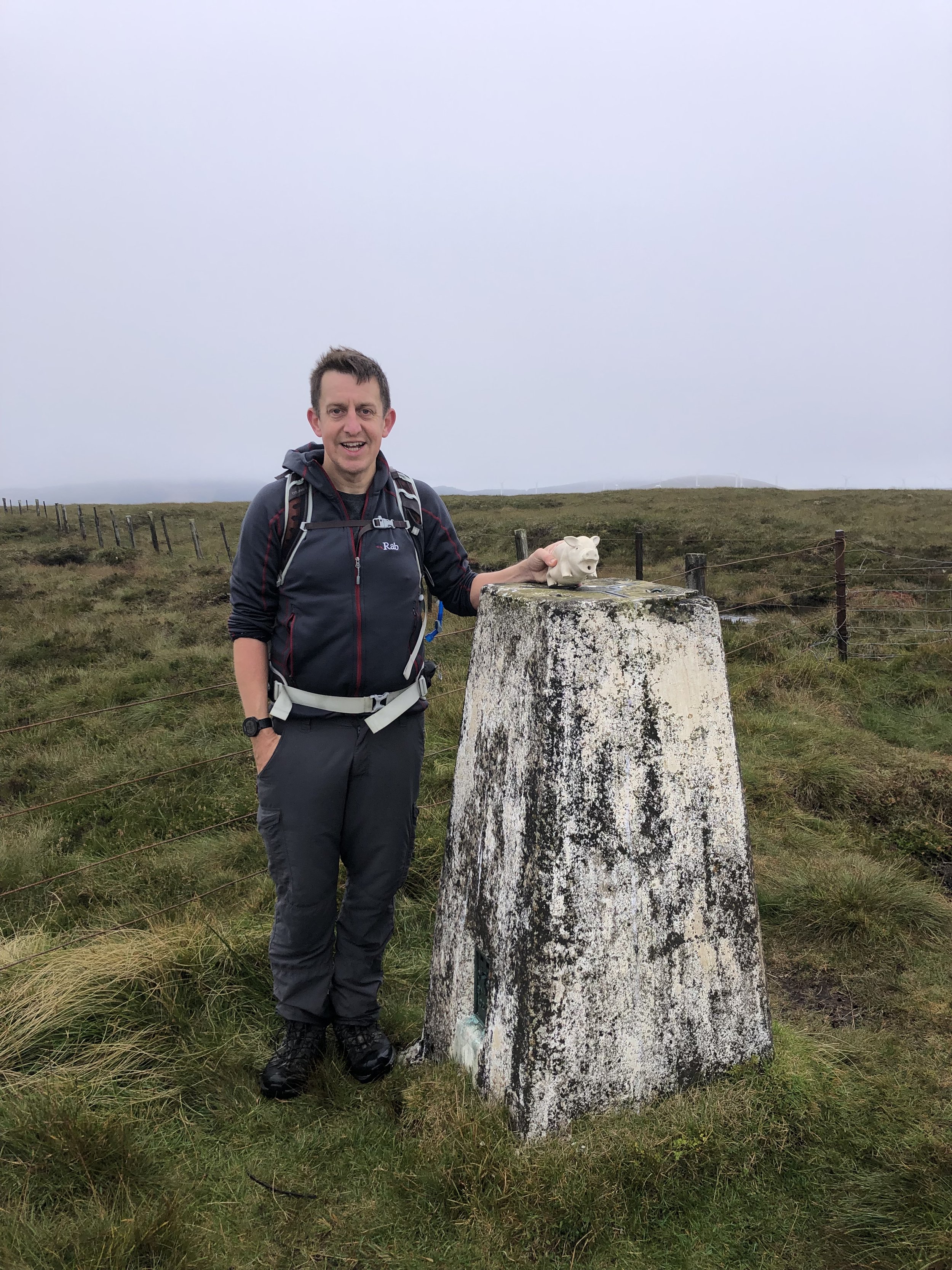
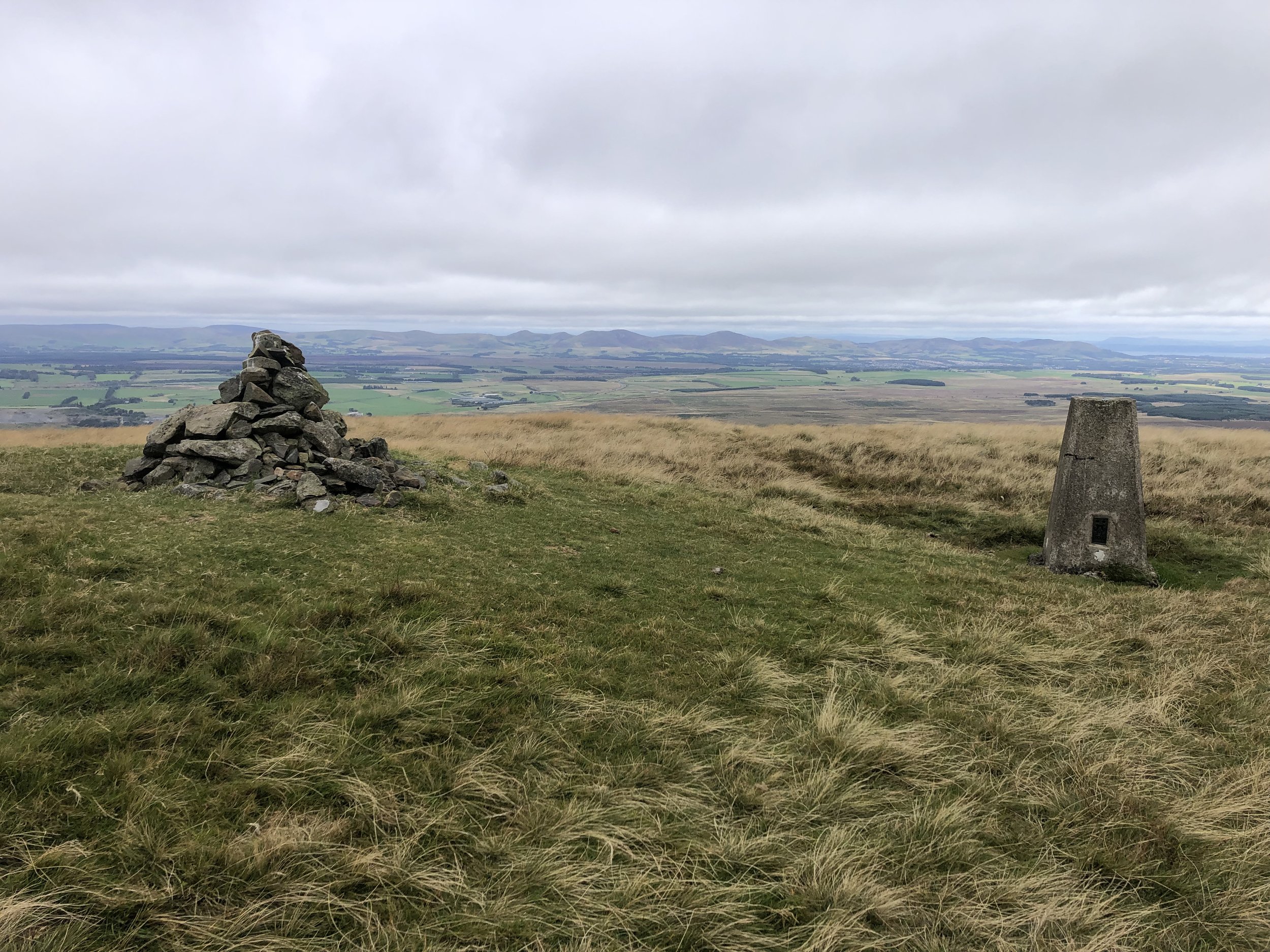
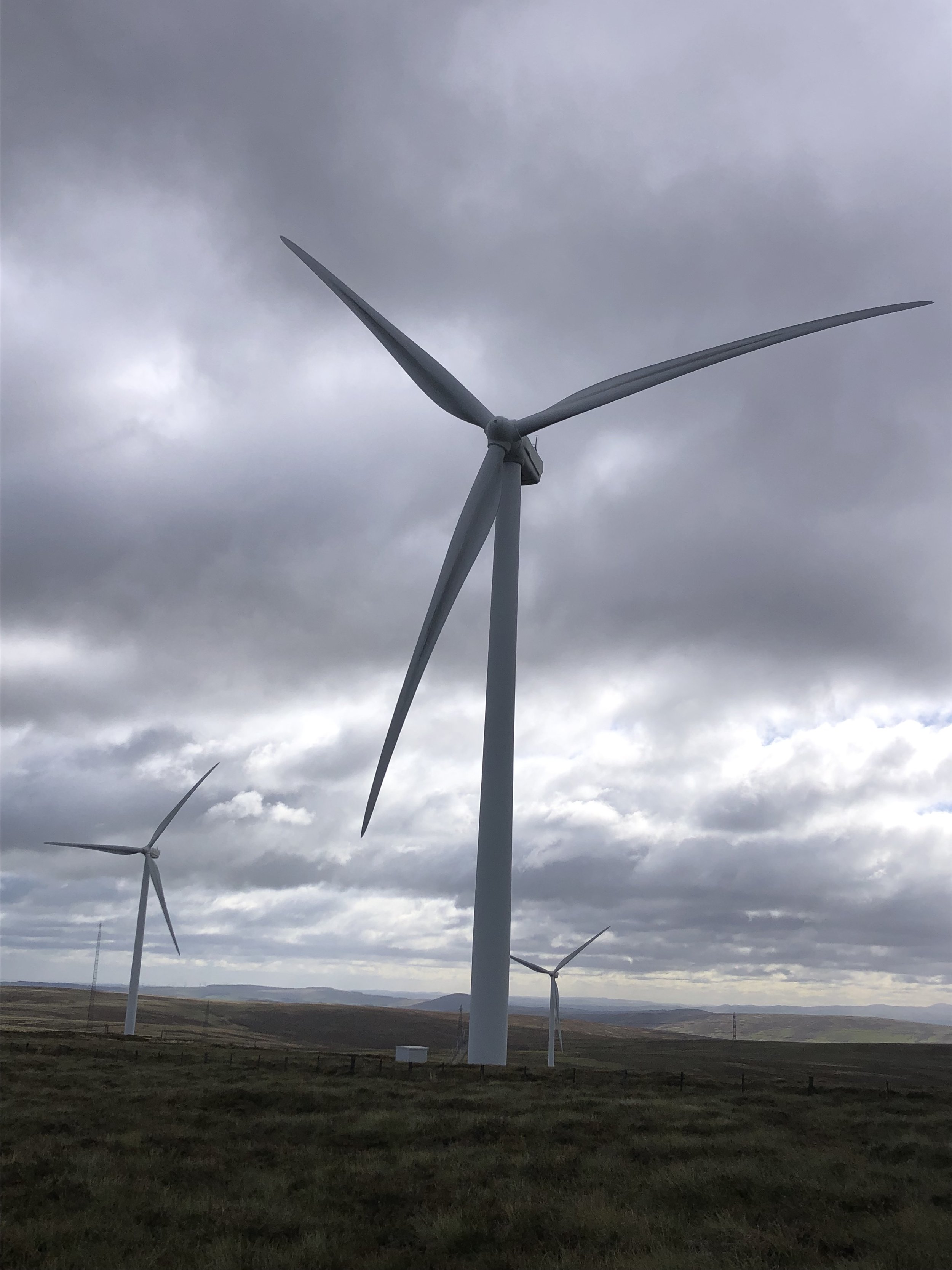
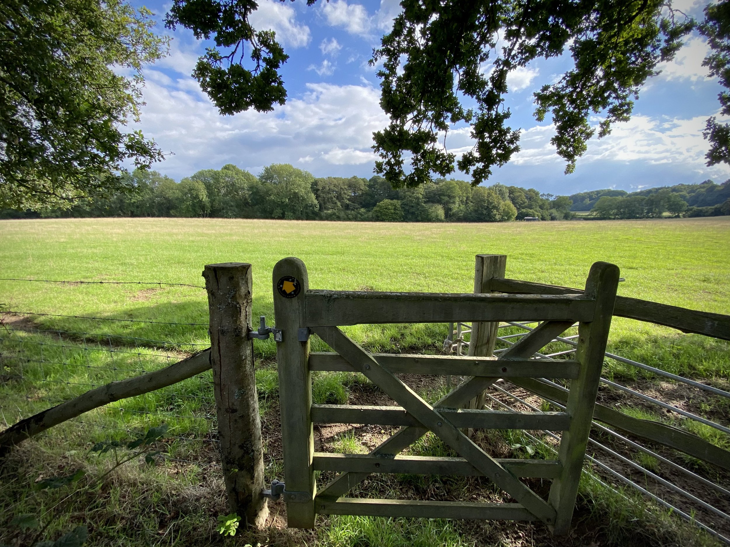
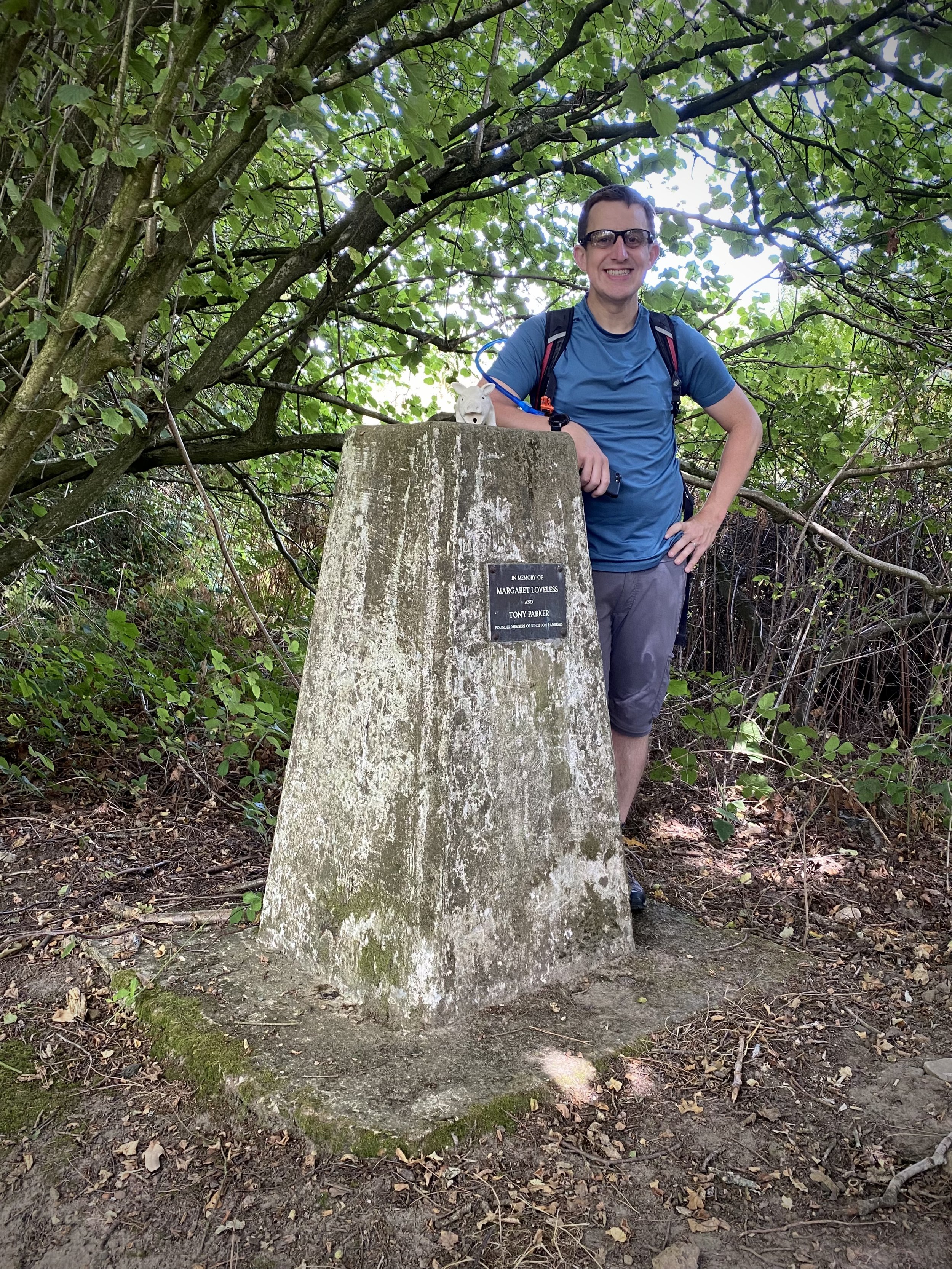
Section 9: Pitch Hill and Holmbury Hill
Distance: 10 km (6.2 miles), Elevation change: +/- 239m
Section 10: Leith Hill and Broadmoor
Route Distance: 10.3 km (6.4 miles), Route Elevation Change: +/- 206m
Section 11: Westcott and Bury Hill
Distance: 9 km (5.6 miles), Elevation change: +/- 163m
Section 12: The Nower and Dorking
Distance: 10.8 km (6.7 miles), Elevation change: +/- 222m
Section 13: Brockham and Betchworth
Distance: 10.4 km (6.5 miles), Elevation change: +/- 149m
Section 14: Betchworth and Reigate Heath
Distance: 9.6 km (5.9 miles), Elevation change: +/- 98m
Section 15: Reigate and Redhill Common
Distance: 9.1 km (5.6 miles), Elevation change: +/- 136m
Section 16: Earlswood and Nutfield Priory
Distance: 8.8 km (5.5 miles), Elevation change: +/- 165m
Section 17: Nutfield and Bletchingley
Distance: 9.9 km (6.1 miles), Elevation change: +/- 164m
Section 18: Bletchingley and Godstone
Distance: 10.4 km (6.5 miles), Elevation change: +/- 143m
Section 19: Tandridge and Oxted
Distance: 10.6 km (6.6 miles), Elevation change: +/- 165m
Section 20: Oxted and Limpsfield
Distance: 11.2 km (7 miles). Elevation change: +/- 142m

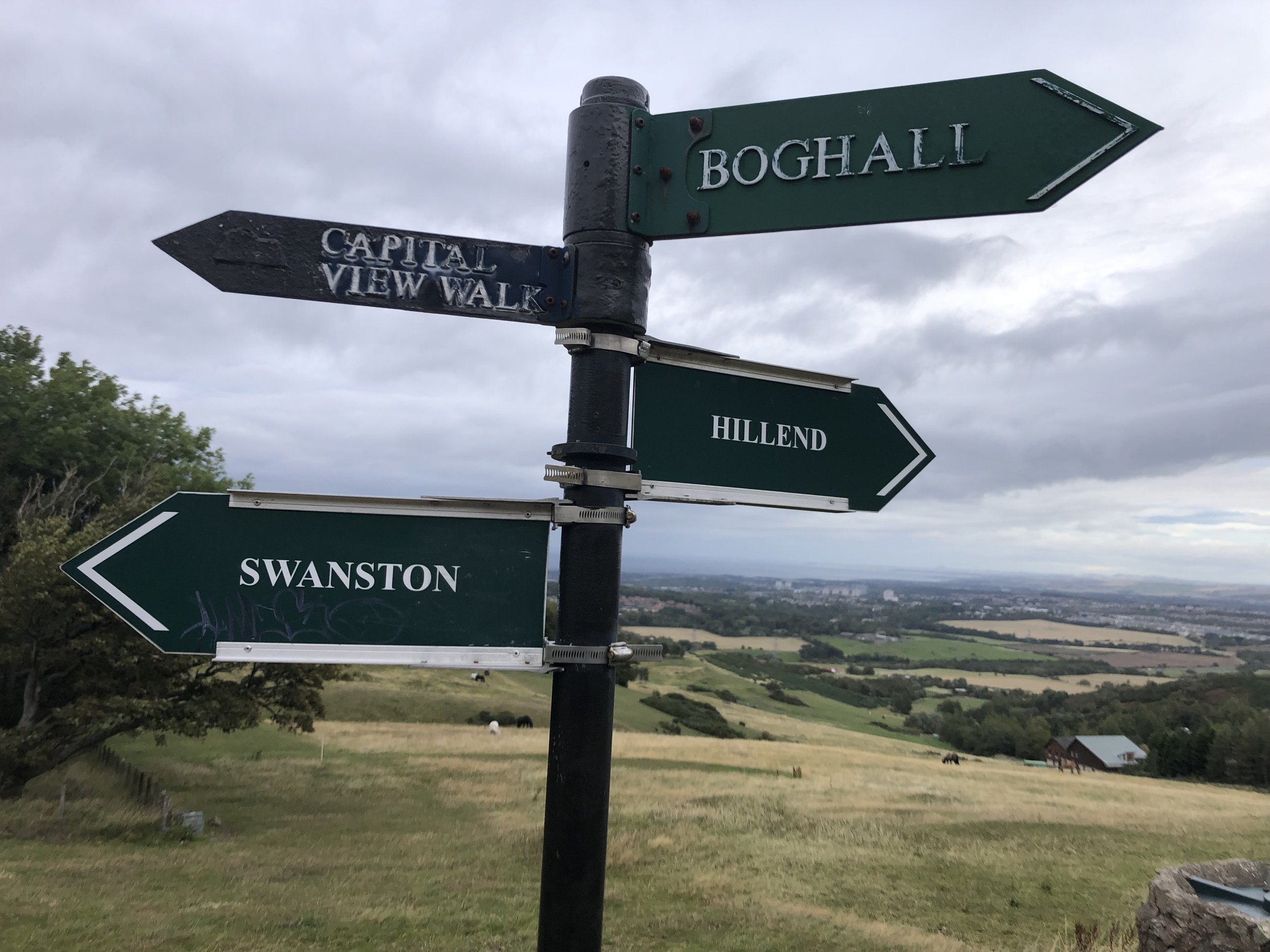
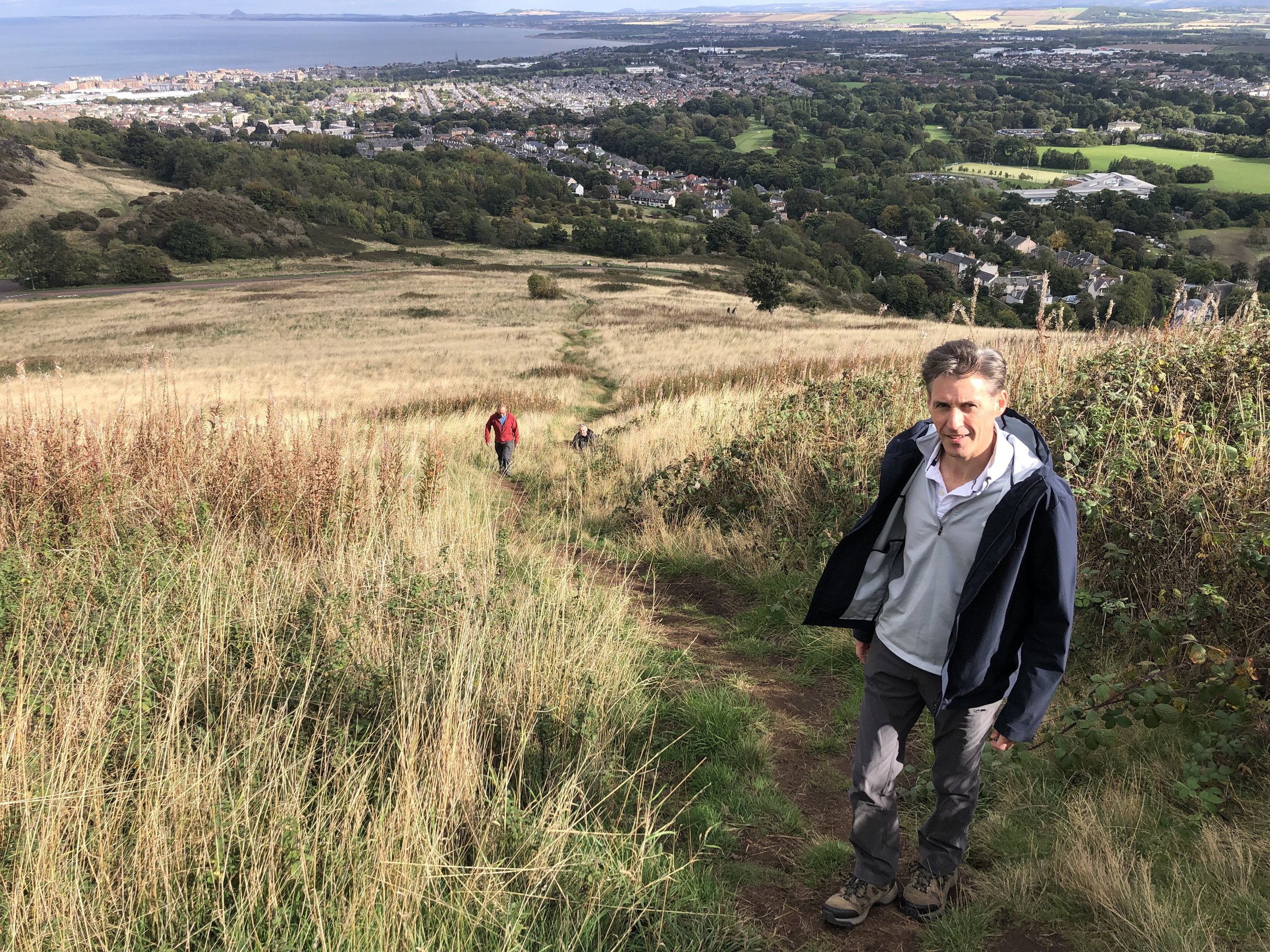
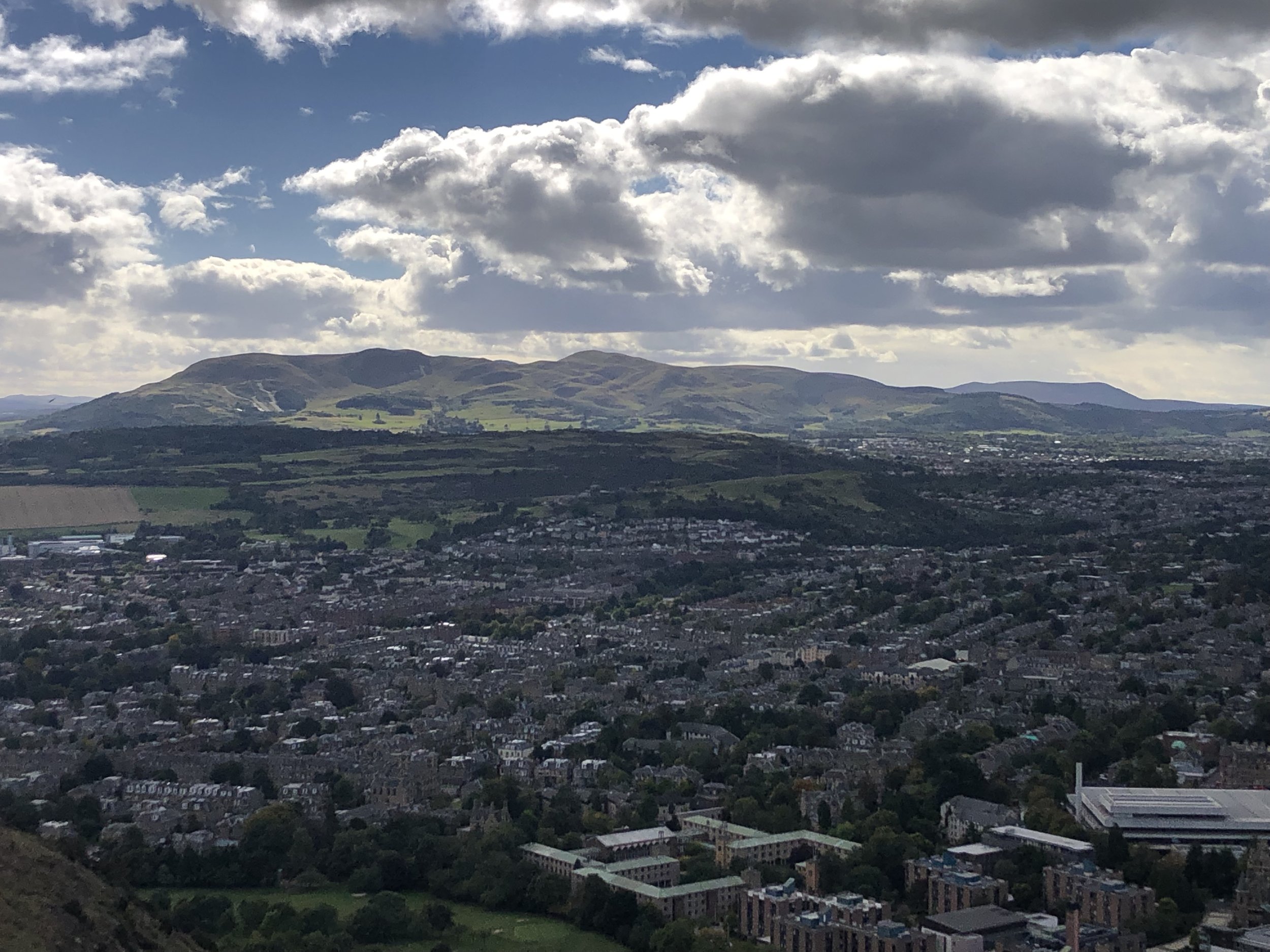
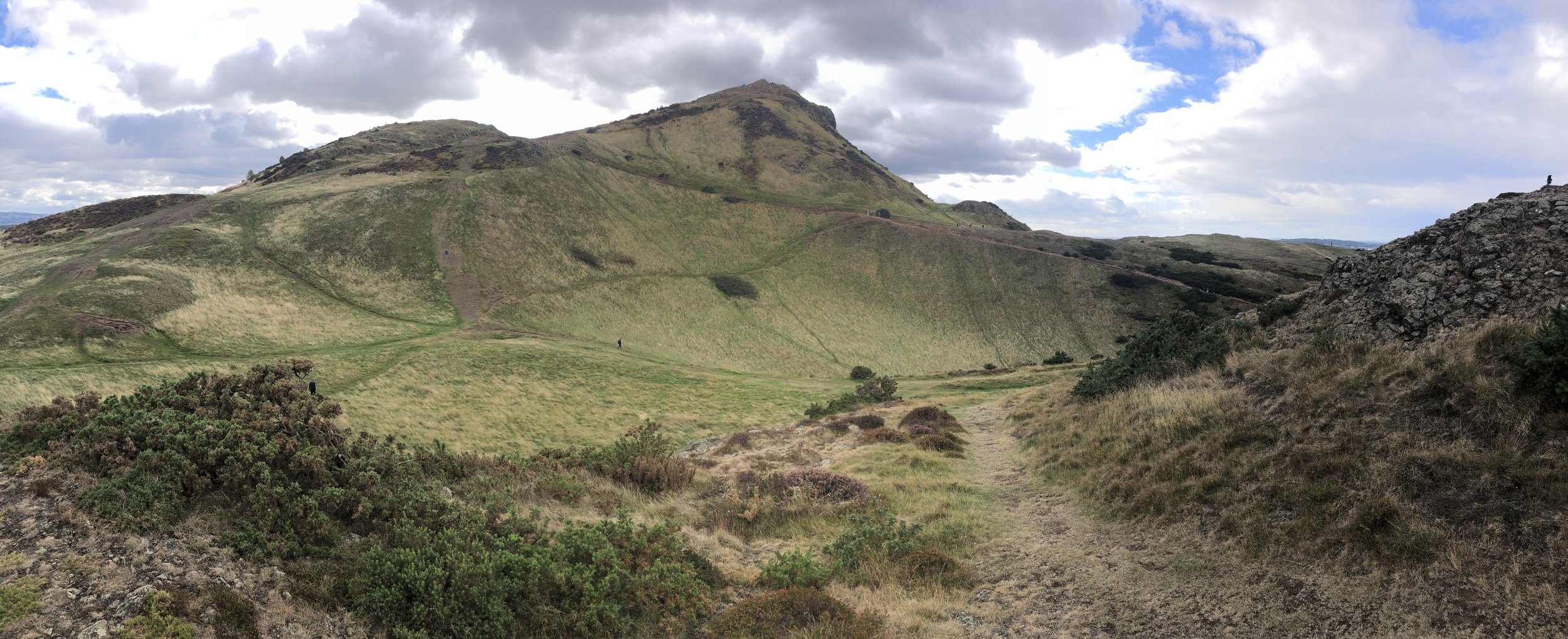
North face of Arthur’s Seat from Whinney HIll
Allermuir Hill and Arthur’s seat are two very different hills, linked only as being short walks very accessible from Edinburgh Centre. For us they were two “bonus peaks” that we squeezed in on our Edinburgh Crescent County Top trip.
Member of: Marilyn
Parent Peak: Scald Law NHN = Turnhouse Hill
Elevation: 493m
Date climbed: 25th September 2022
Coordinates: 55° 52' 57'' N, 3° 14' 14'' W
Route Start / End: Midlothian Snowsports Centre, Hillend, Biggar Road, Edinburgh, EH10 7DU
Route Distance: 4.0 km (2.5 miles)
Route Elevation Change: +/- 240m
Subsidiary tops on route: None .. but Caerketton Screes could easily be added to the route
GPX File: get via Buy Me a Coffee
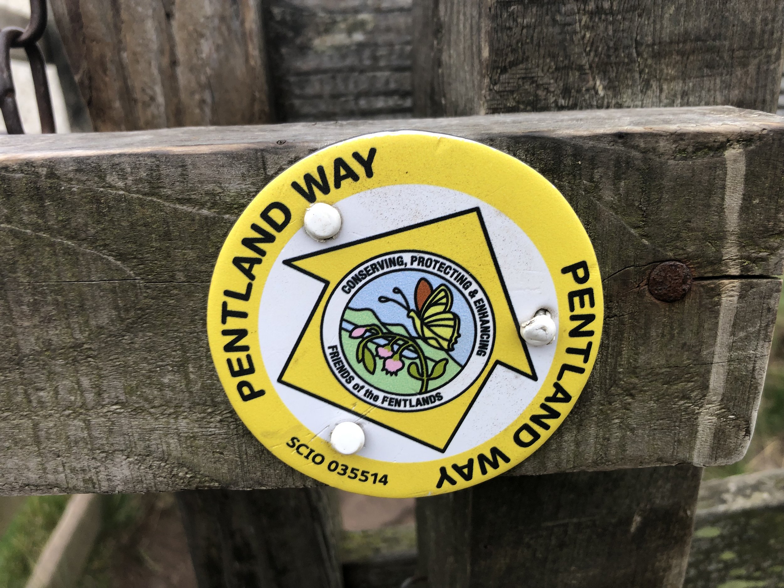
Other routes touched (walk): Pentland Way
Other routes touched (cycle): None
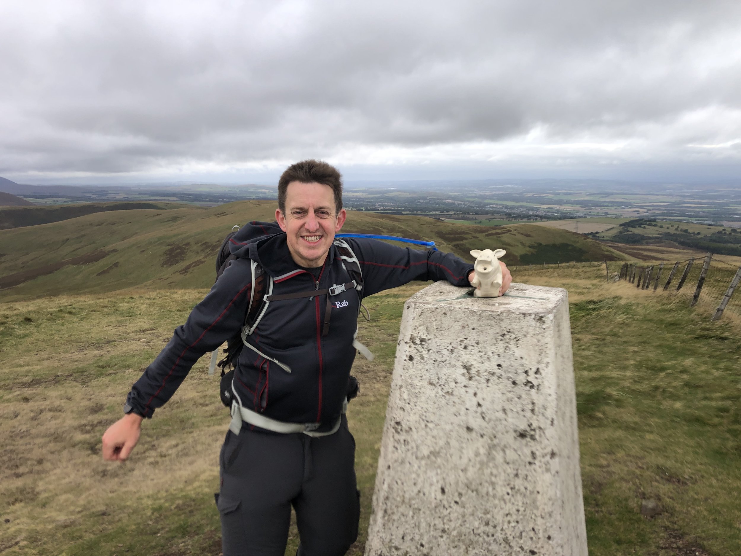
OS Trig Pillar: TP0816 - Allermuir Hill
Map: Edinburgh Map | Musselburgh & Queensferry | Ordnance Survey | OS Explorer Map 350
Links: Wikipedia (Pentland Hills), Peakbagger, Hillbagging
Having completed Blackhope Scar earlier in the day and with some time to spare, I picked Allermuir as our bonus walk as it was close to our hotel in Dalkeith. We parked at the Midlothian Snowsports Centre and to the track heading west towards the Pentland Way. We chose to ascend via the col between Allermuir and Caerketton Screes. In hindsight, and with better planning, I would have ascended before Caerketton Screes to bag that summit too in the way to Allermuir.
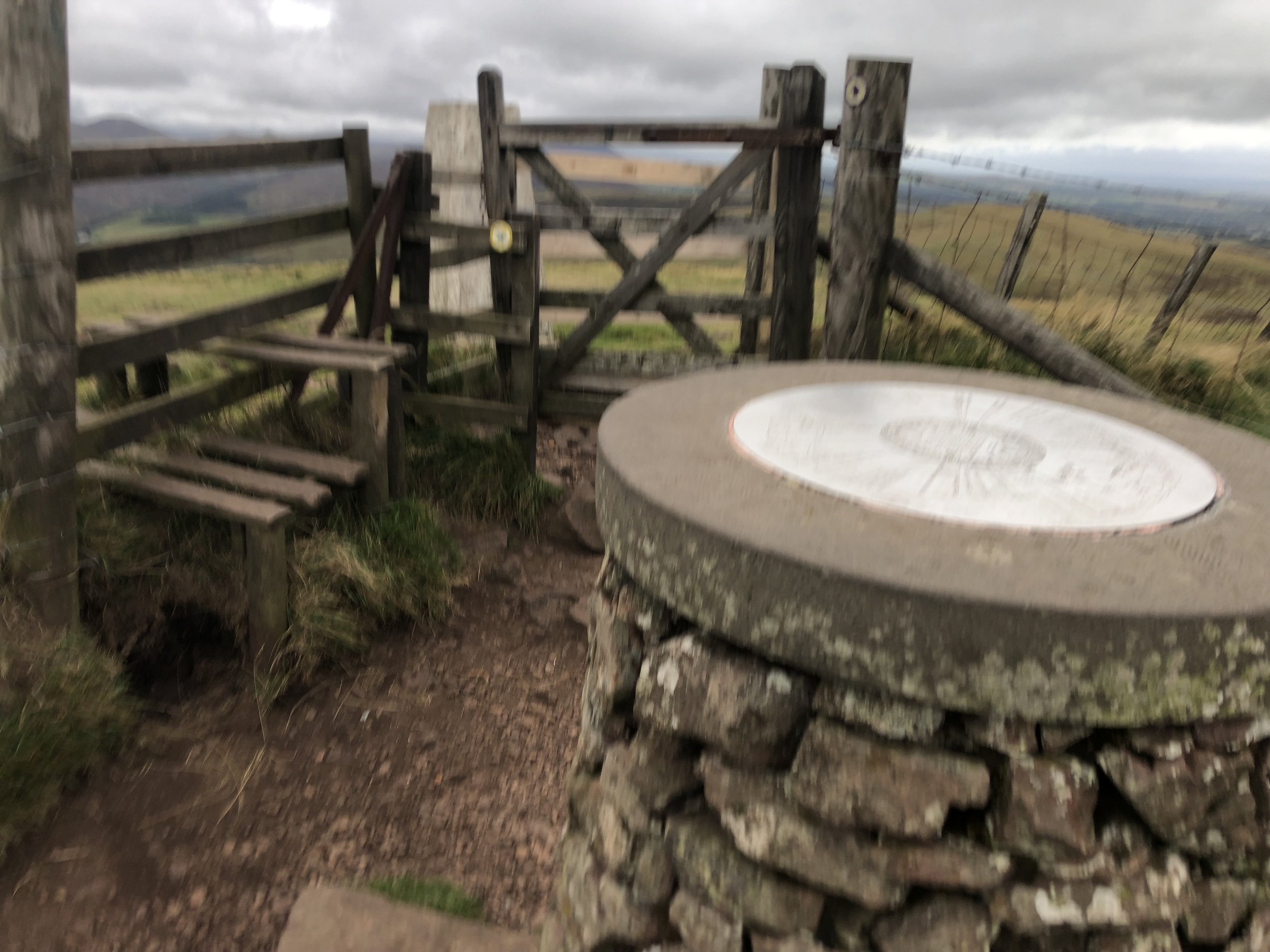
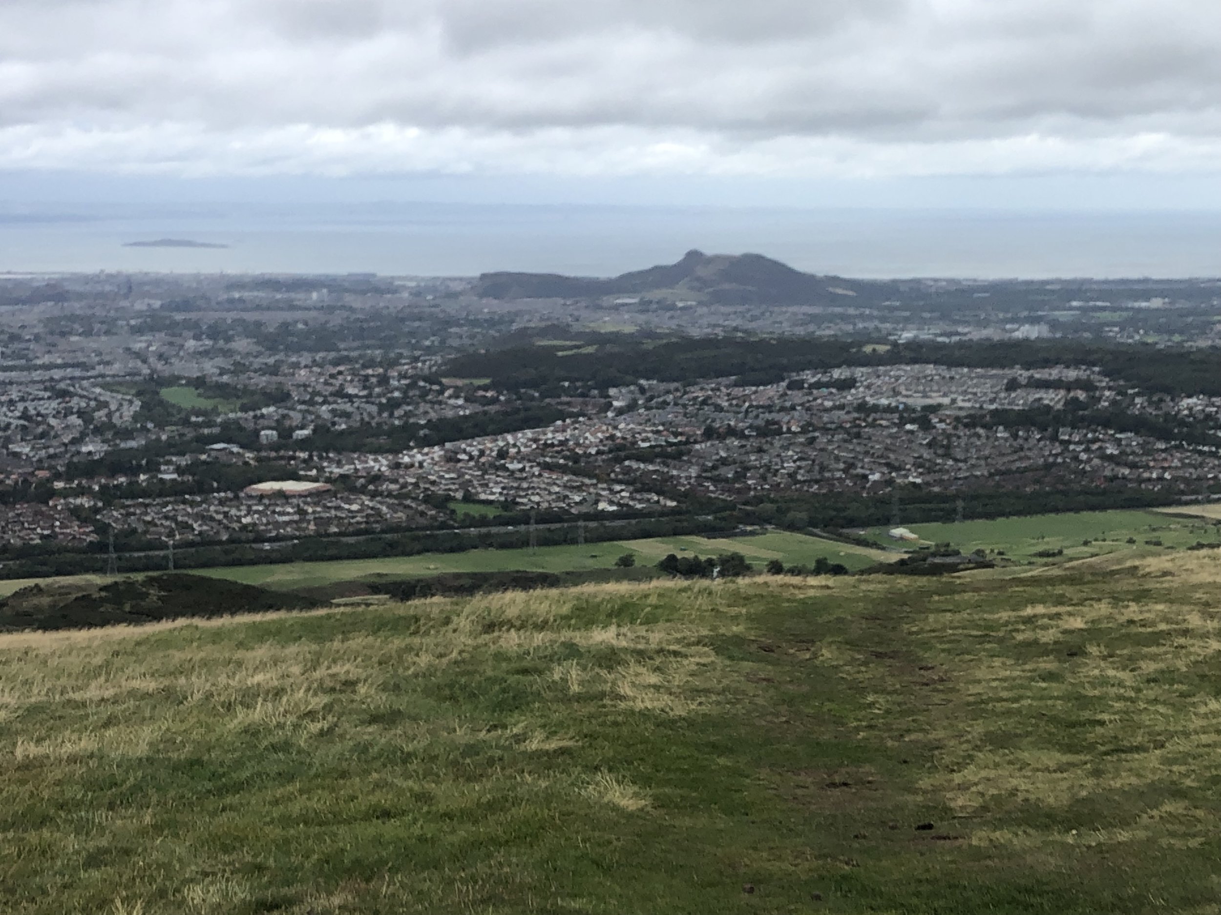
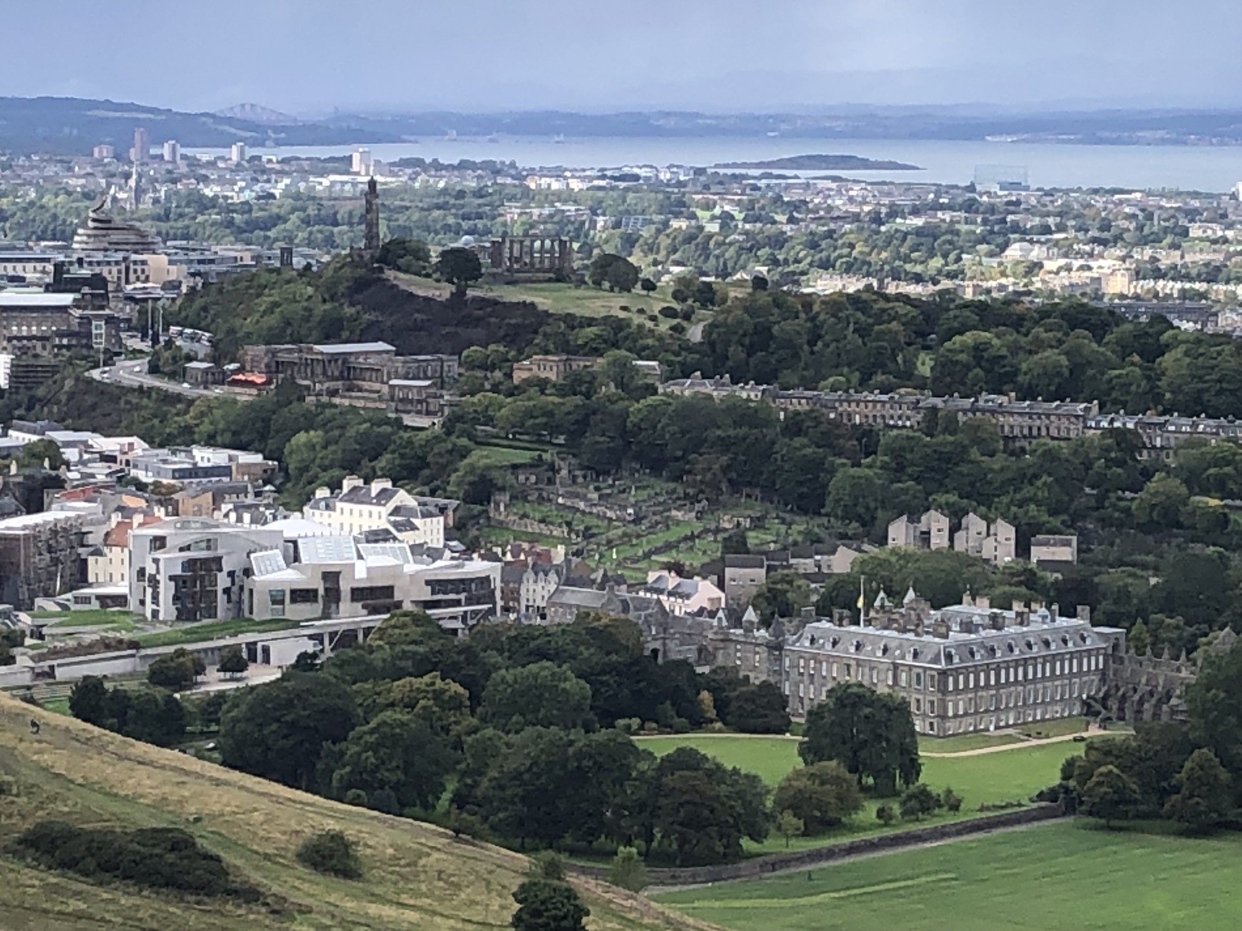
From the Trig Pillar at the summit of Allermuir you get a great view over to Edinburgh, including Arthur’s Seat, the Firth of Forth and, in the other direction, the Pentland Hills. We were there on a very windy afternoon so didn’t hang around on the summit for long so descended following the Pentland Way to the north-east then back to the Snowsports Centre.
Member of: Marilyn
Parent Peak: Allermuir Hill (to be verified) TBC NHN = Caerketton Hill
Elevation: 251m
Date climbed: 26th September 2022
Coordinates: 55° 56' 38'' N, 3° 9' 42'' W
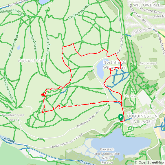
Route Start / End: Parking area near Duddingston Lodge, Old Church Lane, Duddingston, Edinburgh, EH15 3PY
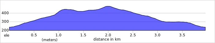
Route Distance: 3.7 km (2.3 miles)
Route Elevation Change: +/- 195m
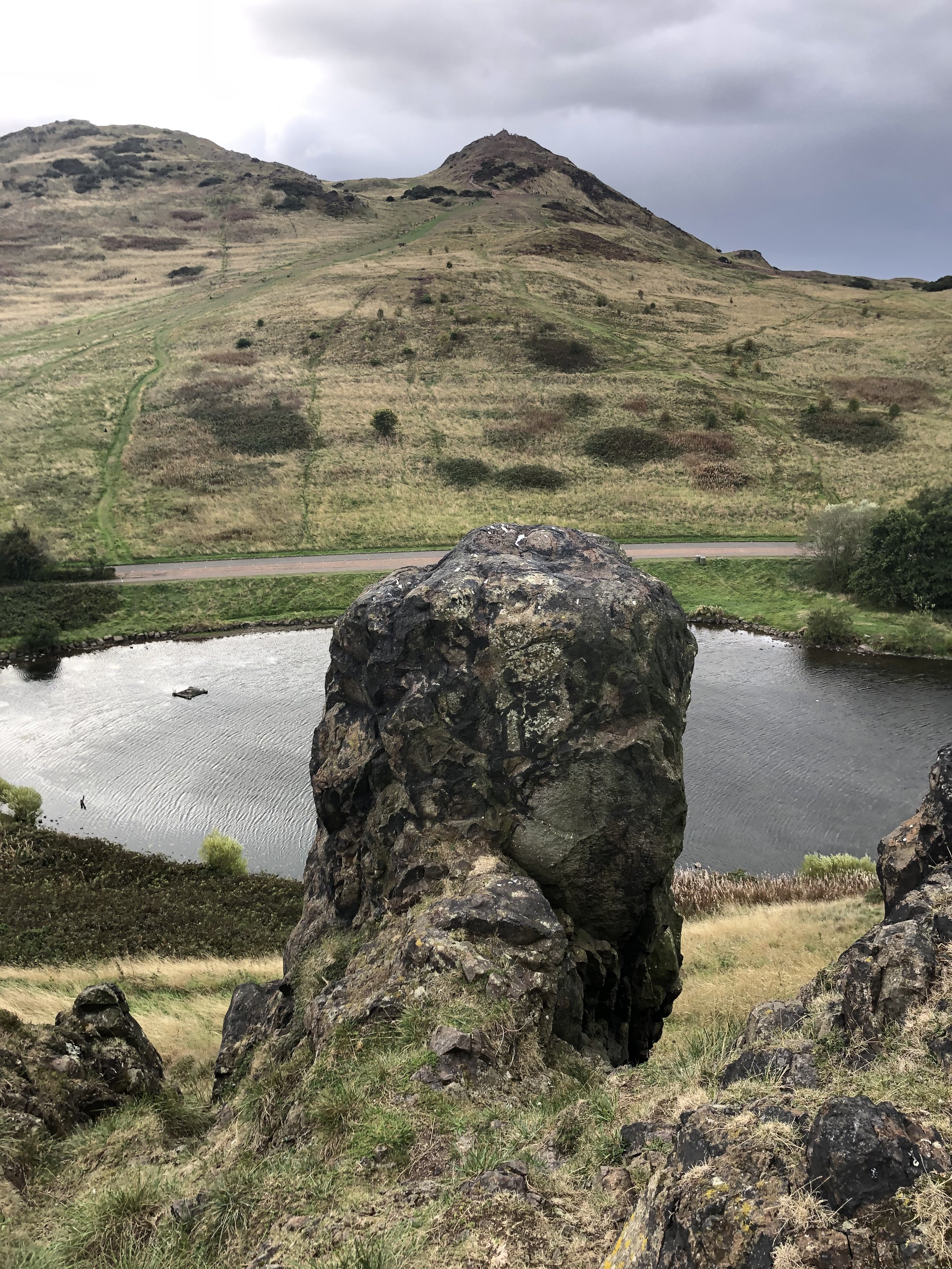
Subsidiary tops on route: Crow Hill (238m), Nether Hill (237m), Whinney Hill (174m), Dunsapie Crag (146m)
GPX File: get via Buy Me a Coffee
Other routes touched (walk): None
Other routes touched (cycle): None
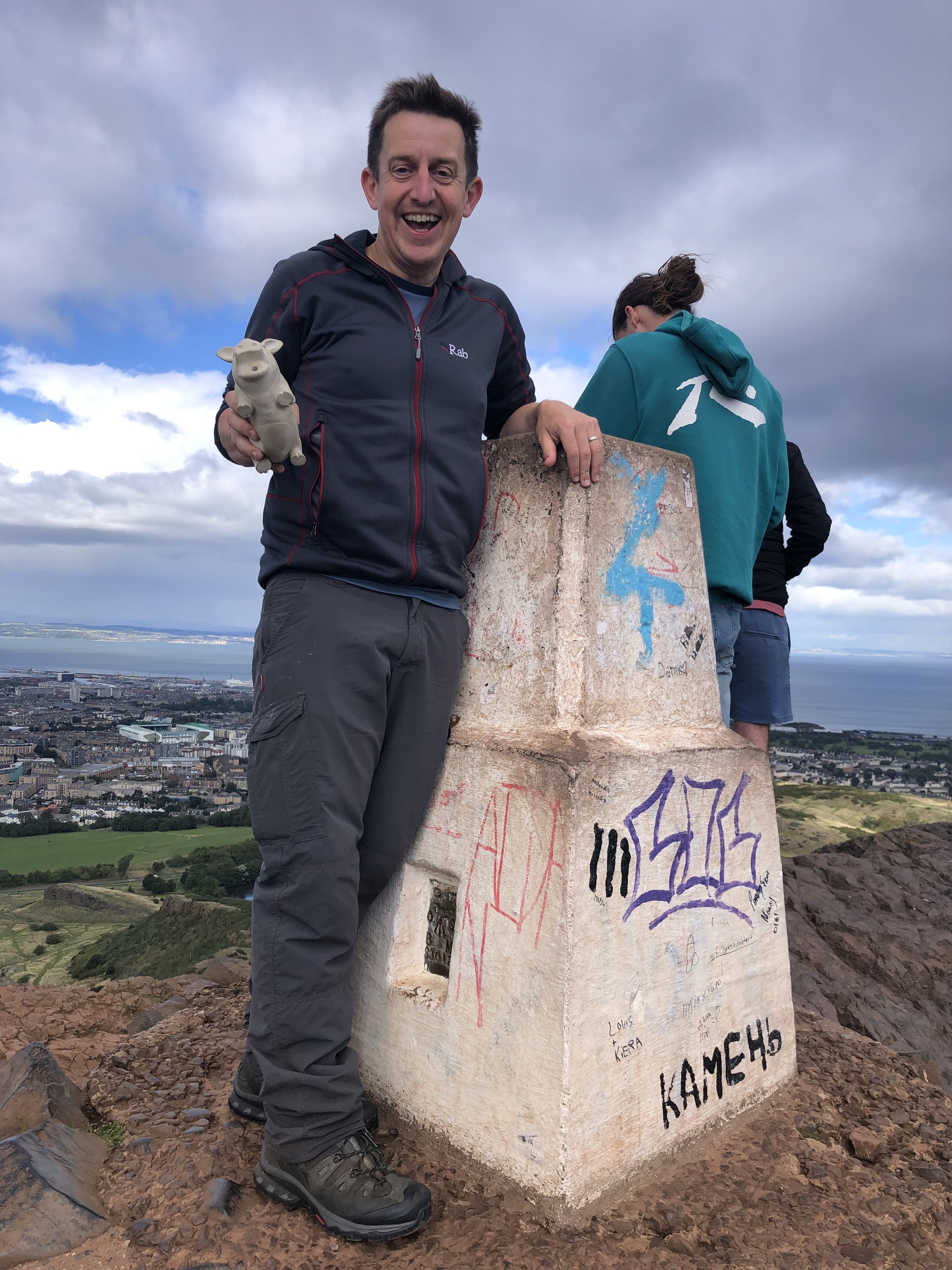
OS Trig Pillar: TP0893 - Arthurs Seat
Map: Edinburgh Map | Musselburgh & Queensferry | Ordnance Survey | OS Explorer Map 350
Links: Wikipedia, Peakbagger, Hillbagging
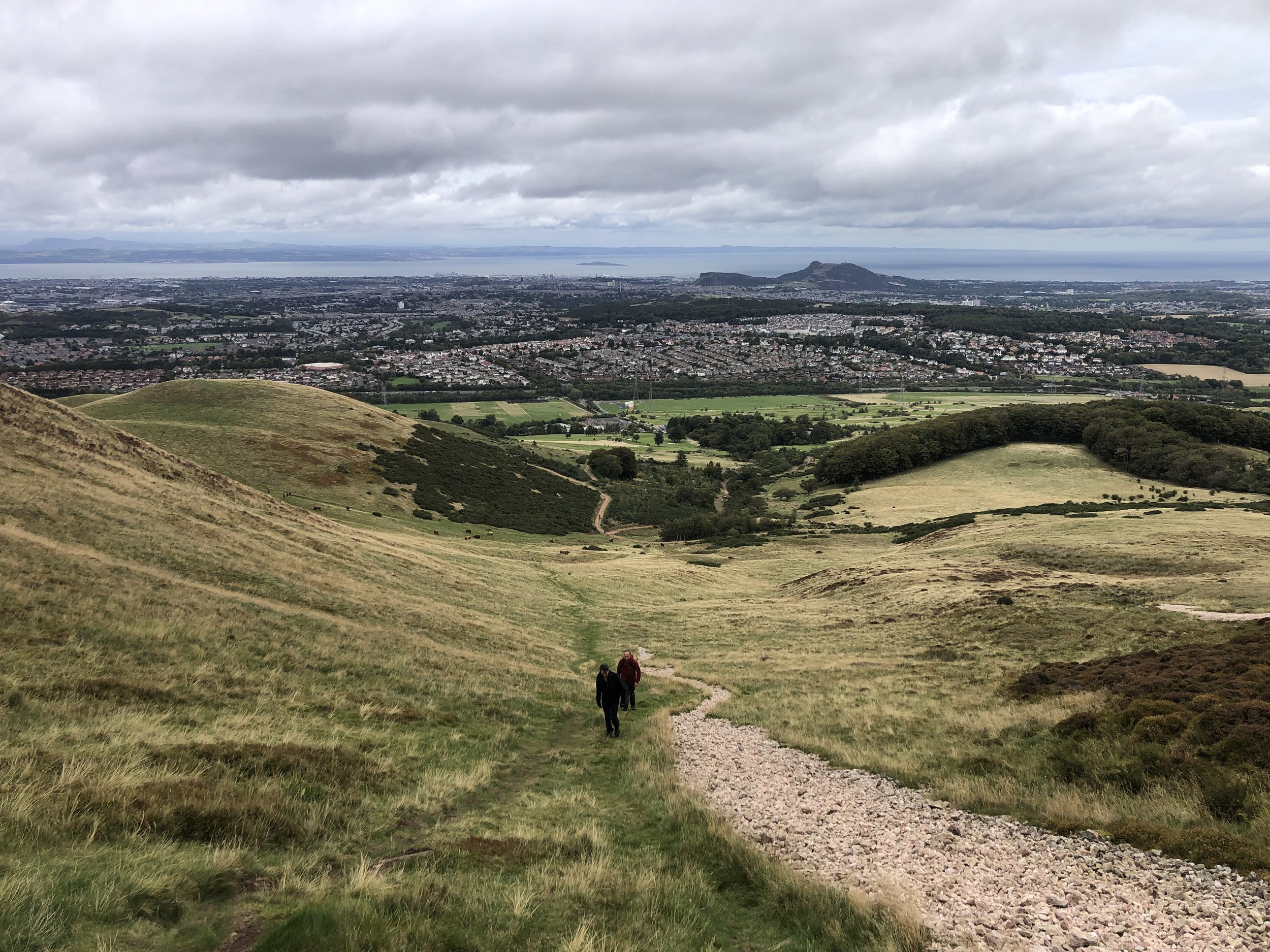
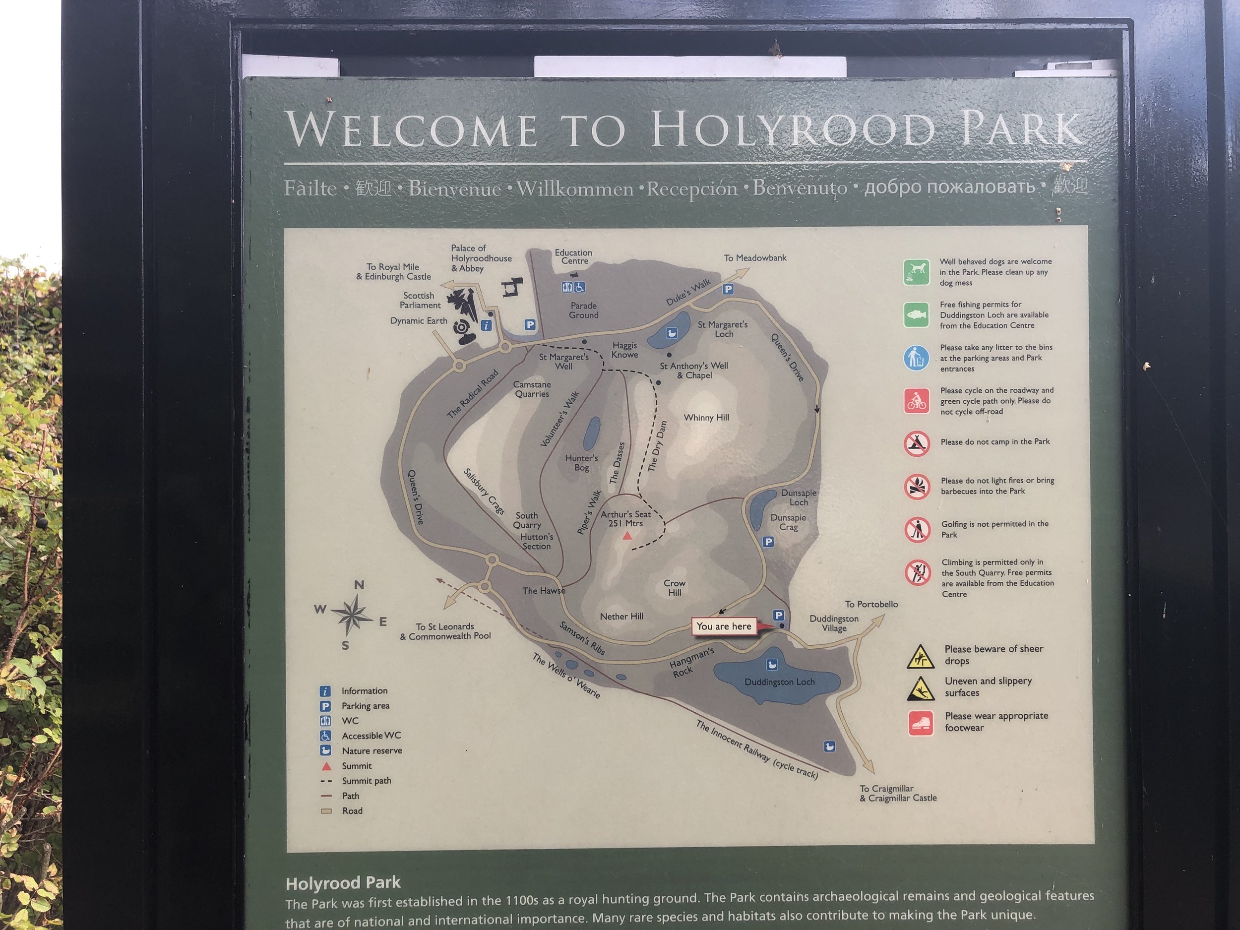
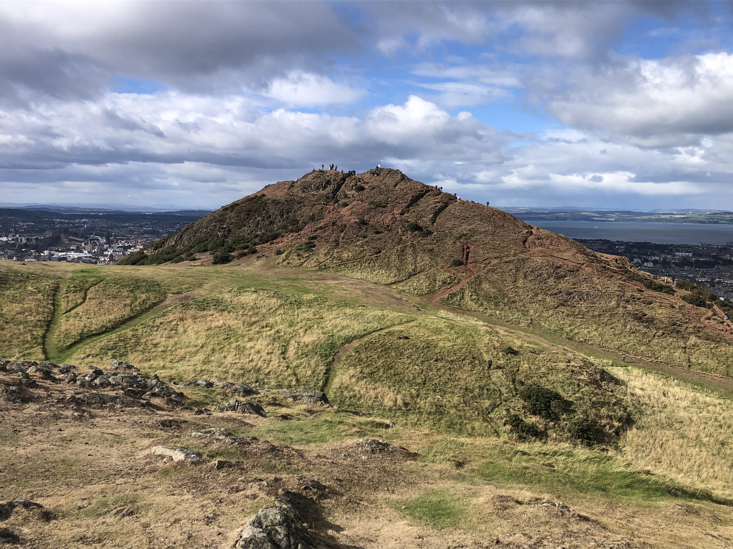
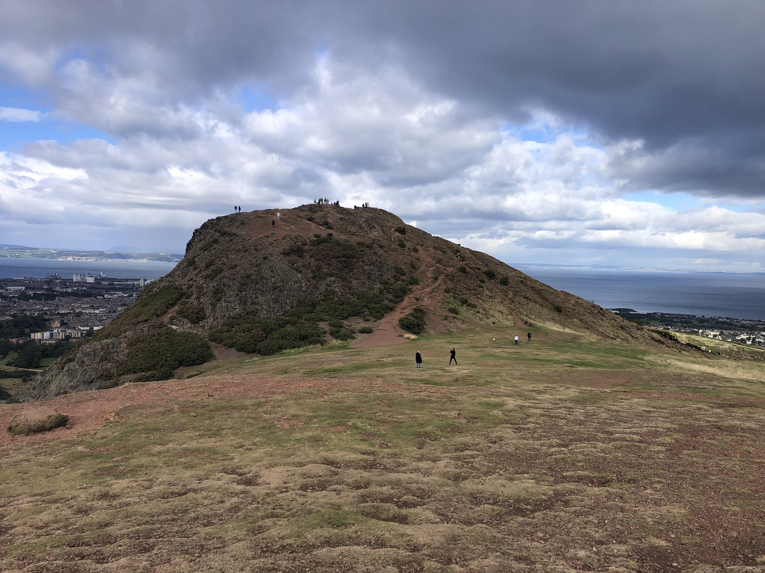
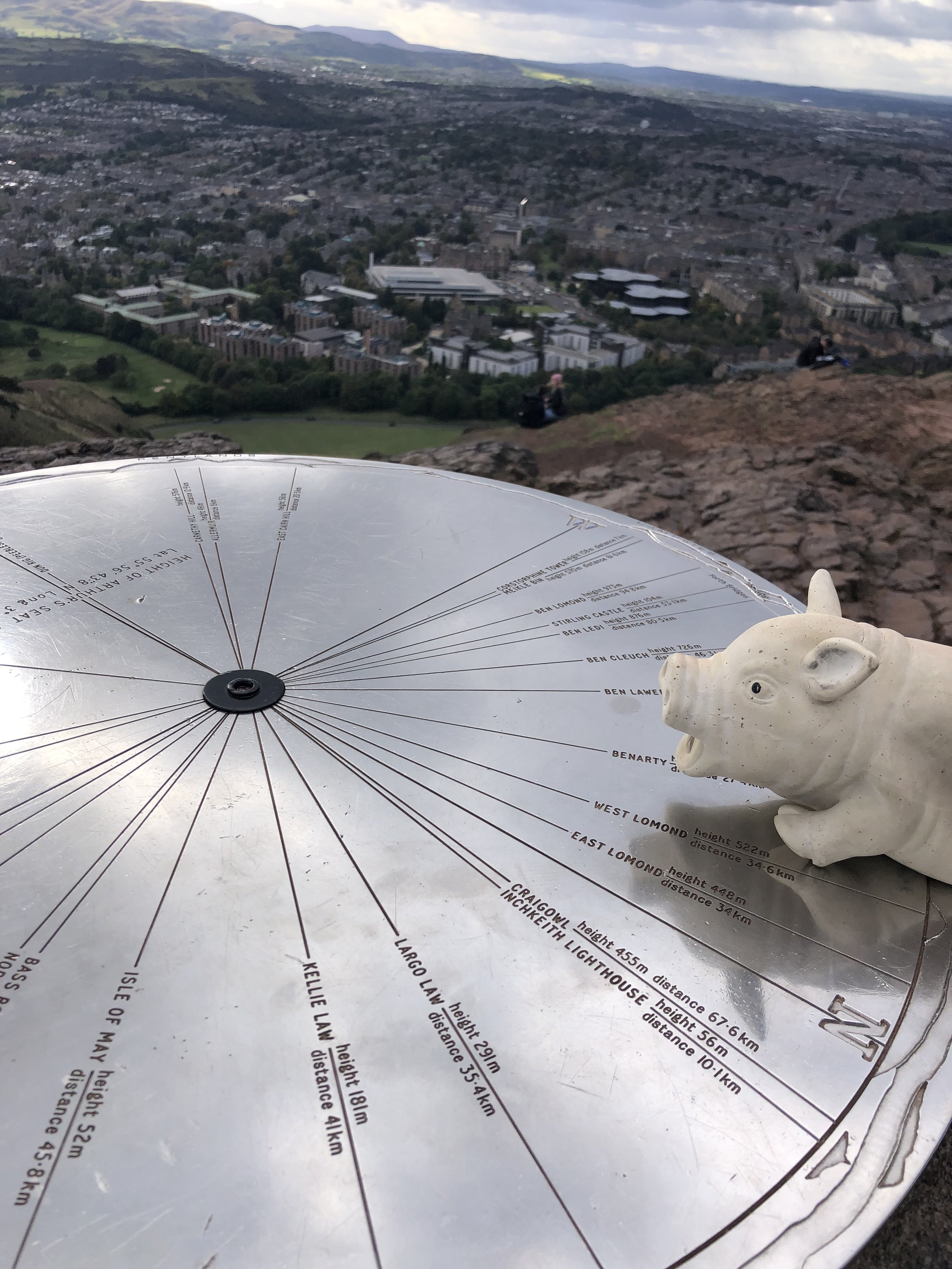
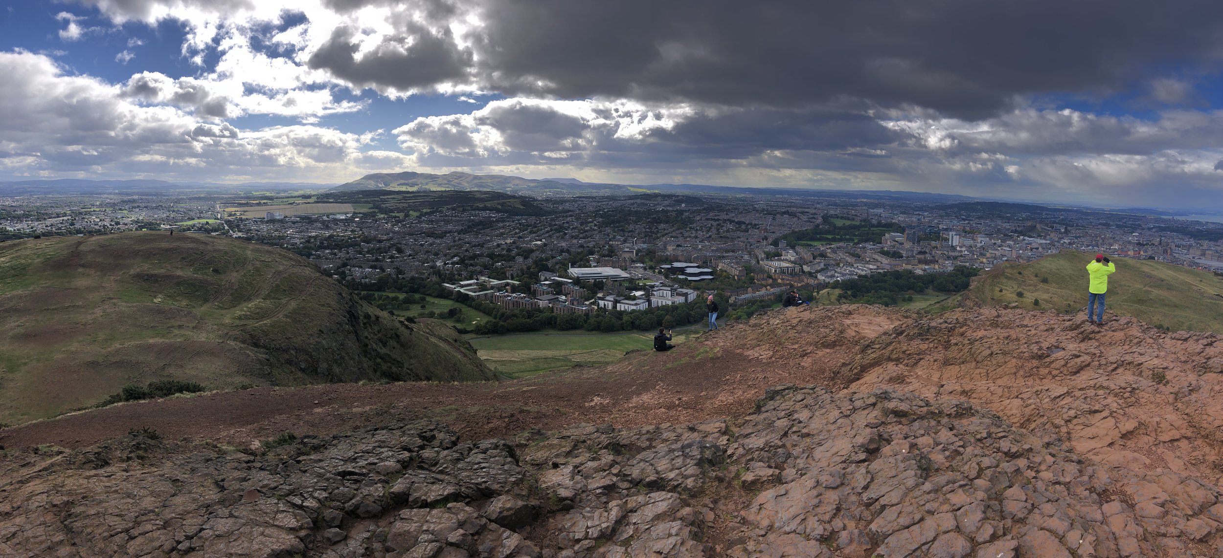
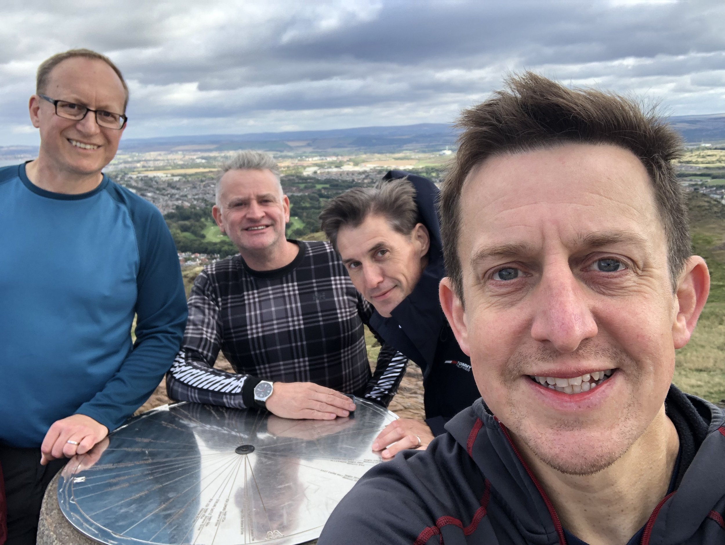
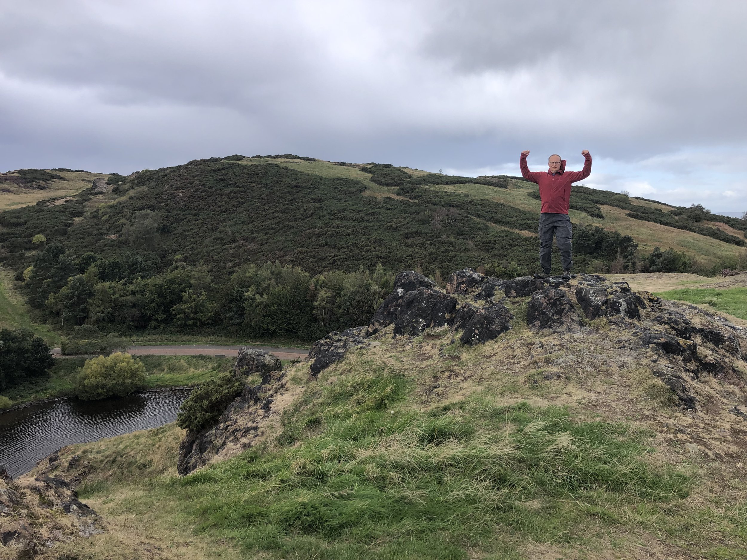
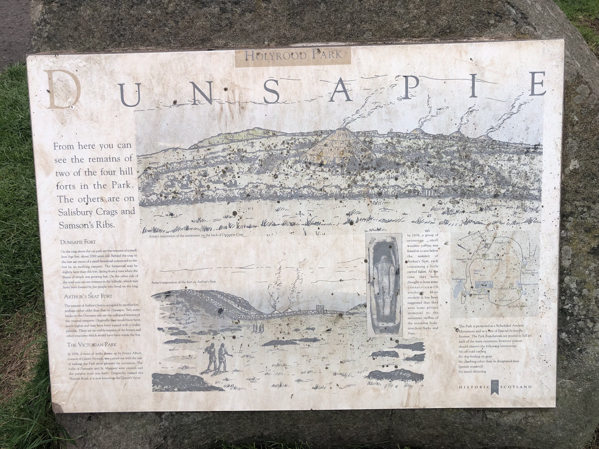
Arthur’s Seat is an icon of Edinburgh, an extinct volcano dominating Holyrood Park to the east of the city centre. We had completed Meikle Says Law in good time and were keen to fit it in on the way back to the airport. Rather than a simple out-and-back from the closest car park, we ended up having enough time for a small circuit covering 4 smaller peaks on the east side of Holyrood.
Most people access Arthur’s Seat from the west, closest to the city centre. Instead we found a small, quieter car park in the east at Duddingston Village. The simple out-and-back option would have taken us less than 40 minutes and we did the whole circuit in only an hour and a quarter. With more time I would have included Salisbury Crags and Haggis Knowe on the west of the park to do the full Holyrood Circuit. I reckon that the full route would have taken around 2 and a half hours.
Bagging Arthur’s Seat was a satisfying conclusion to our Edinburgh County Tops weekend. We had a a clear day and had a good view to several of the peaks that we bagged over the weekend and the city itself.

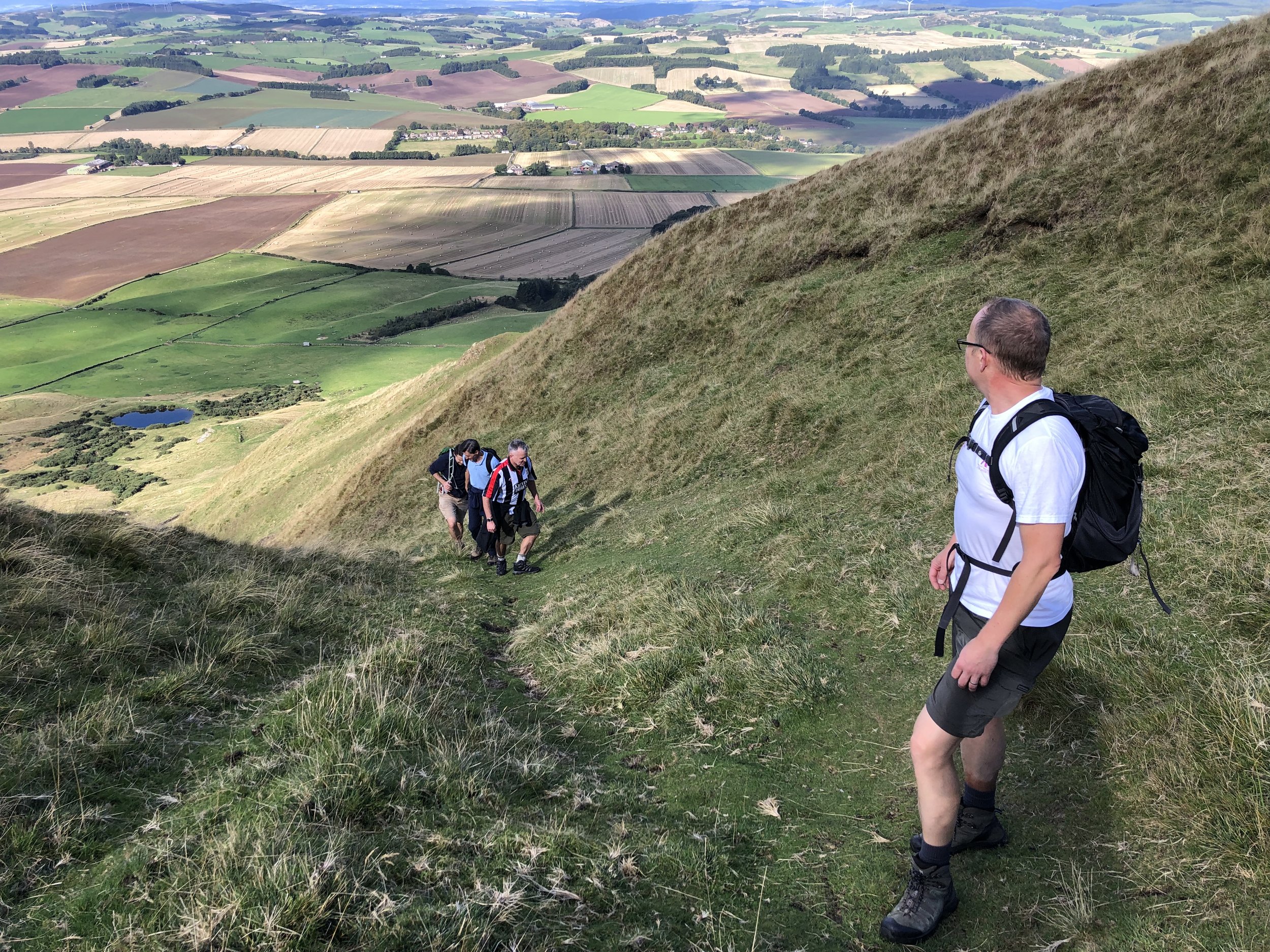
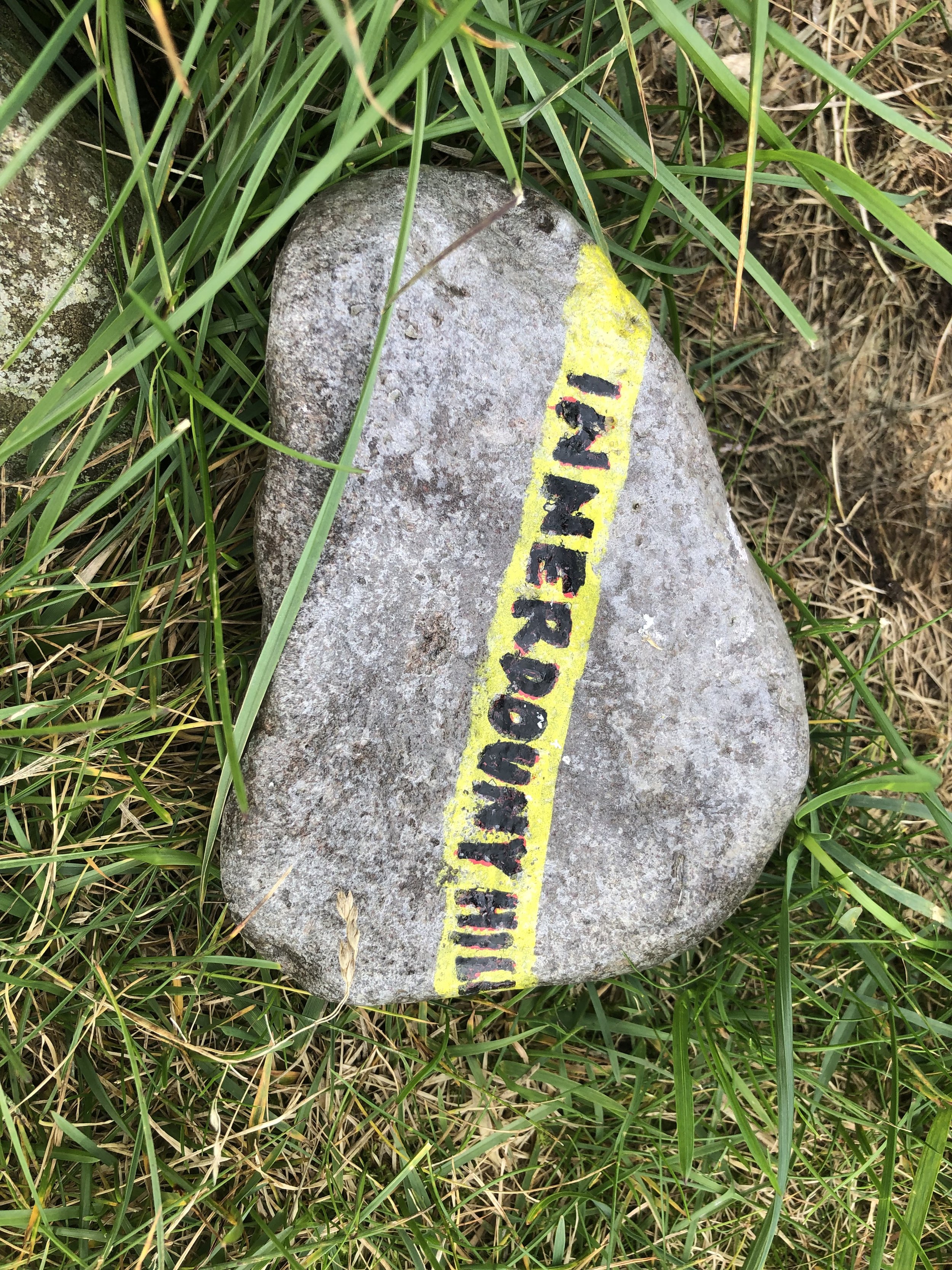
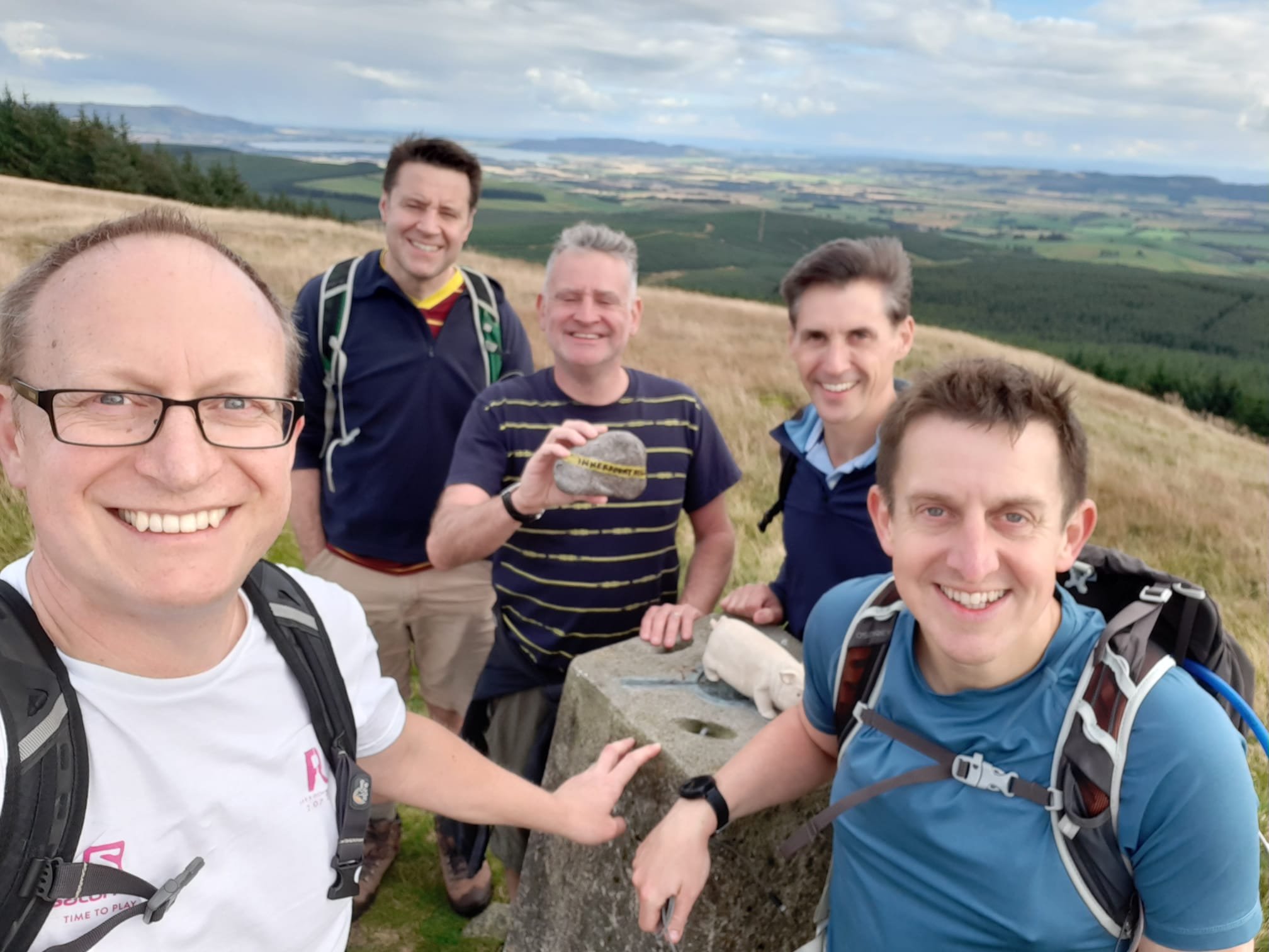
Ascent of Innerdouny Hill
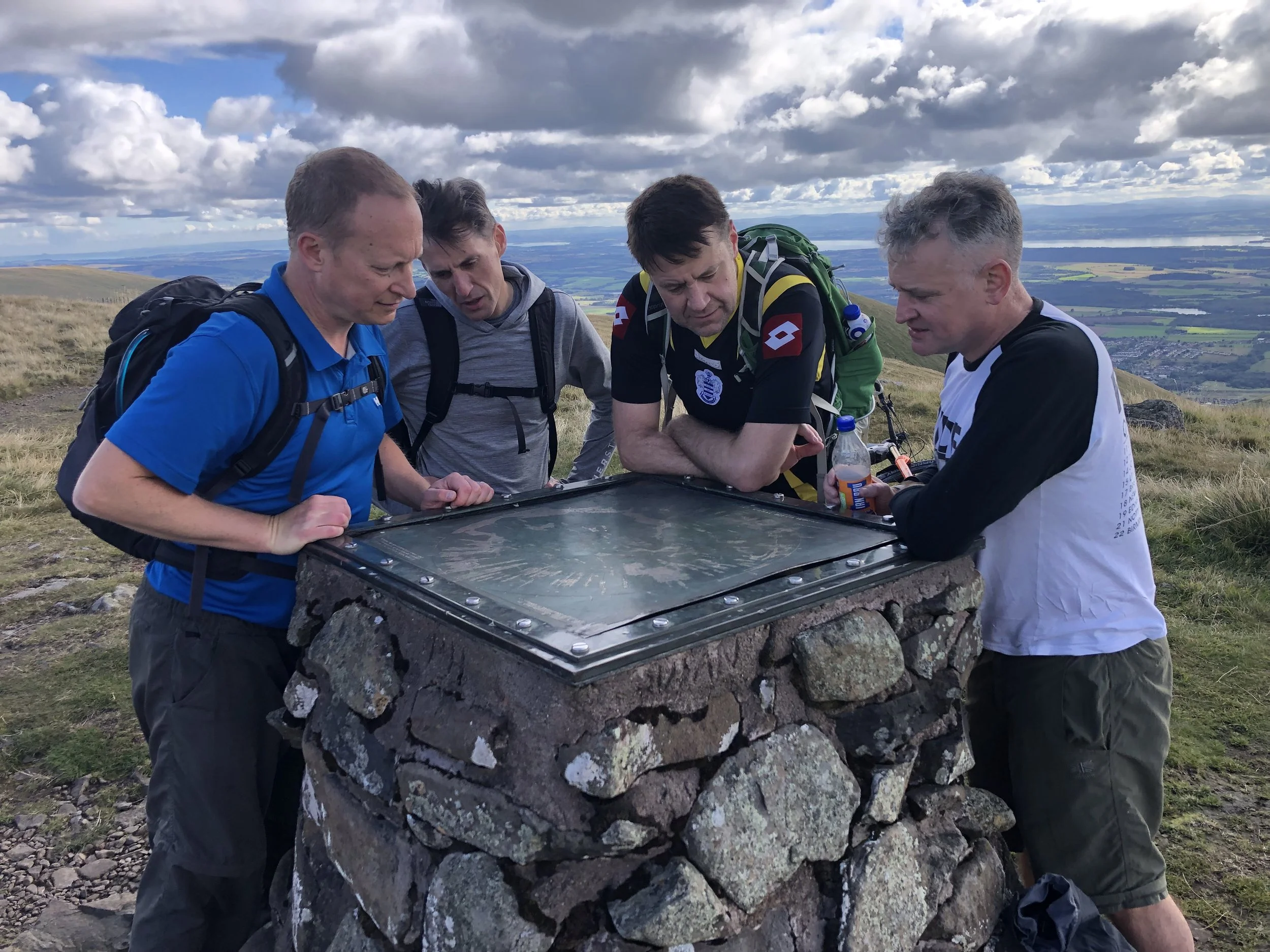
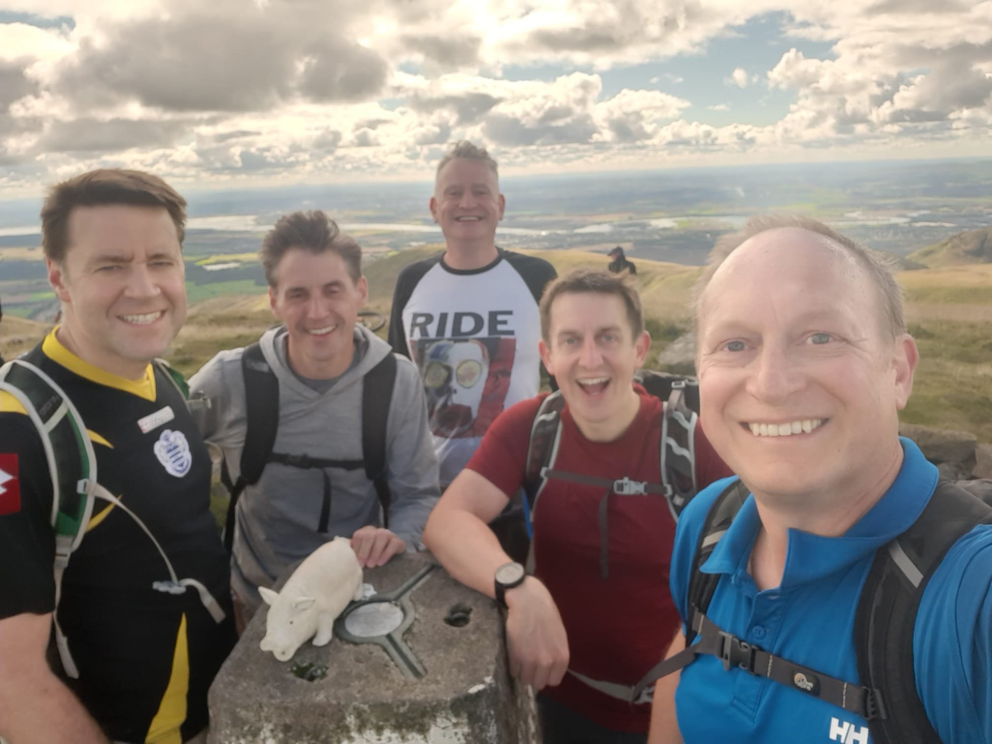
Our UK County Top bagging trips have now got into a rhythm of an annual long weekend at the end of September. Our group has also grown to 6, although there’s always the inevitable last minute cancellation due to house move / new job / failing body / [*insert excuse here]. For our second Scottish adventure we tackled the “Edinburgh Crescent”, a collection of 6 high points covering 7 historic counties, all within an hour of Edinburgh airport.
We also managed to bag a couple of “bonus peaks”, Allermuir HIll and Arthur’s Seat over the weekend. See this post for details on these.
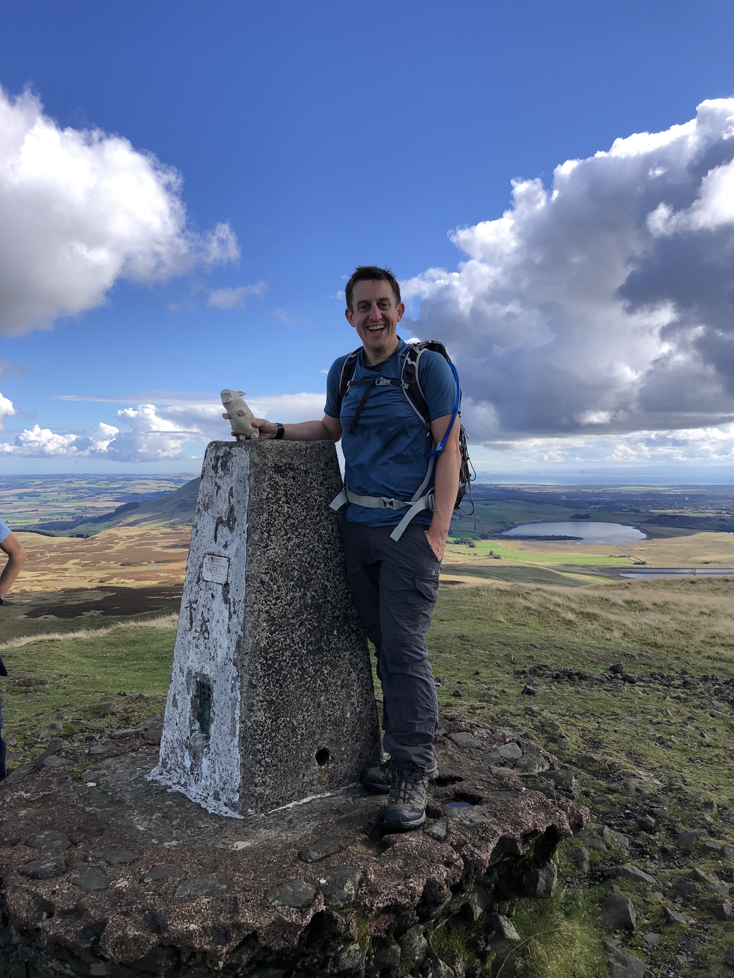
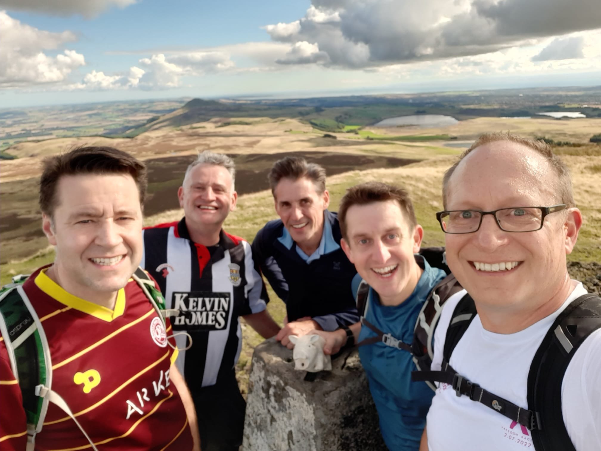
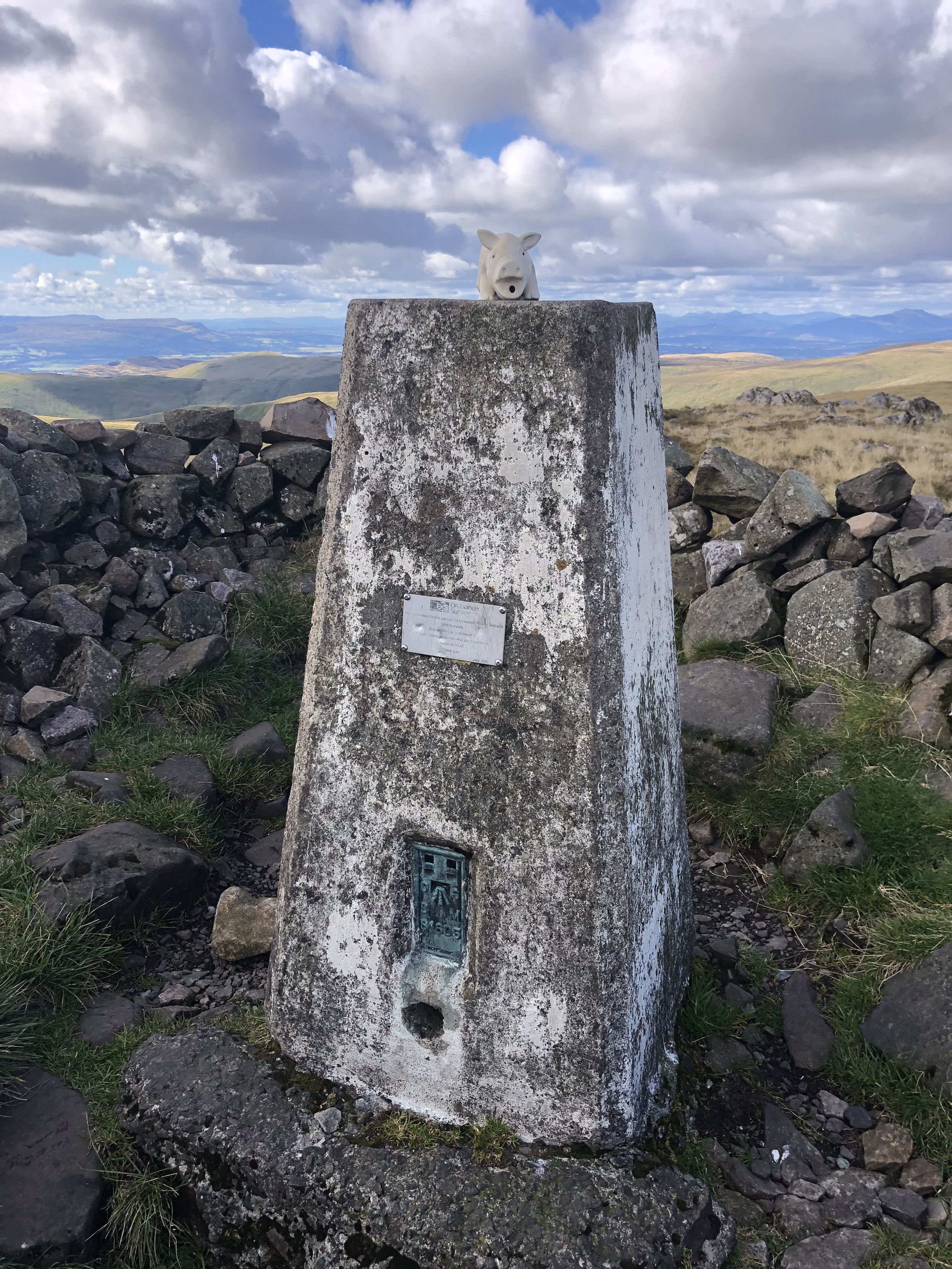
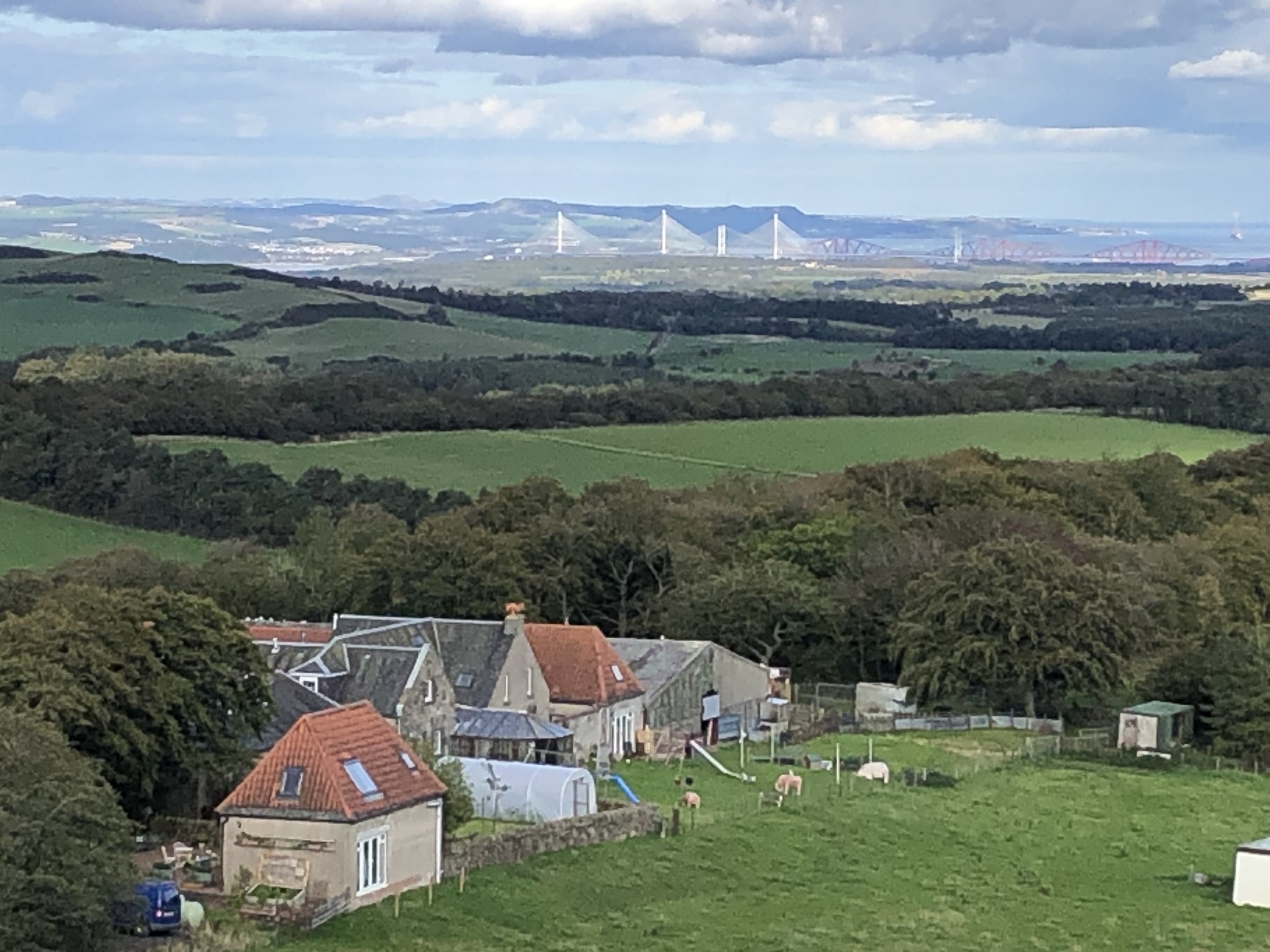
Significance: Highest peak in Fife (Historic CT)
Member of: Marilyn
Parent Peak: Ben Cleuch NHN = Innerdownie
Elevation: 522m
Date climbed: 23rd September 2022
Coordinates: 56° 14' 43'' N, 3° 17' 49'' W
Route Start / End: Bunnet Stane Car Park, Cupar, KY14 7RR
Route Distance: 4.5 km (2.8 miles)
Route Elevation Change: +/- 365m
Subsidiary tops on route: None
GPX File: get via Buy Me a Coffee
Other routes touched (walk): None
Other routes touched (cycle): NCN 1 / EV12 passes Bunnet Stane Car Park
OS Trig Pillar: TP0674 - West Lomond
Map: Glenrothes North, Falkland & Lomond Hills Map | Auchtermuchty & Cupar | Ordnance Survey | OS Explorer Map 370
Guidebook: The UK's County Tops (Jonny Muir)
Links: Wikipedia (West Lomond), Wikipedia (Fife), Bunnet Stane, Peakbagger, Hillbagging
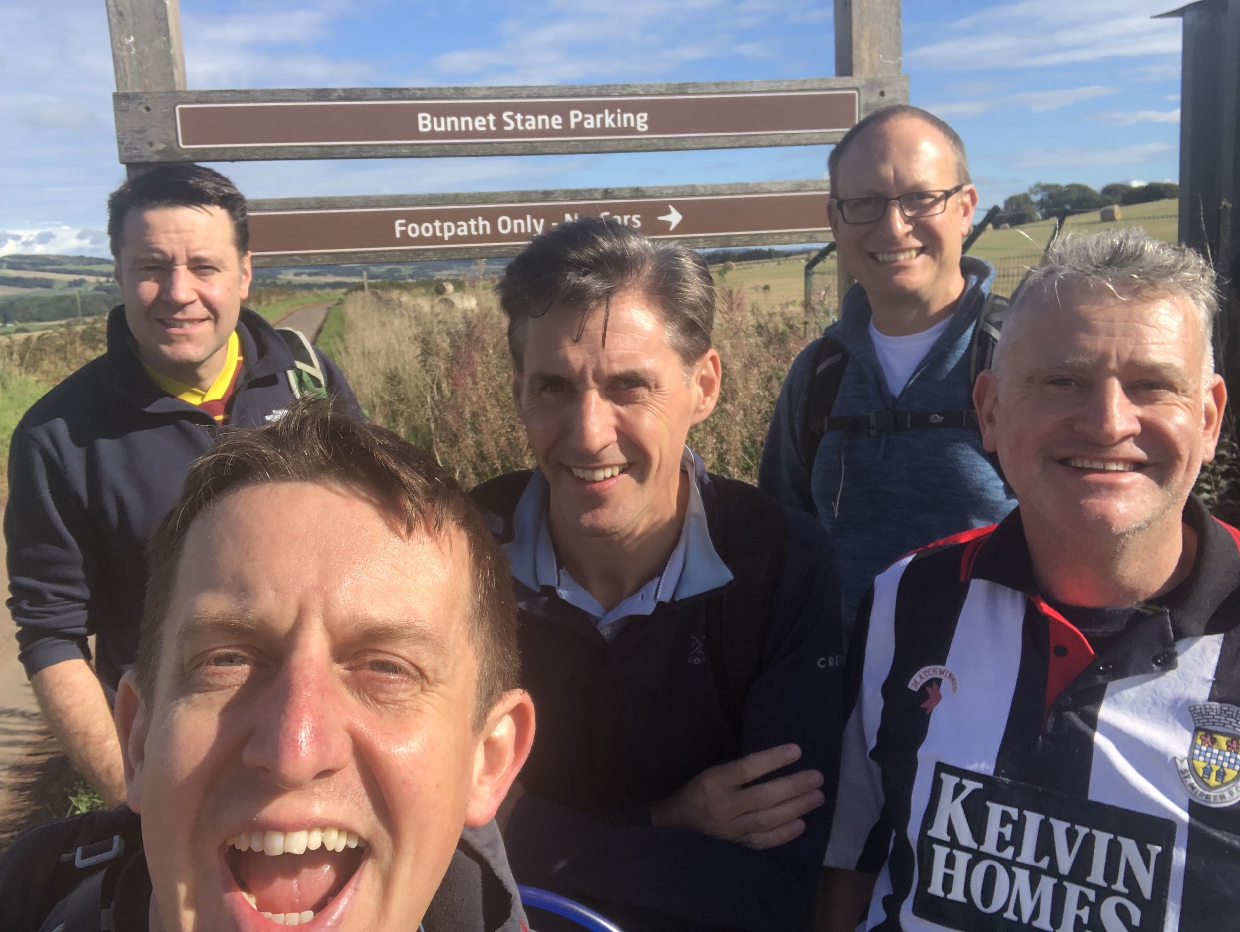
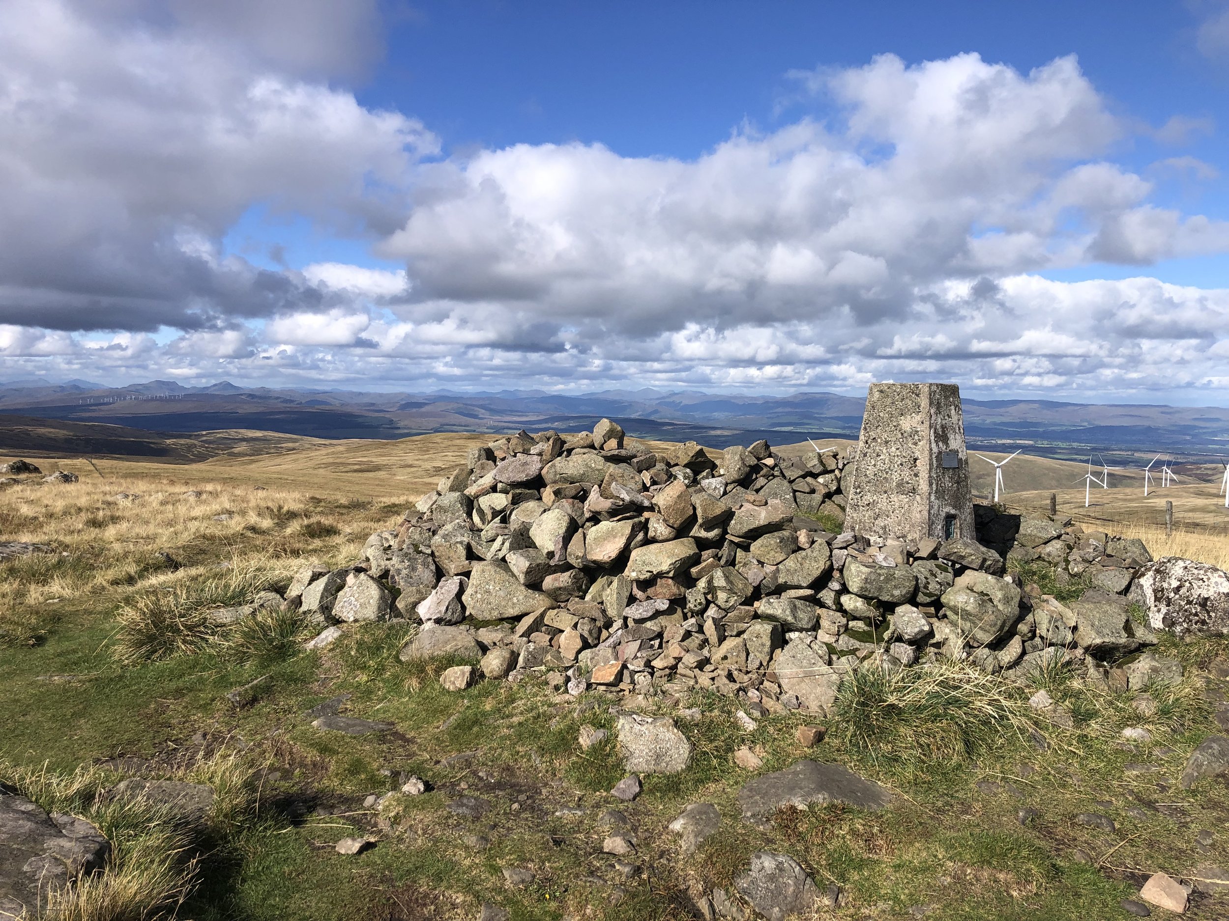
Having landed in Edinburgh Airport mid-morning on the Friday, we picked up a rental car for the 40 minute drive to West Lomond. This is the most north-easterly of this trip’s peaks and a nice warm-up for the longer treks to follow. We met with Joel, who drove from Northern Ireland, at Bunnet Stane Car Park. Don’t let the “car park” label fool you though, it’s just a layby for about 4 cars with a parking sign on it.
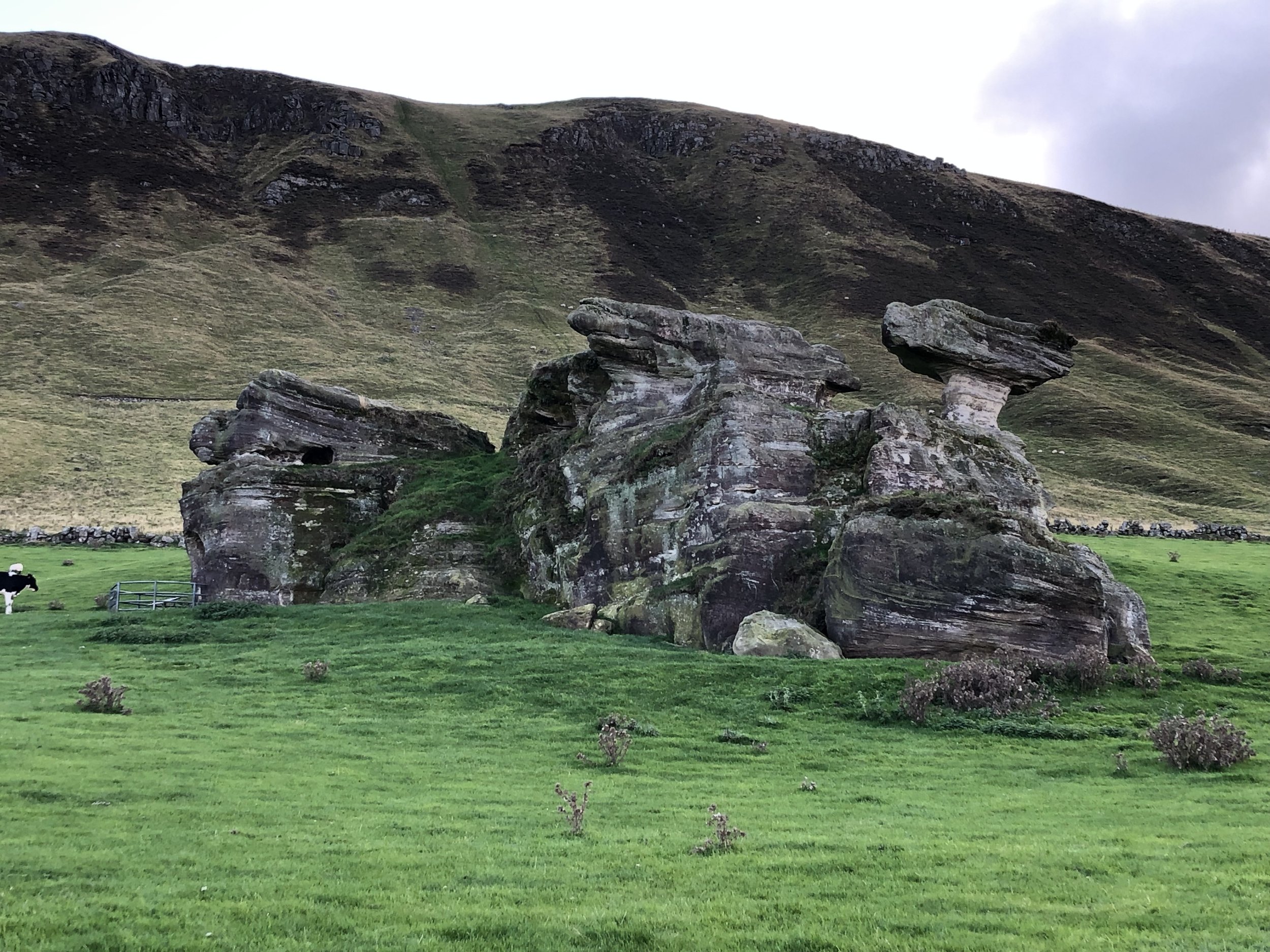
The walk to the summit is fairly straightforward, initially flat before getting steeper after Bunnet Stane. This is a rock formation with a man-made cave at the bottom and a information sign describing the history and myth around it. It’s worth stopping here to check it out before the ascent to the summit.
There’s several footpaths to the Trig Pillar at summit but we chose the most well-trodden. For the descent I originally planned to return on the same route but decided at the top to mix it up a bit and make it a circle. This didn’t work out too well as the path I chose to follow was cut of by a fence ahead of a steep drop. We took a alternative, slightly less steep, route down to meet the path we came up on. In hindsight we would have been better off sticking to the out-and-back.
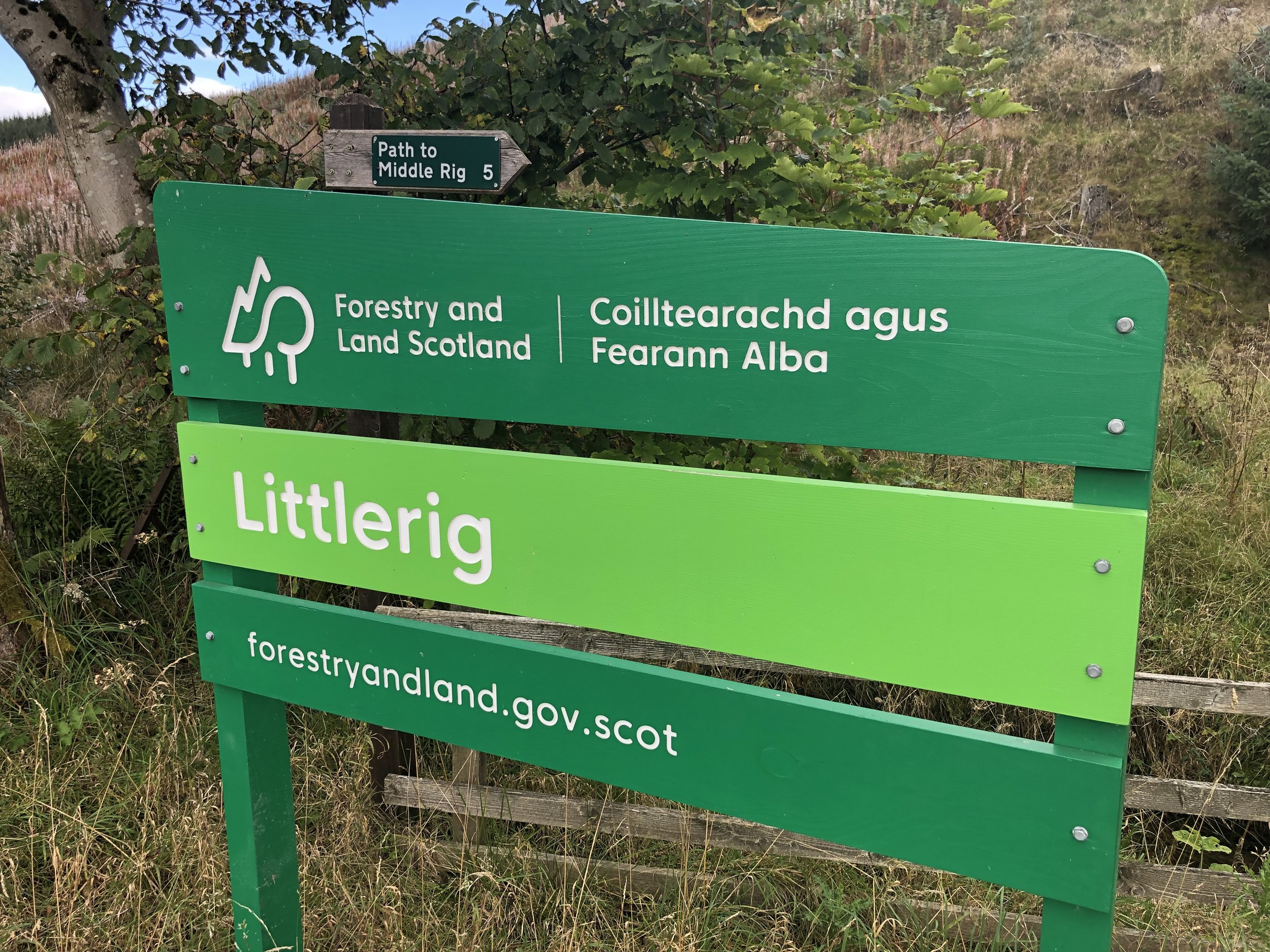
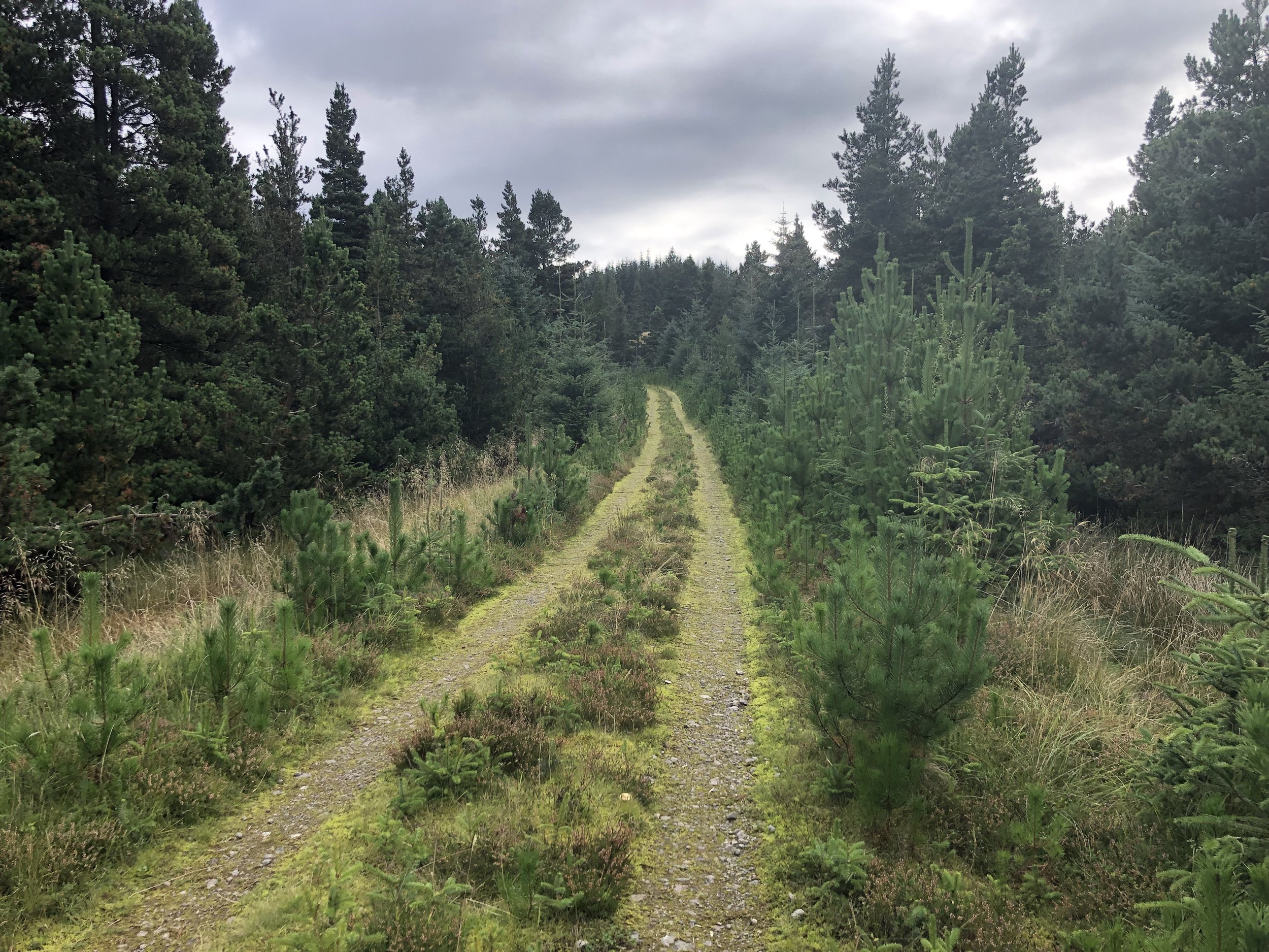
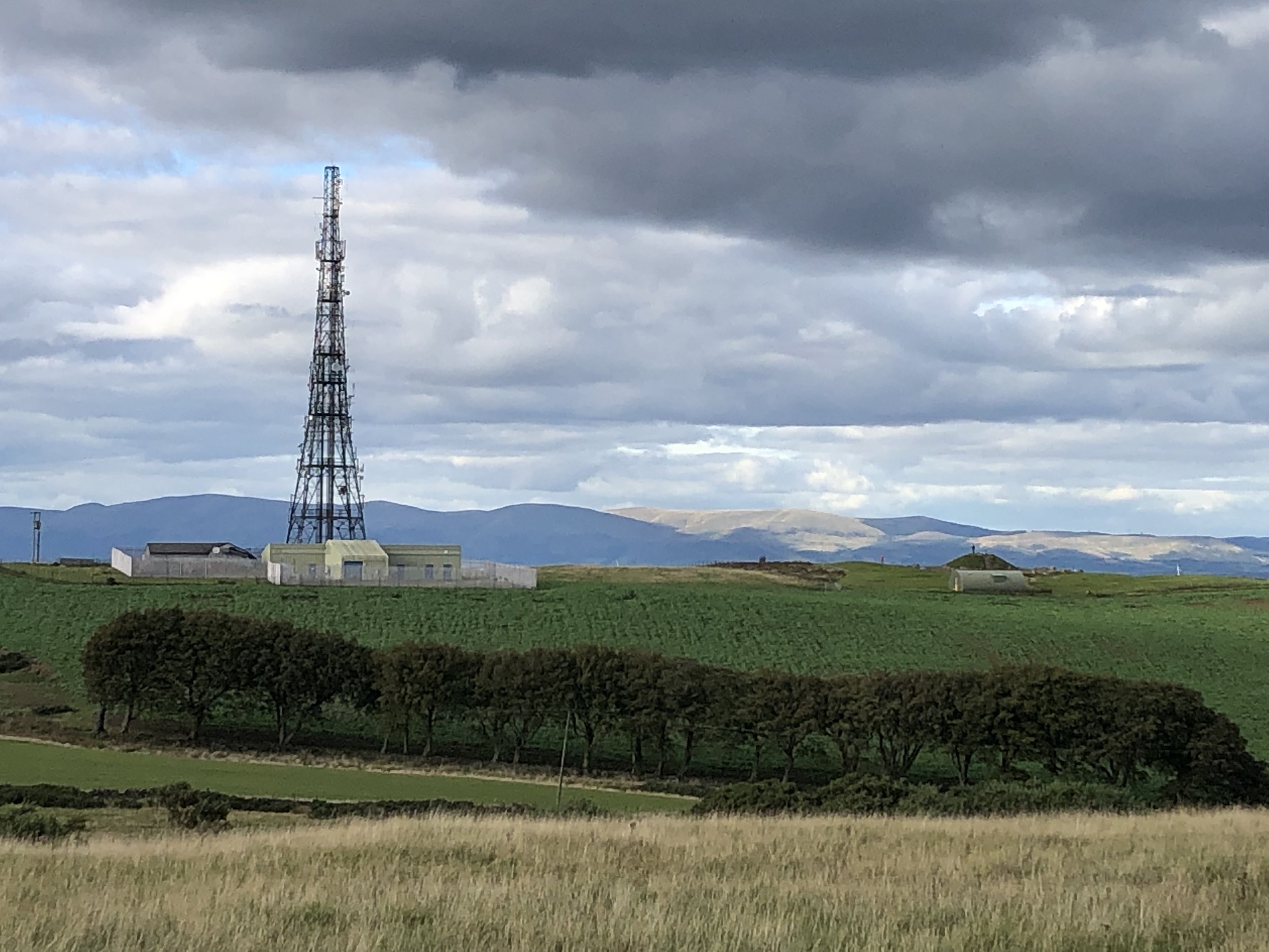
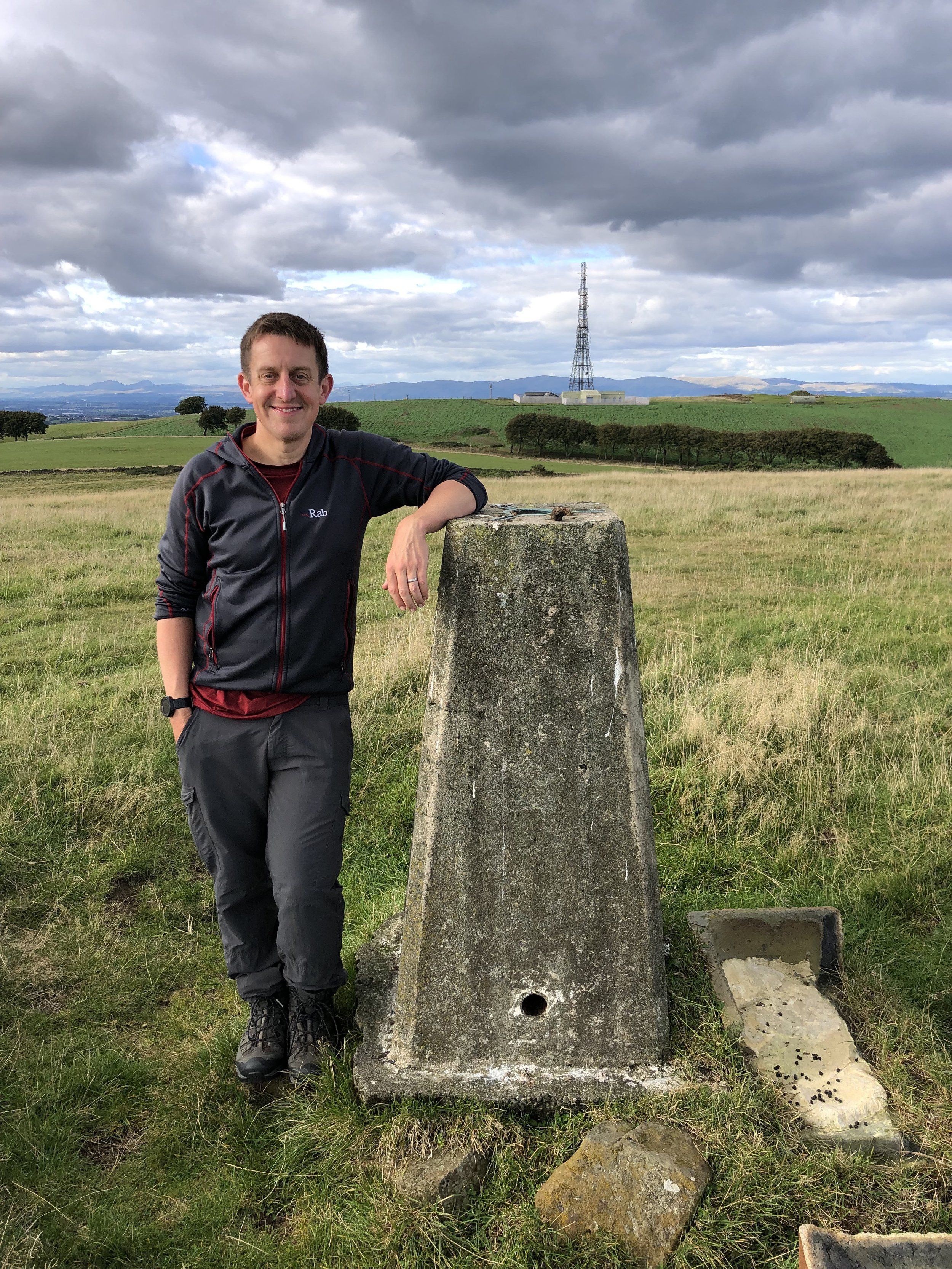
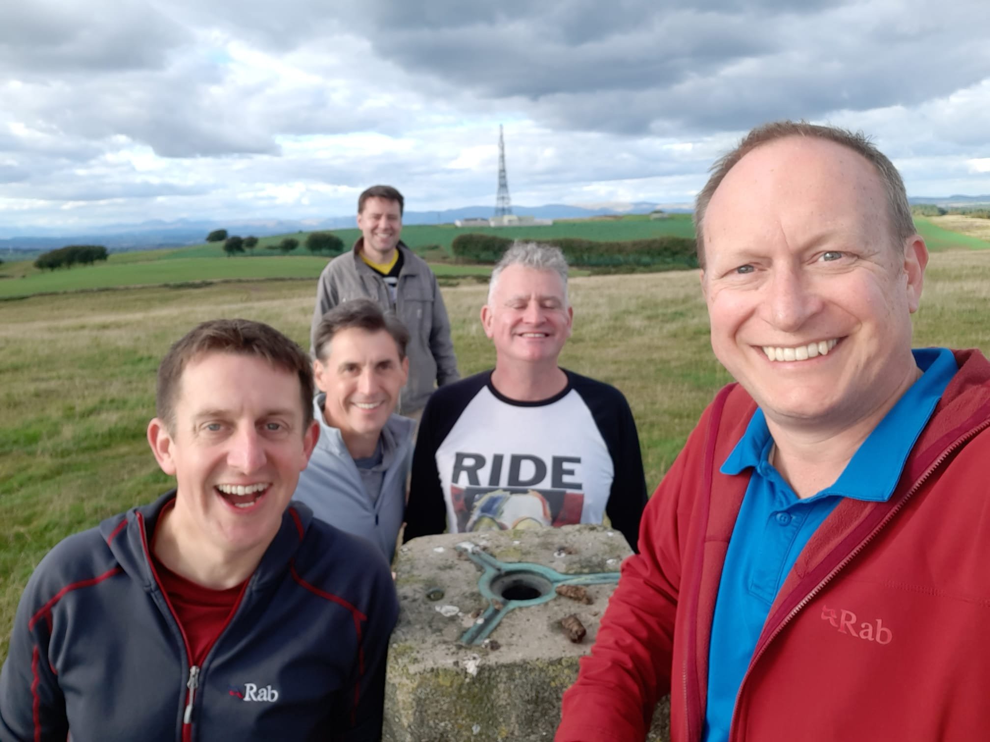
Significance: Highest peak in Kinross-shire (Historic CT)
Member of: Marilyn
Parent Peak: Ben Cleuch NHN = Innerdownie
Elevation: 497m
Date climbed: 23rd September 2022
Coordinates: 56° 14' 55'' N, 3° 33' 48'' W
Route Start / End: Forestry Commission Car Park at Littlerig on B934
Route Distance: 9.2 km (5.7 miles)
Route Elevation Change: +/- 220m
Subsidiary tops on route: None
GPX File: get via Buy Me a Coffee
Other routes touched (walk): None
Other routes touched (cycle): None
OS Trig Pillar: TP4108 - Innerdouny Hill
Map: Perth & Kinross Map | Ochil Hills East & Loch Leven | Ordnance Survey | OS Explorer Active Map 369
Guidebook: The UK's County Tops (Jonny Muir)
Links: Wikipedia (Innerdouny Hill), Wikipedia (Kinross-shire), Peakbagger, Hillbagging
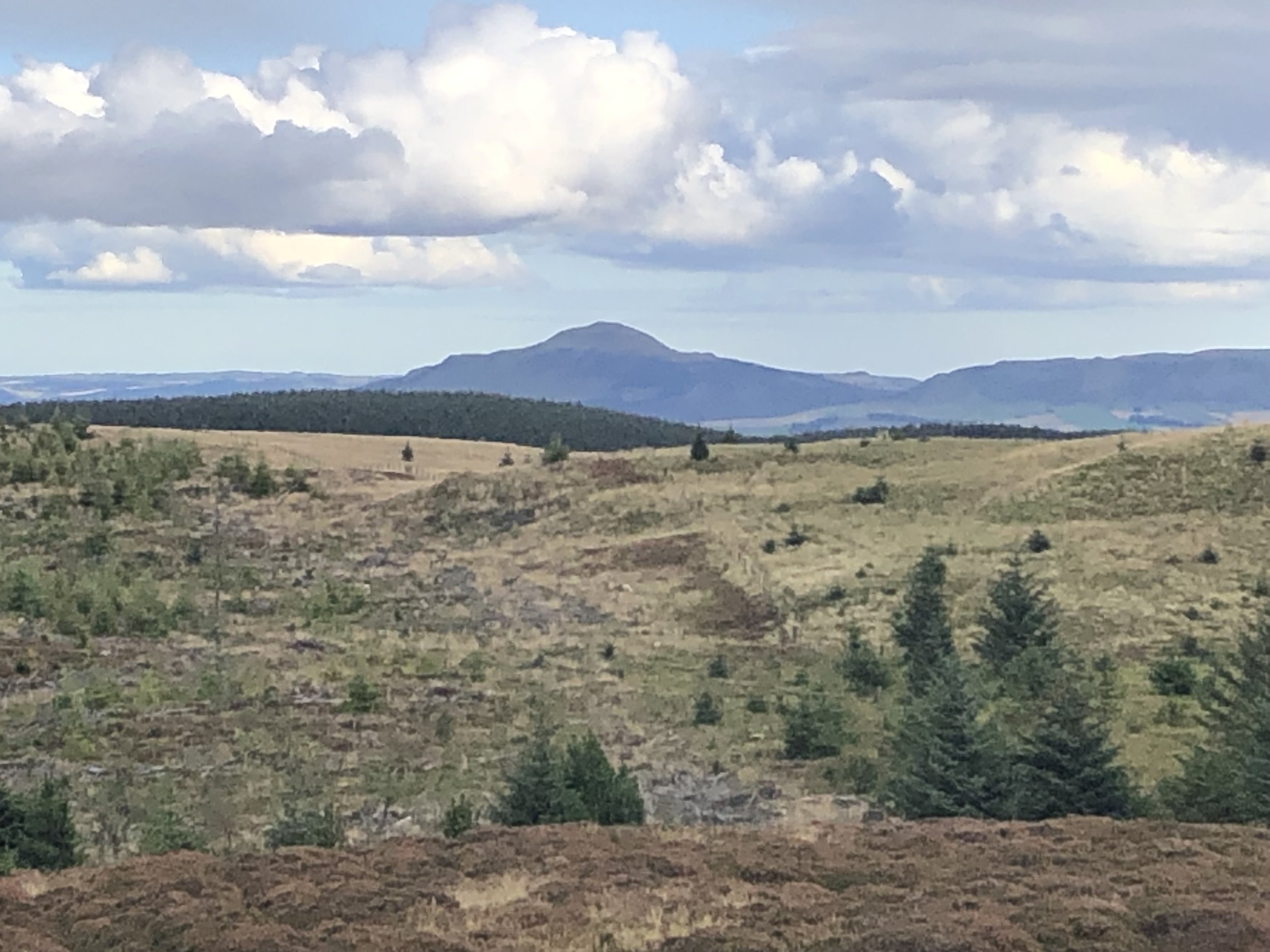
After West Lomond it’s a half an hour drive to the Littlerig Forestry Commission car park at the start of the walk to Innerdouny Hill. The car park didn’t come up on our sat-nav so we just headed north along the B934 looking out for it on the right. In the end it was easy to find and enough parking for several cars. Given the relative obscurity of the peak, it’s unlikely that you’ll be fighting for a parking spot here.
This is a longer walk than West Lomond but much less elevation. The first 3.9 km follows a wide Forestry Commission track before taking a right turn up a narrow path to the summit. We were there on a very clear day and got great views over the Firth of Forth and some of the other peaks of our trip.
As with West Lomond an out-and-back would have been the best plan. Instead we followed a clearing between a wooded area and a wall to try a more direct route down to the start of the track. It definitely made a more interesting route but in reality didn’t save much time or distance vs. retracing our steps from the summit.
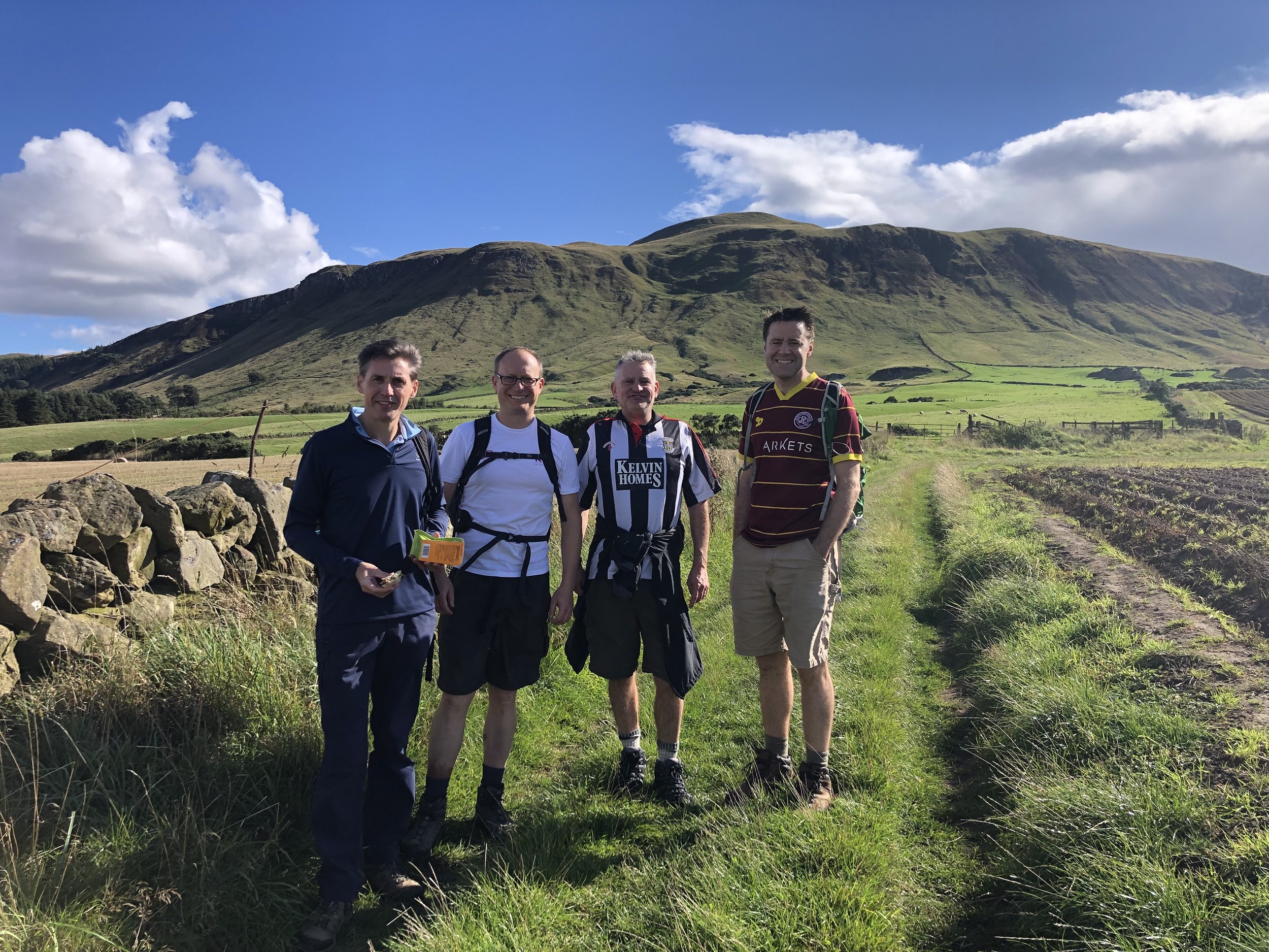
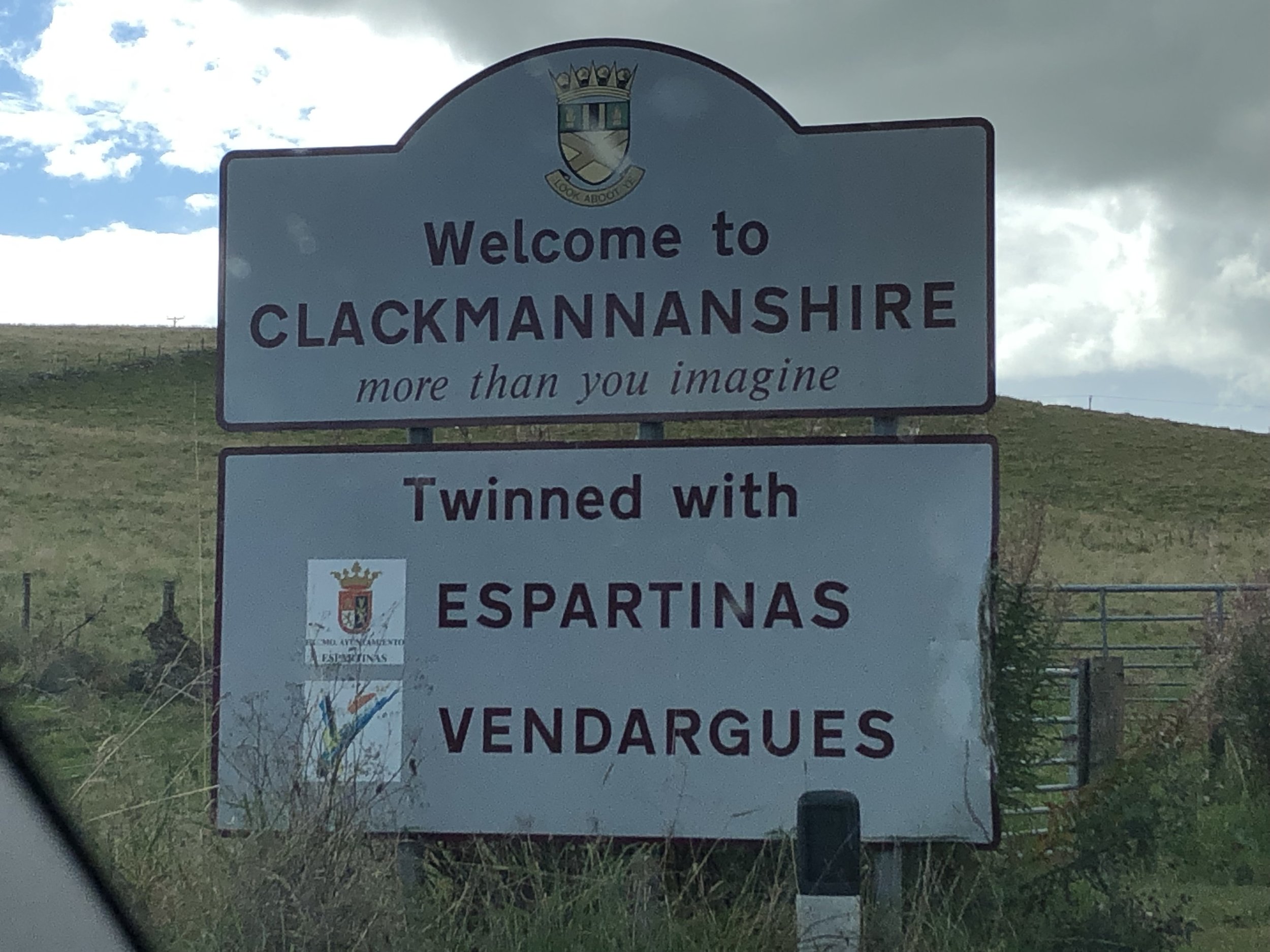
Significance: Highest peak in Clackmannanshire (Historic CT)
Member of: Marilyn, Donald, Graham
Parent Peak: Ben Chonzie NHN = Carn Chois
Elevation: 721m
Date climbed: 24th September 2022
Coordinates: 56° 11' 8'' N, 3° 46' 10'' W
Route Start / End: Free on-street parking at Upper Mill Street, Tillicoultry, FK13 6AX
Route Distance: 7.9 km (4.9 miles)
Route Elevation Change: +/- 650m
Subsidiary tops on route: The Law (638m)
GPX File: get via Buy Me a Coffee
Other routes touched (walk): None
Other routes touched (cycle): None
OS Trig Pillar: TP0672 - Ben Cleugh
Map: Stirling & Ochil Hills West Map | Alloa & Dunblane | Ordnance Survey | OS Explorer Map 366
Guidebook: The UK's County Tops (Jonny Muir)
Links: Wikipedia (Ben Cleuch), Wikipedia (Clackmannanshire), Peakbagger, Hillbagging
Day 2 started with the University of Stirling parkrun, right next to the hotel where we were staying. Stirling is a good option for an overnight stay on the trip and our hotel, part of the University campus, worked out well.
From Stirling it was less than a 30 minute drive to the start of the walk to Ben Cleuch. This was a shorter distance than the previous 2 walks but much higher elevation. Navigation is straightforward as there’s a very well-trodden path to the summit.
Learning from Day 1 we stuck to the out-and-back plan and didn’t attempt a creative alternative route back to the car. The Woolpack Inn, close to the start point, is a good place for a pint and a rest before heading to the Lothians.
Significance: Highest peak in West Lothian (Historic CT)
Member of: Marilyn
Parent Peak: West Cairn Hill NHN = West Cairn HIll
Elevation: 312m
Date climbed: 24th September 2022
Coordinates: 55° 55' 22'' N, 3° 37' 18'' W
Route Start / End: Cairnpapple Hill parking, 2km from Torphichen, Bathgate, EH48 4LD
Route Distance: 650 km (0.4 miles)
Route Elevation Change: +/- 14m
Subsidiary tops on route: None
GPX File: get via Buy Me a Coffee
Other routes touched (walk): None
Other routes touched (cycle): None
Map: Falkirk, Cumbernauld & Livingston Map | Linlithgow, Bathgate & Kilsyth | Ordnance Survey | OS Explorer Map 349
Guidebook: The UK's County Tops (Jonny Muir)
Links: Wikipedia (Cairnpapple Hill), Wikipedia (West Lothian), Peakbagger, Hillbagging
Our original plan for Cairnpapple was to follow the short circular route in Jonny Muir’s guidebook. We parked at the small Cairnpapple parking area and took the well-marked south-westerly path to the burial mound. Cairnpapple is commonly regarded as the highest point in West Lothian although the Ballencreif Hill Trig Pillar to the south is higher. Jonny Muir’s guide has the walk continuing in a straight line south from the burial ground to the Trig. Some boundary work must have been done in the meantime as we found a new fence in the way and no obvious means to walk straight to the Trig. Note that Historic Scotland charges an entry fee to the burial ground, although it’s easy to avoid it as the ticket office is not on the gate.


Route Start / End: Top Point Parking, Unnamed Road (south of Cairnpapple Hill), Bathgate, EH48
Route Distance: 1.1 km (0.7 miles)
Route Elevation Change: +/- 16m
OS Trig Pillar: TP0991 - Ballencrieff Hill
Links: Peakbagger (Knock)
To access the Trig Pillar we returned to the car and drove south down the minor road to a layby near the gate to the field containing the Trig Pillar. Alternative parking can be found on the south side of Knock Hill, another contender for West Lothian’s high point. After climbing to the toposcope on Knock Hill we cross the field to bag the Trig Pillar.
Significance: Highest peak in Midlothian (Historic CT)
Member of: Marilyn, Donald, Graham
Parent Peak: Windlestraw Law NHN = Windlestraw Law
Elevation: 651m
Date climbed: 25th September 2022
Coordinates: 55° 43' 25'' N, 3° 5' 31'' W
Route Start / End: Small parking area on southern end of Gladhouse Reservoir
Route Distance: 17.7 km (11 miles)
Route Elevation Change: +/- 518m
Subsidiary tops on route: The Kips (542m), Bowbeat Hill (636m), Bowbeat Rig (585), Dundreich (623m)
GPX File: get via Buy Me a Coffee
Other routes touched (walk): None
Other routes touched (cycle): None
OS Trig Pillar: TP1448 - Blackhope Scar and
Map: TP1448 - Blackhope Scar and TP2914 - Dundreich
Guidebook: The UK's County Tops (Jonny Muir)
Links: Wikipedia (Blackhope Scar), Wikipedia (Midlothian), Peakbagger, Hillbagging
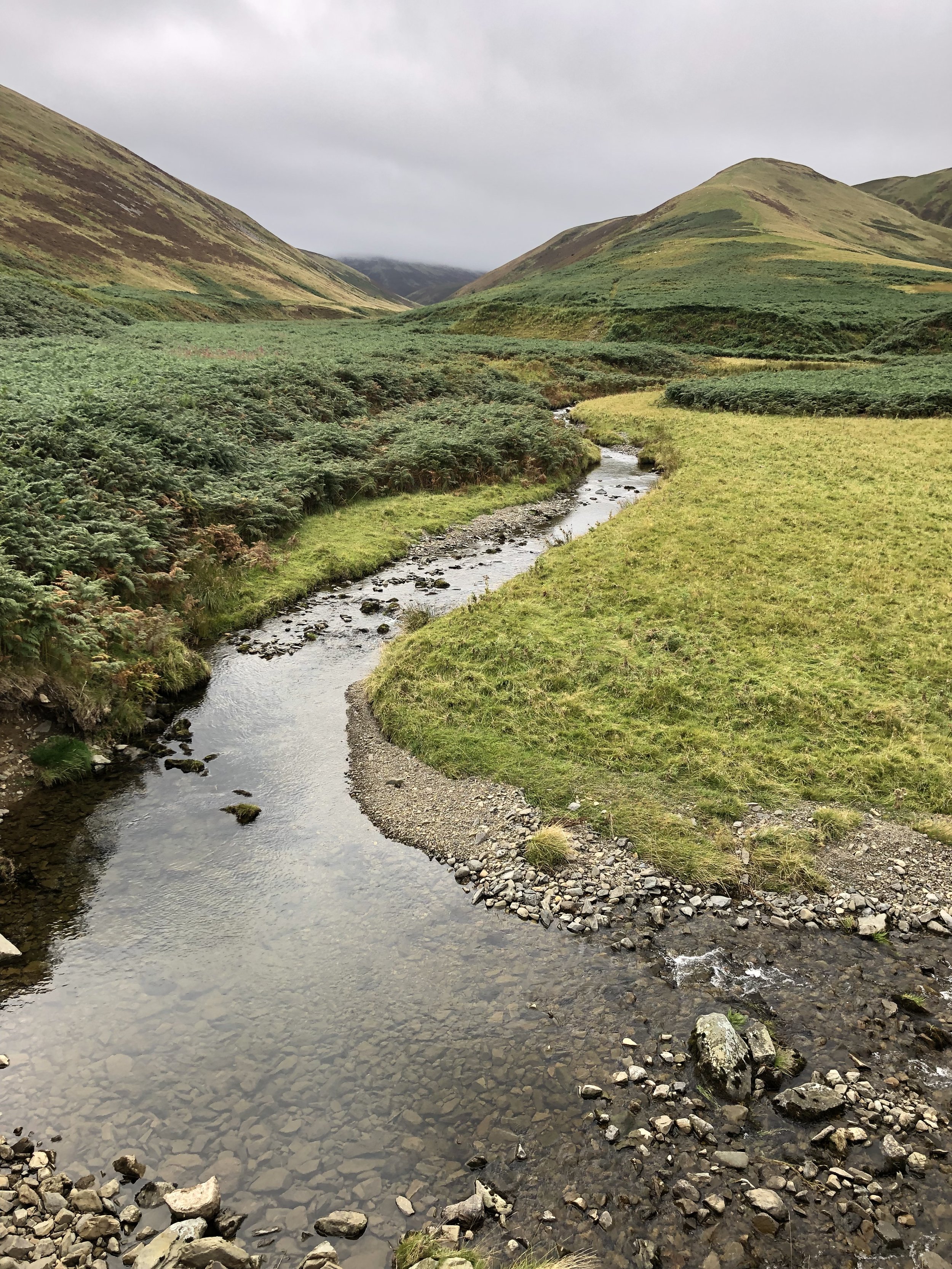
Blackhope Scar was the longest and most interesting of the weekend’s peaks. The small parking area on the southern edge of Gladhouse Reservoir is the best, and realistically only, place to start the walk. The first 2 km is fairly flat as the route follows the private road through a farm and up to the ruins of Hirendean Castle. After the ruins the route ascends in a south-westerly direction to the summit. I had read that the route is very boggy and was preparing for a Meikle Fell style swamp. As we were there following a particularly dry summer the ground was solid and much easier than expected.
Jonny Muir’s guidebook shows the route as an out-and-back to the summit but there’s a more interesting circular route. See this post on Walk Highlights and this video on YouTube for good detailed descriptions on the full circular. As well as being more interesting as a circular, you’ll bag an extra Trig Pillar and a couple of extra summits.
Significance: Highest peak in East Lothian (Historic CT)
Member of: Marilyn
Parent Peak: Windlestraw Law NHN = Windlestraw Law
Elevation: 535m
Coordinates: 55° 50' 49'' N, 2° 40' 13'' W
OS Trig Pillar: TP0685 - Sayers Law
Links: Wikipedia (Lammermuir Hills), Wikipedia (East Lothian), Peakbagger, Hillbagging
Significance: Highest peak in Berwickshire (Historic CT)
Member of: N/A
Parent Peak: Meikle Says Law NHN = Meikle Says Law
Elevation: 535m
Coordinates: 55° 50' 45'' N, 2° 40' 15'' W
Links: Wikipedia (Berwickshire), Peakbagger, Hillbagging
For both peaks:
Date climbed: 26th September 2022
Route Start / End: Layby opposite to gated entrance to Faseny on Gifford-Longformacus Road
Route Distance: 10.7 km (6.6 miles)
Route Elevation Change: +/- 251m
Subsidiary tops on route: None
GPX File: get via Buy Me a Coffee
Other routes touched (walk): None
Other routes touched (cycle): None
Map: Lammermuir Hills Map | Dalkeith, Bonnyrigg & Gifford | Ordnance Survey | OS Explorer Map 345
Guidebook: The UK's County Tops (Jonny Muir)
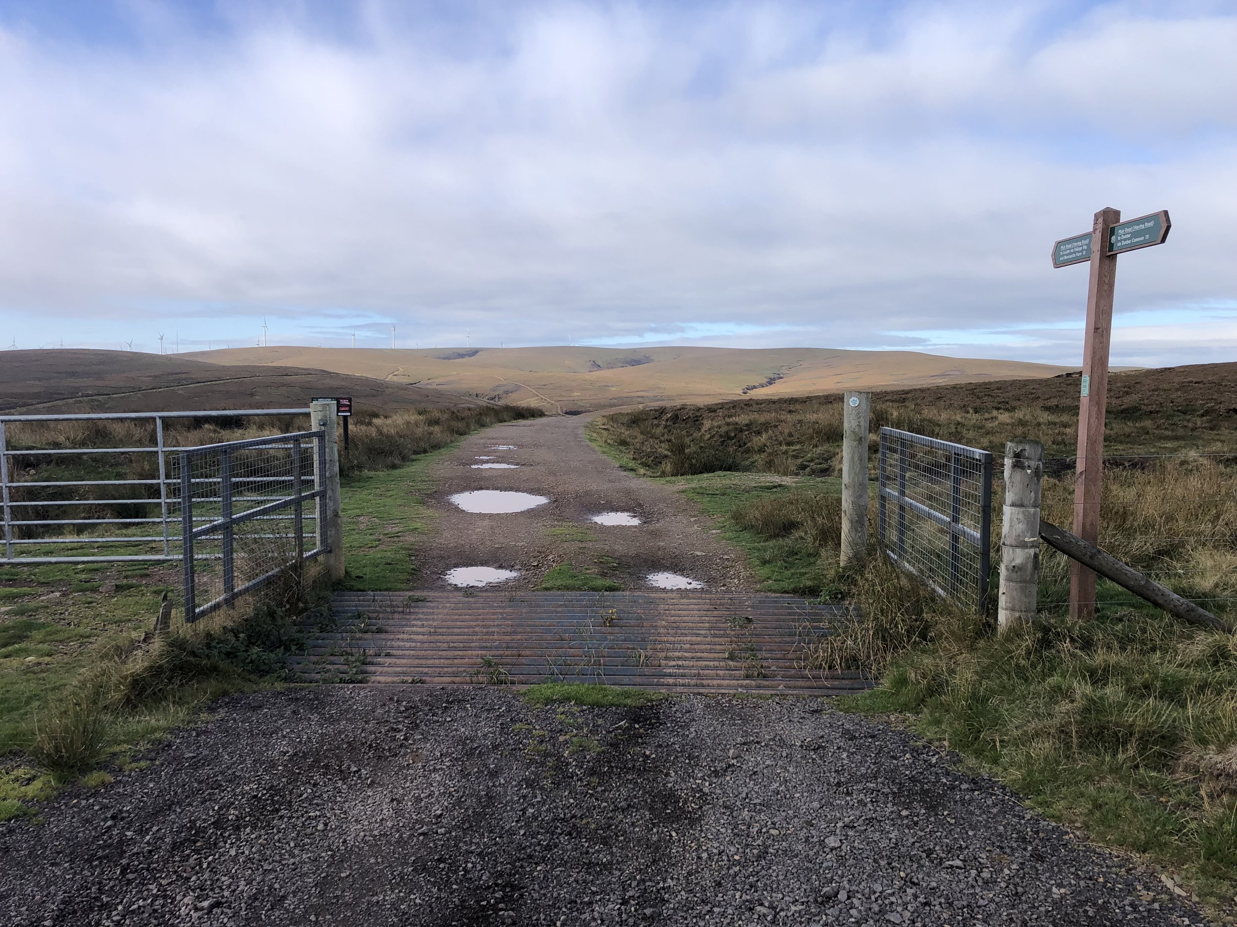
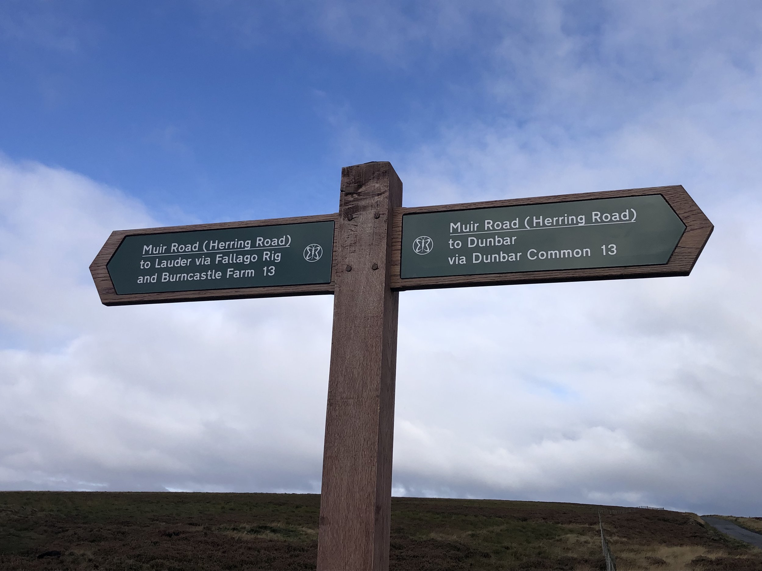
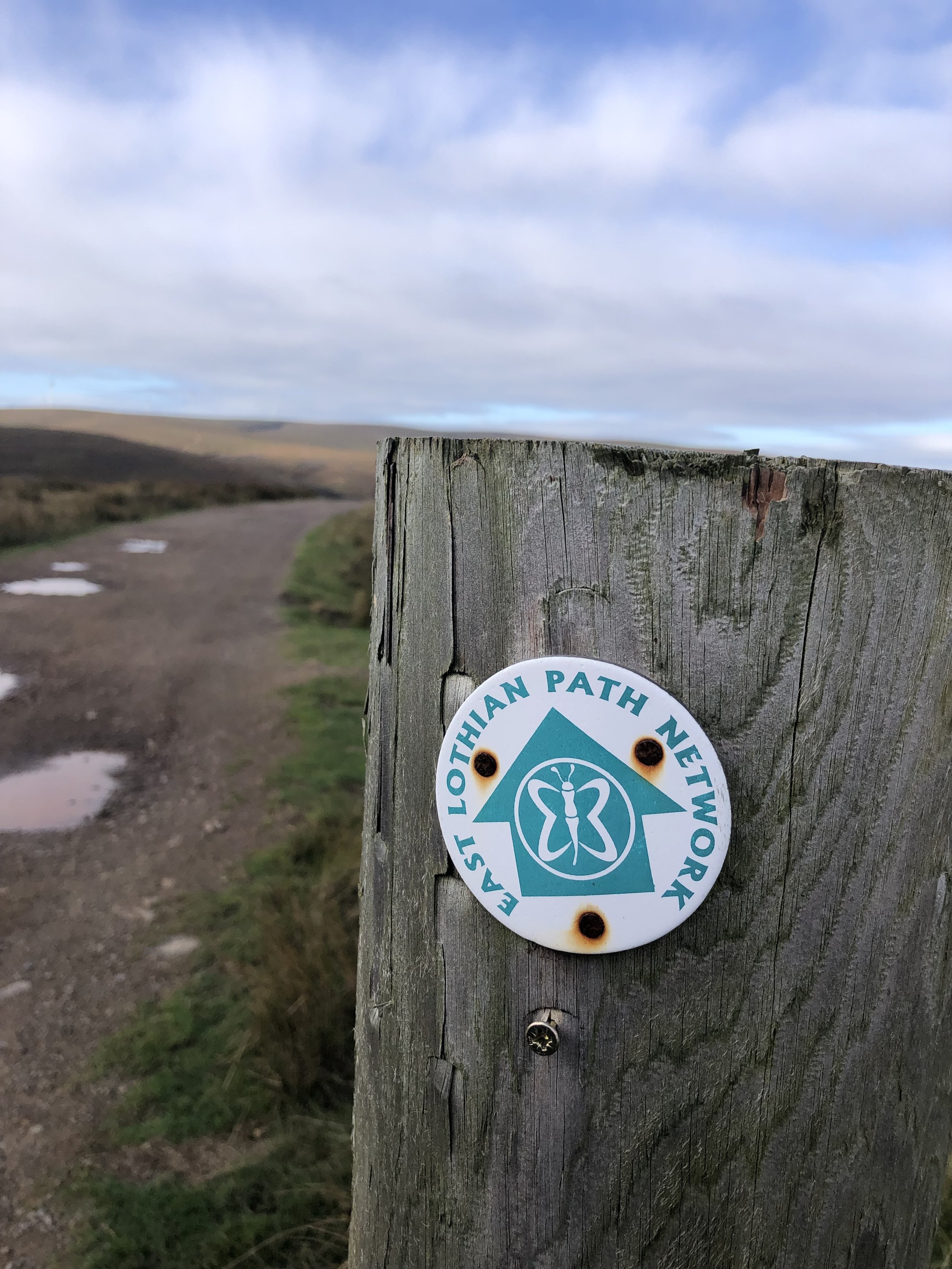
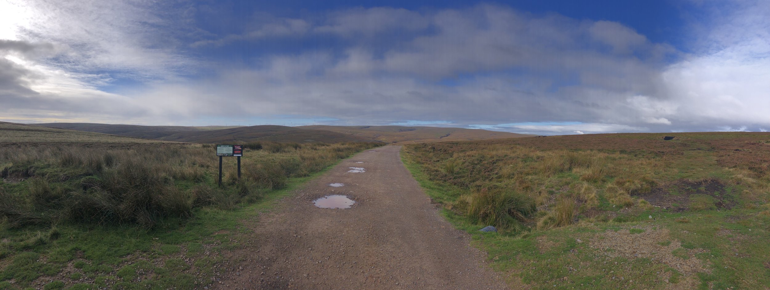
For our final walk of the weekend we headed to the eastern end of the Lothians for Meikle Says Law. As with Blackhope Scar this involves a short section from the parking area followed by a circular route. We took an anti-clockwise direction on the circular section following a track running parallel to Faseny Water. There’s a few places where the stream crosses the track but we found it easy to jump over without getting wet. It would be a different story after very wet conditions so be prepared to search for other places to cross or make sure that you have good waterproof boots.
Taking the anti-clockwise direction turned out to be a good plan as the track takes you right up to the summit. The Trig Pillar marks the high point of East Lothian. It’s very close to the border with Berwickshire and it’s a 100m walk to the south to bag the high point of that county. There’s nothing to mark the Berwickshire top so we just took a bearing from the gate near the Trig Pillar to the coordinates. It certainly didn’t feel like a summit but there’s was nothing else notable around so we decided to call it there.
From the Berwickshire top we retraced our steps to the Trig Pillar and followed a path on the south side in an easterly direction. The path comes and goes and it’s quite heavy going, but keep to the left of the fence and you’ll be fine. You’ll cross the East Lothian/Berwickshire border a few times on this path but with nothing to mark the boundary.
When you reach a small gate in the fence where another path comes in from the east, you’ll leave the fence, now heading in a north-easterly direction back down to Faseny Water. After crossing the footbridge you’ll have closed the loop and can return to the parking spot on the road.
Based only on connections between the walks. Add more based on accommodation, bonus walks etc. Driving times based on light traffic.
Edinburgh Airport to West Lomond: 32 miles / approx 40 minutes.
West Lomond to Innerdouny Hill: 18 miles / approx 30 minutes.
Innerdouny Hill to Ben Cleugh: 13 miles / approx 30 minutes.
Ben Cleuch to Cairnpapple Hill: 35 miles / approx 60 minutes.
Cairnpapple Hill to Blackhope Scar: 50 miles / approx 90 minutes.
Blackhope Scar to Meikle Says Law: 42 miles / approx 90 minutes.
Meikle Says Law to Edinburgh Airport: 39 miles / approx 60 minutes.
Total drive: 239 miles / approx 6 hours 40 minutes.

Other High Points in the Edinburgh Crescent Area
East Cairn Hill. 567 metres, City of Edinburgh Present Day County High Point: Peakbagger / Hillbagging
West Cairn Hill. 562 metres, West Lothian Present Day County High Point: Peakbagger / Hillbagging
Darrach Hill. 357 metres, Falkirk Present Day County High Point: Peakbagger / Hillbagging

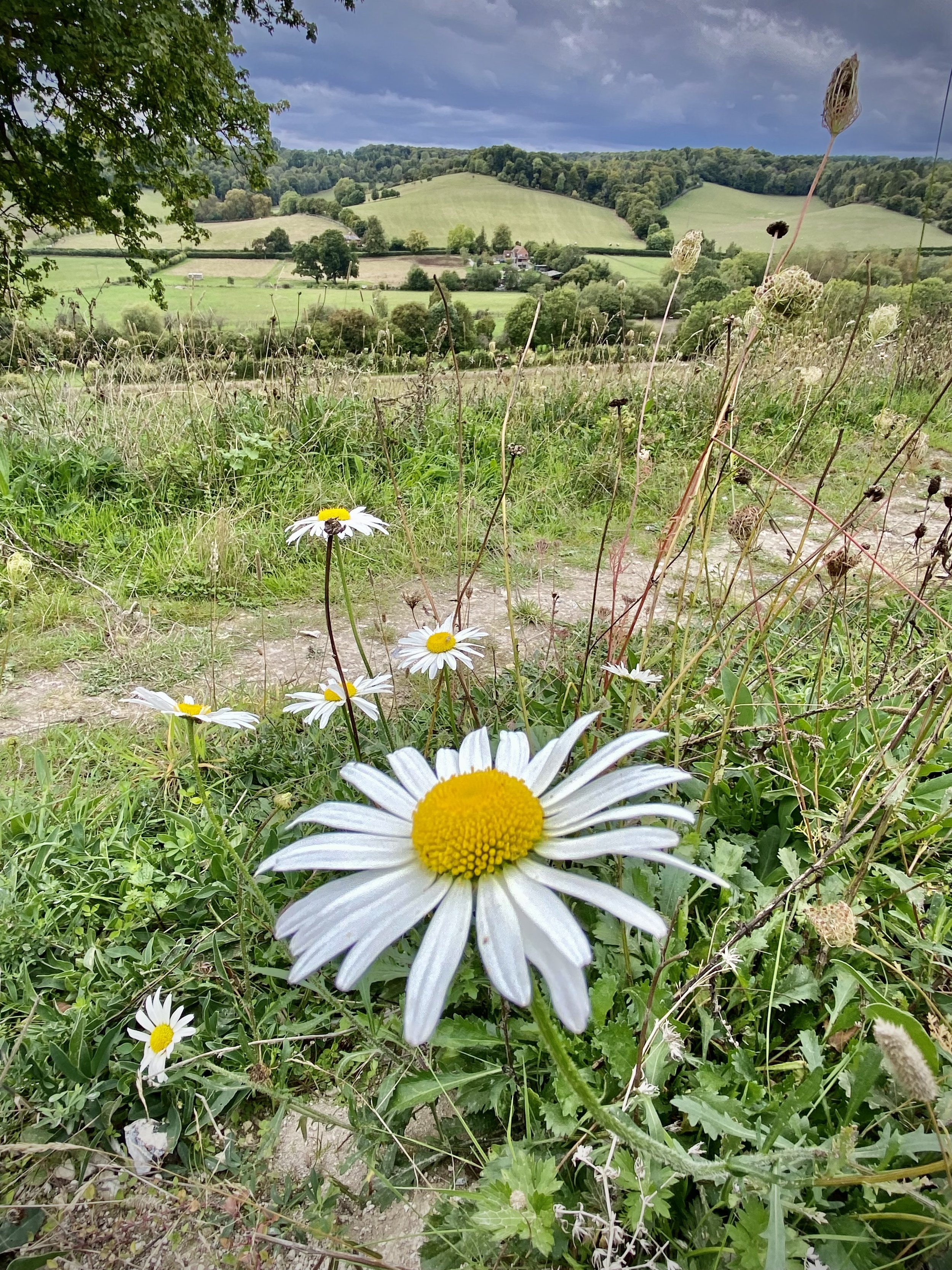
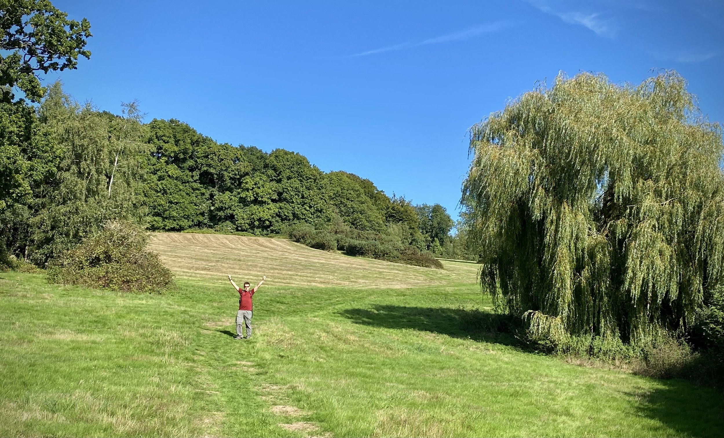
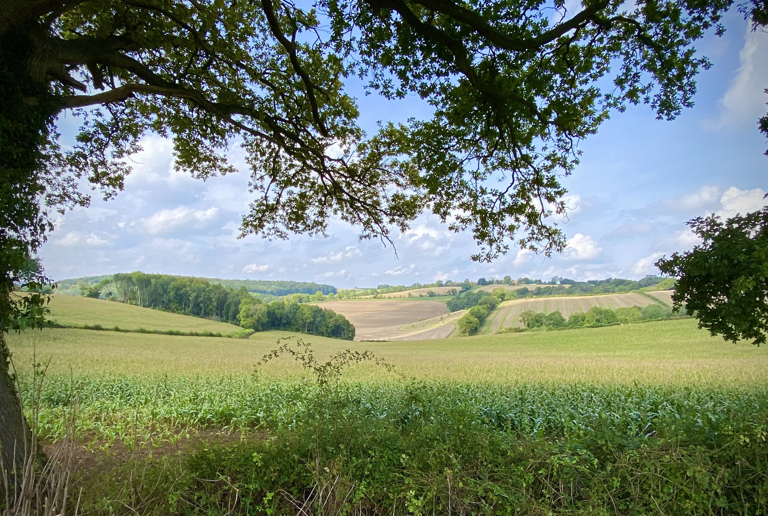
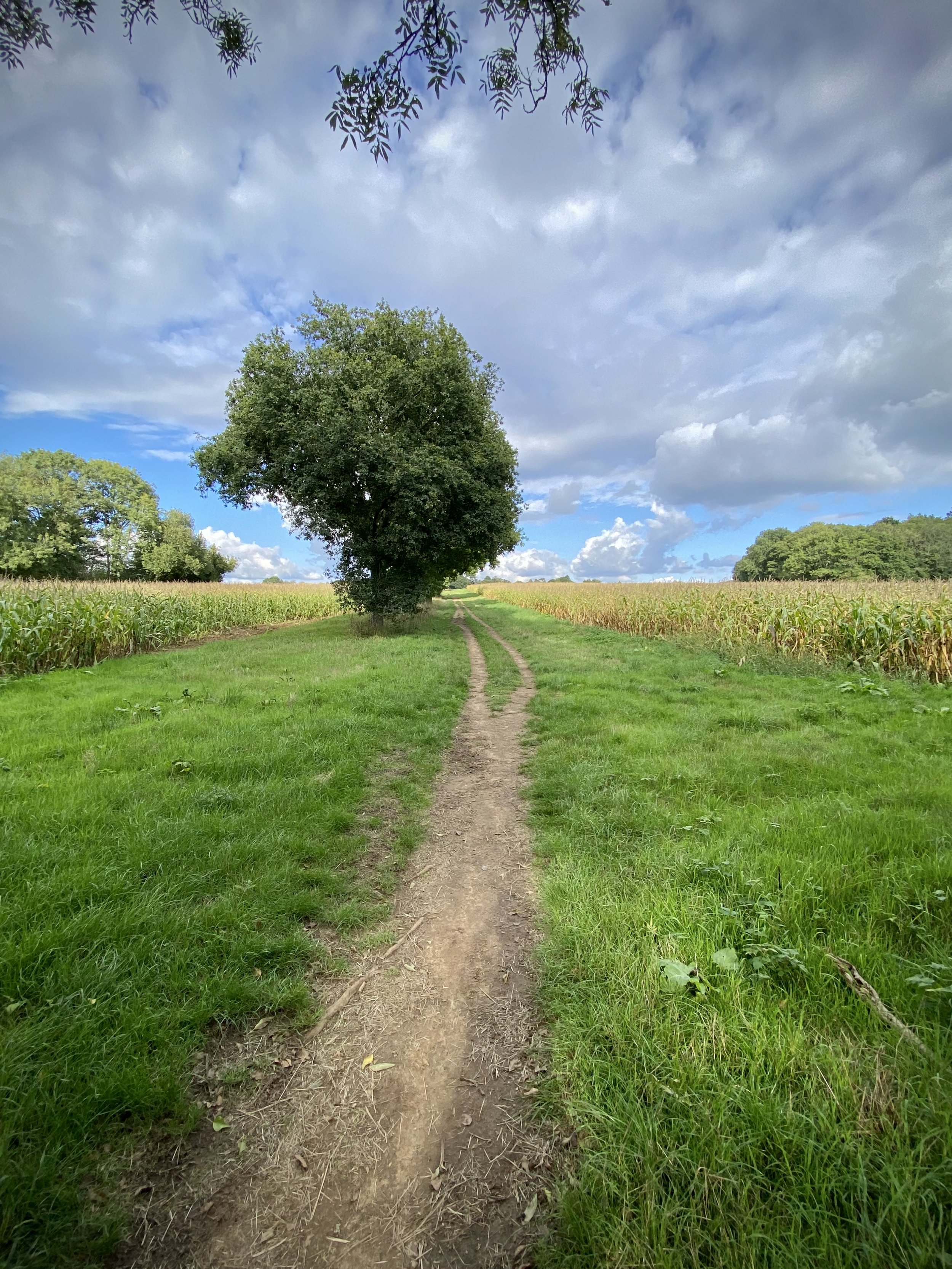
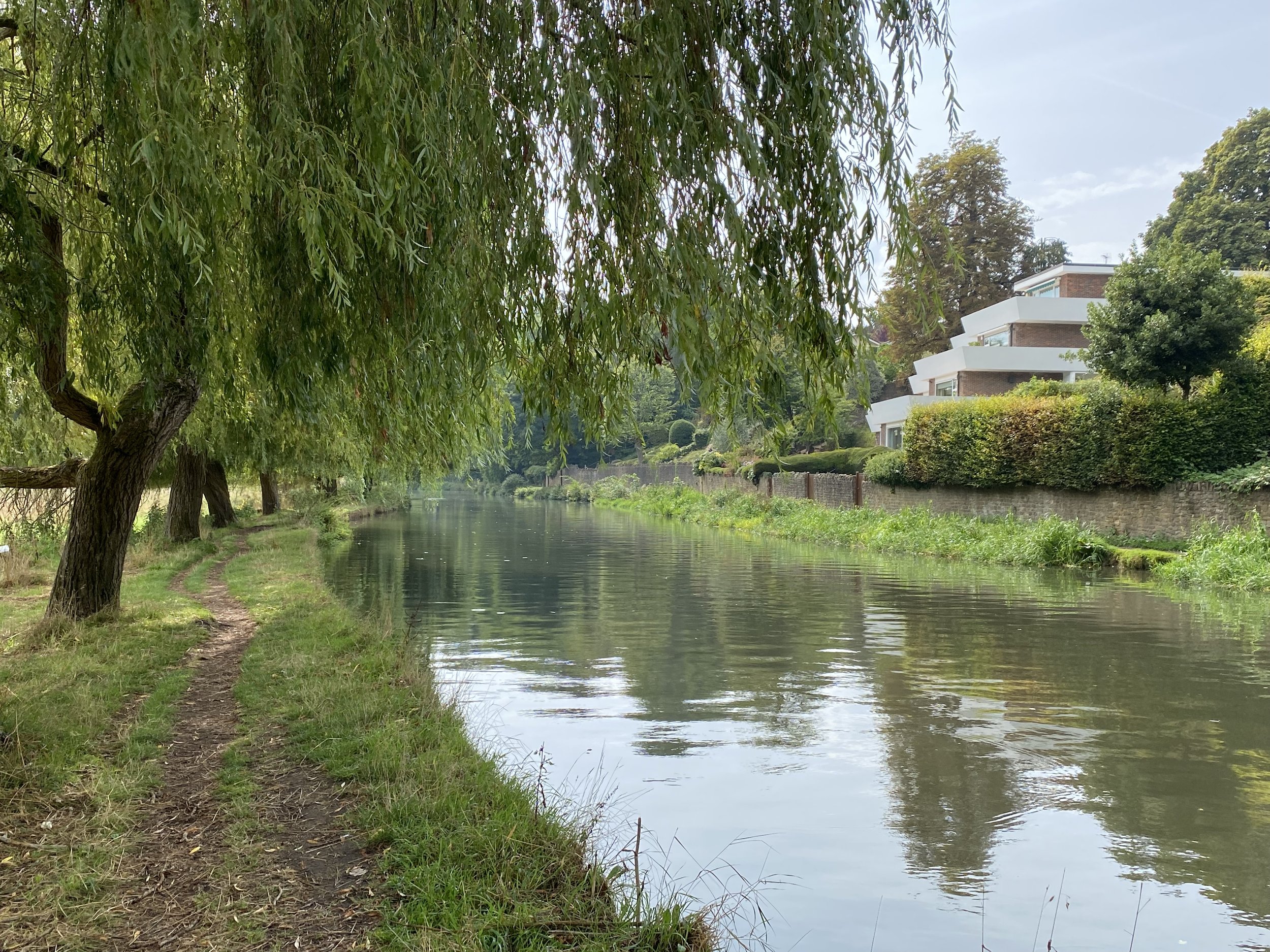
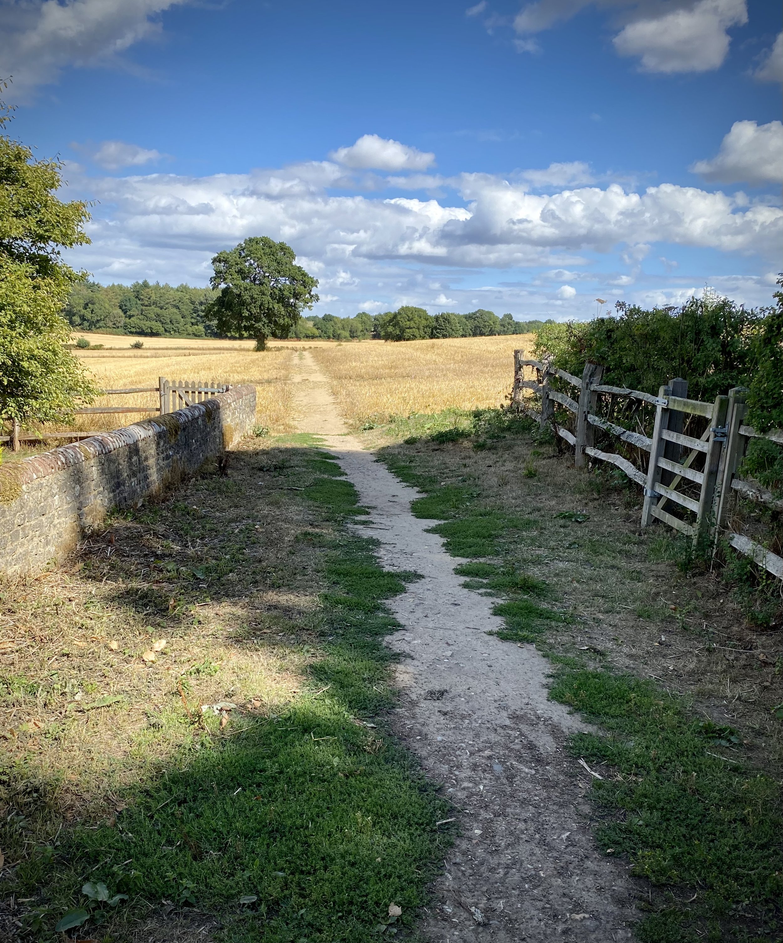
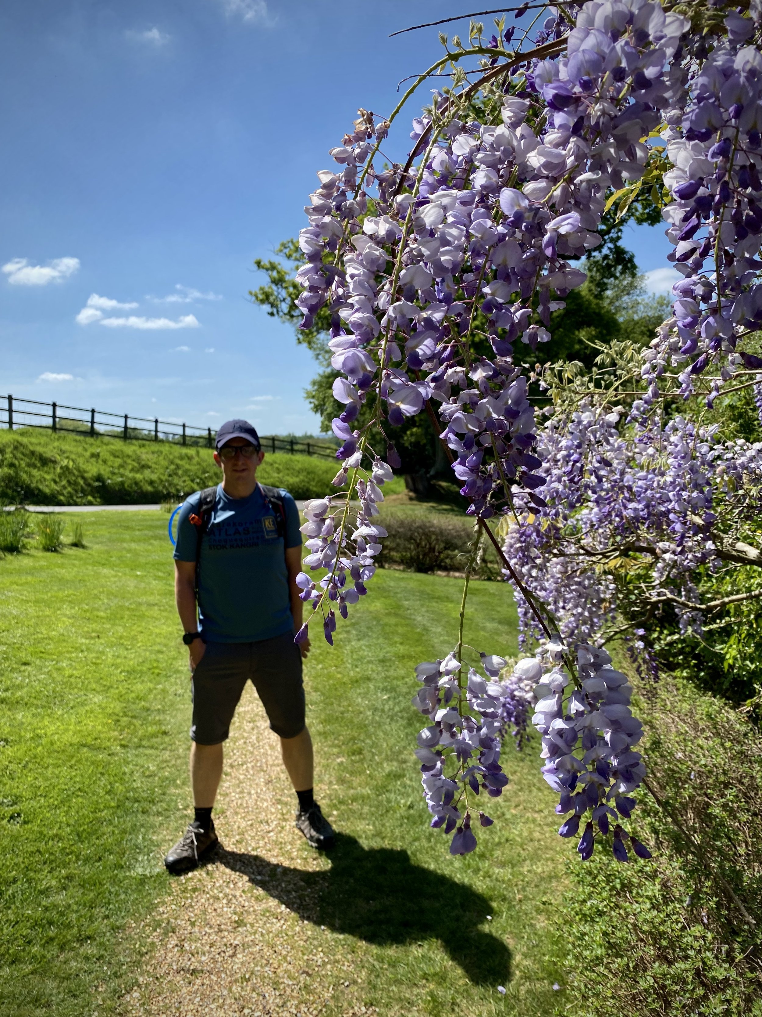
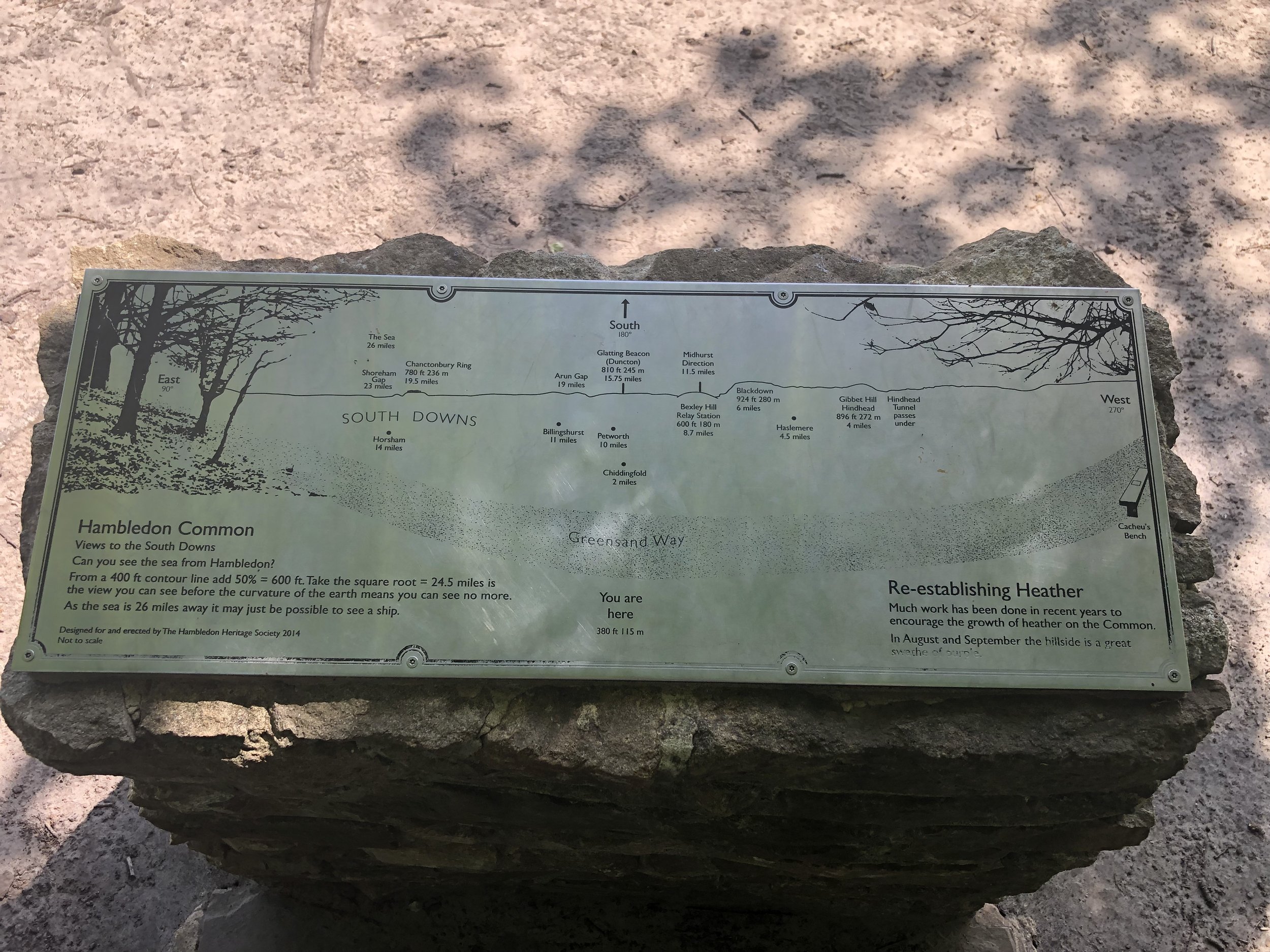
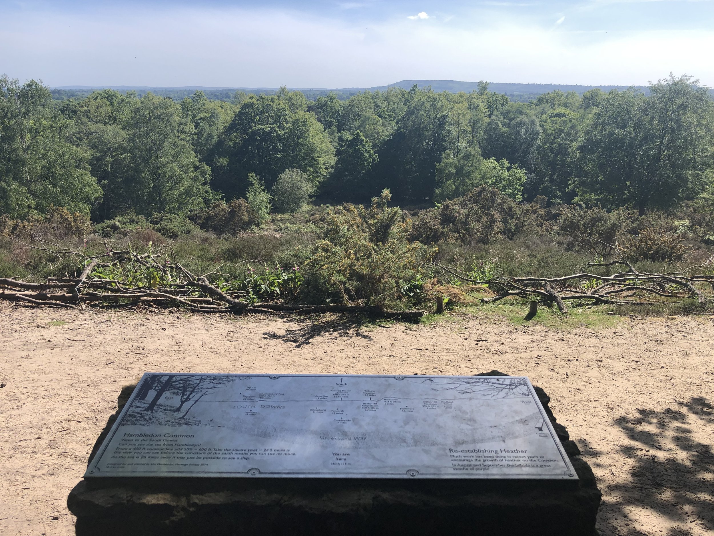
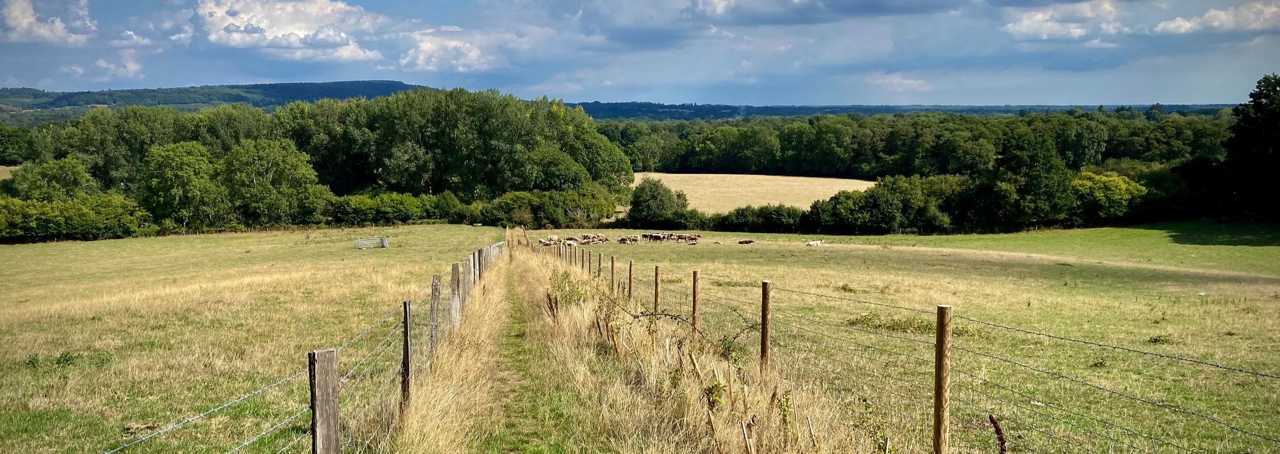
Looking west between Skirmett and Hambledon
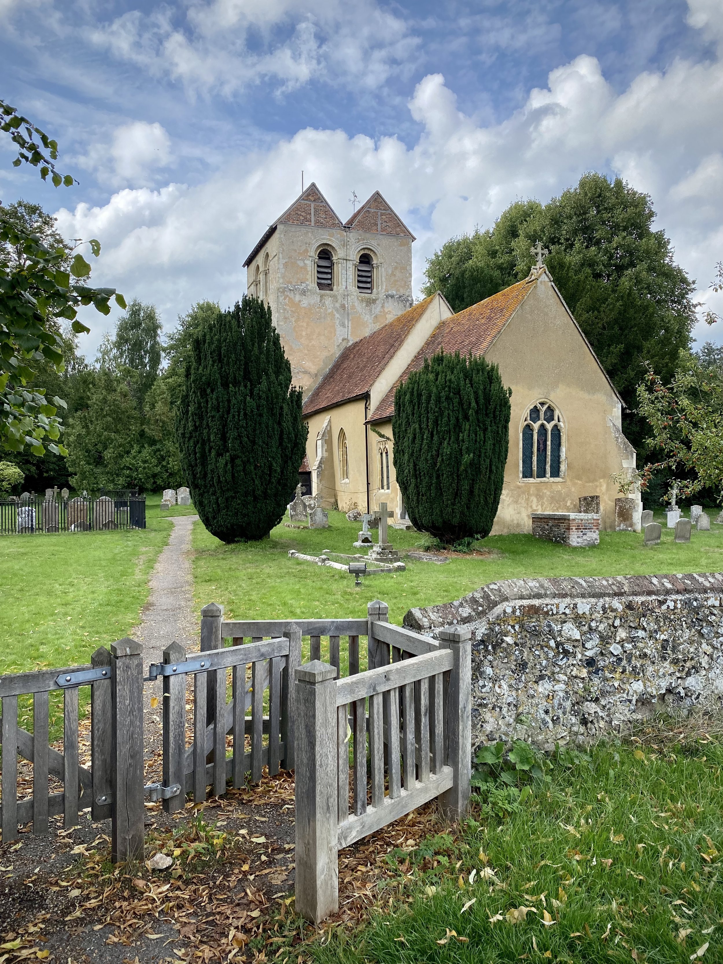
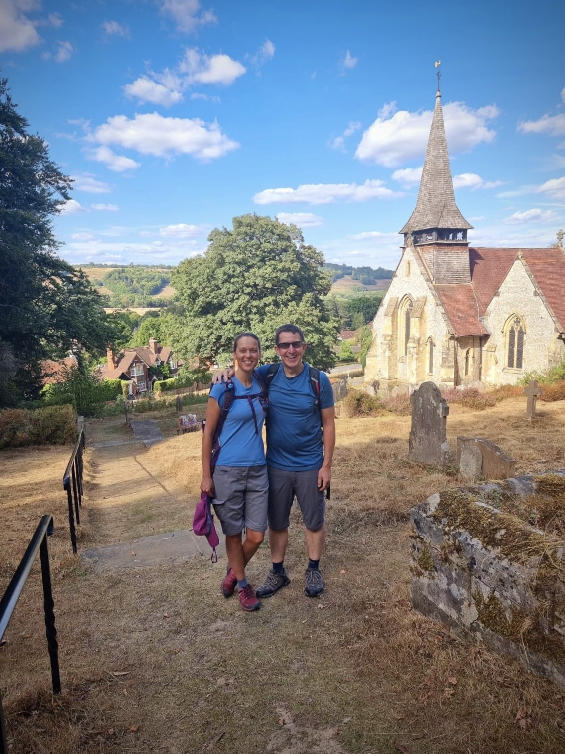
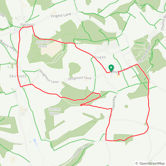
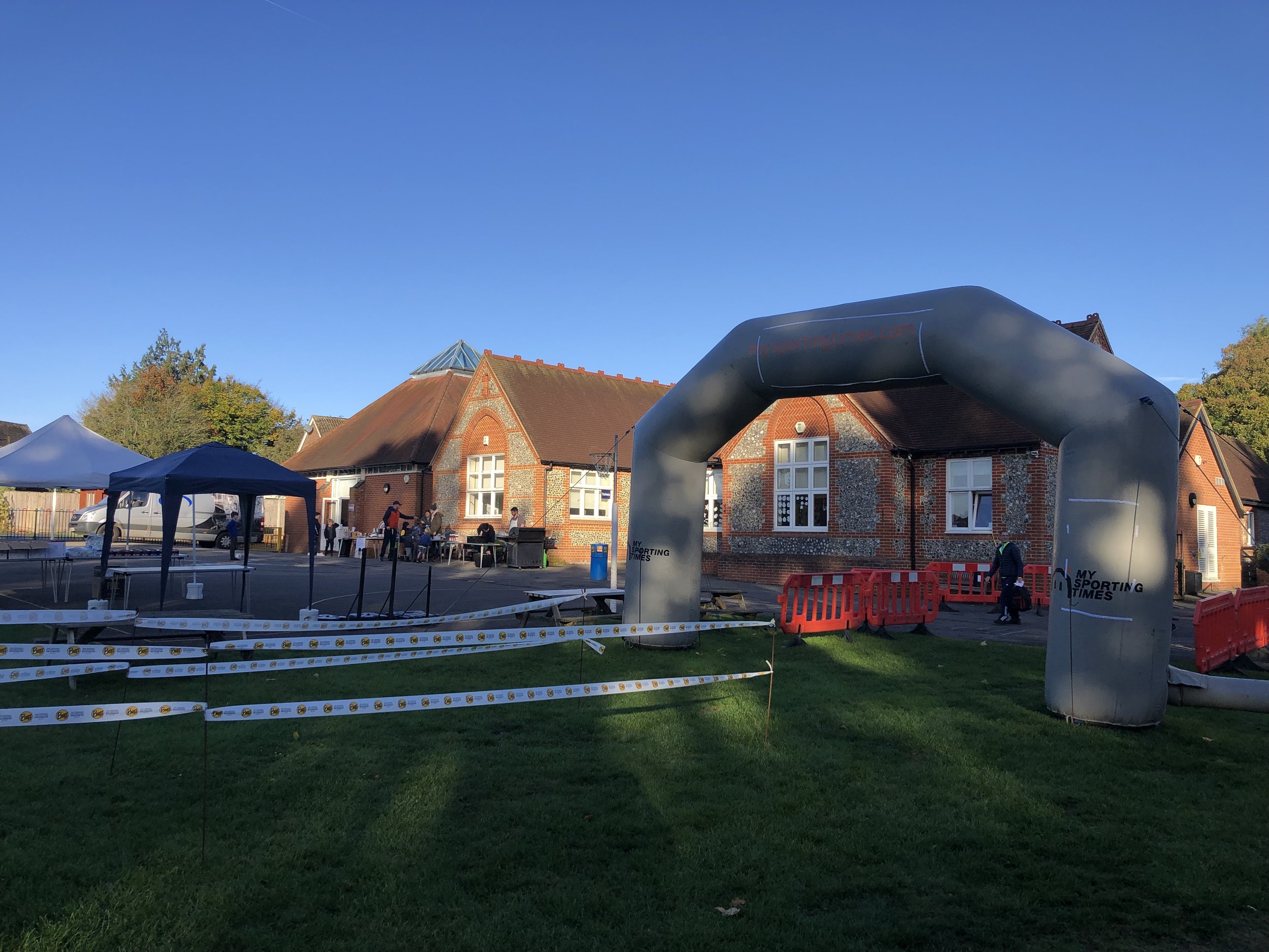
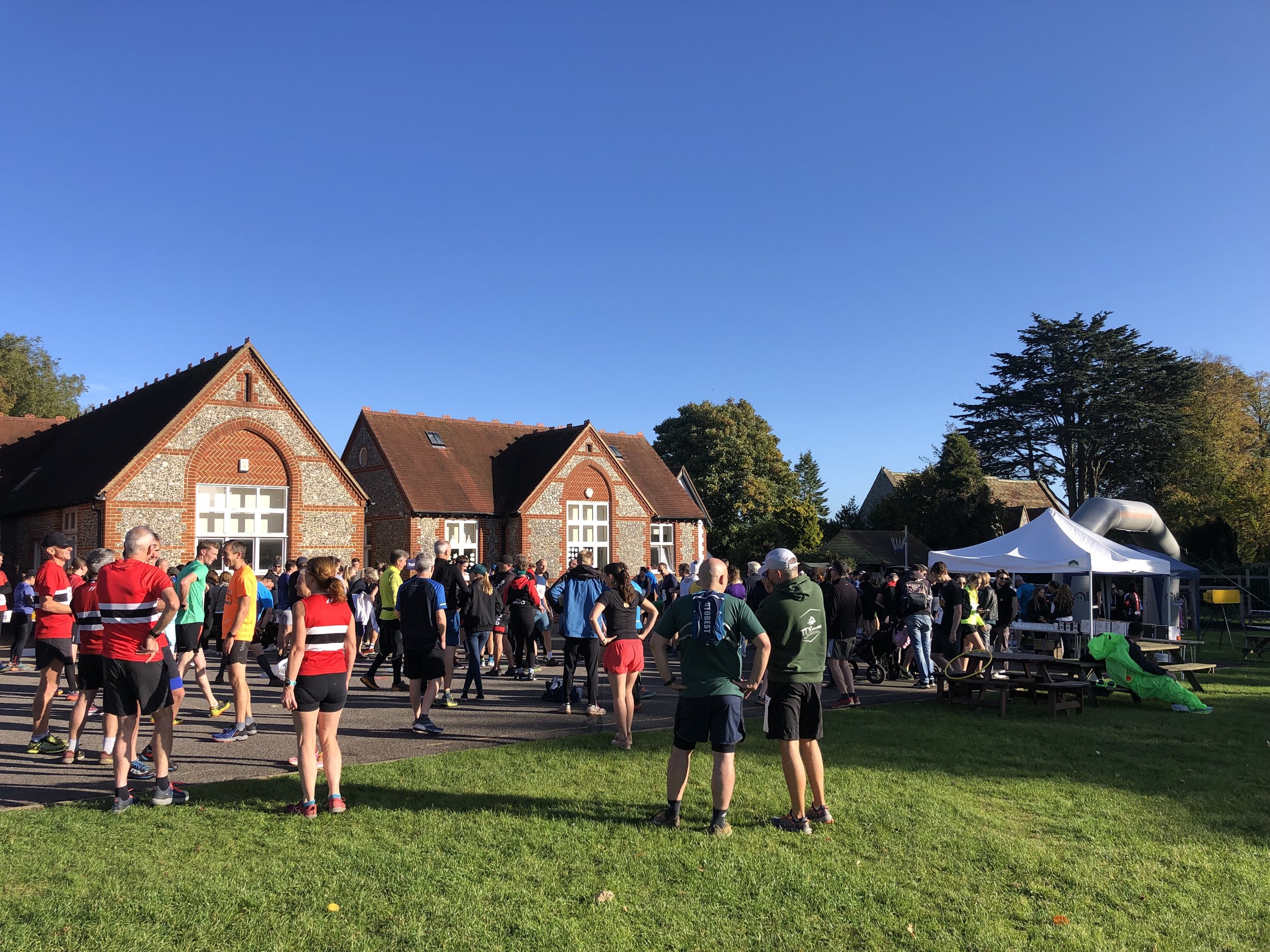
Start & Finish: Frieth Village Hall, Frieth, Henley-on-Thames, RG9 6PR
Distance: 8.9 km (5.5 miles)
Elevation change: +/- 136m
GPX File: get via Buy Me a Coffee
Other routes touched (walk): The Chiltern Way
Other routes touched (cycle): Chilterns Cycleway
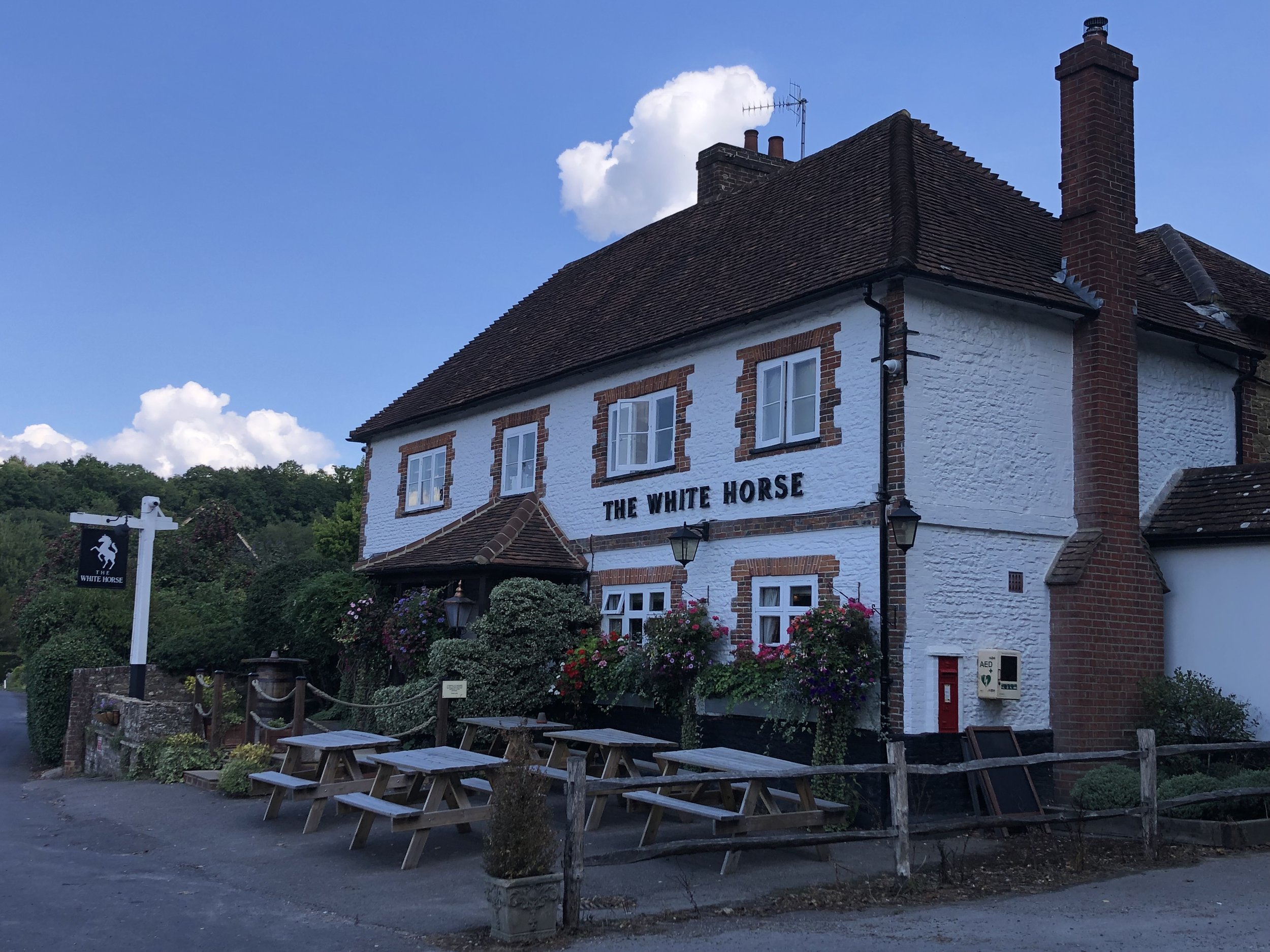
Pubs / Cafes on route: The Yew Tree in Freith and The Frog at Skirmett (just off route at 3.1 km)
Maps:
- OS Explorer Map (171) Chiltern Hills West, Henley-on-Thames and Wallingford
- OS Explorer Map (172) Chiltern Hills East
Links: Frieth, Skirmett
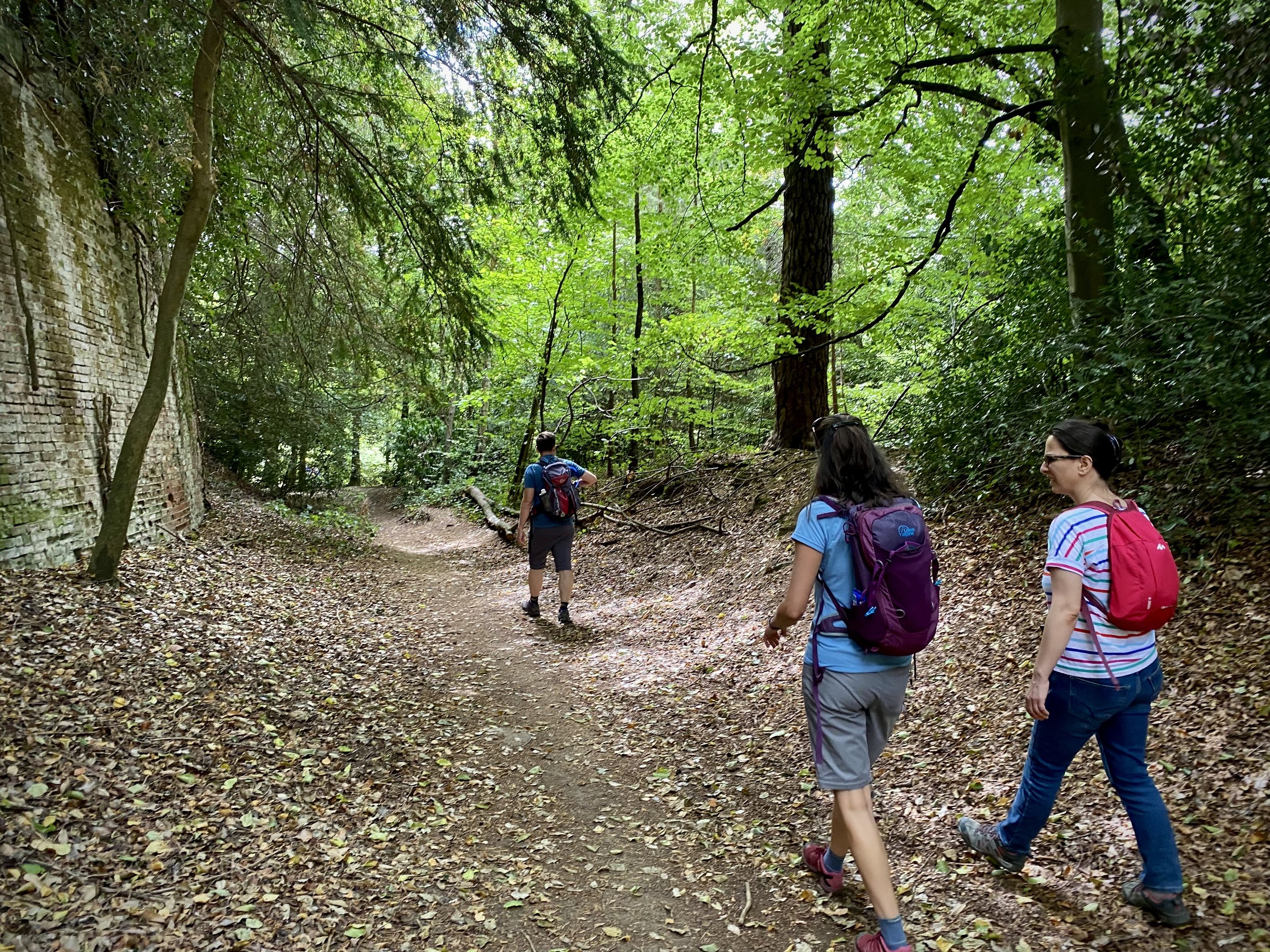
This is part of a series of short circular walks in the Chilterns. The guidance below will help you navigate but don’t use it as a fully accurate turn-by-turn guide. Always take a map and/or a GPX route and prepare well for the weather and terrain.
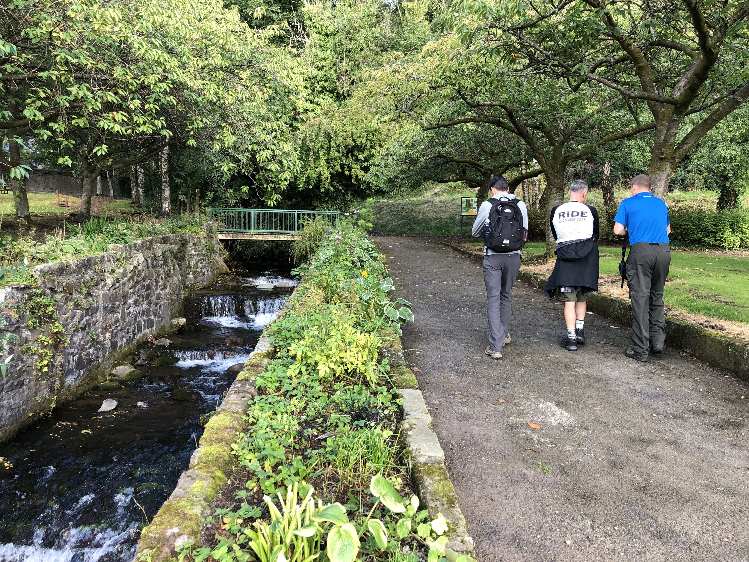
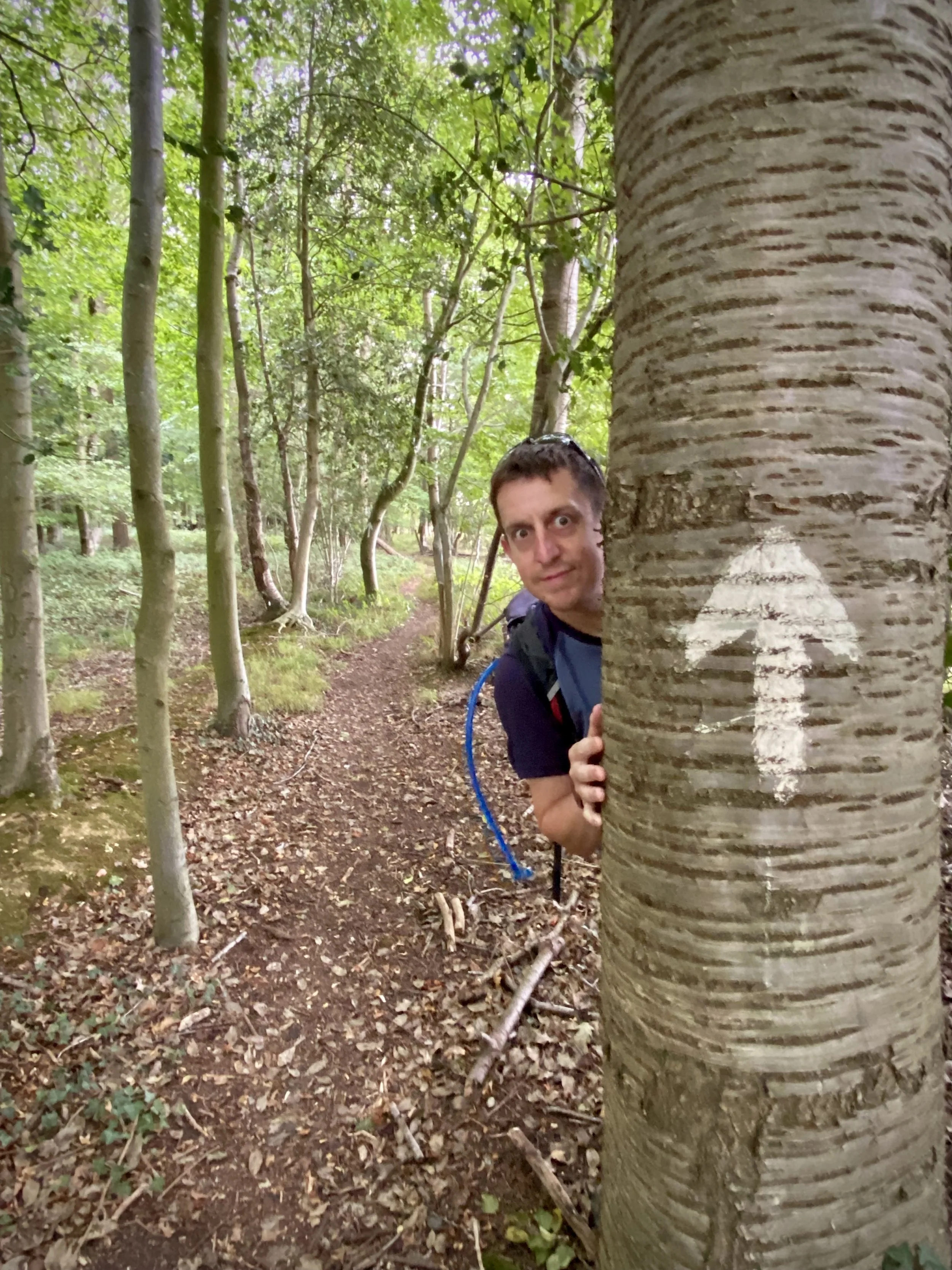
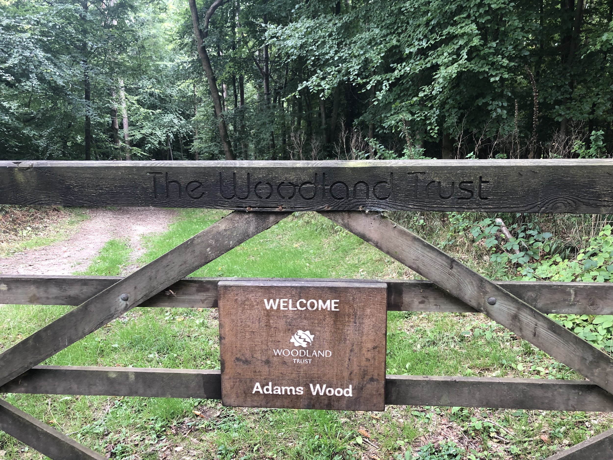
For this walk we parked on the road just outside Frieth Village hall. From here walk in an easterly direction along Church Road and take the first footpath on the left. Continue on the path heading north-west then take a left onto Spurgrove Lane. Take the first road on the right after the curve on Spurgrove Lane. Keep heading north onto a footpath into the woods. At the footpath junction take a left and head in a westerly direction. When you meet the Chiltern Way at the entrance to Adams Wood, take a left onto the Chiltern Way.
Follow the Chiltern Way for 2.9 km until you reach a small lane that connects Skirmett Road with Bagmoor Shaw. Take a left onto the road and follow it until the first footpath on the right that climbs steeply into the woods. Take a moment to visit the shrine just at the top of the hill. At the top of the hill there’s a field where you get a great view over the Hambledon Valley. At the southern corner of the field the path takes a sharp left and follows the edge of the field to Colstrope Lane. Take a left onto Colstrope Lane, following it to the T junction and cross over to take the footpath through a field and into Brushes Wood. Continue through to Moorend Lane and take a left.
Follow Moorend Lane for 800m then take a left hand footpath into the woods before the Lane meets Freith Road. Continue in a north-westerly direction to Moor Common Road. Take a left to return to the village centre, passing the Yew Tree pub along the way.
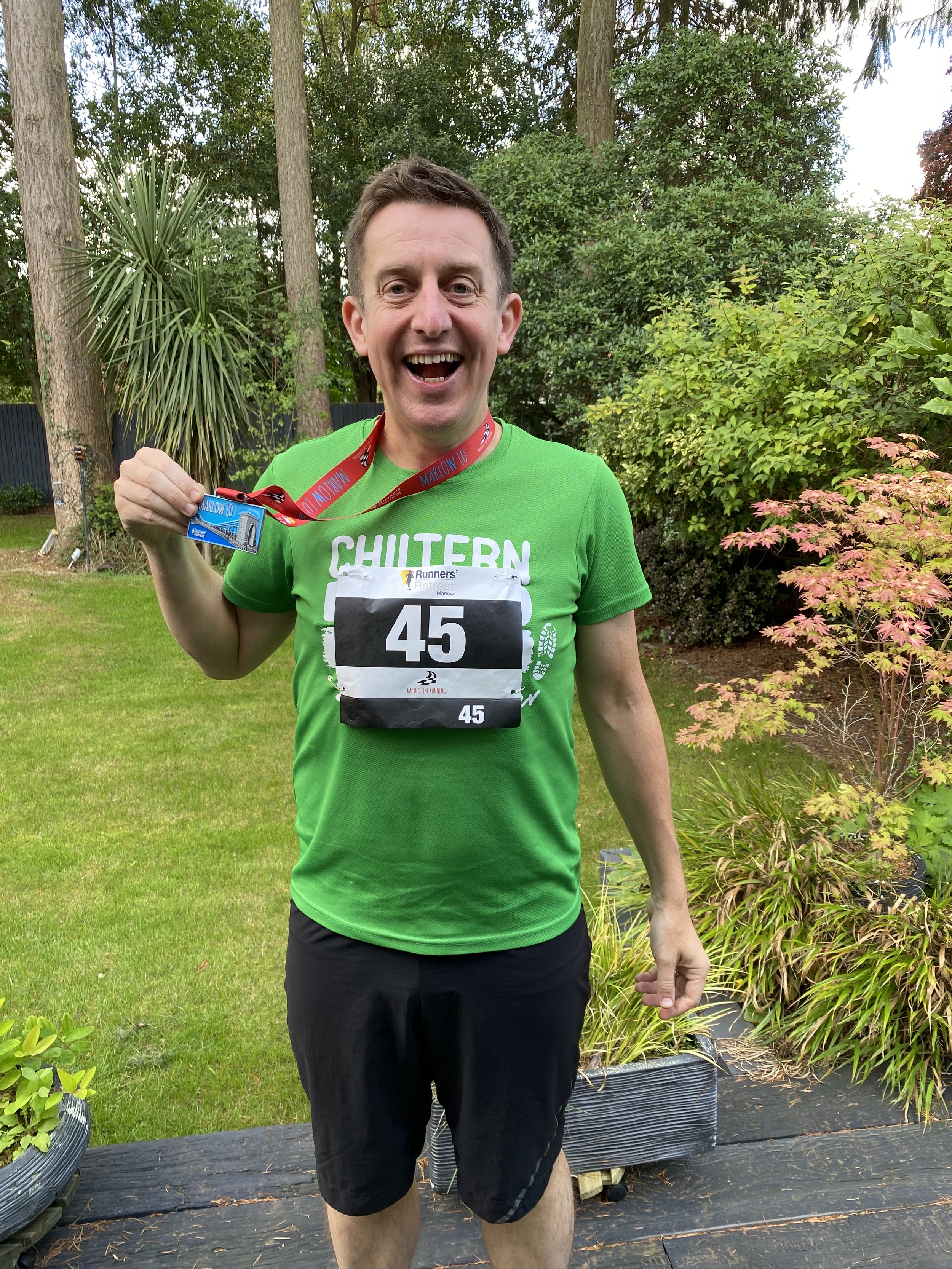
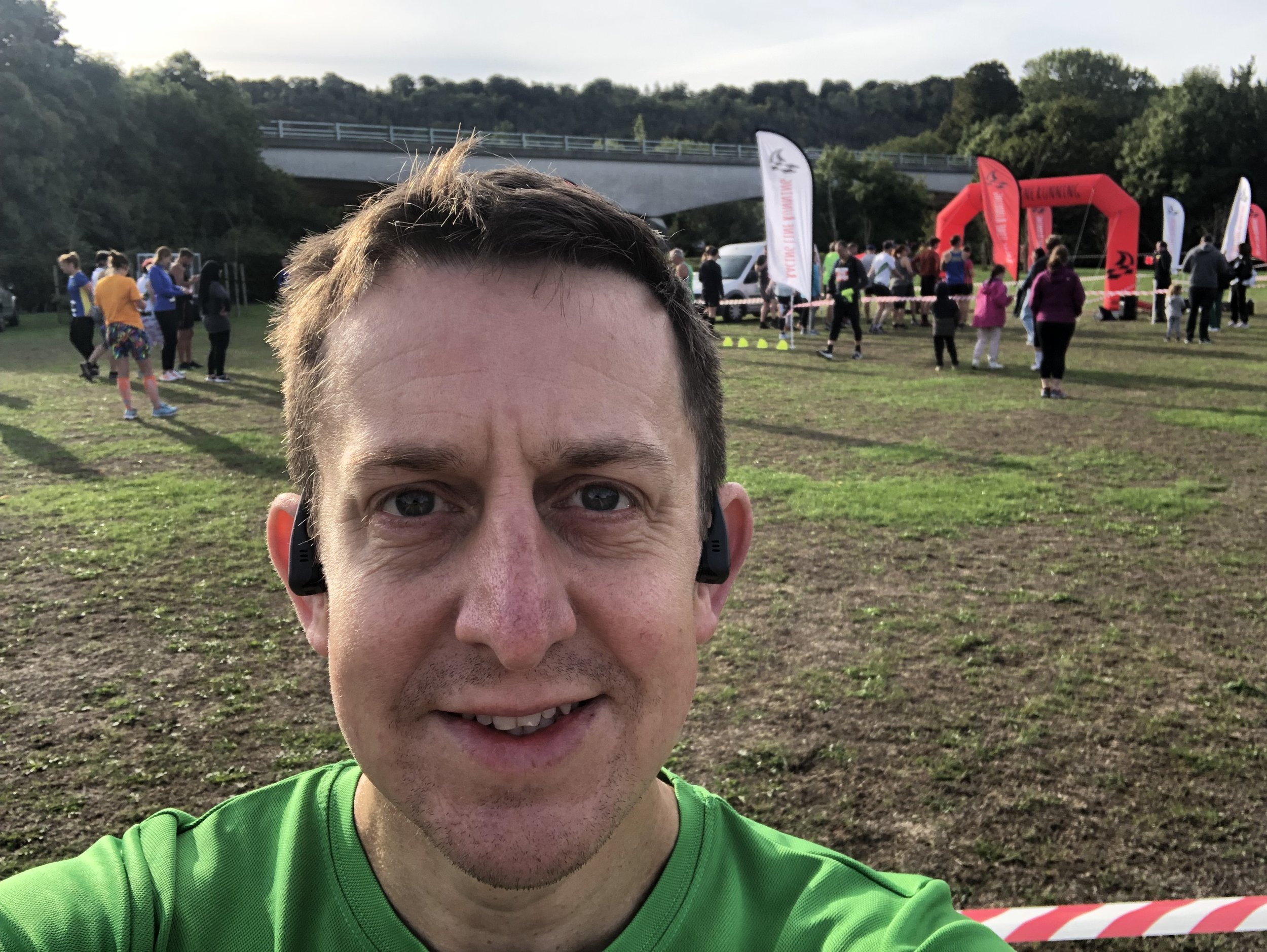
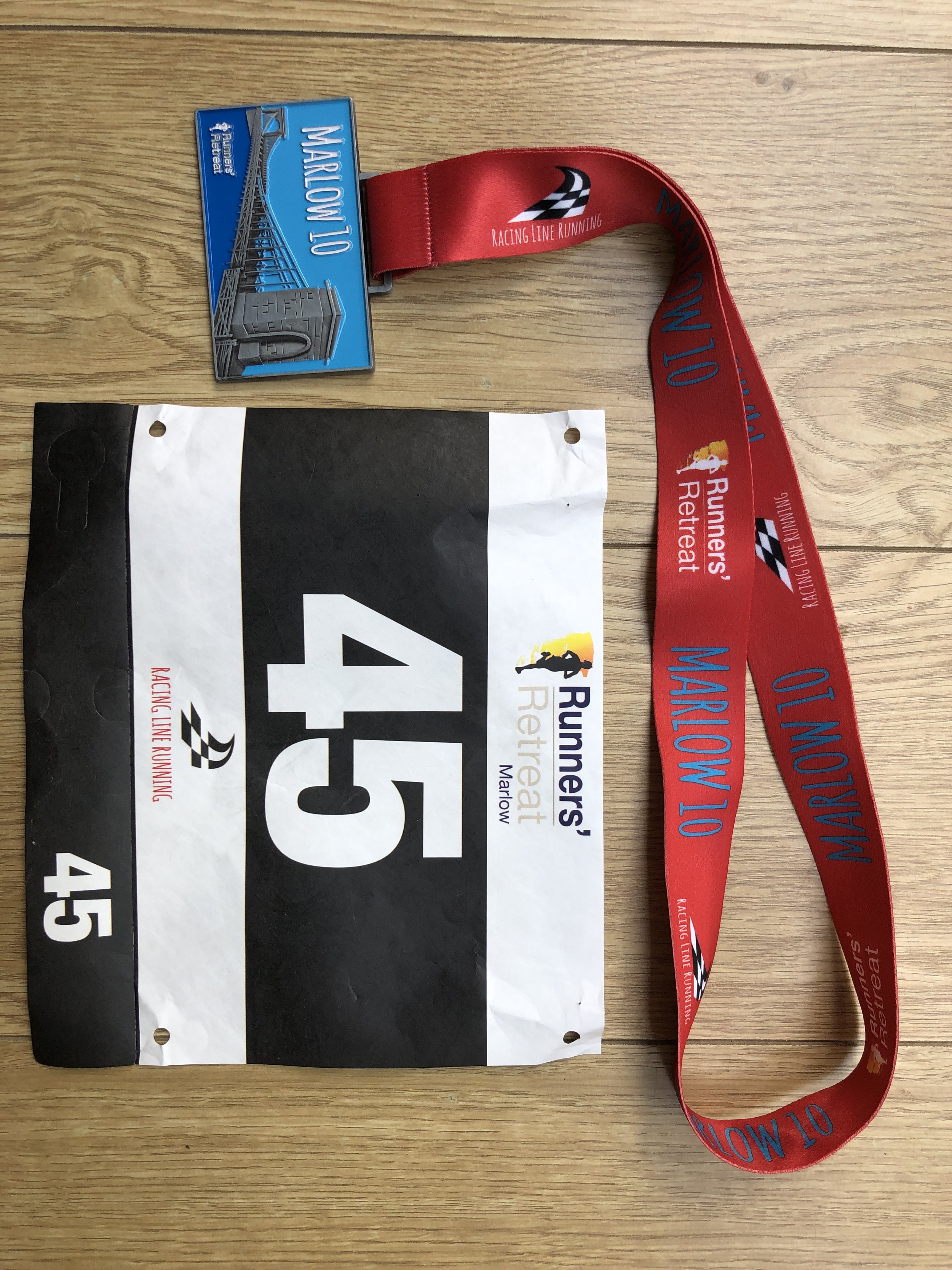
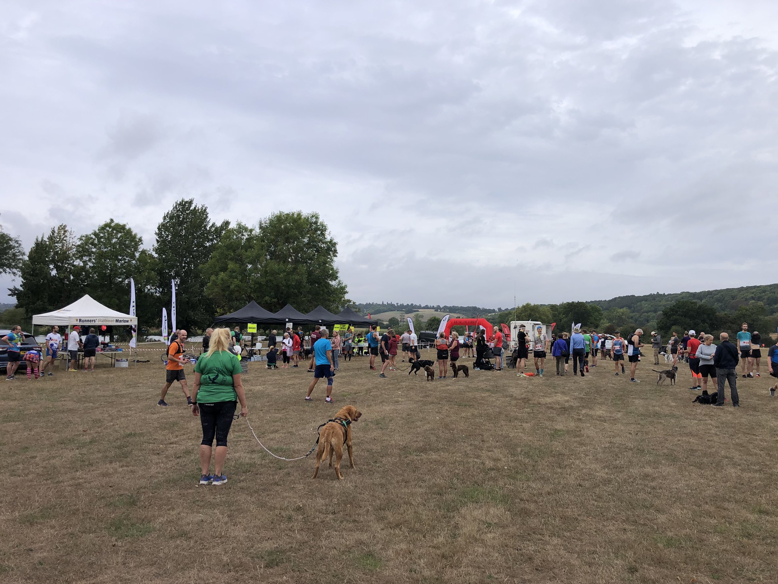
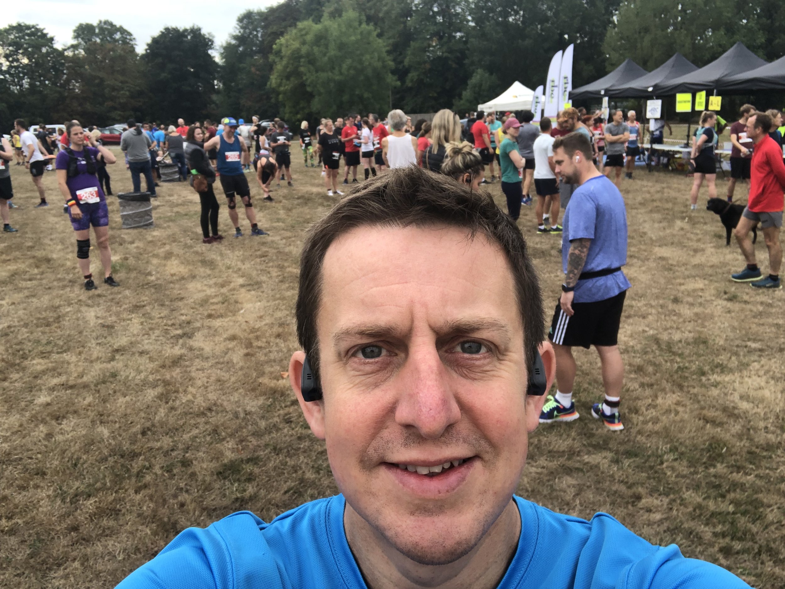
When: September 18th 2022
Where: Fieldhouse Lane, Marlow, SL7 1LU
Course: Single loop around the River Thames between Marlow and Bourne End. 10 mile option also available.
Other routes touched (walk): Thames Path, Walking The Marlow Donkey, Shakespeare’s Way, The Chiltern Way Berkshire Loop, Cookham Bridleway Circuit
Finish time: 59:25

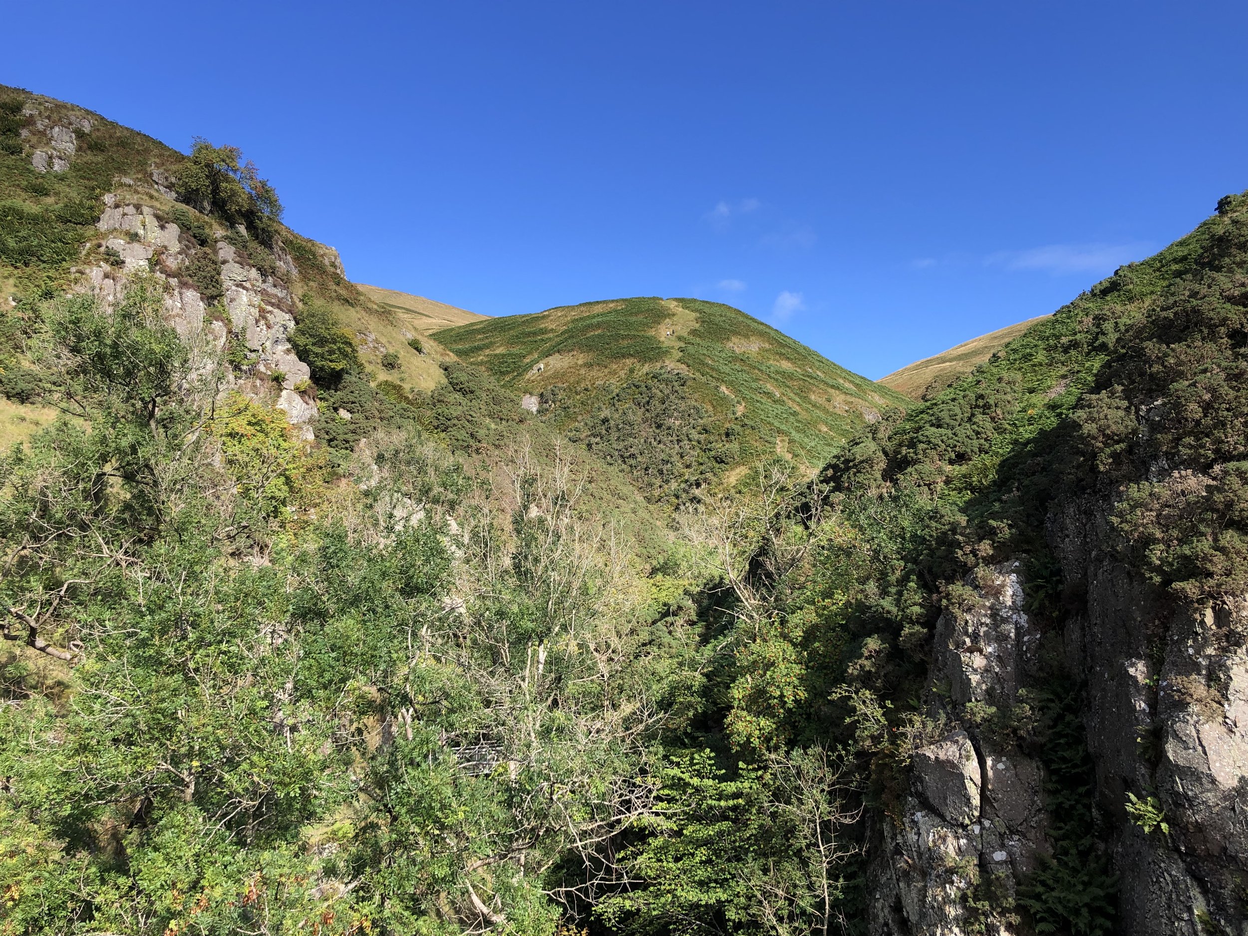
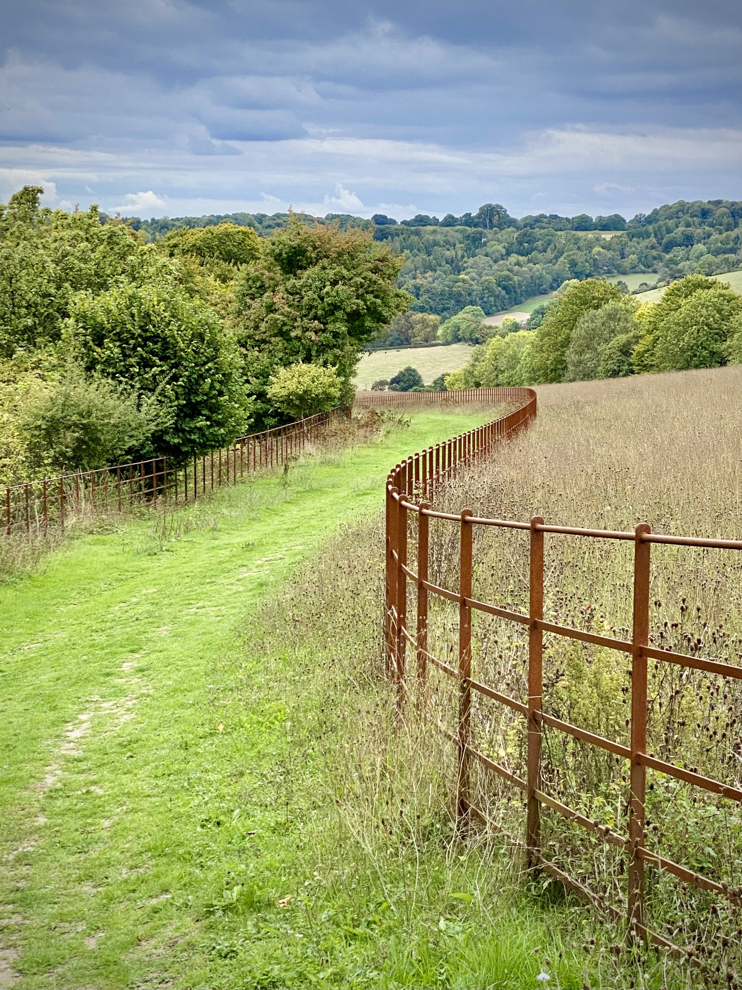
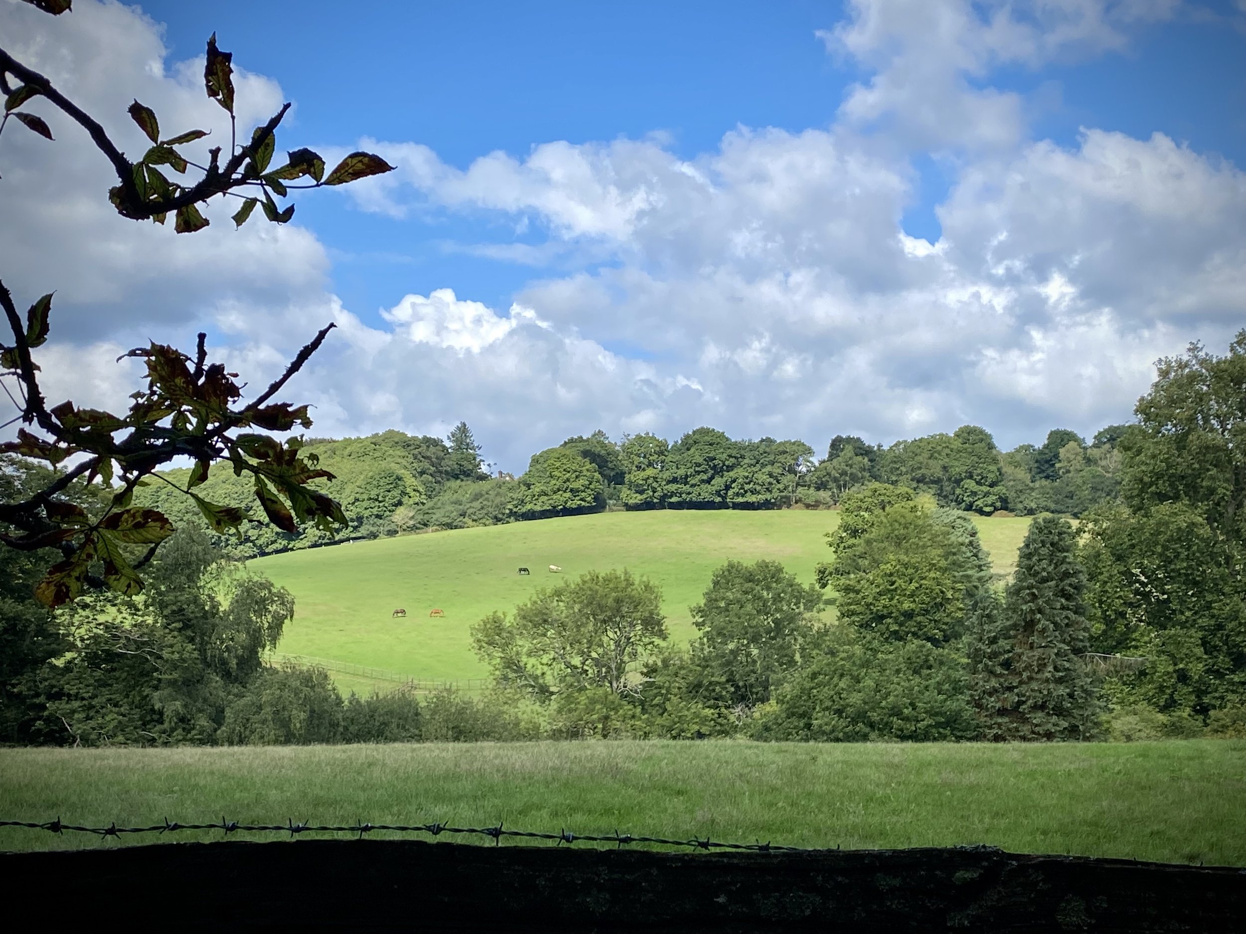
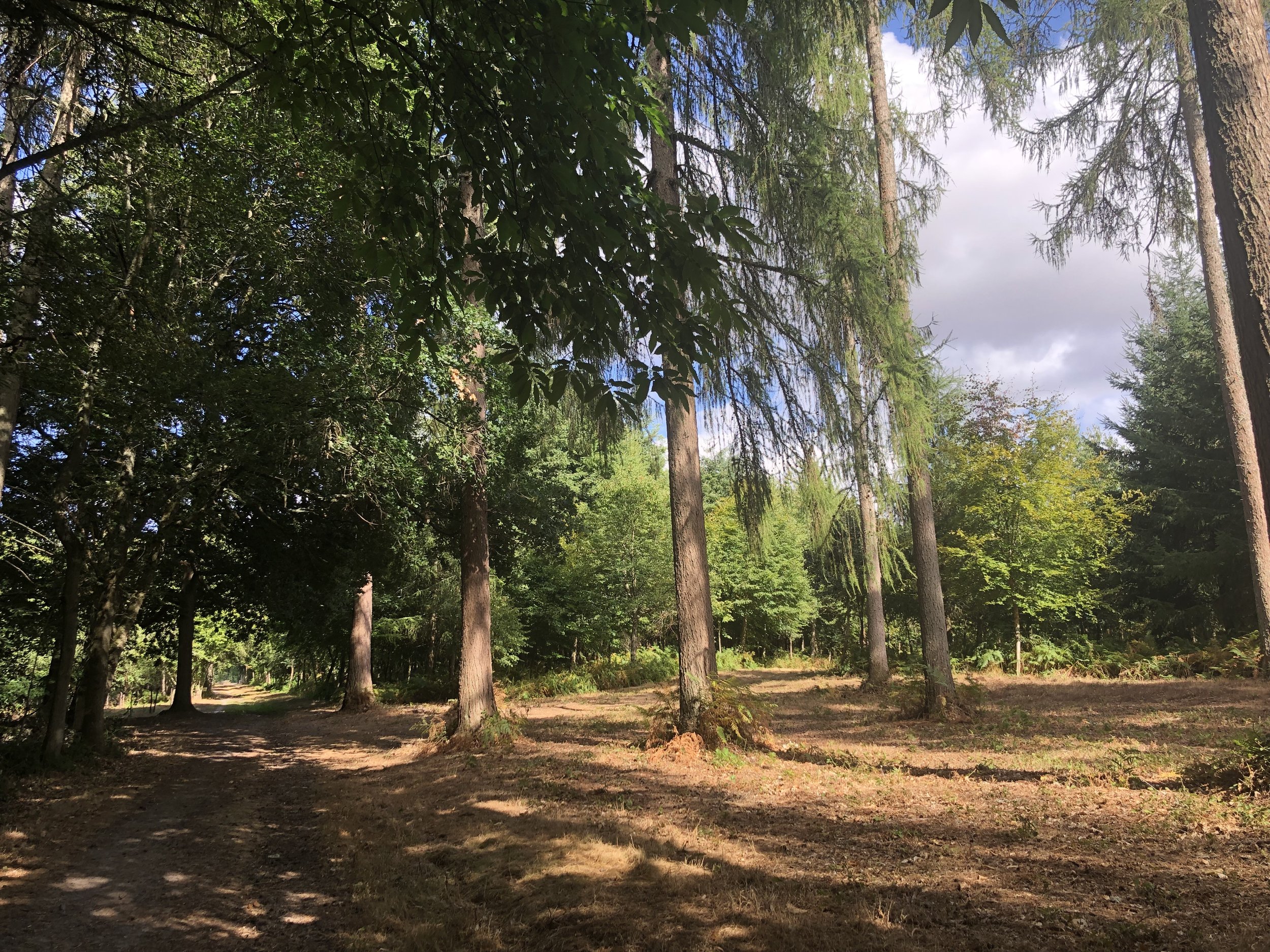
Reynards Hill Viewpoint
Start & Finish: Hurtwood Car Park 3, Pitch Hill, Cranleigh, GU6 7NL
Distance: 10 km (6.2 miles)
Elevation change: +/- 204m
Greensand Way section covered: Long Copse to Pitch Hill Car Park: 4.62 km
GPX File: get via Buy Me a Coffee
Other routes touched (walk): Wey South Path
Other routes touched (cycle): NCN 22, Surrey Cycleway
Pubs / Cafes on route: None
Map: Guildford & Farnham Map | Godalming & Farnborough | Ordnance Survey | OS Explorer Map 145
and Dorking, Box Hill & Reigate Map | Leatherhead & Caterham | Ordnance Survey | OS Explorer Map 146
Links: Winterfold Forest
This is the eighth of a series of short circular walks featuring the Greensand Way. The full trail is a long distance path stretching from Haslemere in Surrey to Ham Street in Kent. Our walks take in short sections of the Greensand Way and loop back to the start on other paths. The Greensand Way is well sign posted however you’ll need a map or GPX route to keep on track for the return sections of the loops. The guidance below will help but don’t use it as a fully accurate turn-by-turn guide.
For this section we parked at Pitch Hill Car Park at the far eastern end of this section of the route. The first half of this route heads west back to where section 7 leaves off. There’s a lot of paths through Winterfold Wood with many junctions and few sign posts. You’ll highly likely get lost without a GPX route and/or map. We inadvertently took a route through private woodland, only realizing once we exited and saw a sign on the gate. I’ve since edited the route to follow public rights of way.
From the car park cross the road and take the right-hand, northerly headed path (not the Greensand Way). This will cross Barhatch Lane and into the Winterfold Wood Estate. Continue in a north-westerly direction along the estate road to a junction where the road becomes private. Take a left and continue heading in a westerly direction. Continue heading west through the wood until you reach Madgehole Lane and follow this to the junction with Woodhill Lane.
Take a left onto Woodhill Lane, heading south-west then take the first left to join Stroud Lane. Follow Stroud Lane south for ~50 and you’ll rejoin the Greensand Way. Continue along Stroud Lane and stay on the Greensand Way when it leaves the lane on a footpath to the left. Continue following the Greensand Way for another 4km back to the car park.
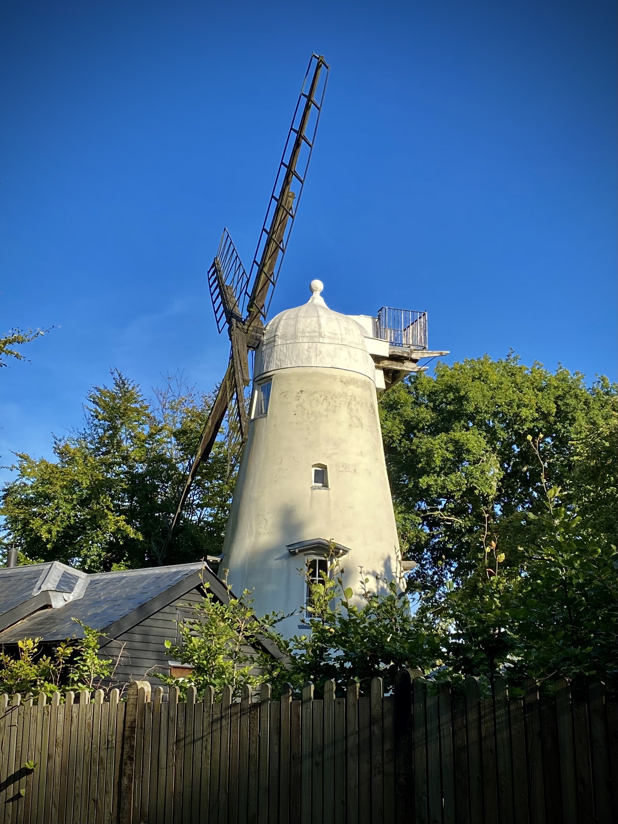
Take a moment to see the viewpoints at Winterfold Hill and Reynards Hill, both with beautifully carved benches. The final point of interest is the Ewhurst Windmill, a listed building now privately owned by visible from the trail.
Previous section: Walking The Greensand Way Part 7 - Shamley Green and Grafham
Next section: Walking The Greensand Way Part 9 - Pitch Hill and Holmbury Hill

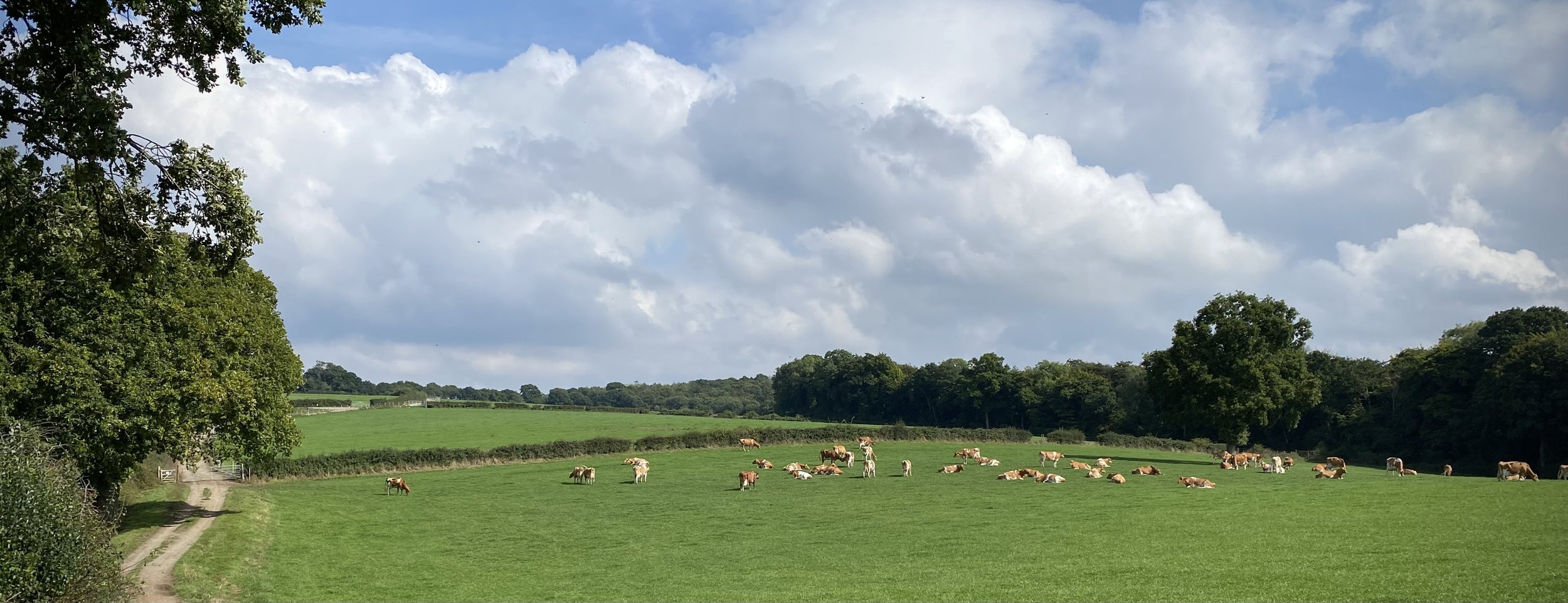
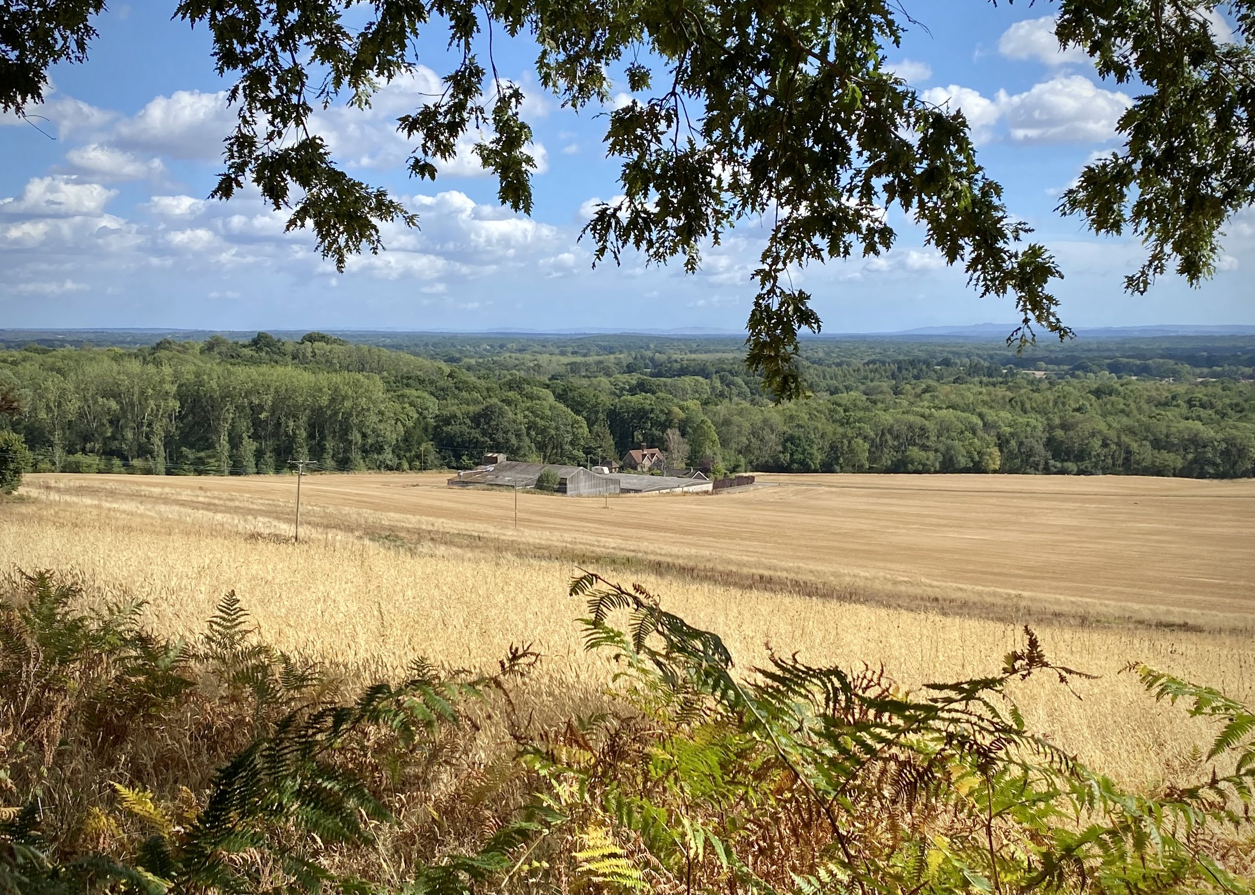
Fields near Bolter End Common
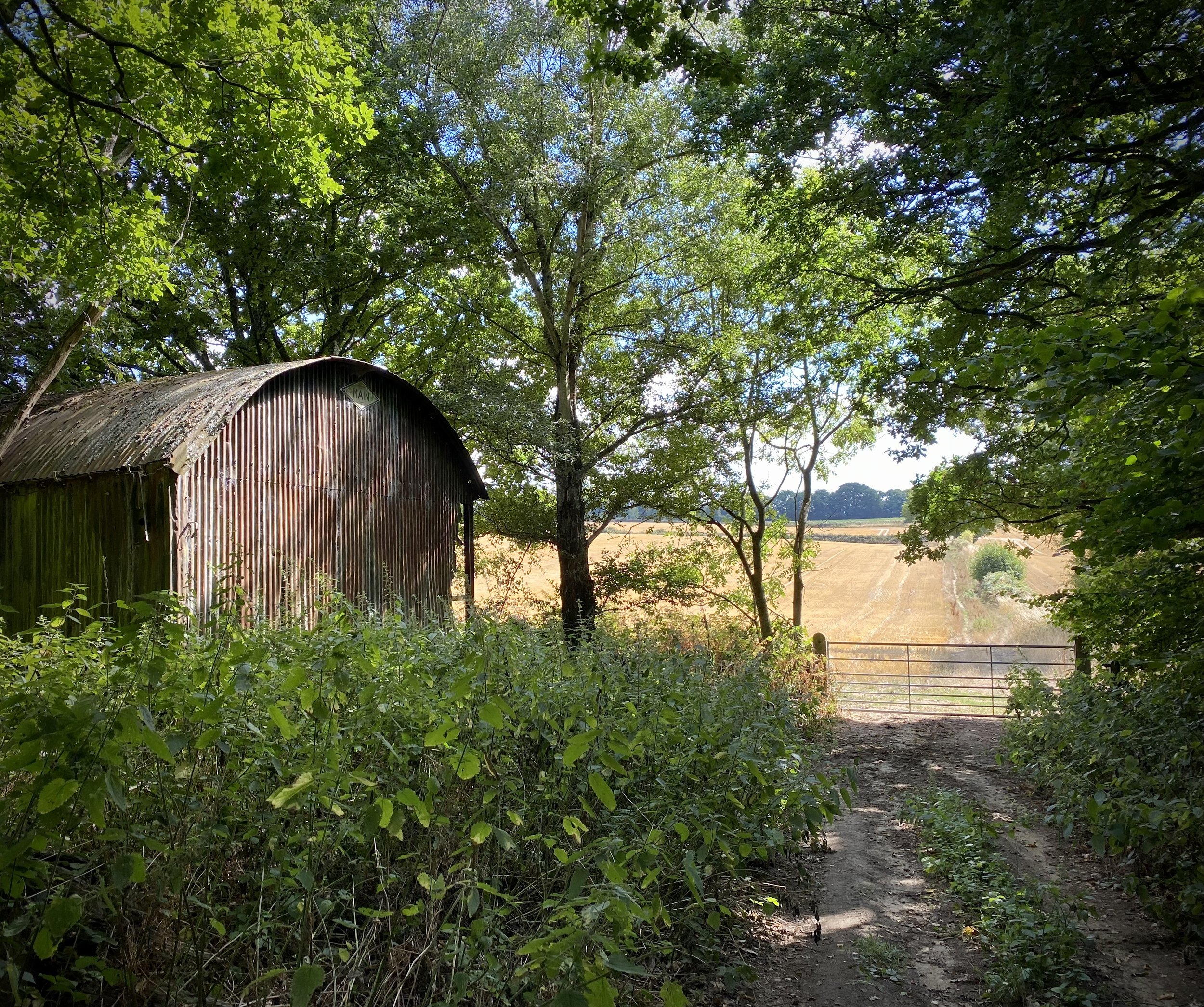
Start & Finish: Village Car Park, 1 The Ferns, Lane End, High Wycombe, HP14 3HB
Distance: 8.7 km (5.4 miles)
Elevation change: +/- 160m
GPX File: get via Buy Me a Coffee
Other routes touched (walk): Chiltern Way
Other routes touched (cycle): Chiltern Cycleway
Pubs / Cafes on route: Several in Lane End village centre, plus The Chequers Inn, Fingest (4.3km in), The Prince Albert (6.9 km in)
Map:
- OS Explorer Map (171) Chiltern Hills West, Henley-on-Thames and Wallingford
- OS Explorer Map (172) Chiltern Hills East
Links: Lane End, Fingest
This is part of a series of short circular walks in the Chilterns. The guidance below will help you navigate but don’t use it as a fully accurate turn-by-turn guide. Always take a map and/or a GPX route and prepare well for the weather and terrain.
For this walk we parked at the free village car park opposite the village hall. From here cross the B482 Finings Road and follow Church Path round the right hand side of Holy Trinity Church. When you reach the old pub, now a house, turn right and follow the footpath down through the woods. At path junctions in the wood keep to the right until you reach the farm track at Bolter End Common. Take a left and descend for 1 km down to the woods. At the woods you’ll meet an east-west path. Take a right through a gate onto a private road and descend until you meet Fingest Lane.
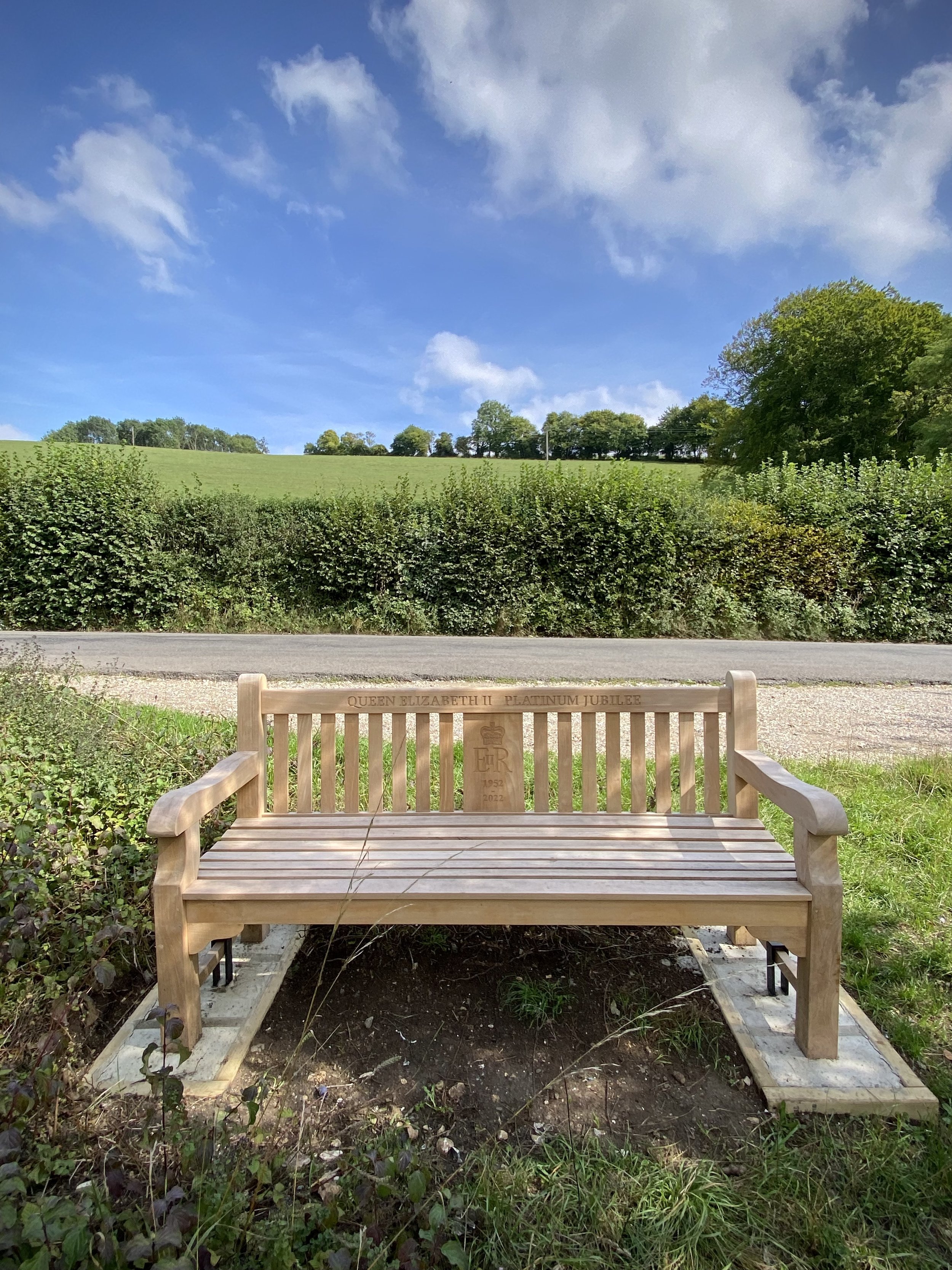
Take a right onto Fingest Lane and look out for a clearing with a bench dedicated to Queen Elizabeth’s Platinum Jubilee. Here you can take a footpath that runs in a north-westerly direction parallel to Fingest Lane. Follow this path and take a left at the end where the road curves to the right. Follow this path along the edge of fields in a south-westerly direction until you reach the village of Fingest. The Chequers Inn is a good place to stop for a rest at this half way point of the trip.
When leaving the Chequers Inn walk in an easterly direction along Fingest Lane and take the footpath on the right signed The Chilterns Way. Follow this path up the hill keeping the woods on your right. After ~500 metres, the path will briefly enter Mousell’s Wood then across a field and into another woods. In this second woods, leave the Chiltern Way as it takes a sharp right. Instead continue along the path heading east to a path junction at Adams Wood. Take a left and follow the path into Adams Wood in a northerly direction for only a few metres before the path curves back to the east. Follow this path for just under 1 km until you reach the far eastern side of the woods. Take a right turn and head south until you meet the junction with Spurgrove Lane. Take a left on a path through the hedge and descent through a field until you meet Fingest Road.
If you need a rest here the Prince Albert Pub is not far down the road on the right. Otherwise cross Fingest Road and follow the path past some houses on the left up through the woods. There’s a few paths here that all interconnect but you’ll need to make sure you’re heading north-east to connect with Church Road. Take a right onto Church Road and follow the pavement alongside it until you see a path on the right with a sign to a house called Chiltern View. Follow this path and take a right at the junction so that you’re walking north with the allotments on your right. You’ll reach the back of Holy Trinity Church where you can either take a right or left hand path around it to connect back to the start.

Near Gate Street Farm
Start & Finish: Shamley Green Christ Church, Church Hill, Shamley Green, Guildford, GU5 0UD
Distance: 10.3 km (6.4 miles)
Elevation change: +/- 107m
Greensand Way section covered: Gate Street Farm to Long Copse, Stroud Common: 4.4 km
GPX File: get via Buy Me a Coffee
Other routes touched (walk): Wey South Path
Other routes touched (cycle): Downs Link
Pubs / Cafes on route: None, however the Bricklayers Arms and Red Lion are a short walk from the start/finish
Map: Guildford & Farnham Map | Godalming & Farnborough | Ordnance Survey | OS Explorer Map 145
Links: Shamley Green, Grafham, Gate Street Farm
This is the seventh of a series of short circular walks featuring the Greensand Way. The full trail is a long distance path stretching from Haslemere in Surrey to Ham Street in Kent. Our walks take in short sections of the Greensand Way and loop back to the start on other paths. The Greensand Way is well sign posted however you’ll need a map or GPX route to keep on track for the return sections of the loops. The guidance below will help but don’t use it as a fully accurate turn-by-turn guide.
For this section we planned to park in the small car park on the opposite side of the B2128 (Church Hill) to Shamley Green Christ Church. Normally this would be OK but there was a wedding at the church at the time so we parked near the village green. Although it adds 10 minutes to each end of the walk, there's more parking options and 2 pubs for a pre or post walk rest. The Greensand Way crosses the B2128 by the church. Follow the trail initially in a north-easterly direction and continue as it curves to the south-east. After 1.6 km (from the church) you'll leave the Greensand Way at a fork in the woods and follow the right hand path for ~400m until you reach a small road.
Take a right onto the road and follow it down to meet the B2128 again. Take a right onto the B2128 and follow it north for ~300m to take the first footpath on the left. Be careful here as there's no pavement, although there's a narrow grass verge so you don't need to walk on the road. Cross the field then take a left onto Upper House Lane. Follow this south until you meet Run Common Road.
Take a right onto Run Common Road and follow it for 1.1 km before taking a left hand footpath opposite the entrance to a farm. Be very careful on this road. There's no pavement and, although the road isn't busy, cars can go quite fast. Once you cross the River Wey there's a 300m section where you can walk on a protected path to the left of the road.
Having left Run Common Road, follow the path alongside the left hand side of the field to the A281 Horsham Road. Take a right onto the road, following the pavement, and take the first footpath on the left. Follow this path to Gate Street.
Take a right onto Gate Street and continue past the farm and back onto the Greensand Way. You'll now be on the same part of the trail where you left off on section 6. Continue to follow the Greensand Way back to the start at Shamley Green Christ Church.
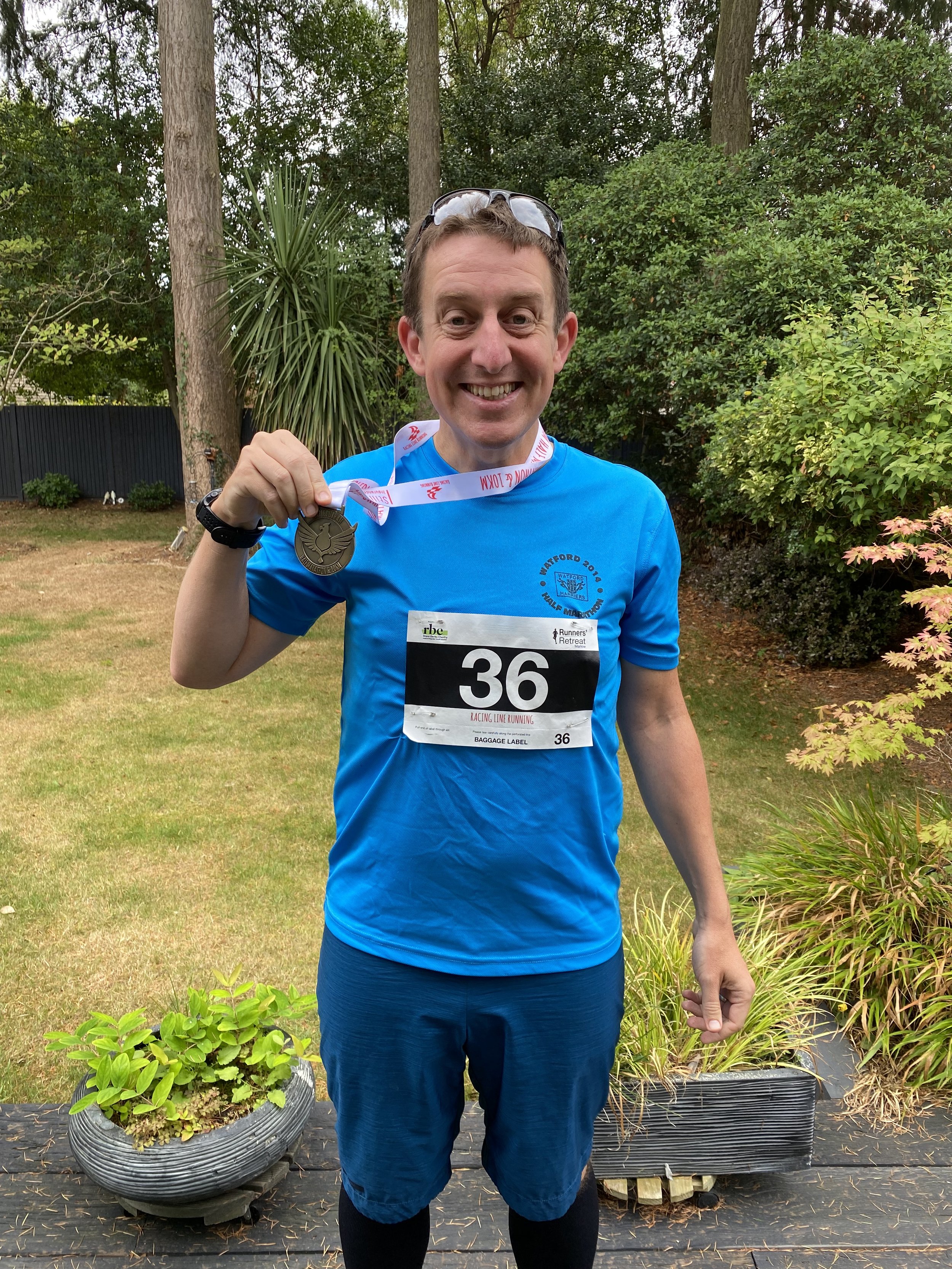
When: September 4th 2022
Where: Mapledurham Country Park, RG4 7TR
Course: Single loop hilly course in the woods and fields around Mapledurham Country Park.
Other routes touched (walk): Chiltern Way Southern Extension
Finish time: 57:48

Pewley Down, Guildford
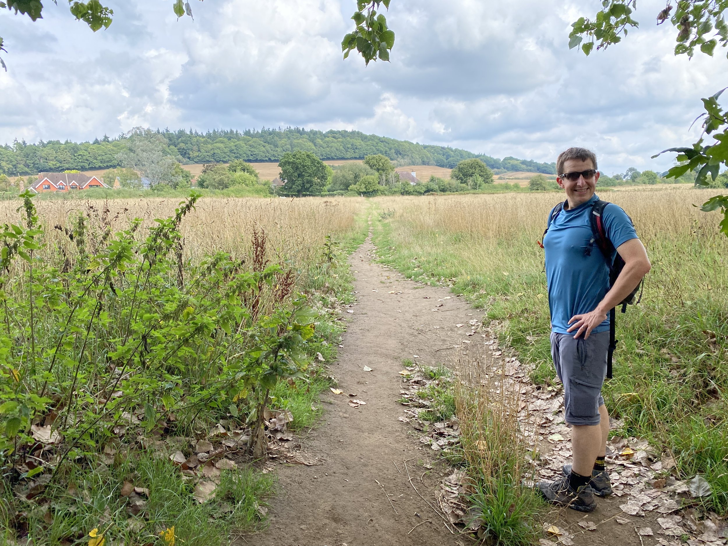
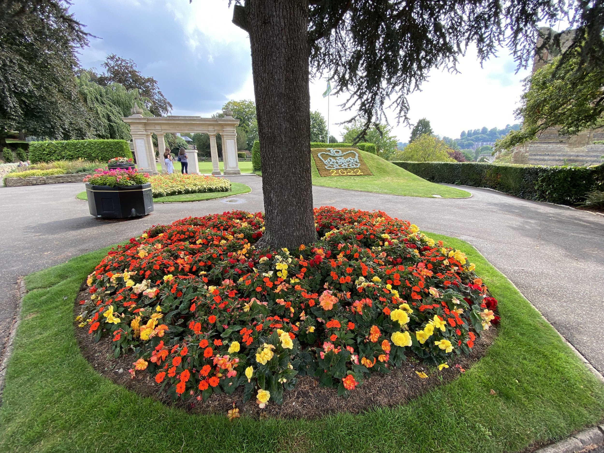
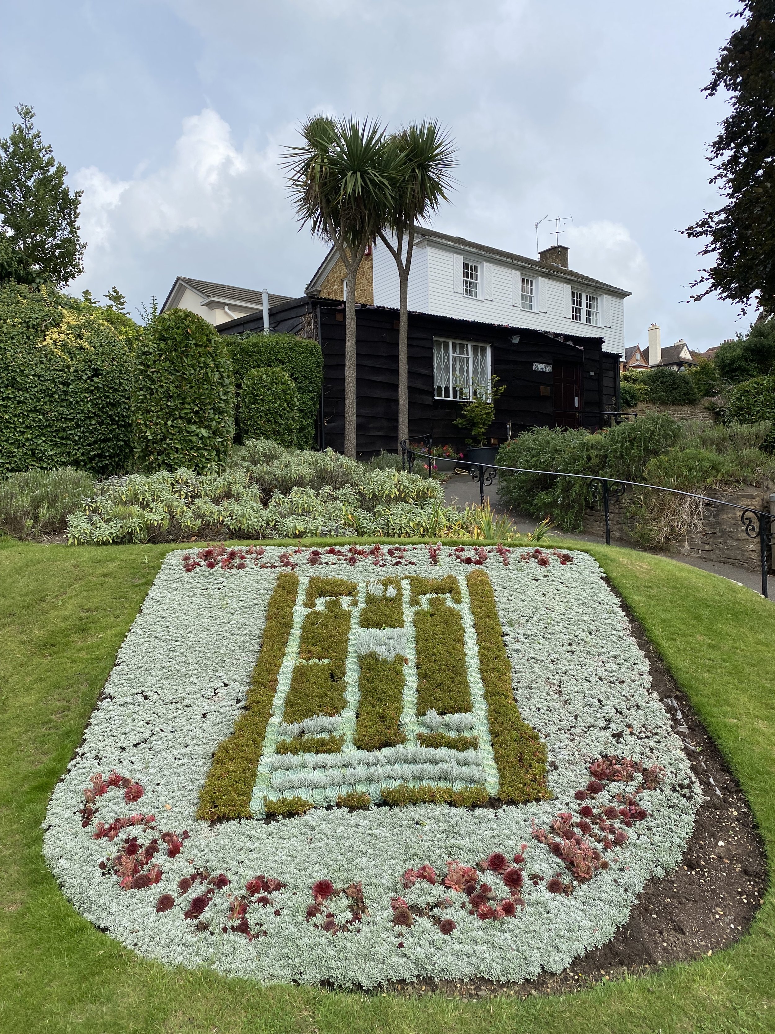
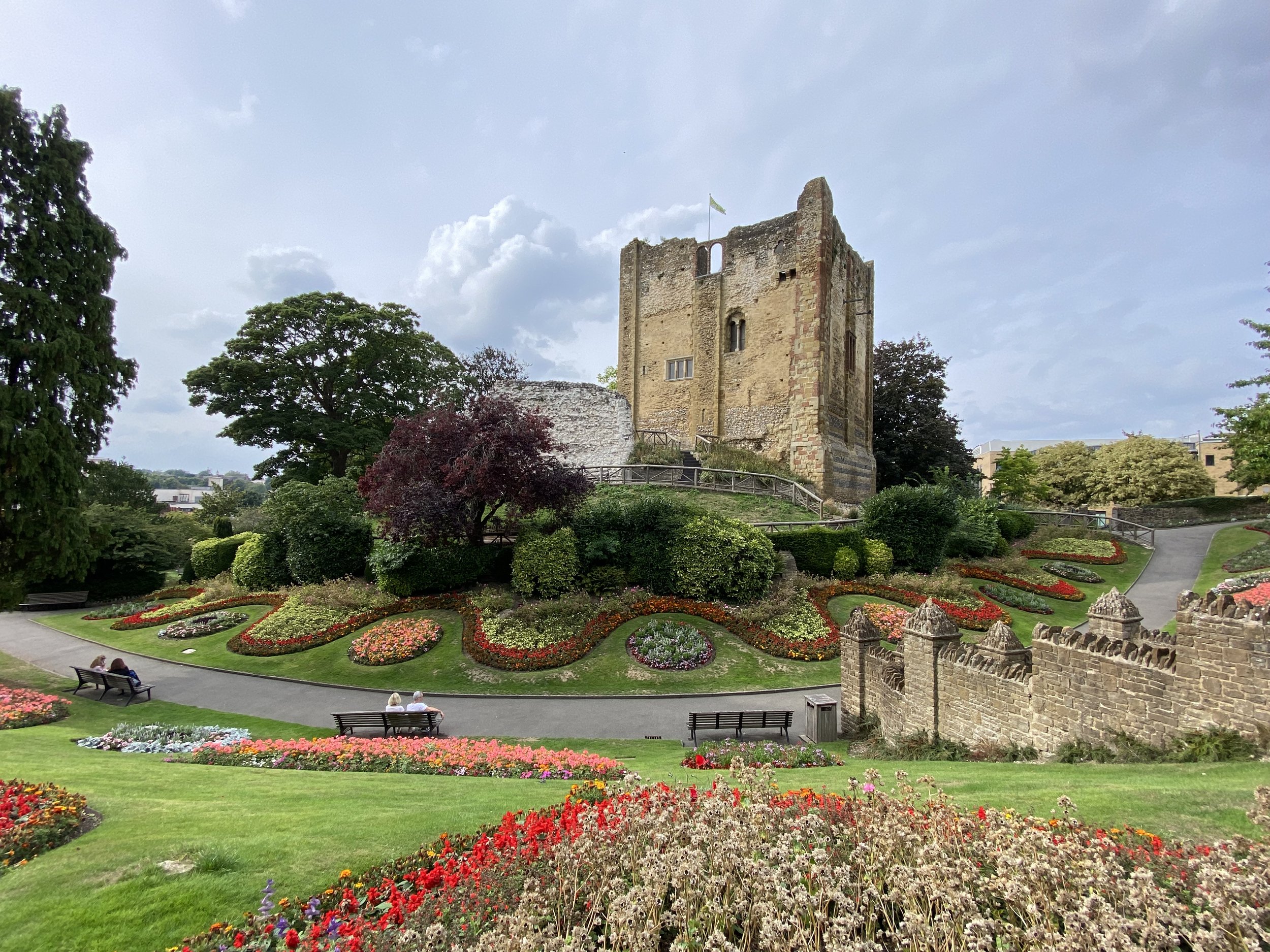
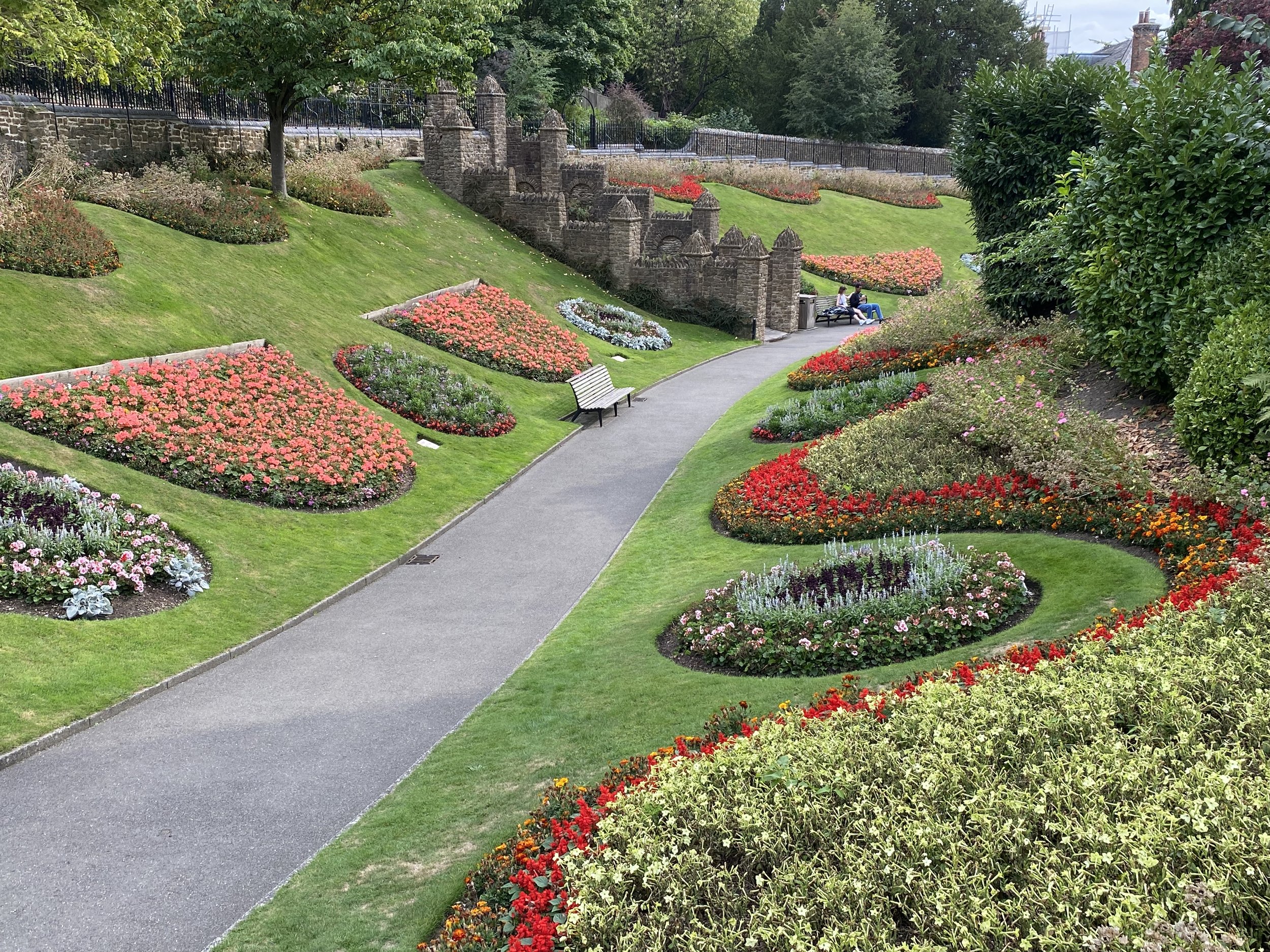
Start & Finish: Millbrook Car Park, A281, Guildford, GU1 3XJ
Distance: 8.1 km (5 miles)
Elevation change: +/- 147m
GPX File: get via Buy Me a Coffee
Other routes touched (walk): Wey-South Path, North Downs Way
Other routes touched (cycle): NCN 22
Pubs / Cafes on route: The Weyside (at start), Seahorse Guildford (at 2..3km), The March Hare (at 7.6 km)
Map: Guildford & Farnham Map | Godalming & Farnborough | Ordnance Survey | OS Explorer Map 145
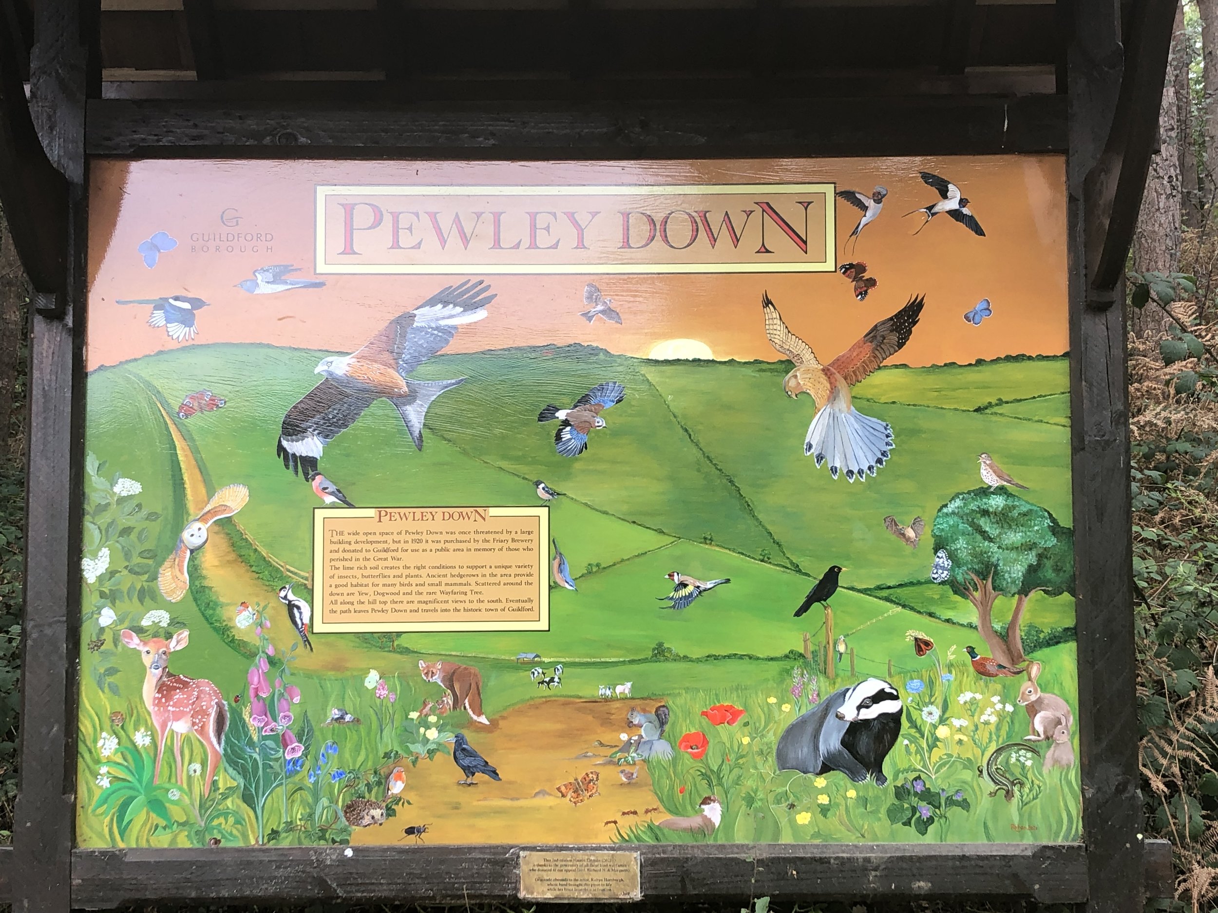
Links: Guildford, River Wey, Shalford Mill National Trust, Chantry Wood, Pewley Down, Semaphore House, Guildford Castle
This is a short circular walk starting and ending in the centre of Guildford, Surrey. I’d seen it a few times on maps and crossed it a couple of times but otherwise hadn’t heard much about it. I also couldn’t find anything about it on the internet. Please contact me or comment below if you know anything about the background to the trail. Despite not knowing much about its background we found this to be a very pleasant short walk with several points of interest along the way.
We parked at Millbrook Car Park in the centre of Guildford and headed south along the east hand-side of the River Wey. Shortly after the Weyside pub you can cross over the Wey to join the Wey-South Path continuing south on the west side of the river. The towpath was blocked off for repairs when we were there but you can also follow the river on the east side of the path and reconnect ~1km later at the next bridge.
If you’re on the west side, you’ll reach a wooden bridge near Ferry Lane. Cross this bridge and return to the east side of the river. You’ll now be on the North Downs Way heading east. When you reach Shalford Park leave the North Downs Way and follow the path on the western edge of the park, continuing south over the Tillingbourne. At a path junction follow the Scholar’s Trail signs to take a left turn to meet the A281 near the Seahorse pub. Take a right onto the A281 then, cross over and take a left onto the lane to Shalford Mill. The Mill is a small National Trust property that’s worth a visit, especially if you’re a member.
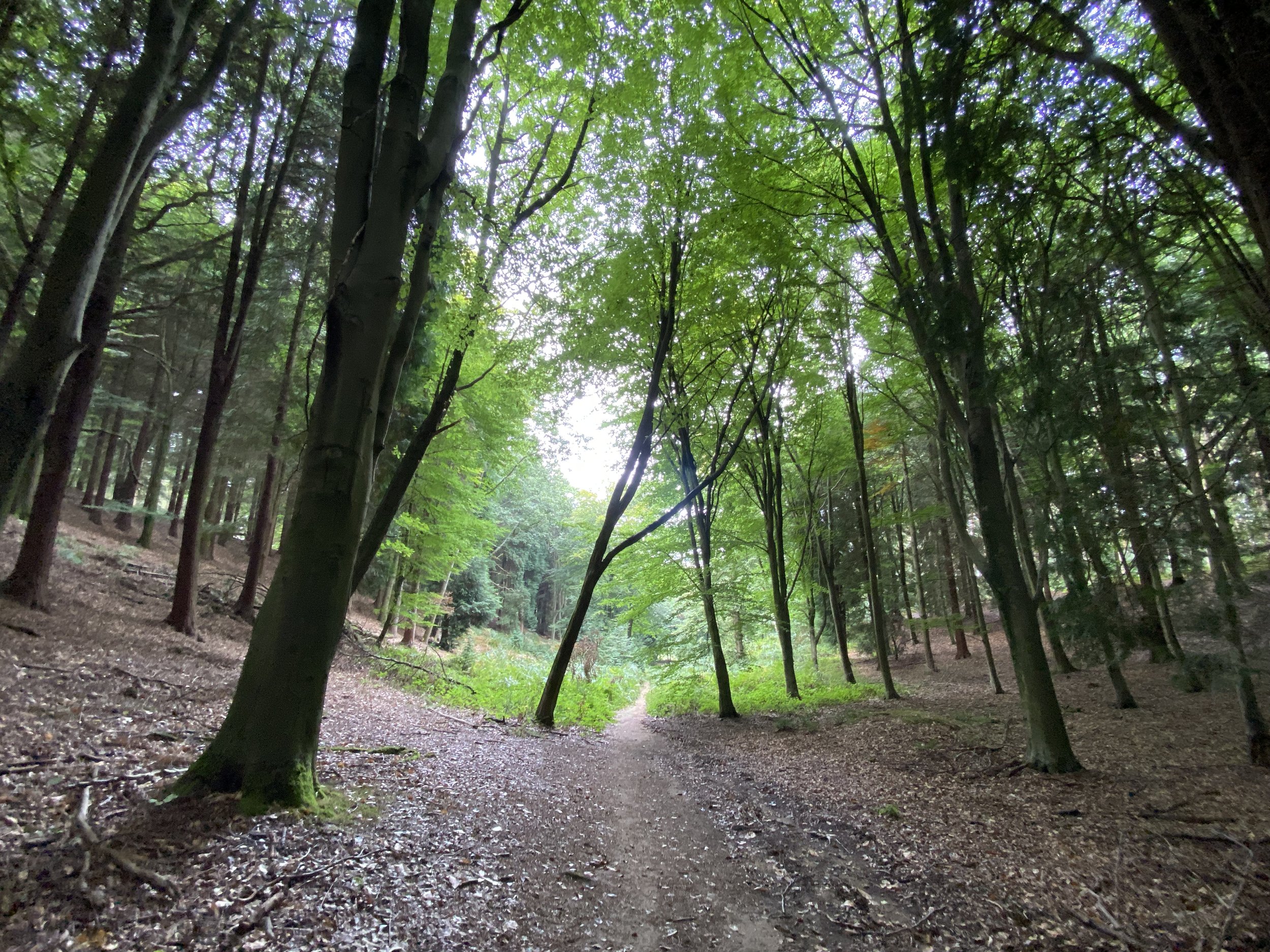
From Shalford Mill continue along the path in a north-easterly direction. Join Shepherds Way in a northerly direction for ~300m then take a right onto a narrow path when the road curves to the left. When you reach the next road take a right into Chantry Wood. The Trail snakes through Chantry Wood for 2.5km. We didn’t see a lot of Scholar’s Trail signs here, especially on some important junctions, so a map or GPX route is essential here.
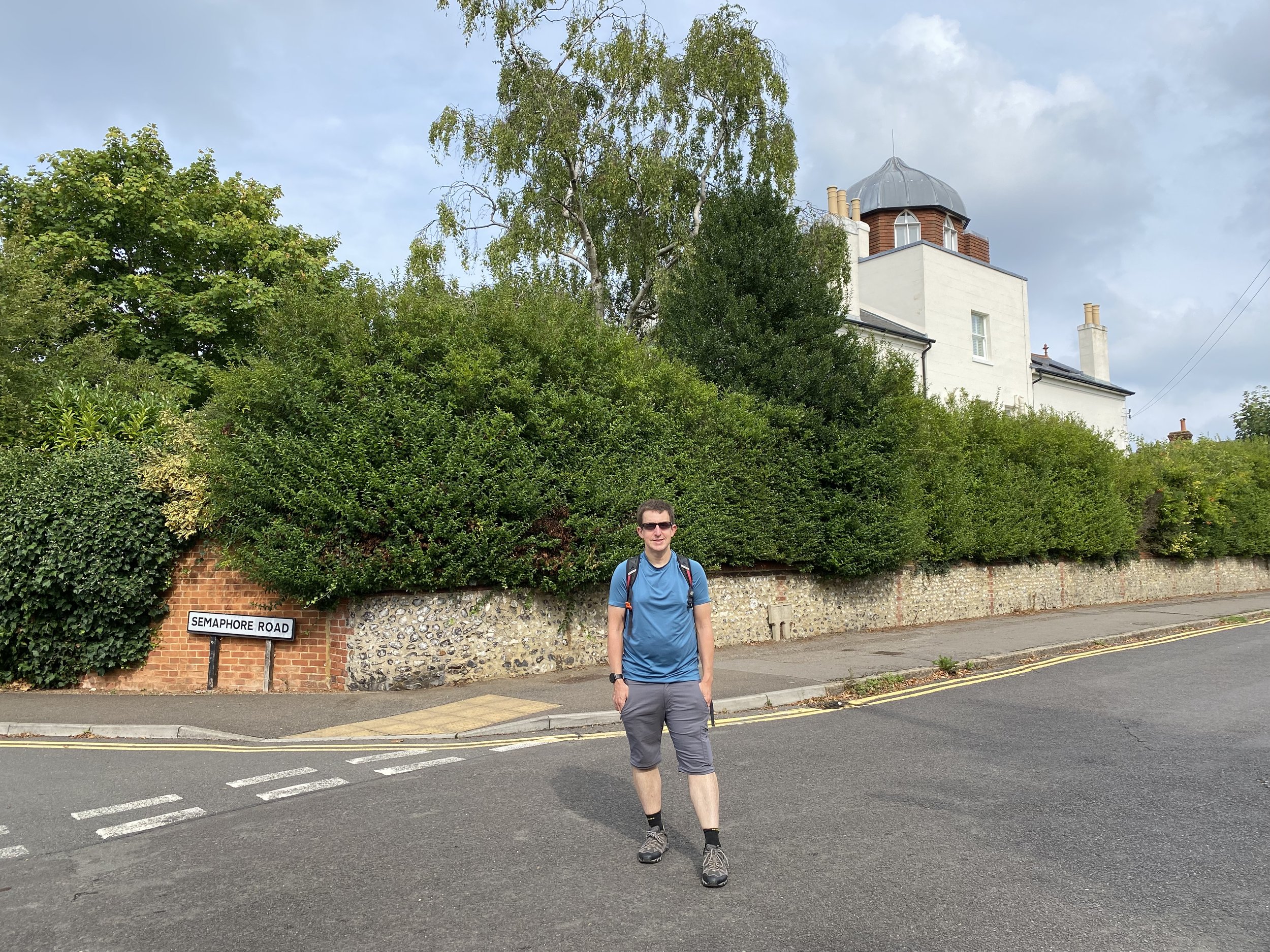
At 5.5 km into the walk the Trail takes a sharp left turn out of the wood and though fields in a north-westerly direction. This is a long, straight section that takes you across Pewley Down back into Guildford. Stop on the way for some great views to the south from the top of Pewley Down. Head to the north-west corner of Pewley Down to Pewley Hill (road). Follow this for 750m descending down to the March Hare pub. Along Pewley Hill you’ll pass Semaphore House, an example of a series of semaphore towers that linked The Admiralty in London with Portsmouth Dockyard. This one, now a private residence, is the next along the line from the Chatley Heath Tower seen on the Discover Downside walk.
At the March Hare pub take a left onto South Hill and continue south-east for 220m, taking a path on the right into woodland. Follow the path down the hill to Quarry Street and the Millbrook Car Park. An alternative finish that we took is to take a left after the March Hare and walk around the grounds of Guildford Castle. This is well worth a visit if you’ve not been there before. The Castle Grounds exists onto Castle Hill, then Quarry Street and then the car park.
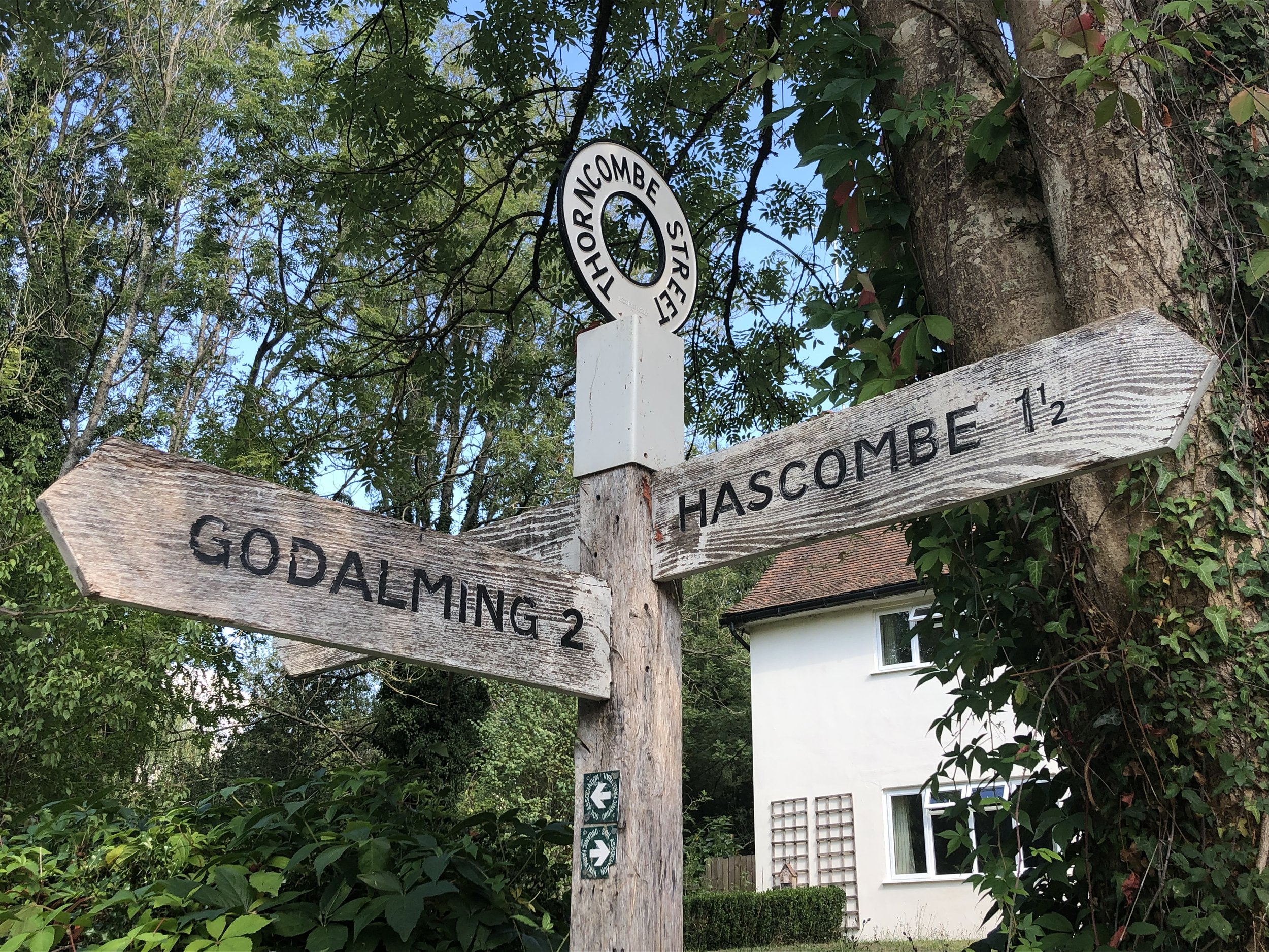
View to the east near Thorncombe Street
Start & Finish: Free parking opposite the White Horse Pub, The Street, Hascombe, Godalming GU8 4JA
Distance: 10 km (6.2 miles)
Elevation change: +/- 179m
Greensand Way section covered: Hascombe to Gate Street Farm: 3.86km
GPX File: get via Buy Me a Coffee
Other routes touched (walk): None
Other routes touched (cycle): None
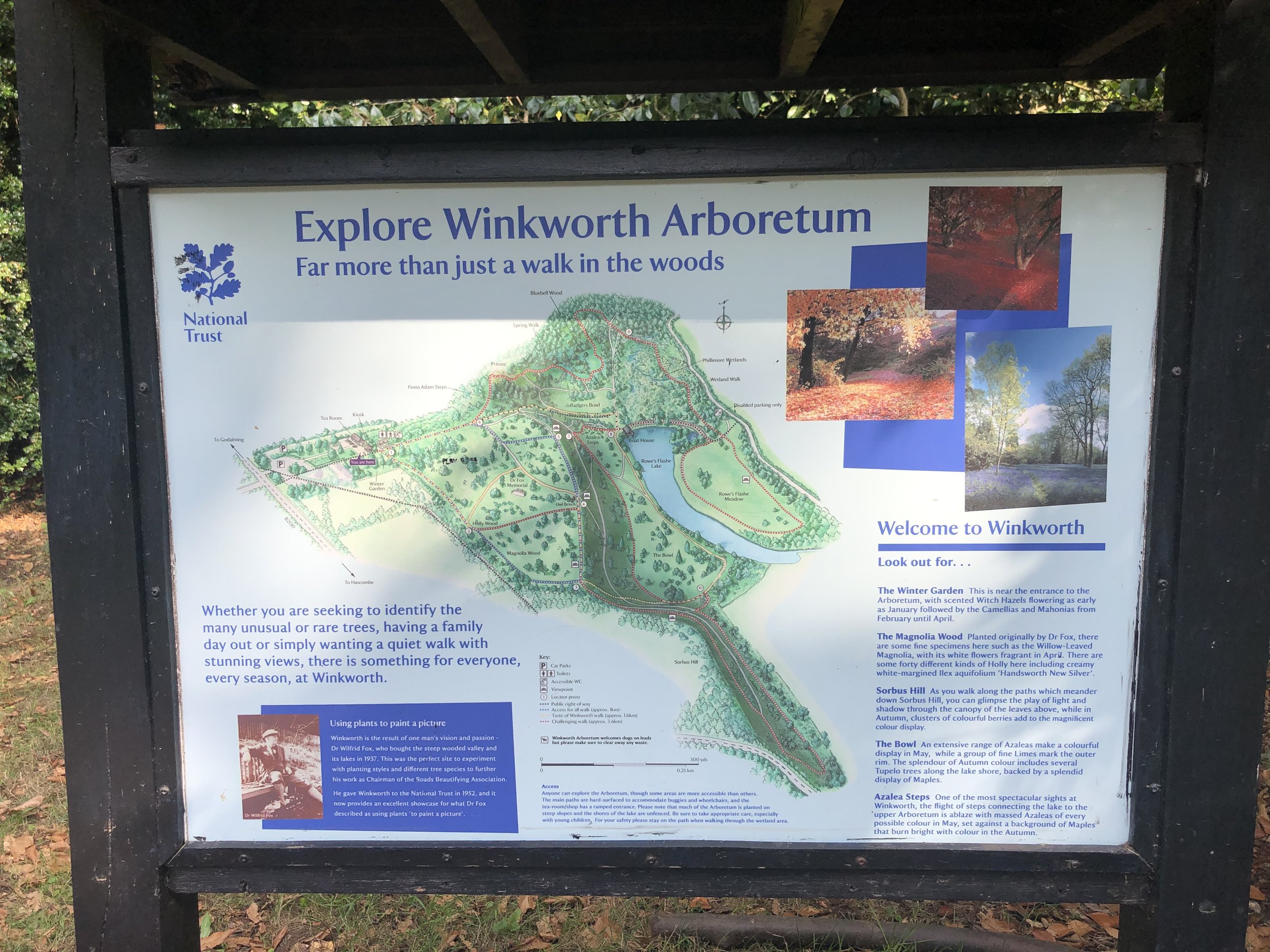
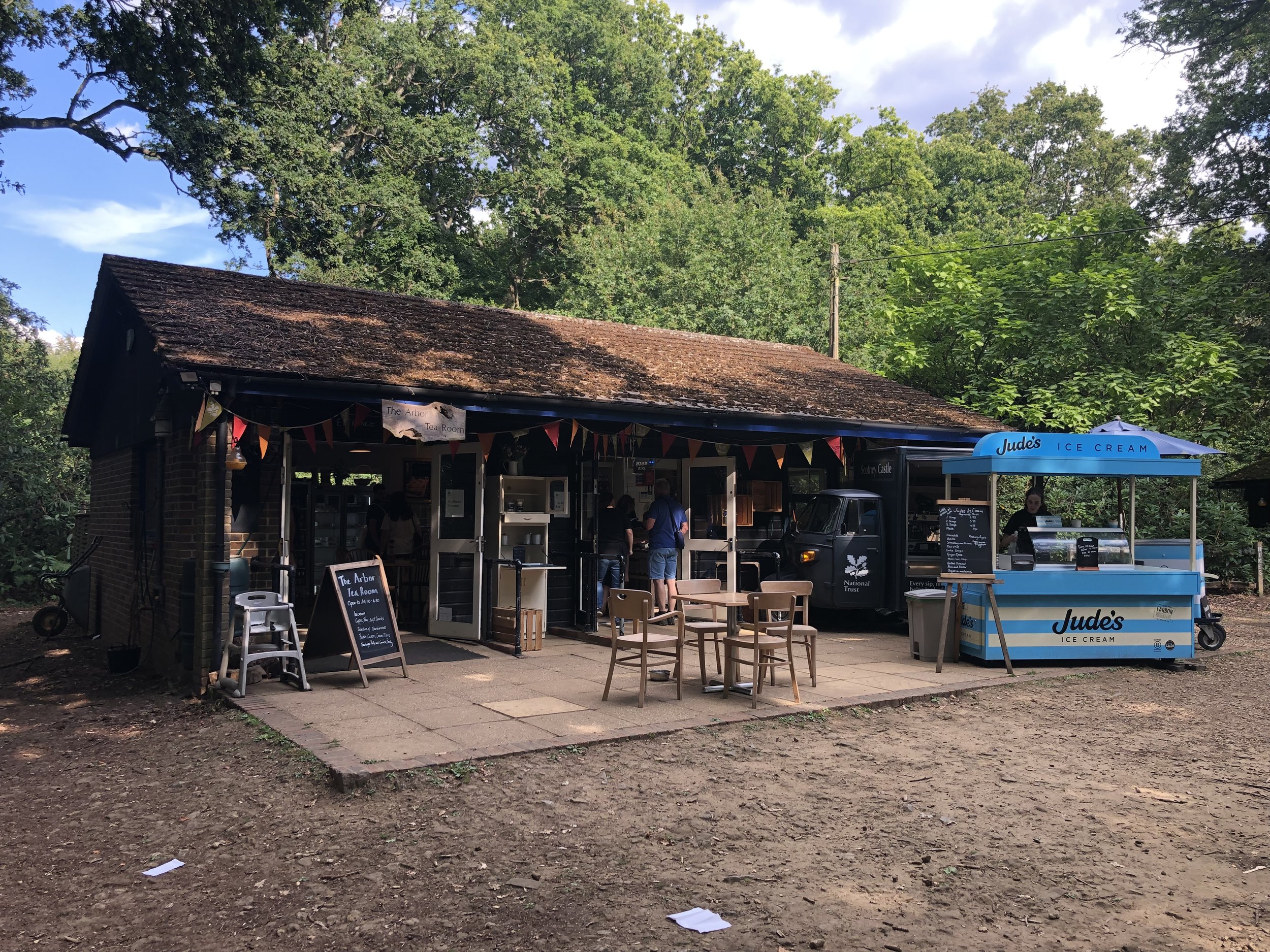
Pubs / Cafes on route: White Horse Pub Hascombe, Tea Room at Winkworth Arboretum
Map: Guildford & Farnham Map | Godalming & Farnborough | Ordnance Survey | OS Explorer Map 145
Links: Hascombe, Wintershall Partnership, Gate Street Farm, National Trust Winkworth Arboretum
This is the sixth of a series of short circular walks featuring the Greensand Way. The full trail is a long distance path stretching from Haslemere in Surrey to Ham Street in Kent. Our walks take in short sections of the Greensand Way and loop back to the start on other paths. The Greensand Way is well sign posted however you’ll need a map or GPX route to keep on track for the return sections of the loops. The guidance below will help but don’t use it as a fully accurate turn-by-turn guide.
For this section we parked at a free car park opposite the White Horse pub in Hascombe. This is less than 200m from where section 5 left the Greensand Way and starts you off right on the trail. From the parking spot cross the road and take a left in front of the pub onto Church Road. Follow the Greensand Way for just under 4km until a path junction in the woods north of Gate Street Farm.
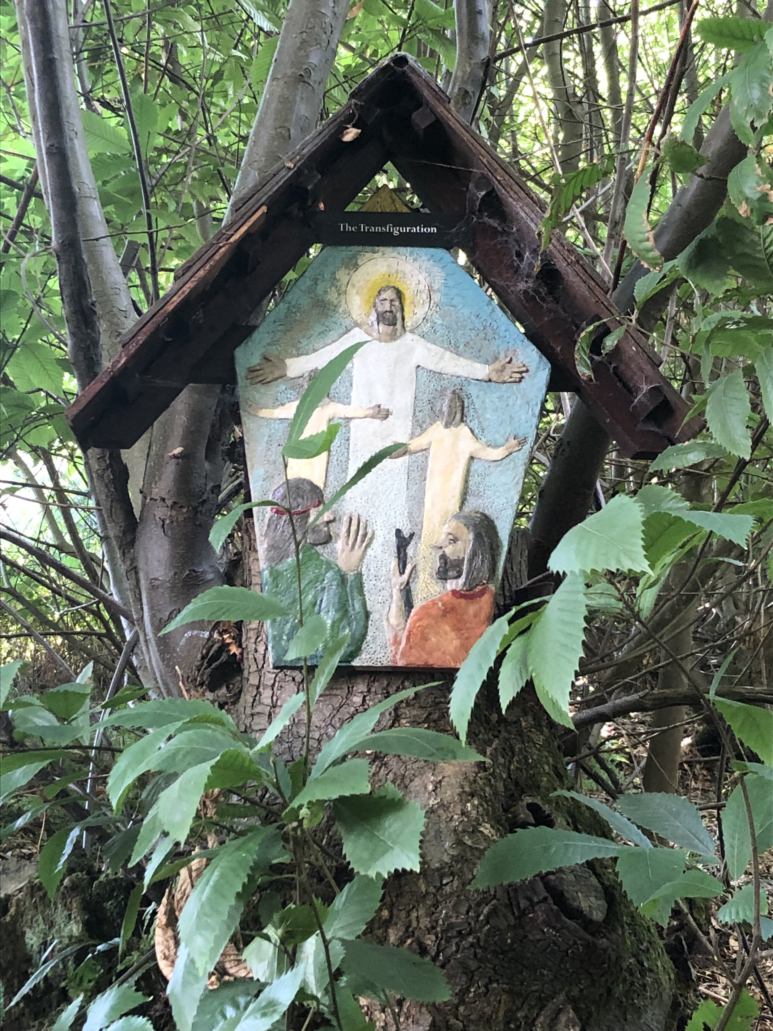
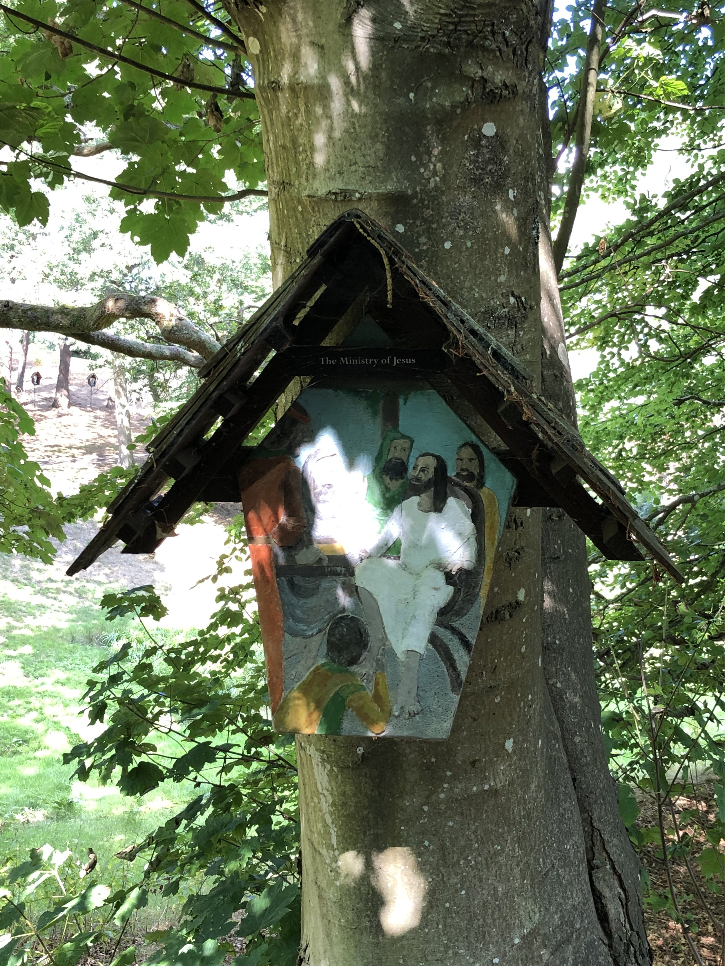
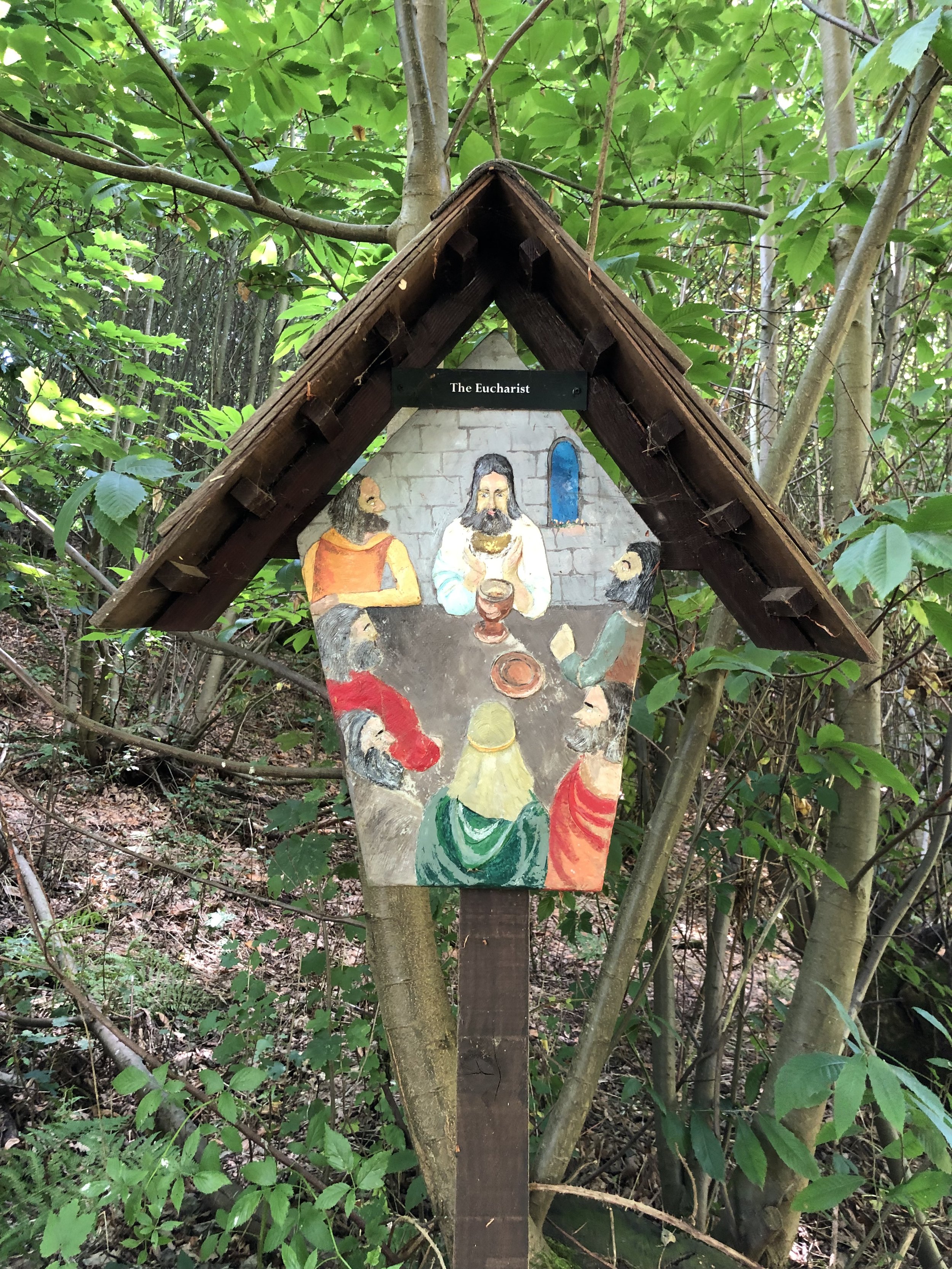
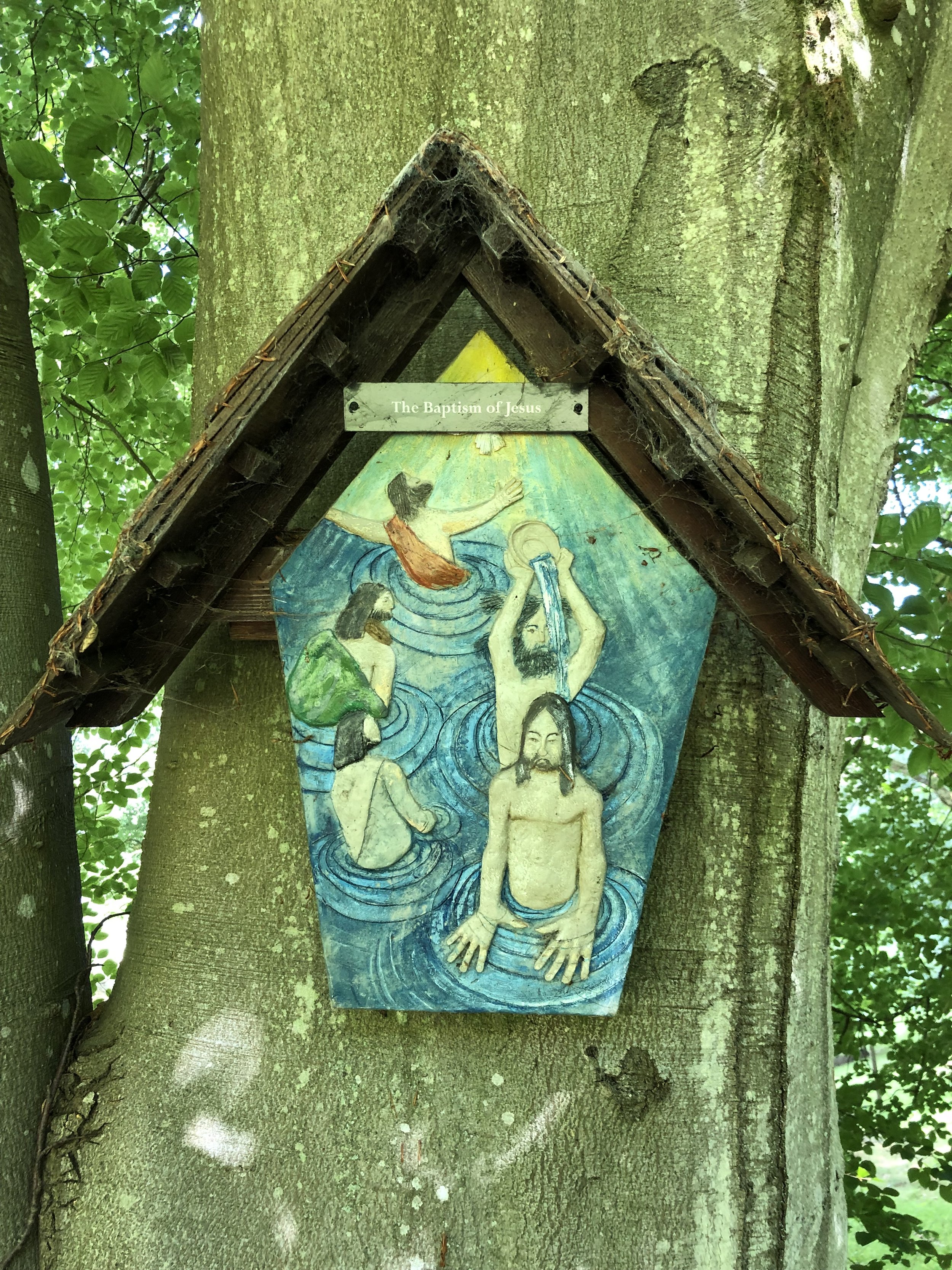
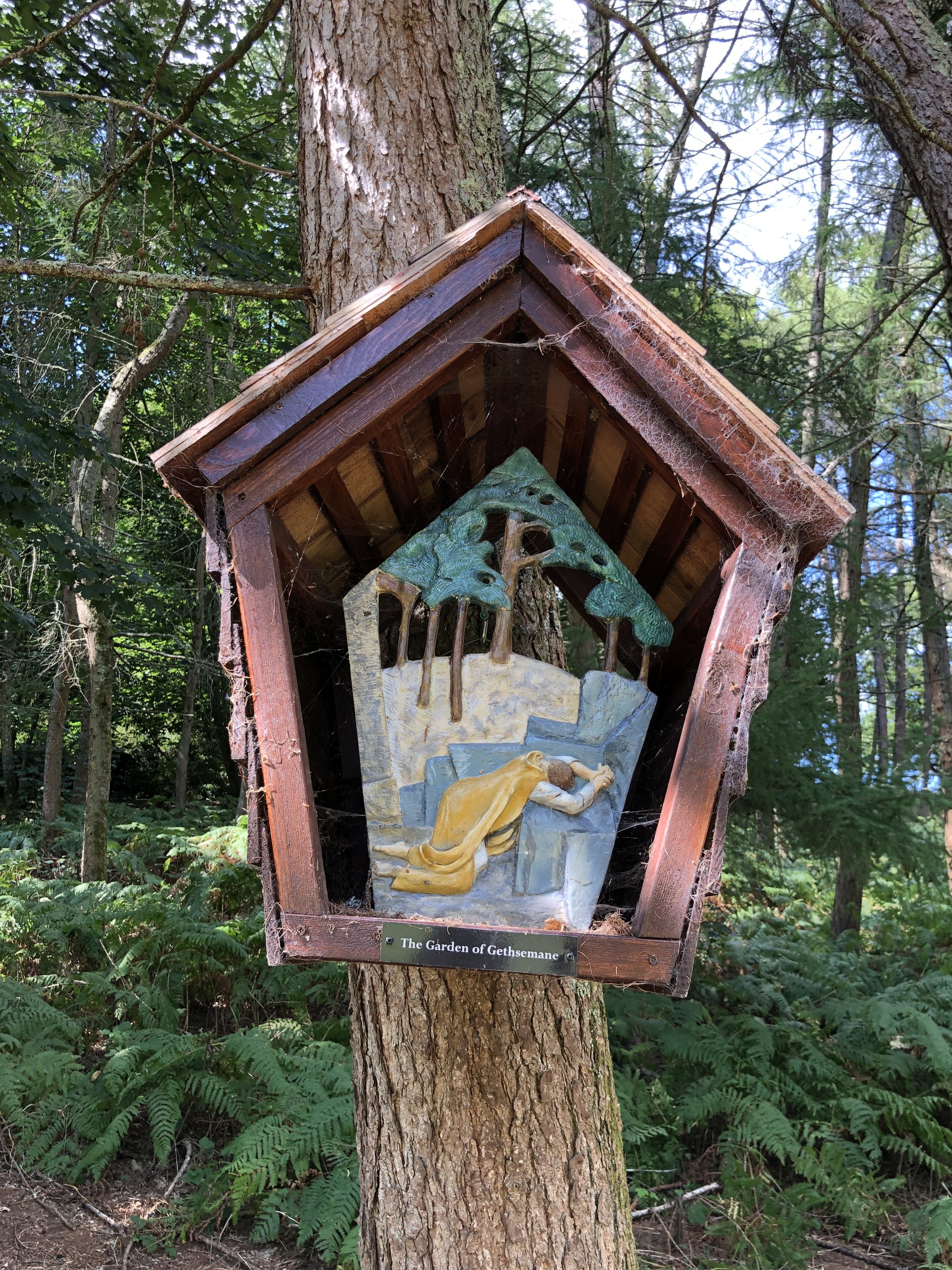
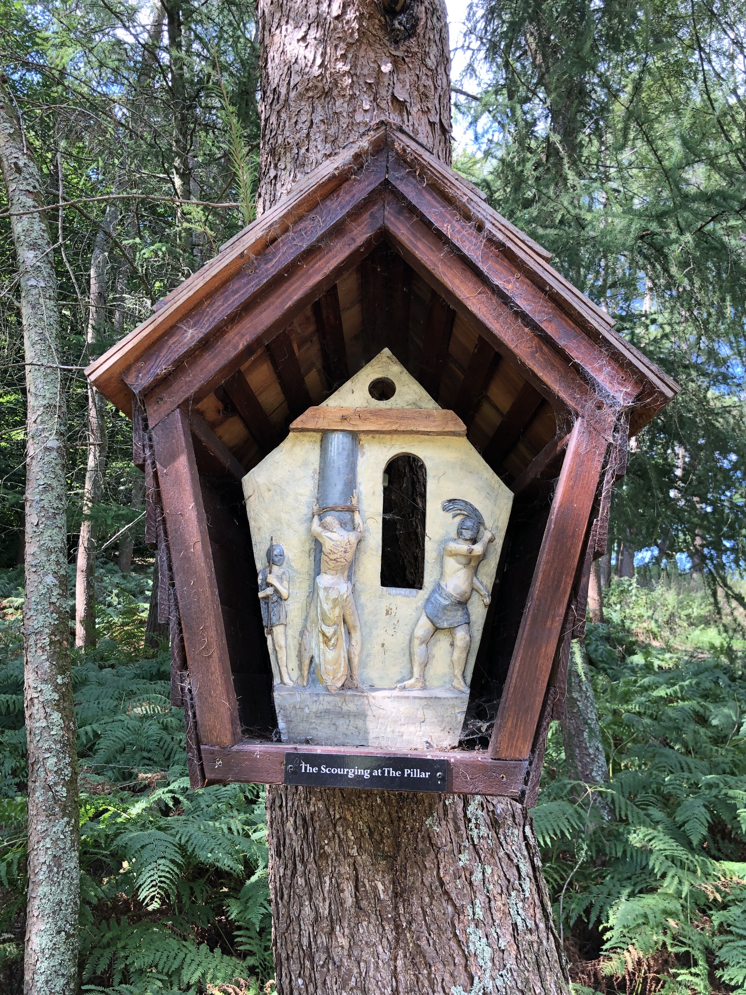
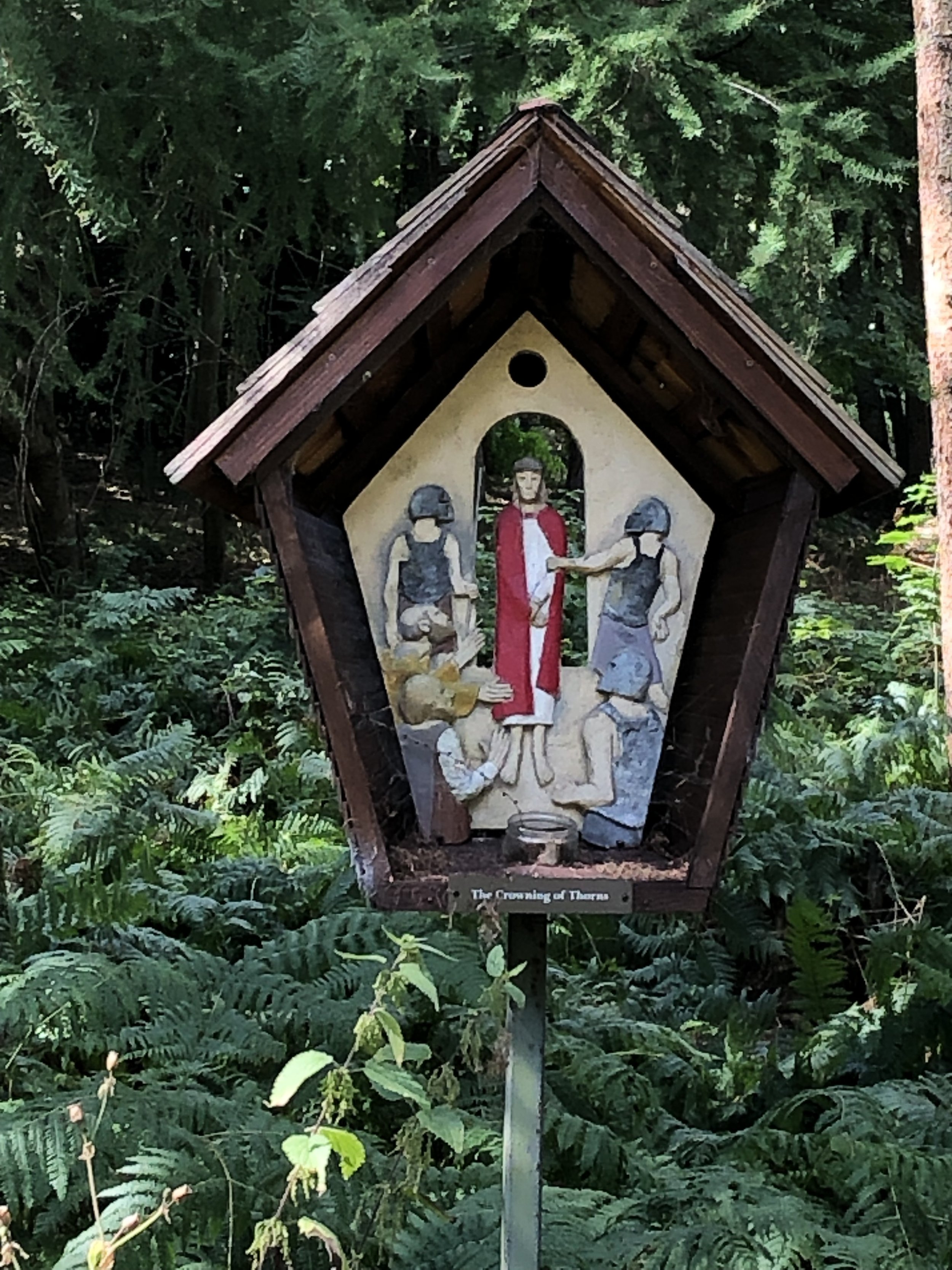
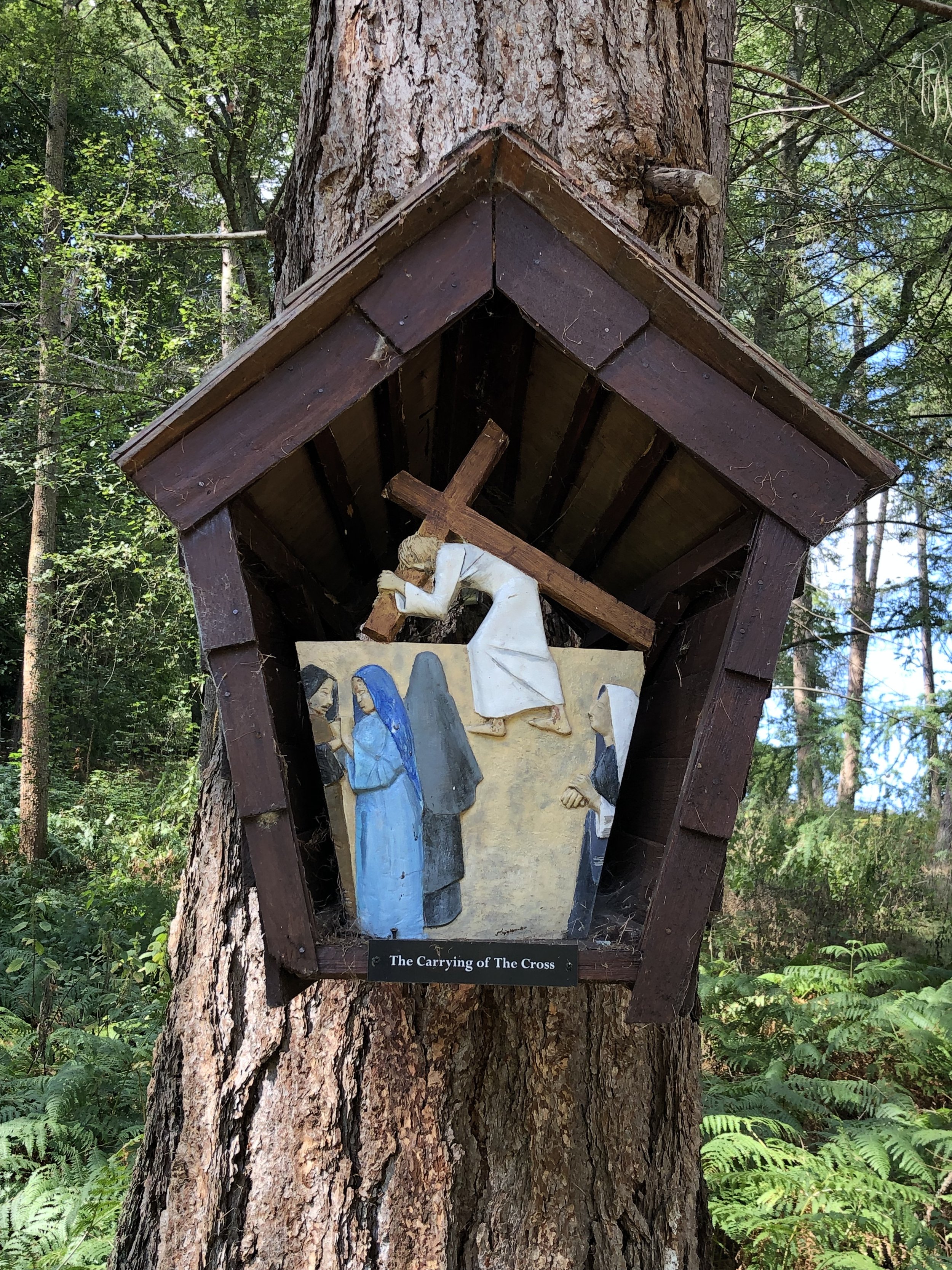
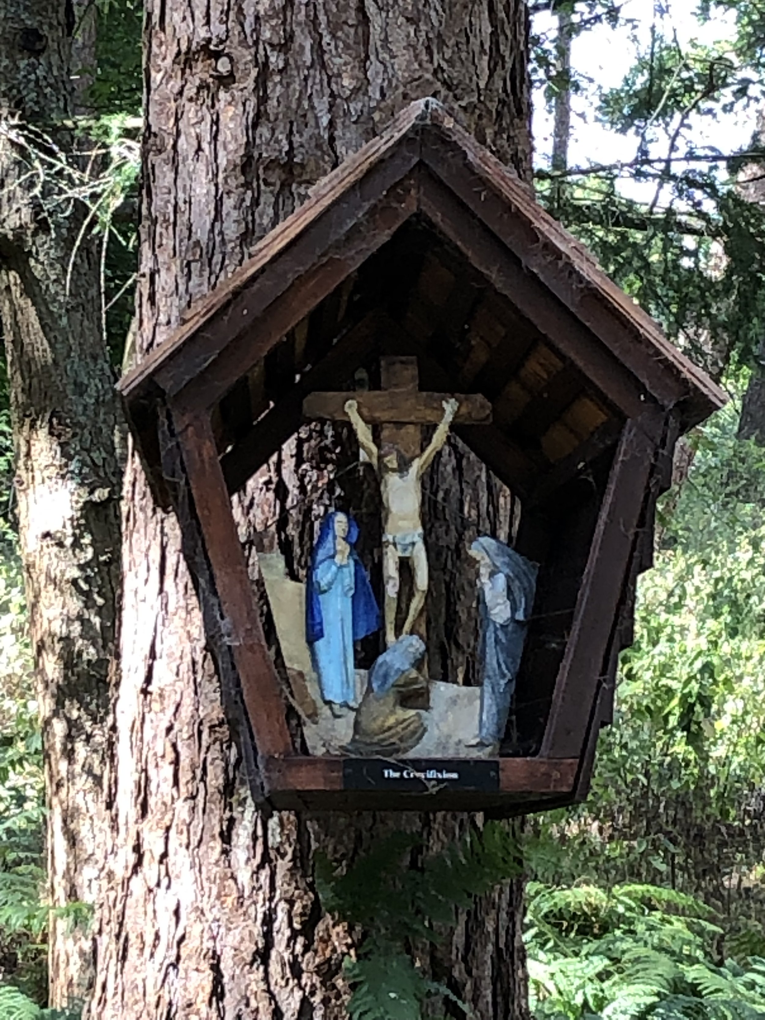
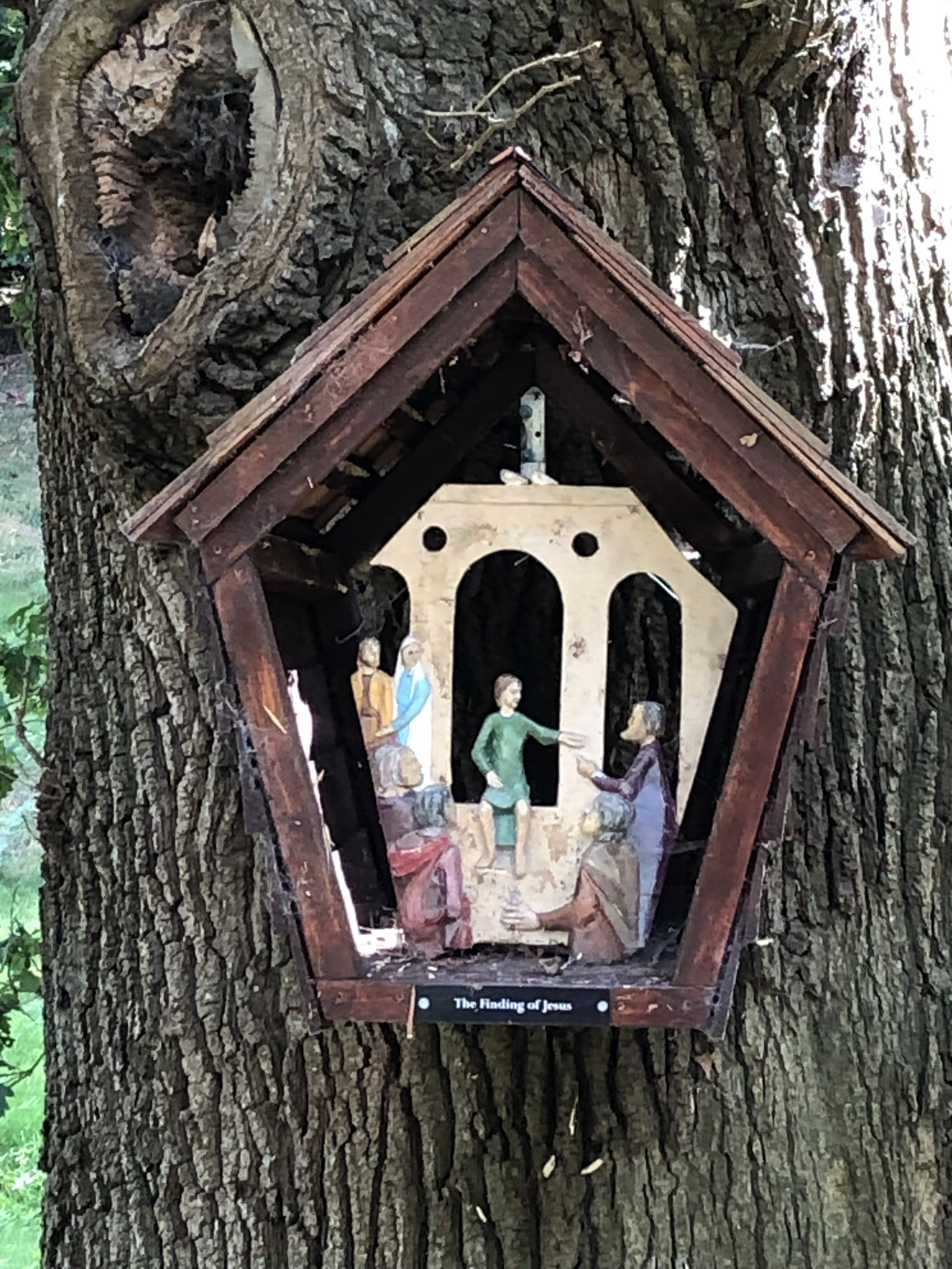
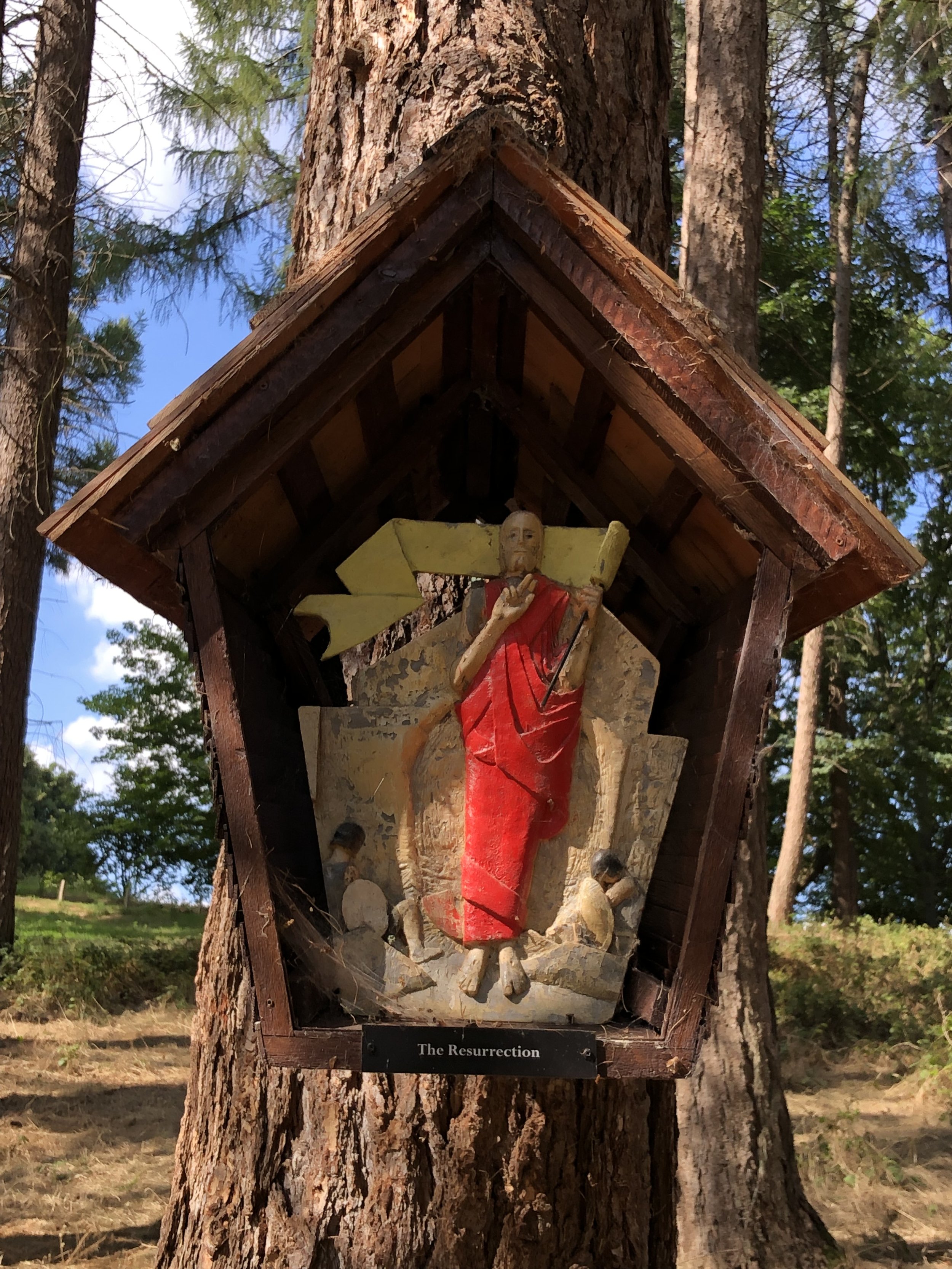
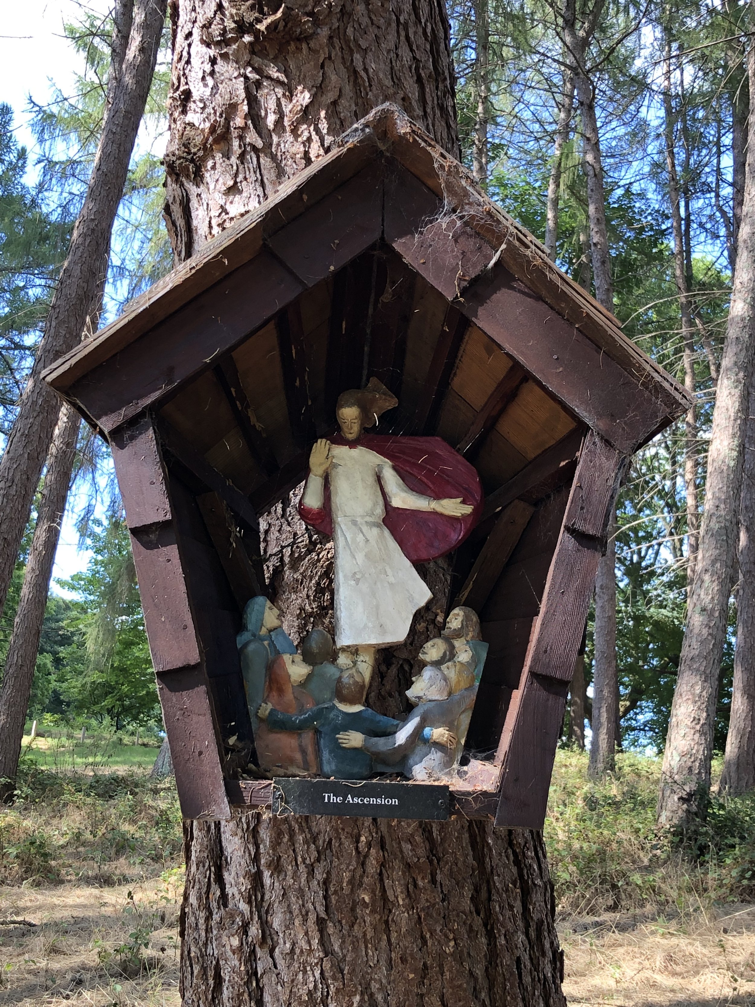
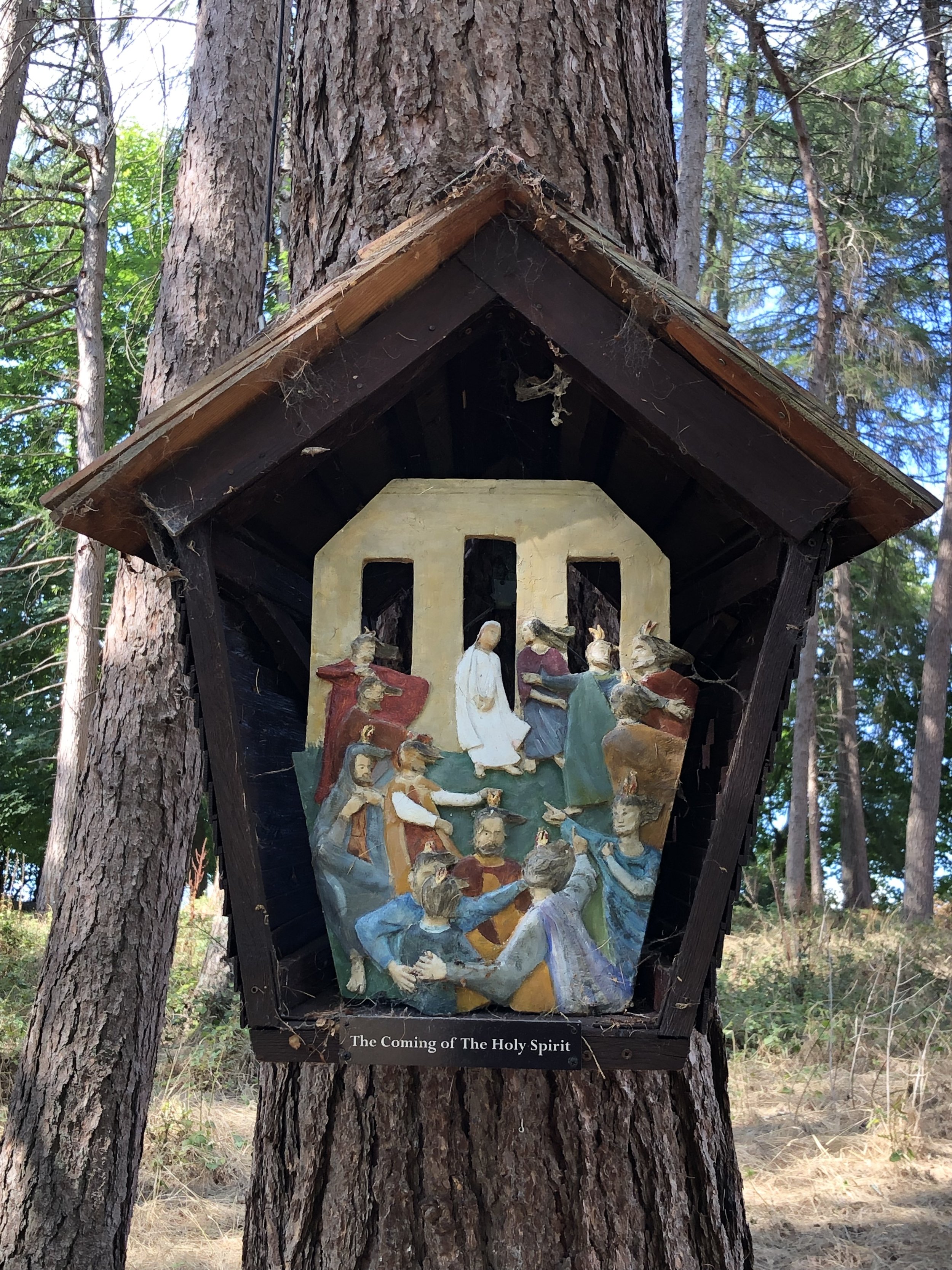
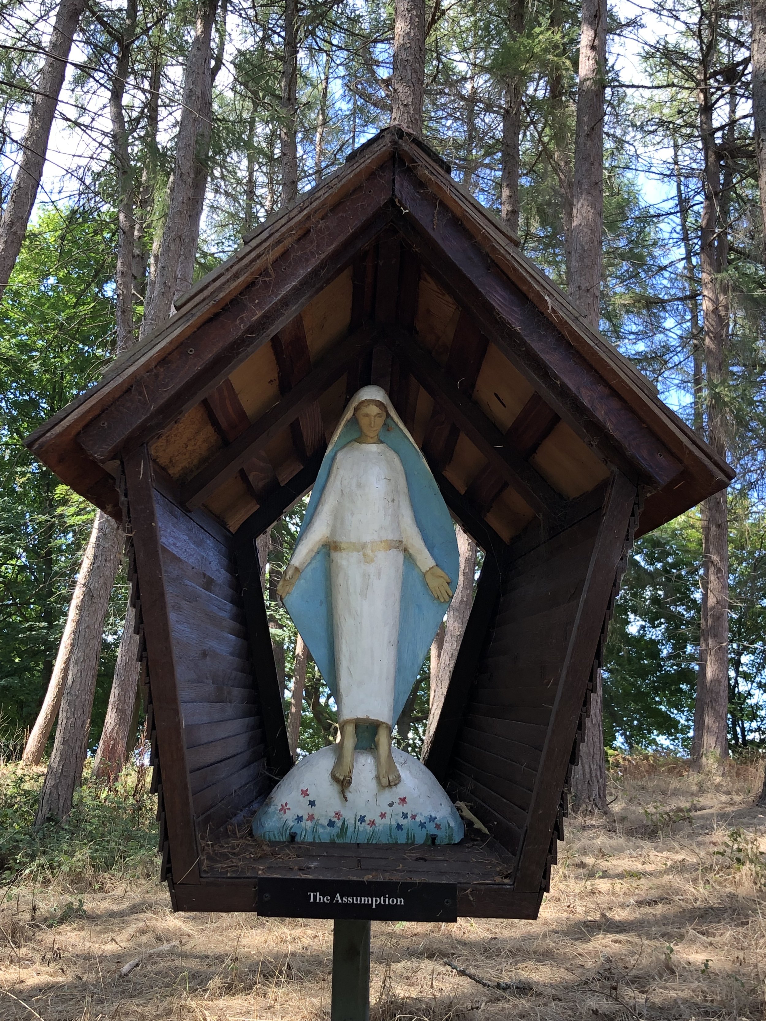
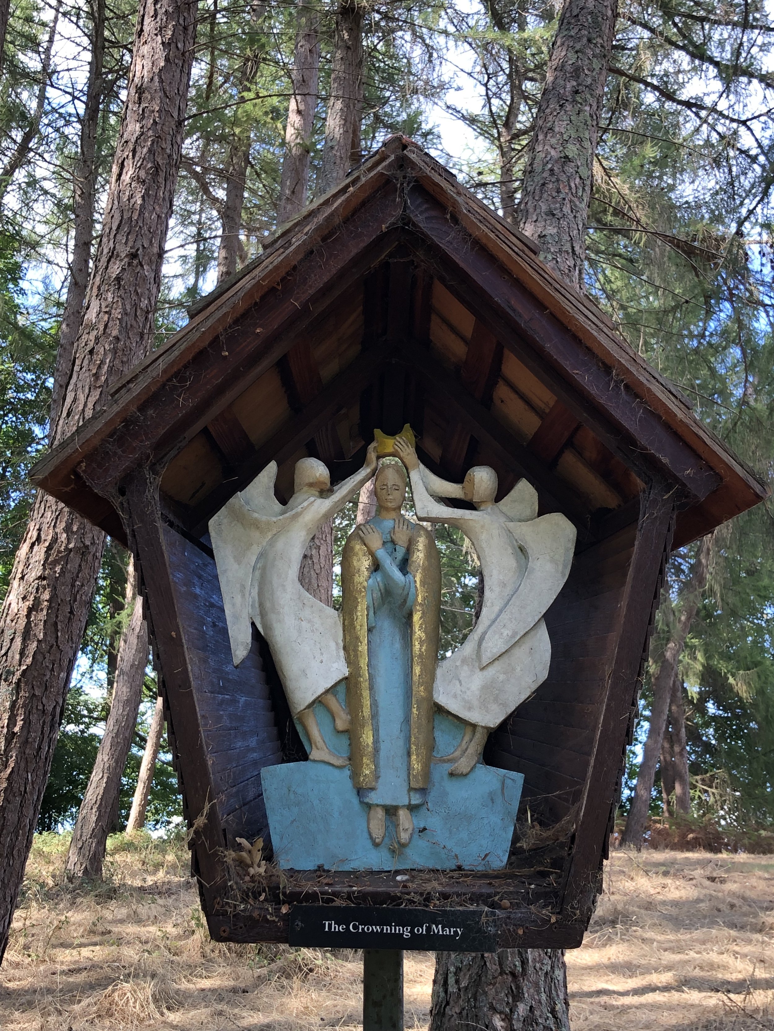
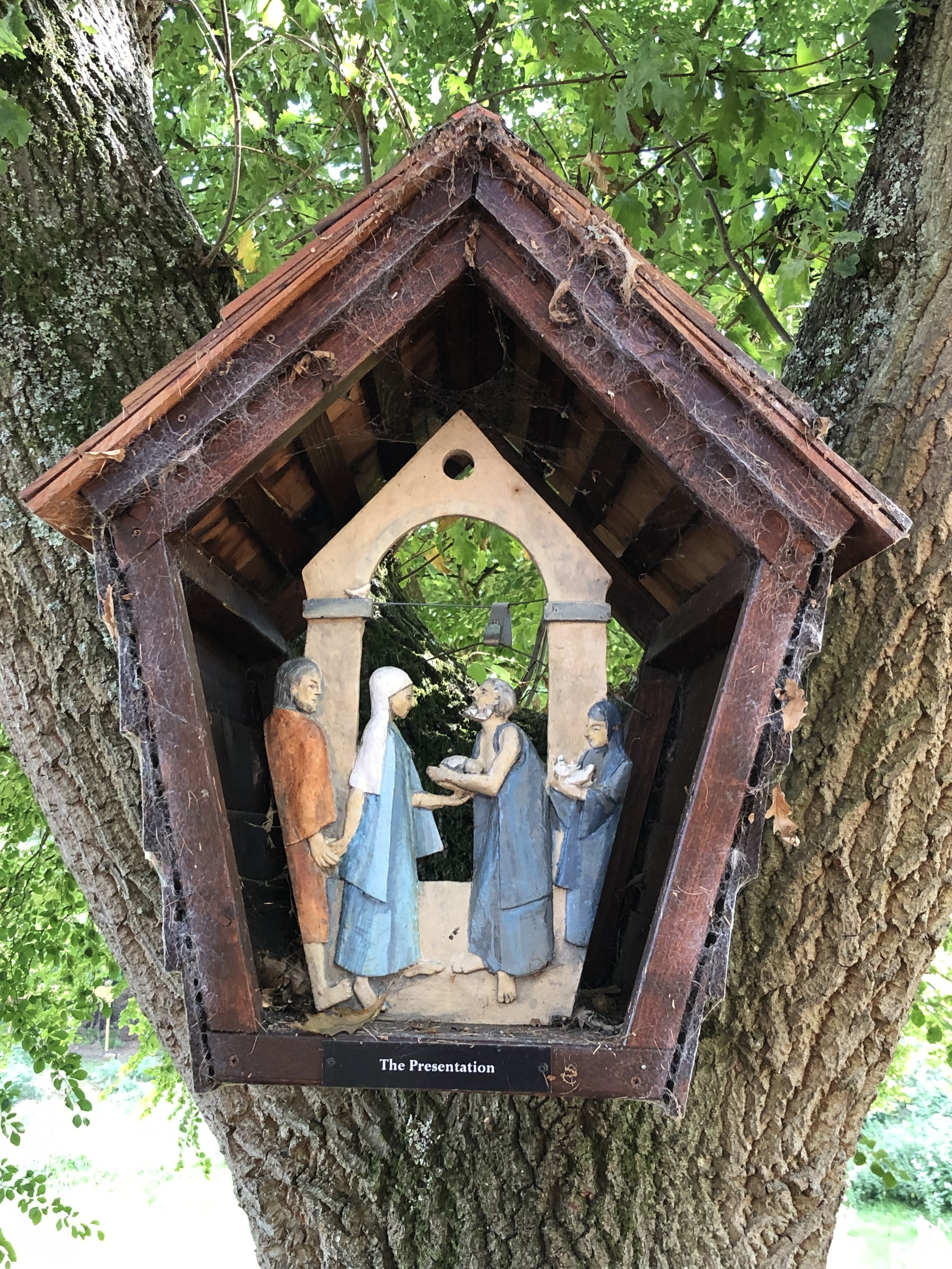
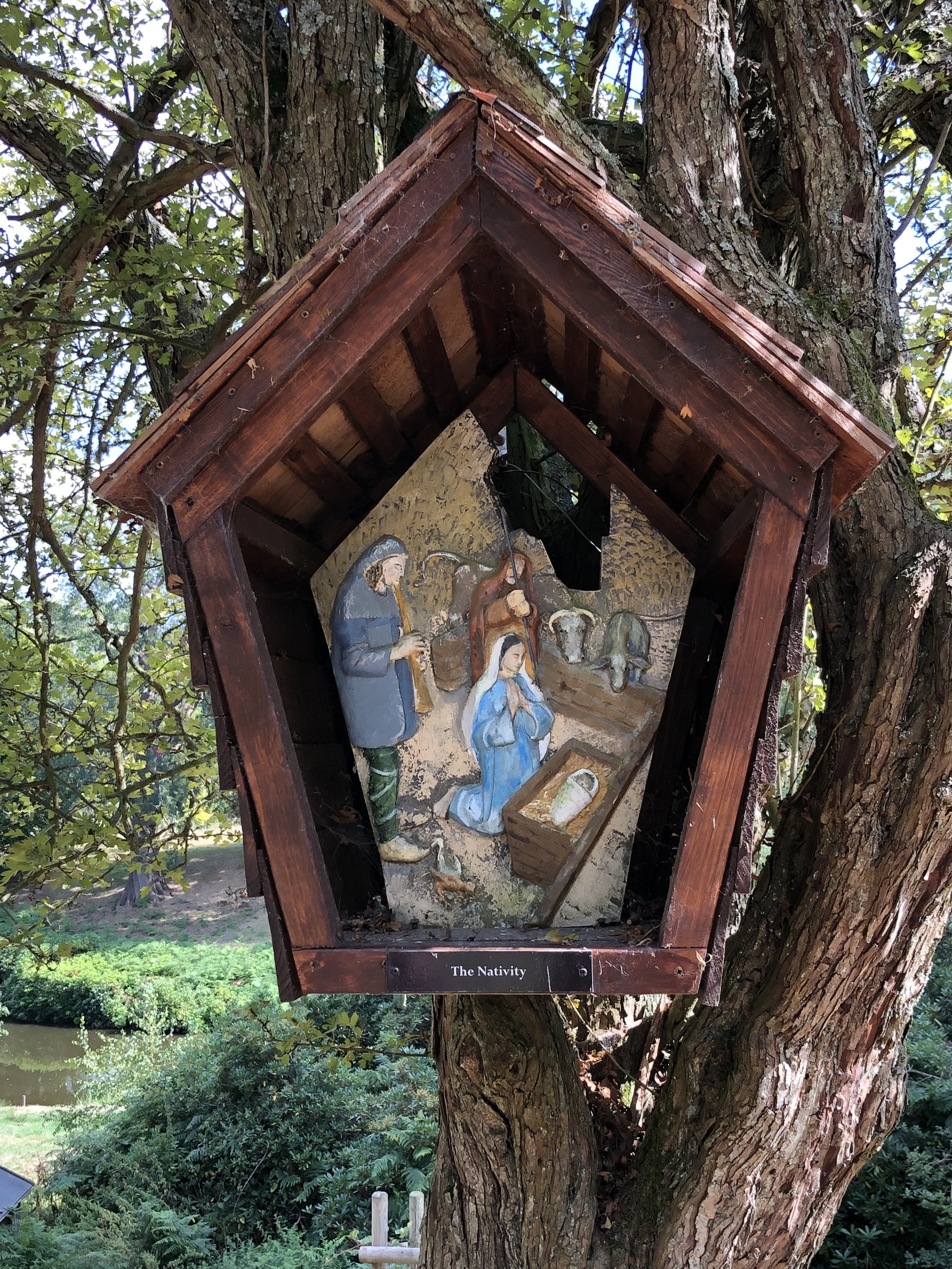
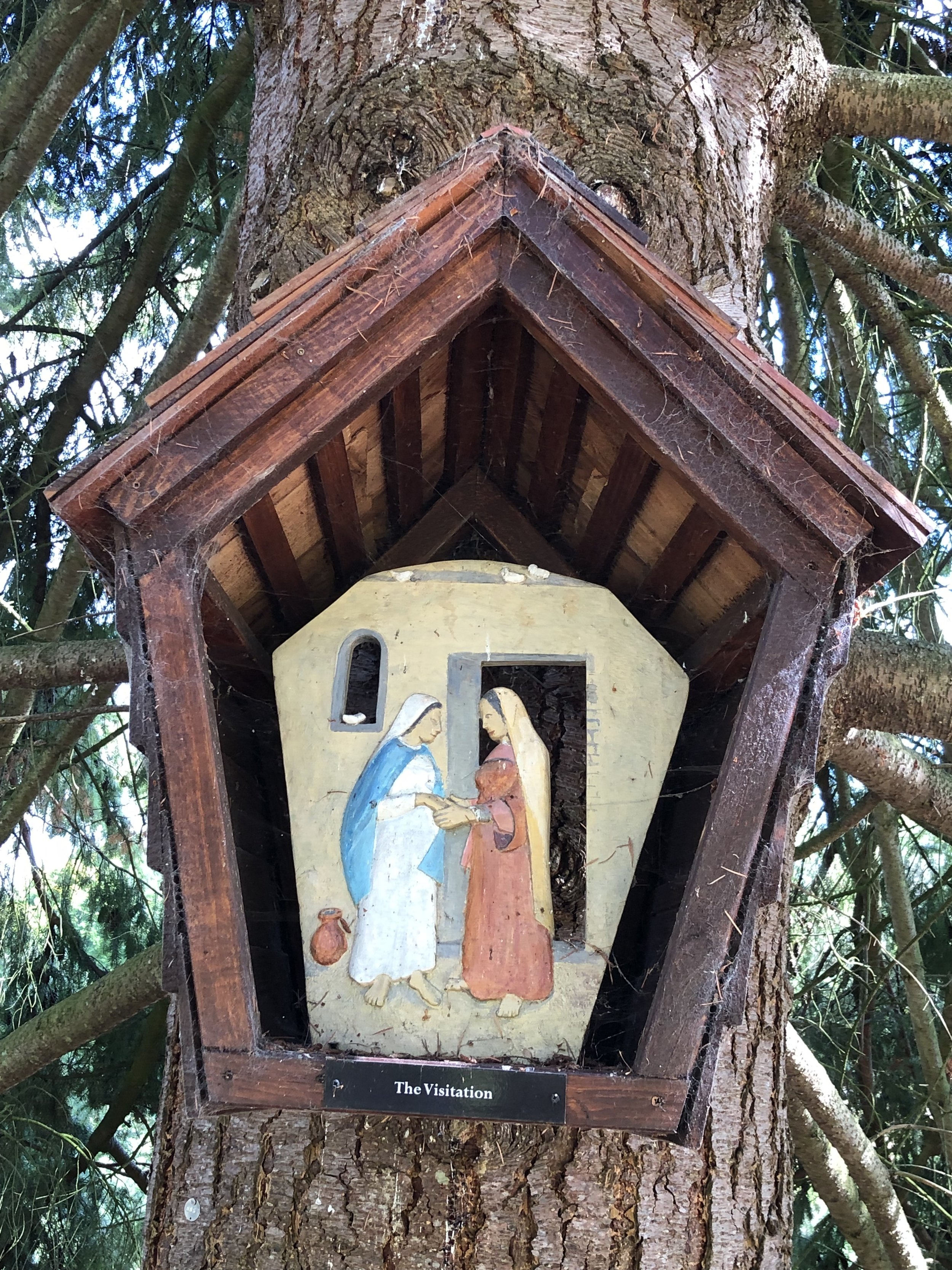
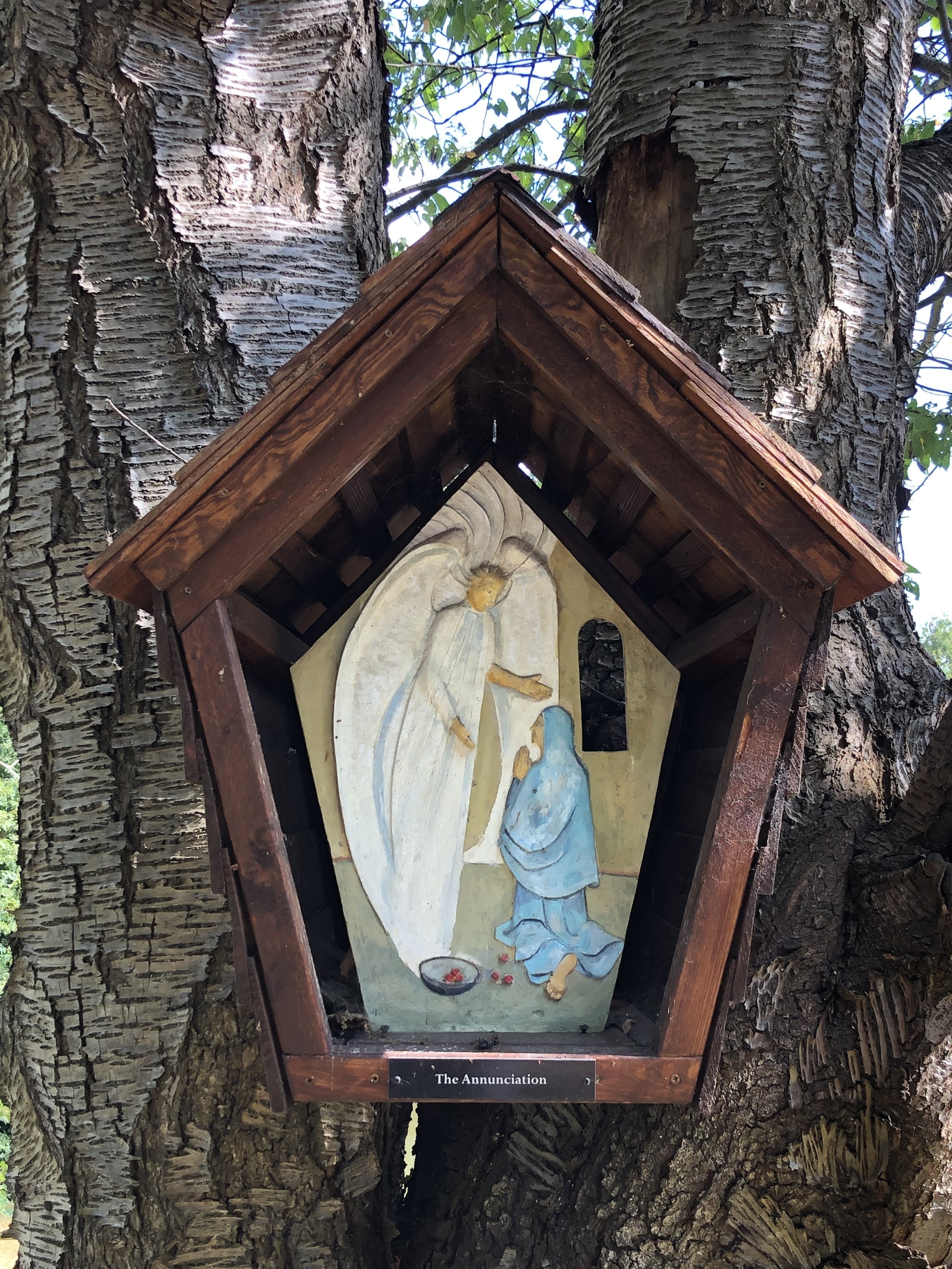
At 2.6km into the walk you’ll enter the grounds of the Wintershall Estate and the Rosary Way. This is a short walk lined with carvings depicting the life of Jesus. Walking in this west-east direction, you’ll encounter the end of the story first with the carving of the Transfiguration. To see the full story tracing back to the first carving of the Annunciation you’ll need to take a small diversion from the Greensand Way towards the main building on the estate. Scroll down to see our photos of the carvings.
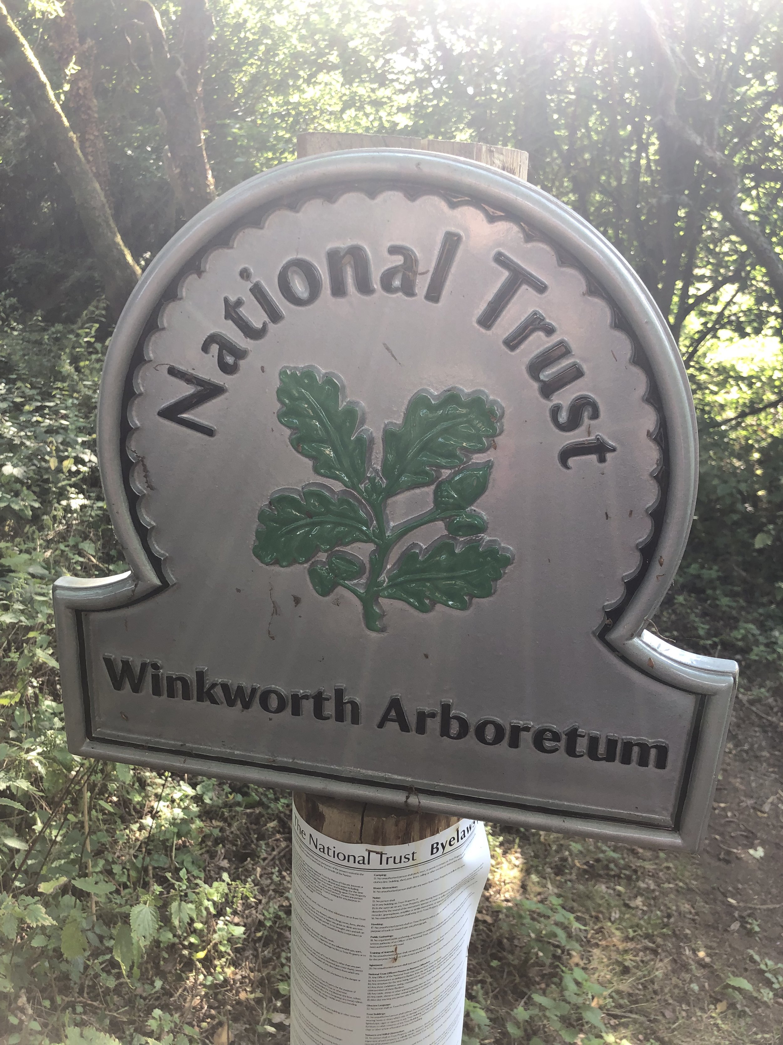
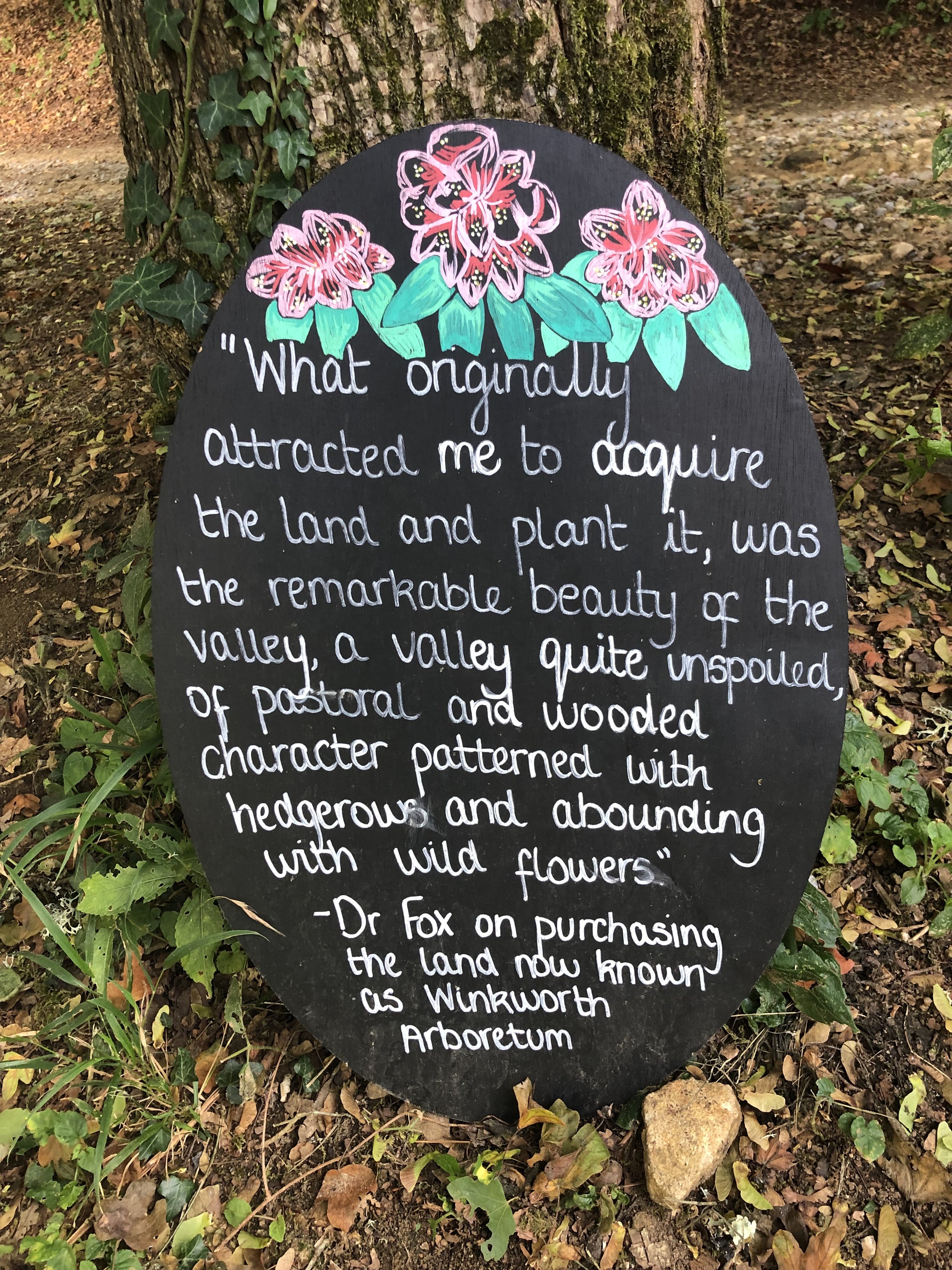
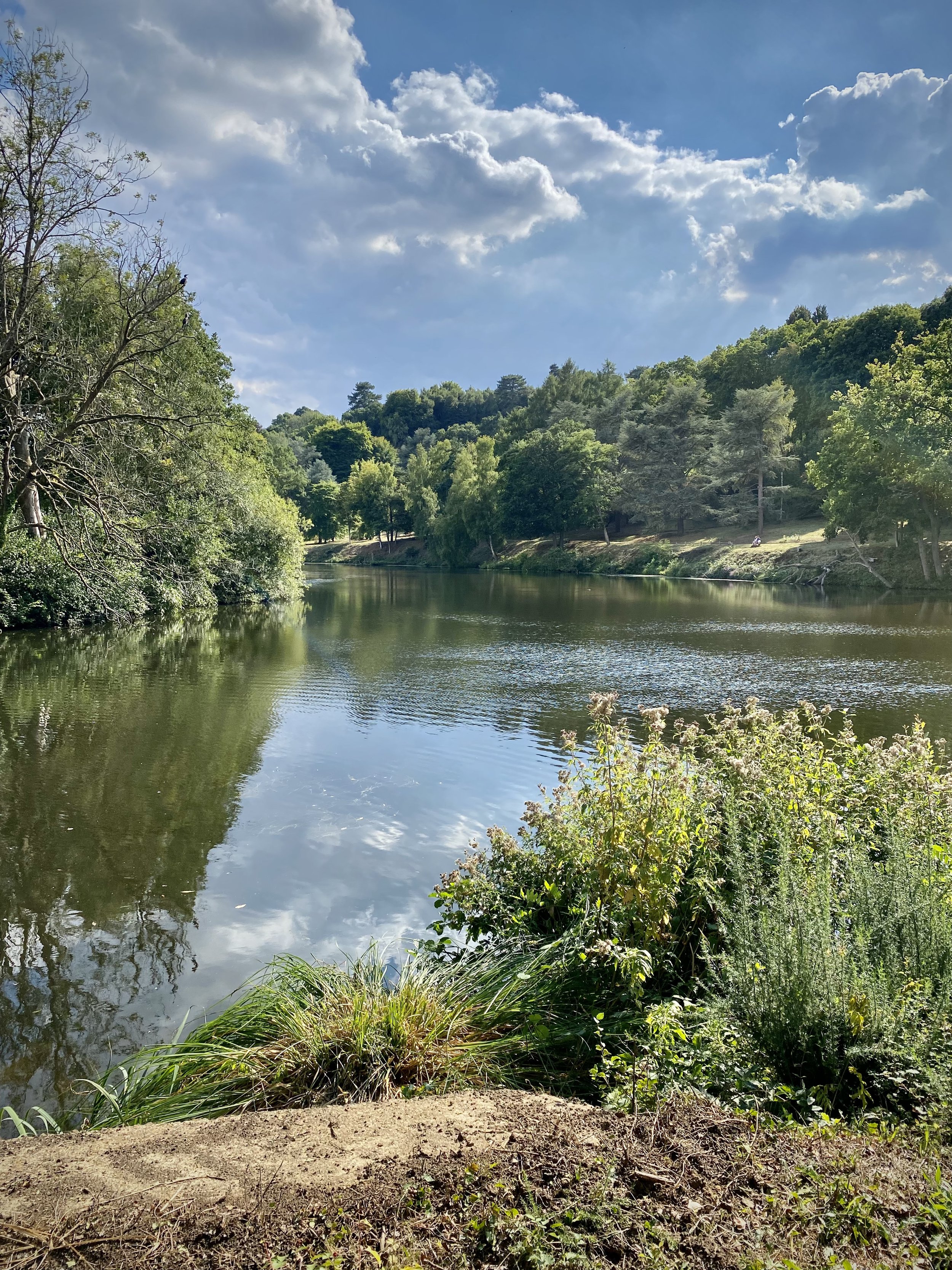
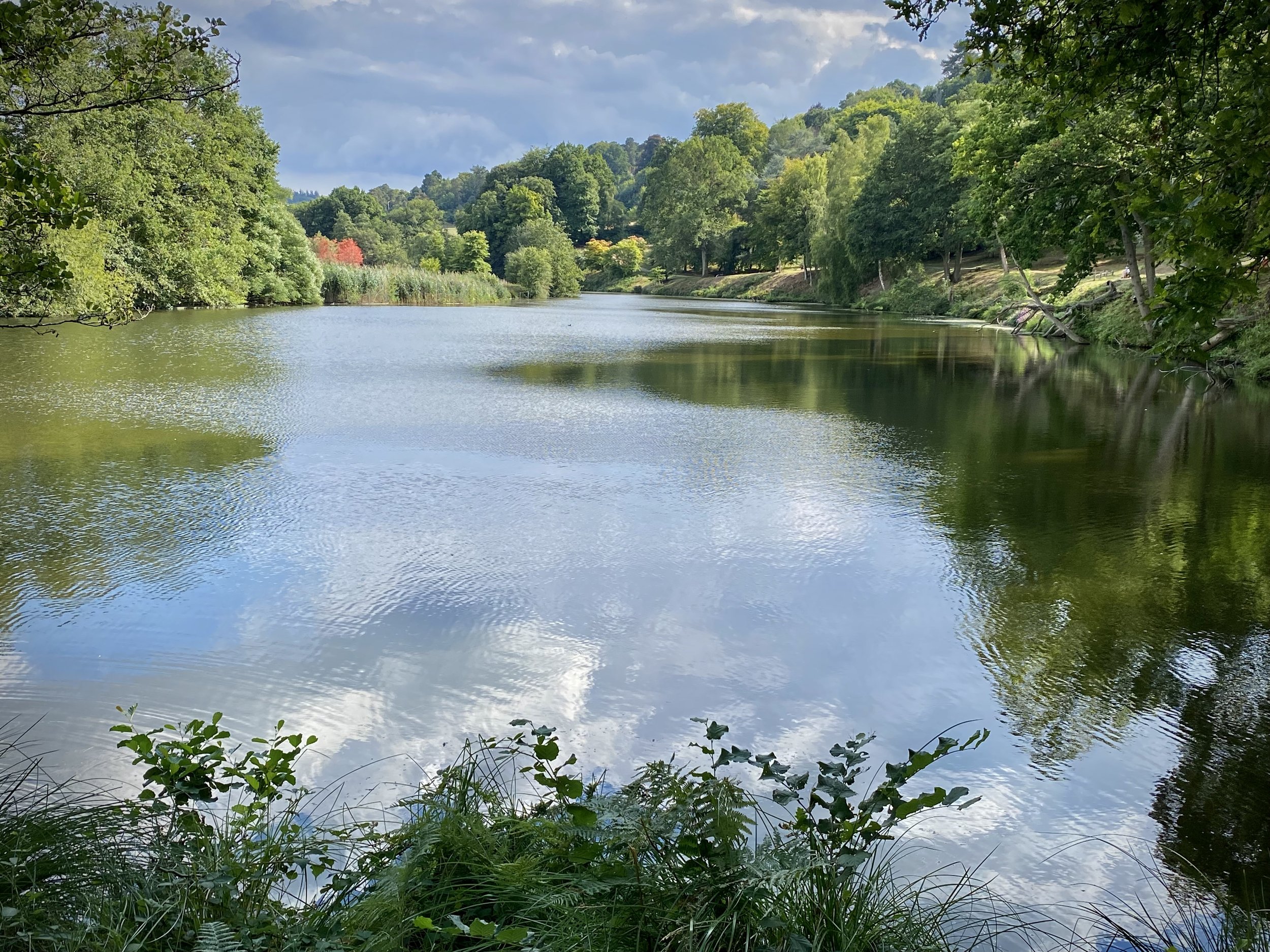
From the path junction in the woods north of Gate Street Farm take a sharp left onto a westerly path ascending through a field. Continue for just over 1km to Thorncombe Street. Take a left, then first right onto Alldens Hill then the first footpath on the left. Follow this path in a southerly direction until you reach Thorncombe Street again. Continue along Thorncombe Street for ~50m until you reach a path on the right to enter Winkworth Arboretum. This is shortly after the Disabled Car Park entrance.
Entrance to Winkworth Arboretum is free for National Trust Members and charged for non-members. There’s no gate or ticket office on the Thorncombe Street entrance so you’ll need to pay or show your membership pass at the main entrance. From the Thorncombe Street entrance, follow the path at the north end of the lake and up the hill to the main entrance and Tea Room.
When leaving the Arboretum take a left on to a footpath leading to the south parallel to the B2130 Brighton Road. The path will end at the B2130 where you’ll take a right, following the road for 20m to take a left onto an unnamed lane. Be very careful on Brighton Road as there’s no pavement and cars can come quite fast. Make sure you’re seen and cross over to the left hand side before the road curves to the right.
Once on the unnamed road you’ll be on familiar ground as you’ll have covered this section in the opposite direction in section 5. Continue south then east until you meet the Greensand Way again and follow it east until you reach the car park opposite the White Horse pub.
Previous section: Walking The Greensand Way Part 5 - Hydons Ball and Holloways Heath
Next section: Walking The Greensand Way Part 7 - Shamley Green and Grafham

Footbridge over the River Wey near Guildford
Start: The Good Intent Pub, 60-62 The Street, Puttenham, Guildford, GU3 1AR
Finish: Newlands Corner Car Park, A25 Shere Road, Newland's Corner, Albury, GU4 8S
Distance: 12.8 km (7.9 miles)
Elevation change: +256m / -181m. Net +75m
GPX File: get via Buy Me a Coffee
Other routes touched (walk): Puttenham Walk (SCC), The Fox Way, Wey South Path, Scholar’s Trail
Other routes touched (cycle): NCN 22, Downs Link
Pubs / Cafes on route: Ye Olde Ship Inn (GU2 4EB) and Newlands Corner Cafe at the end.
Map: OS Explorer Map (145) Guildford and Farnham
Guidebook: The North Downs Way National Trail from Farnham to Dover (Cicerone)
Links: Puttenham, Guildford, St Martha’s Hill, Newlands Corner
This is the second of a series of short point-to-point walks along the North Downs Way. The full trail is a long distance path stretching from Farnham in Surrey to Dover in Kent. Our walks took in short sections of 10 km to 13 km which we did with a friend over the course of a couple of years when our schedules coincided. The North Downs Way is well sign posted however I highly recommend taking a map or GPX route to keep you on track. The Cicerone book on the trail is a great guide to the points of interest along the way.
For this section we left one car outside the Good Intent Pub and the other at the large car park at Newlands Corner. Heading east, the first few kms of his section heads through Puttenham Golf course and quiet fields and woods. After 6km the trail descend to its lowest point of this section to cross the River Wey. Here you’re directly south of Guildford, the first major town near the trail since Farnham. The trail crosses the river on a wooden bridge shown in the banner photo above.
1 km after the river the trail passes through Chantry Wood and ascends to the sections high point at Martha’s Hill. The view from here to the south is spectacular on a clear day and the church is worth having a look inside. Descending from the summit of Martha’s Hill you’ll pass the start of the Downs Link which connects the North Downs Way to the South Downs Way, mostly along disused railways. Next the trail curves round to the north and follows the southern edge of woodland to Newlands Corner.
Previous Section (west): Walking The North Downs Way Part 1: Farnham to Puttenham
Next Section (east): Walking The North Downs Way Part 3: Newlands Corner to Ranmore Common

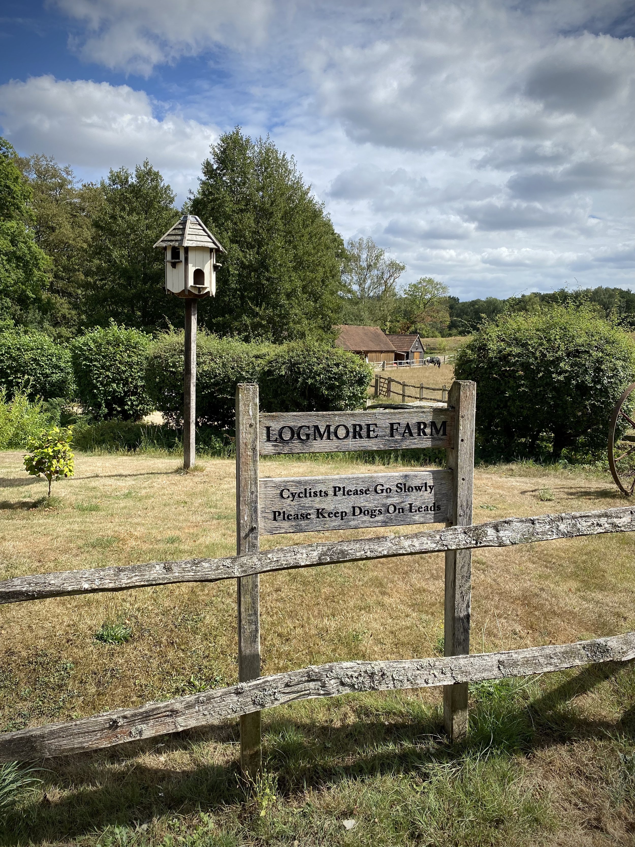
Farmland between Broadmoor and Wotton
Start & Finish: Holy Trinity Westcott, Logmore Lane, Westcott, Dorking RH4 3NN
Distance: 9 km (5.6 miles)
Elevation change: +/- 163m
Greensand Way section covered: Broadmoor Village to Bury Hill: 5.2km
GPX File: get via Buy Me a Coffee
Other routes touched (walk): None
Other routes touched (cycle): Leith Hill Greenway
OS Trig Pillar: TP4514 - Logmore Farm
Pubs / Cafes on route: None
Map: Dorking, Box Hill & Reigate Map | Leatherhead & Caterham | Ordnance Survey | OS Explorer Map 146
Links: Wescott
This is the eleventh of a series of short circular walks featuring the Greensand Way. The full trail is a long distance path stretching from Haslemere in Surrey to Ham Street in Kent. Our walks take in short sections of the Greensand Way and loop back to the start on other paths. The Greensand Way is well sign posted however you’ll need a map or GPX route to keep on track for the return sections of the loops. The guidance below will help but don’t use it as a fully accurate turn-by-turn guide.
For this section we parked at Holy Trinity Church just off the A25 at Westcott. From here you can access the Greensand Way by walking south for ~100m up Westcott Heath lane. Take a left at the junction and follow the Greensand Way for 1 km until you reach Milton Street. Take a left onto Milton Street then the first path on the right, following the Greensand Way to the house at the top of the hill. Here you’ll leave the Greensand Way to take a path on the right back down the hill to Milton Street. Follow Milton Street south until it becomes a footpath then reaches a small footbridge over the Milton Brook.
Cross the footbridge over the Milton Brook and through a kissing gate into a field. Follow this footpath for 1.2 km in a south-westerly direction until you meet Logmore Lane. Turn left then immediately right to follow an unnamed lane to Logmore Farm. The lane ends at the farm but you can continue heading south-west up the hill through woods until you meet the Leith Hill Greenway. Take a left onto the Greenway and follow it to the Logmore Farm Trig Pillar on the left of the path.
From the Trig Pillar continue south for 300m then take a right hand path, leaving the Greenway. Descend through the woods, crossing over the Tilling Bourne until you reach the Greensand Way. Take a right and follow the Greensand Way. You’ll shortly pass Broadmoor Village where you left the Greensand Way on Section 10. Continue following the Greensand Way for 4 km until you reach Westcott Heath lane to return to Holy Trinity church.
In this final section near Westcott you’ll pas close to OS Trig Pillar TP3280 - Furzefield. However, this is on private property with no public right of way leading to it so you’ll need permission to visit.
Previous section: Walking The Greensand Way Part 10 - Leith Hill and Broadmoor
Next section: Walking The Greensand Way Part 12 - The Nower and Dorking

View north from the Greensand Way to Hydon’s Ball
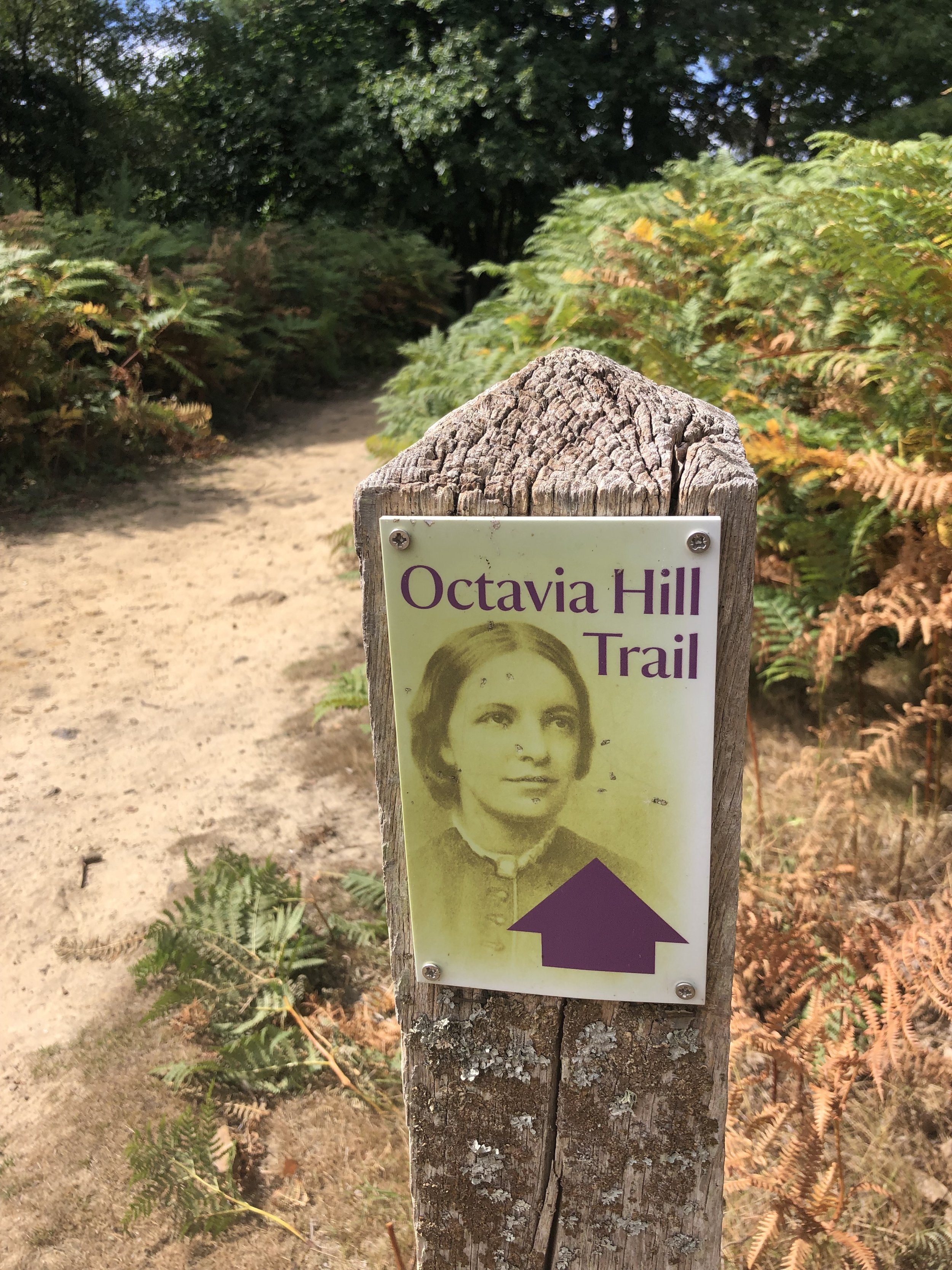
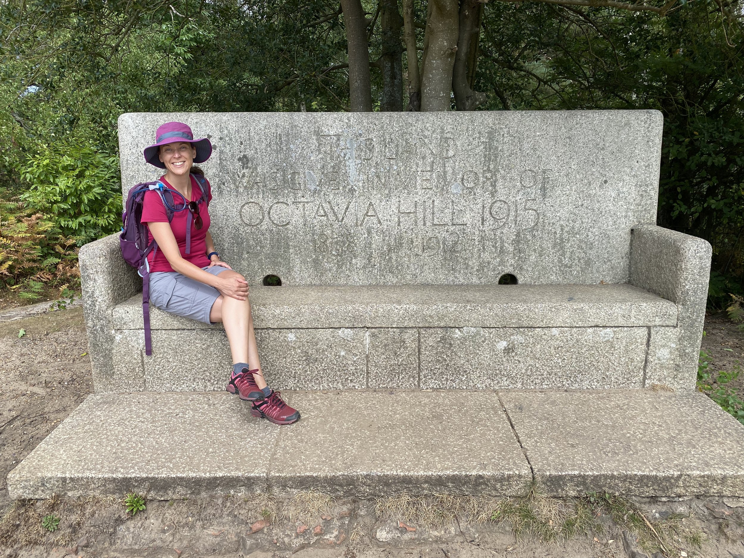
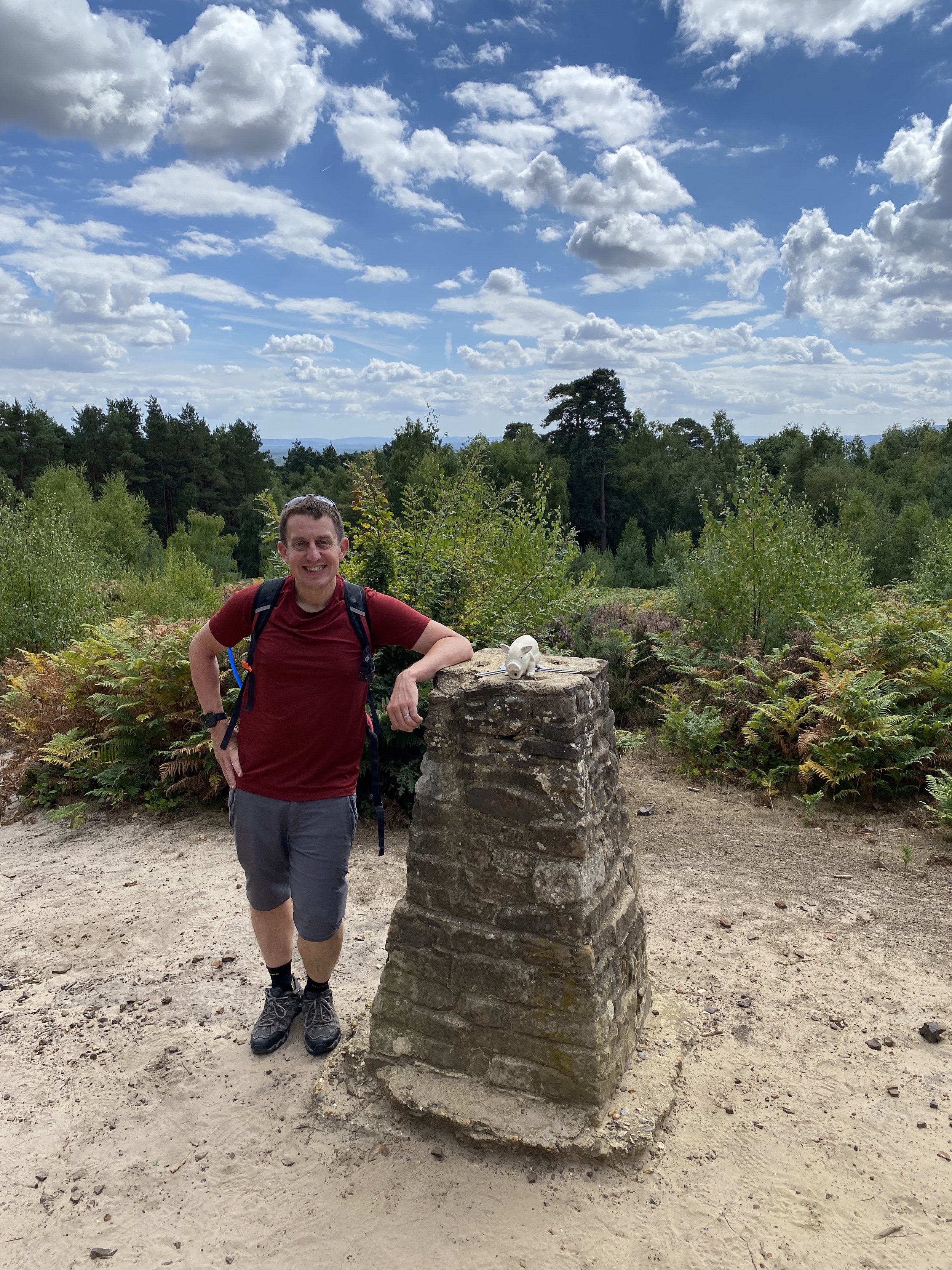
Start & Finish: National Trust - Hydon's Ball and Heath car park, Salt Lane, Godalming, GU8 4BB
Distance: 9.3 km (5.8 miles)
Elevation change: +/- 172m
Greensand Way section covered: Hambledon Church to Hascombe: 3.7km
GPX File: get via Buy Me a Coffee
Other routes touched (walk): Octavia Hill Trail
Other routes touched (cycle): None
OS Trig Pillar: TP4093 - Hydons Ball
Pubs / Cafes on route: None
Map: Guildford & Farnham Map | Godalming & Farnborough | Ordnance Survey | OS Explorer Map 145
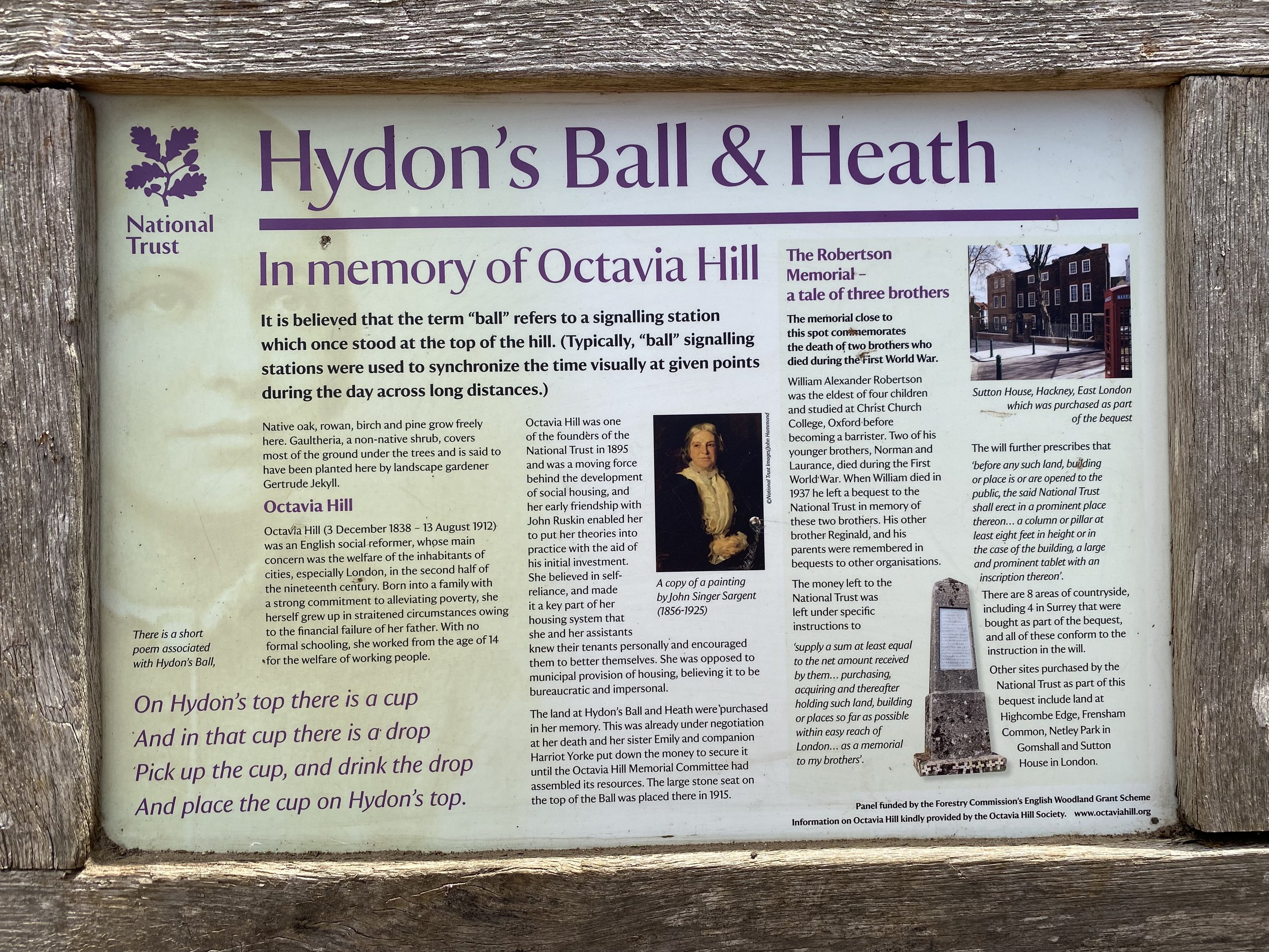
Links: National Trust - Hydon's Ball and Heath, Octavia Hill, Hambledon Church
This is the fifth of a series of short circular walks featuring the Greensand Way. The full trail is a long distance path stretching from Haslemere in Surrey to Ham Street in Kent. Our walks take in short sections of the Greensand Way and loop back to the start on other paths. The Greensand Way is well sign posted however you’ll need a map or GPX route to keep on track for the return sections of the loops. The guidance below will help but don’t use it as a fully accurate turn-by-turn guide.
For this section we parked at the free National Trust Car Park at Hydon's Ball and Heath. Follow the paths through the heath in a southly then south-westerly direction to the top of the hill with the OS Trig Pillar and stone memorial bench to Octavia Hill. Stop for a while to take in the view to the south and the Greensand Way at the bottom of the hill.
From the Trig Pillar follow the Octavia Hill Trail west for ~120 metres, then take a left hand path to follow it down to the memorial pillar. After the memorial continue along paths in a south-westerly direction for approx 1km until you reach Hambledon Church. You’ll now have reached the start and finish of section 4. Take the left hand track onto the Greensand Way and follow it in an easterly direction for 3.7 km.
This section of the Greensand Way is very quiet, along pretty holloways with occasional long vistas to the south. When you get to the edge of the woods just before The White Horse Pub at Hascombe you’ll leave the Greensand Way on a north-heading path. Continue onto this path onto Hoe Lane, then take a left-hand path that climbs steeply up a hill, initially on wooden steps and back into Holloways Heath. Cross over Mare Lane and follow a private road with some very expensive houses on it for just over 1km until you reach the junction with Hascombe Road. Take a sharp left onto a path before Hascombe Road and follow this in a south-westerly direction back to the Hydon’s Ball car park.
Previous section: Walking The Greensand Way Part 4 - Witley and Hambledon
Next section: Walking The Greensand Way Part 6 - Winkworth and Hascombe

Start & Finish: Hambledon Church, 1 Church Lane, Hambledon, Godalming, GU8 4DS
Distance: 9 km (5.6 miles)
Elevation change: +/- 124m
Greensand Way section covered: Edge of Heath Hills Wood to Hambledon Church: 4.5km
GPX File: get via Buy Me a Coffee
Other routes touched (walk): None
Other routes touched (cycle): Surrey Cycleway
Pubs / Cafes on route: The Merry Harriers (near start/finish)
Map: Haslemere & Petersfield Map | Midhurst & Selborne | Ordnance Survey | OS Explorer Map OL33
Links: Witley, Hambledon, Hambledon Church
This is the fourth of a series of short circular walks featuring the Greensand Way. The full trail is a long distance path stretching from Haslemere in Surrey to Ham Street in Kent. Our walks take in short sections of the Greensand Way and loop back to the start on other paths. The Greensand Way is well sign posted however you’ll need a map or GPX route to keep on track for the return sections of the loops. The guidance below will help but don’t use it as a fully accurate turn-by-turn guide.
For this section we parked at the end of the Greensand Way part and walked back to where we left the trail on section 3. Hambledon Church has a handful of parking spaces and had several available when we arrived early afternoon on a Saturday. You’ll probably be fine getting a space there as long as it’s outside of church service times. Alternative parking is at the Merry Harriers pub 300m into the trip. Ask permission to park there first.
From Hambledon Church the route back to Heath Hills Wood runs in a westerly direction on mostly wide paths. It was muddy in parts even after a relatively dry spell so come prepared with waterproof shoes or boots. This section back to the Greensand Way is slightly over 4km and flat(ish) until the 2.5km point where it climbs back up to the trail.
Once you meet the Greensand Way again you’ll be heading in an easterly direction. You’ll cross the railway on a bridge behind Witley Station, missing the town, and through the pretty village of Hambleden. There’s a great viewpoint just before the descent to Hambledon village where you can see back to the hills around the Devil’s Punchbowl and almost to the south coast.
The walk concludes with a gentle climb out of Hambledon village to the church where you started.
Previous section: Walking The Greensand Way Part 3 - Thursley and Witley Park
Next section: Walking The Greensand Way Part 5 - Hydons Ball and Holloways Heath
If something is outdoors, has variety, can be tracked and has challenges, it’s a fair bet that I’ll get obsessed with it. parkun ticks all of those boxes and it’s been an obsession of mine since 2012. A friend who had got the parkrun bug a few years before took me to a Boxing Day Freedom Run in December 2012. I was hooked straight away and returned to Black Park to do my first official one the following week. I started touring early, heading over to Wycombe Rye only a few weeks later. As it happened the event was called off due to ice but we did a Freedom Run anyway and returned the following week to do it properly.
Since then I’ve been touring as much as possible, collecting challenges and counties along the way. Here’s a selection of my blog posts on parkrun. Comment below or contact me if you spot any errors and I’ll donate £1 to the parkrun Forever fund for each correction made.


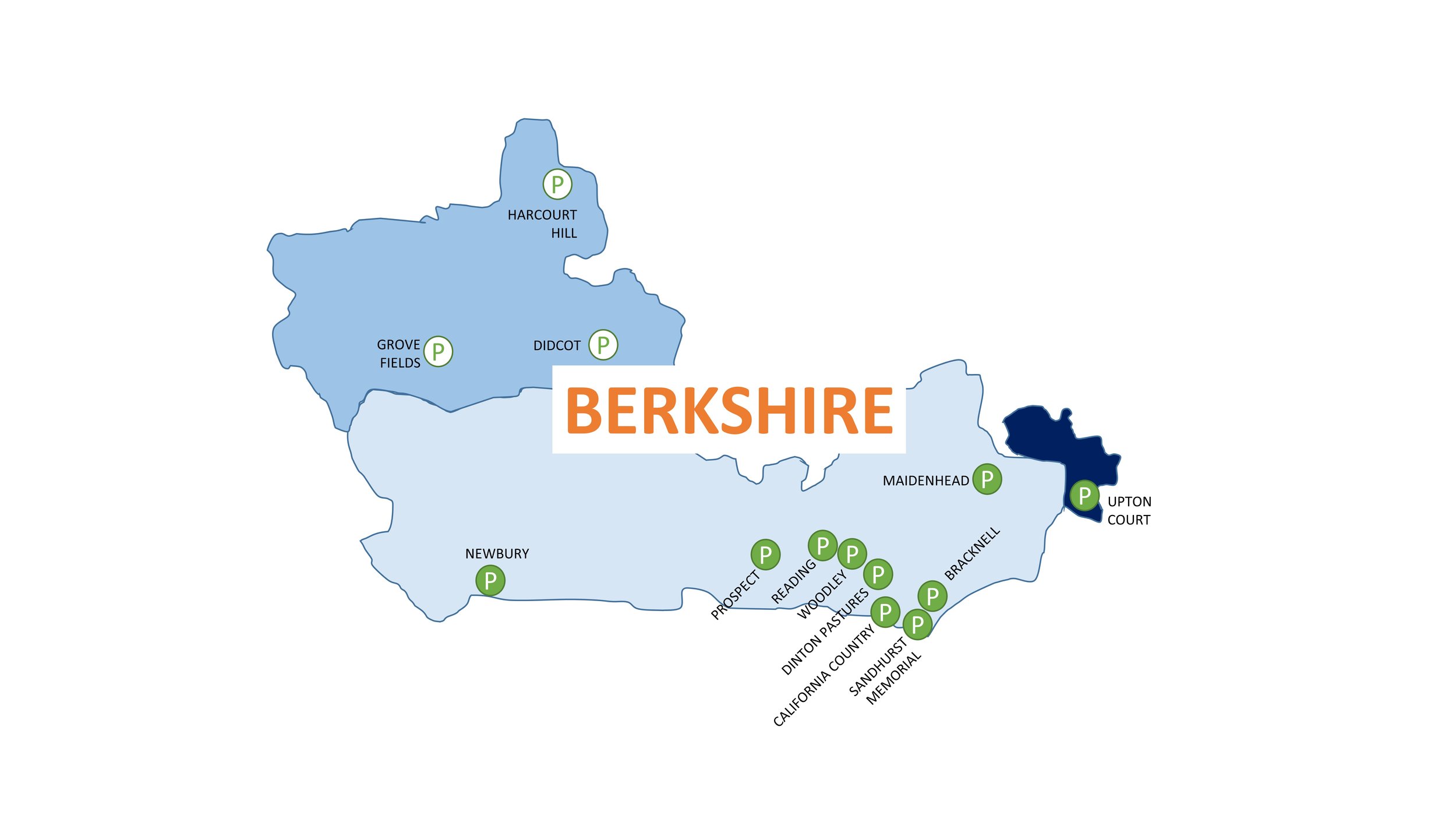
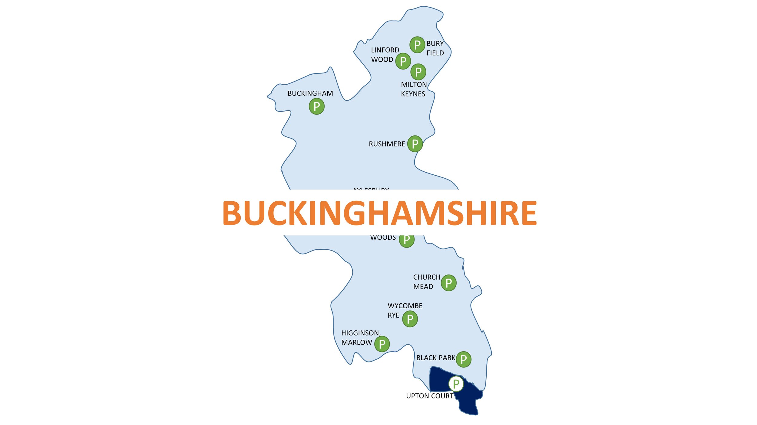
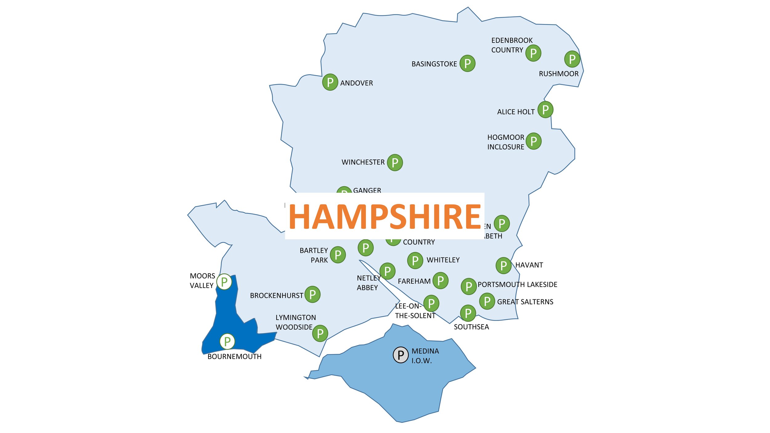

I add in a new county collection page once I’ve completed at least 3 events in the county. If you would like to speed up the process, Buy Me A Coffee and I’ll create a new one for your chosen county.

My completion year for the various parkrun clubs, challenges, countries and counties. There’s a few other smaller challenges that I’ve not shown here.

Green achievement badges sourced from the Running Challenges extension