The Chiltern Rivers
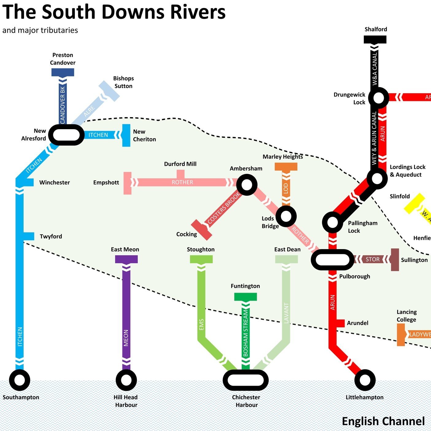
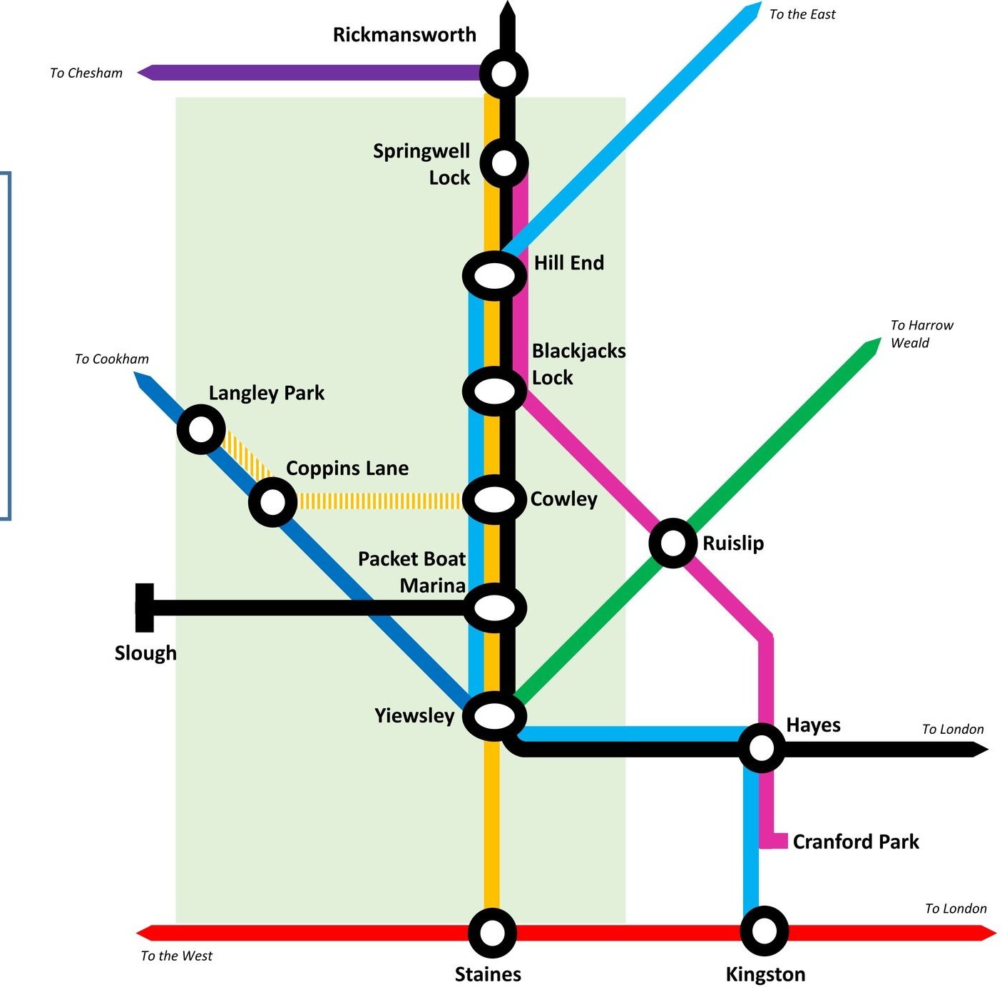
Here’s a Tube-style map of the rivers of the Chiltern Hills AONB and “Greater Chilterns Area”. Let me know if you spot any mistakes and I’ll donate £1 per correction to one of my causes. If you would like a printable PDF version, please Buy Me a Coffee and send me your e-mail via the Contact page. All copies for personal, not commercial use.
It started in 2016 with my Winter Solstice walk along the River Chess. I loved the walk and soon my mind turned to contemplating how many rivers there were in the Chilterns. More importantly, how many of them could be walked, cycled or ran? Over the following few weeks I went on a desk-based adventure researching the source and mouth of every waterway in the area. Unlike the Chess most of them don’t have a well-signed path following them. For these I started planning cycle trips to discover them. These would be circular routes, one section keeping as close as possible to the river, and the other section a return trip along quiet country lanes.
Each trip took me to places I’d not been to before. It also taught me a lot about the geography of an area that I’d grown up near but knew little about. I could see first hand how the rivers formed the valleys that cut through the chalk hills. I also discovered how many of the towns and villages that I knew so well were named after the river that runs through them.
The tricky part what knowing when the adventure would come to an end. Every time I got close I discovered a new stream that I never heard of and had to find that one too. I also had to make a decision about what would classify as a Chiltern River. The main criteria was that either the source had to be in the Chiltern Hills AONB and / or most of the river’s length had to be through the Greater Chilterns area. Some didn’t quite match this but I included them anyway. The Lea, for example, originates North of Luton in the gap between the 2 sections of the AONB. From here it flows away from the Chilterns to meet the Thames on the other side of London. It still felt like a Chiltern River though so I included it. I’m very happy that I did as the cycle trip along it was one of the most enjoyable of the set.
There’s a few that I didn’t include. The Flit and the Hiz both touch the Greater Chilterns area but originate outside of it. I may explore them later but for now I’m happy to give them a miss. I’m sure that there will be other rivers, streams or waterways that I have missed. If you know of any and have a recommendation for an adventure that includes them, post a note in the comments section below.
Scroll down for maps, links to blog posts for each river-based trip and a section on Chilterns towns that take their names from the rivers.
Click on the linked river name below to see the blog post for each river-based trip.
Alderbourne: Source in Fulmer, runs ~5 miles to the Colne Brook at Iver Heath, Buckinghamshire
Ash: Splits from the Colne on Staines Moor, runs ~6.2 miles to meet the Thames at Walton-on-Thames, Surrey
Assendon Stream: Source in Stonor, runs ~4 miles to the River Thames at Henley-on-Thames, Oxfordshire
Bulbourne: Source at Cow Roast, runs ~7 miles to the River Gade at Two Waters, Apsley, Hertfordshire
Chess: Source in Chesham Vale, Buckinghamshire, runs ~11 miles to the River Colne at Rickmansworth, Hertfordshire
Colne: Source near North Mymms, Hertfordshire, runs ~11.2 miles to the the Thames at Staines, Surrey
Colne Brook: Splits from the Colne at Uxbridge Moor, Greater London, runs ~9 miles to the Thames at Hythe End near Staines, Surrey
Ewelme Brook: Source in Ewelme Village, runs ~2 miles to the Thames near Benson Lock, Oxfordshire
Frays River: Splits from the Colne at West Drayton, Greater London, runs ~5.5 miles and rejoins the Colne near Staines, Surrey
Gade: Source at Dagnall, Buckinghamshire, runs ~16 miles to the Colne at Rickmansworth, Hertfordshire
Hambleden Brook: Source at Skirmett, runs 4.1 miles to meet the Thames at Mill End, Buckinghamshire
Hugenden Stream: Sourced from springs near Hughenden Village, runs ~2.2 miles to meet the Wye in High Wycombe
Lea: Source in Leagrave, Bedfordshire, runs 42 miles to meet the Thames at Leamouth, Greater London
Mimram: Source near Whitwell, runs 12 miles to the River Lea at Hertford, Hertfordshire
Misbourne: Source at Great Missenden, runs ~17 miles to the Colne at Denham, Buckinghamshire
Ouzel: Source at Dagnall, runs 20 miles to join the River Great Ouse at Newport Pagnell, Buckinghamshire
Pinn: Source at Pinner, runs approx, 11.4 miles joining the Grand Union and the Frays at Yiewsley, Greater London
Wraysbury: Splits from the Colne at West Drayton, runs ~5.5 miles and rejoins the Colne near the confluence with the Thames at Staines, Surrey
Ver: Source at Kensworth, Bedfordshire, runs ~15 miles to the Colne at Bricket Wood, Hertfordshire
Wye: Source at Bradenham, runs 9 miles to the Thames at Bourne End, Buckinghamshire
Canals & other man made waterways
Wendover Arm Canal
Poyle Channel
Staines Rivers Aqueduct
Wraysbury Lakes Ditch
Chilterns Towns Taking Their Name from the Rivers.
Ashford - River Ash
Bricket Wood - Rivers Ver and Colne: "Bright-coloured small island or piece of marshland"
Bourne End (Buckinghamshire) - River Wye
Bourne End (Hertfordshire) - Bourne Gutter, a short stream that flows into the Bulbourne near Hemel Hempstead
Chalfont St. Giles - River Misbourne. Chalfont means "spring frequented by calves"
Chalfont St. Peter - River Misbourne. Chalfont means "spring frequented by calves"
Colnebrook - Colne Brook (obviously)
Colney - River Colne. Also London Colney, Colney Heath
Fordbridge - River Ash
Fulmer - Alderbourne. Means "Mere or lake frequented by birds", possibly due to the small lakes feeding the river at the end of Framewood Road
Gadebridge - River Gade
Great Gaddesden - River Gade
Great Missenden - River Misbourne
Halliford (Upper and Lower) - River Ash. Means “holy ford”
Little Missenden - River Misbourne
Leagrave - River Lee (possibly - alternative meaning exist that are not connected to the river)
Longford - River Colne and Wraysbury: "Long Ford across the river"
Loudwater - River Wye
Luton - River Lee: "Farmstead on the River Lee"
Pinner - River Pinn
Redbourne - River Ver: "reedy stream", reedy could be a derivation of Reade who owned the manor in the 16th century
Ruislip - River Pinn (could also be Yeading Brook): "leaping place across a river where rushes grow"
High Wycombe - River Wye
St Albans (Roman name = Verulamium) - River Ver
Stanwell - River Colne - "Stoney spring or stream"
Two Waters - Rivers Gade and Bulbourne
Watford - River Colne - "Ford used when hunting"
Wooburn Green - River Wye
Wraysbury - Wraysbury River. River could be named after the town. Strangely the river doesn't go through the town, although the Colne Brook Does
Uxbridge - River Colne: "Bridge of the tribe called the Wixan"
Primary sources: A Dictionary of British Place Names (Mills) and Wikipedia


