The Scottish County Tops

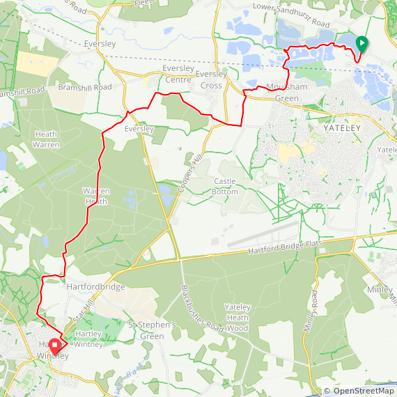
Compared to England, the Scottish Counties have had few changes over the years. There’s 3 main groupings of Scottish County:

  • Scottish Shires. Historic subdivisions of Scotland established in the Middle Ages and used as administrative divisions until 1975.

  • Historic Counties. Also referred to as Traditional Counties or Former Counties. Established by the Local Government (Scotland) Act 1889 and abolished by the Local Government (Scotland) Act 1973.

  • Scottish Council Areas. Also referred to as Present Day Counties. Established by the Local Government etc. (Scotland) Act 1994.

This post shows the highest point in each of Scotland’s counties based on the above groupings. As the Venn diagram shows there is a lot of overlap between the different types of county.

Contact me if you spot a mistake on this page or you have new information and I will make a donation to one of my causes.


Scotland’s Historic County Tops

Also referred to as Traditional Counties or Former Counties. Established by the Local Government (Scotland) Act 1889 and abolished by the Local Government (Scotland) Act 1973. More details on Scotland’s Historic Counties.

The highest points of these Historic Counties are:

  1. Ben Nevis. 1,344 metres. Completed. Historic County = Invernessshire, Present Day County = Highland.

  2. Ben Macdui. 1,309 metres. Historic Counties = Aberdeenshire and Banffshire. Present Day Counties = Aberdeenshire and Moray.

  3. Ben Lawers. 1,214 metres. Completed. Historic County = Perthshire. Present Day County = Perth and Kinross.

  4. Carn Eige. 1,183 metres. Historic County = Ross and Cromarty.

  5. Bidean nam Bian. 1,150 metres. Historic County = Argyll.

  6. Glas Maol. 1,068 metres. Completed. Historic County = Angus.

  7. Ben More Assynt. 998 metres. Historic County = Sutherland.

  8. Ben Lomond. 974 metres. Completed. Historic County = Stirlingshire.

  9. Ben Vorlich. 943 metres. Completed. Historic County = Dunbartonshire.

  10. Goatfell. 874 metres. Completed. Historic County = Buteshire. Present Day County = North Ayrshire.

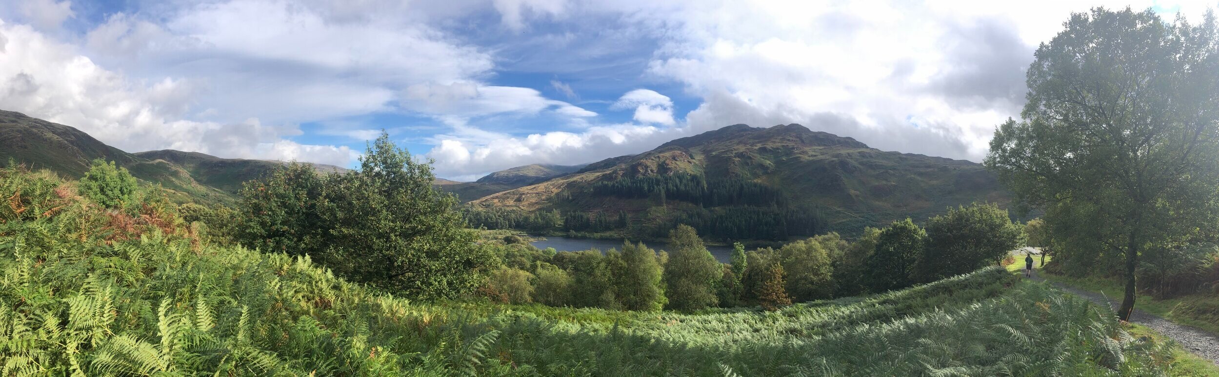
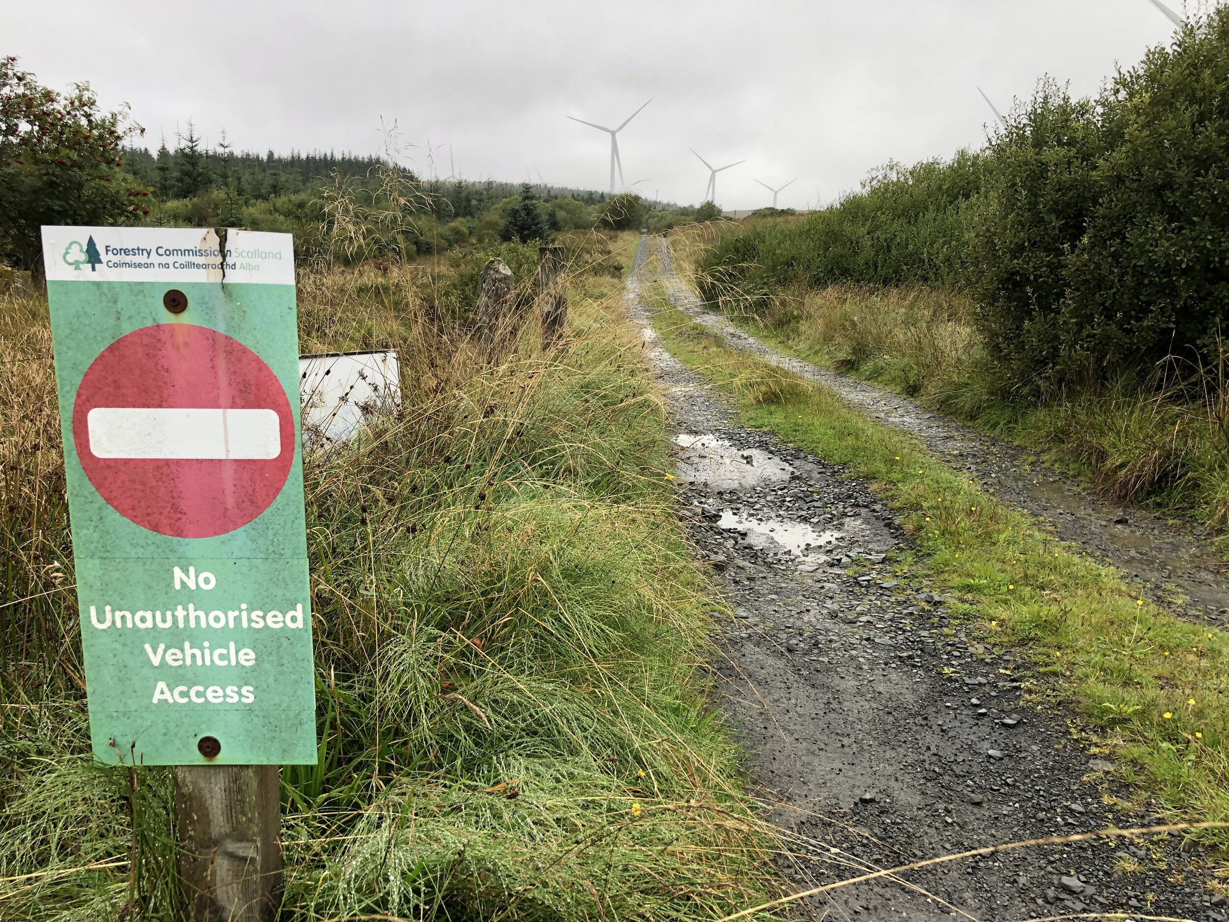
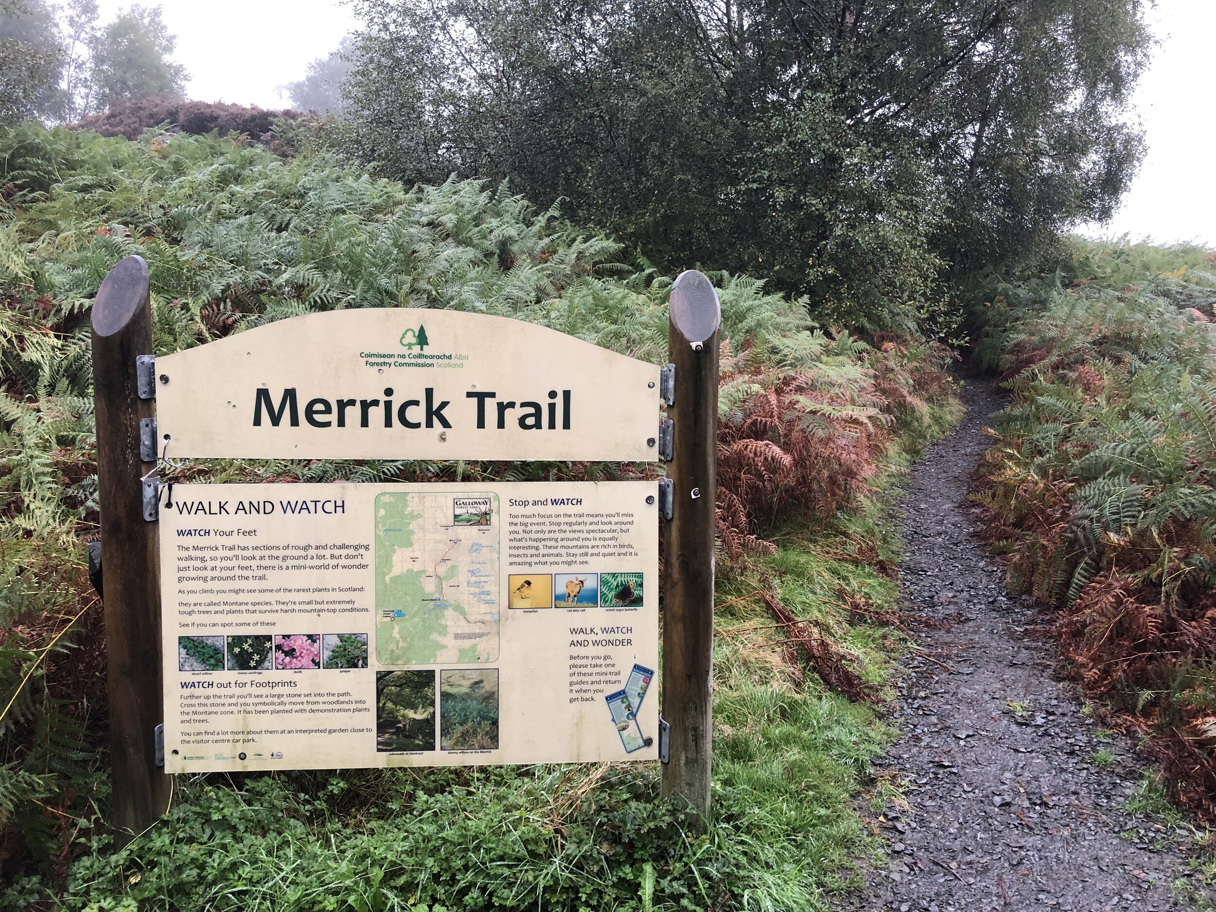
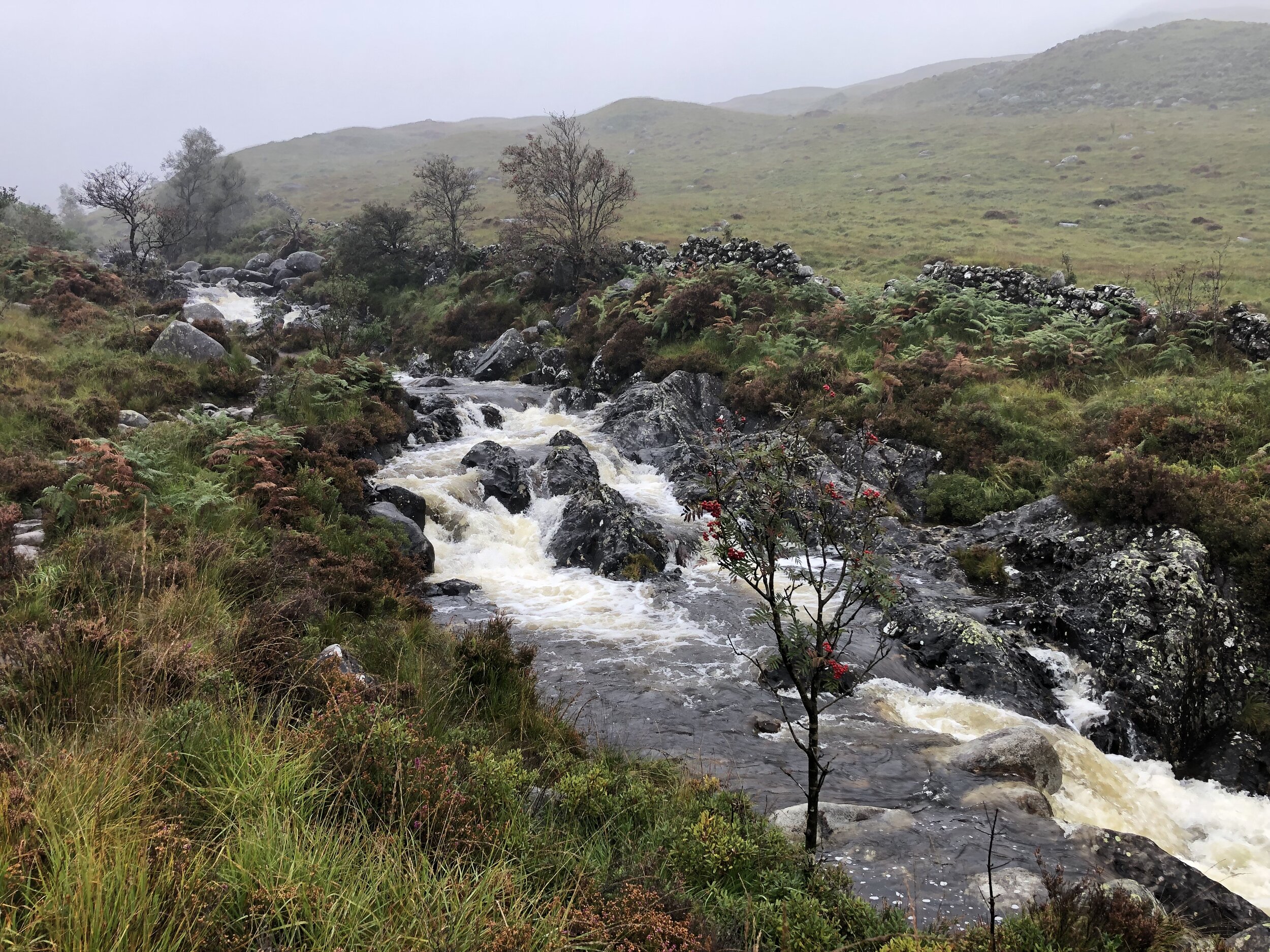
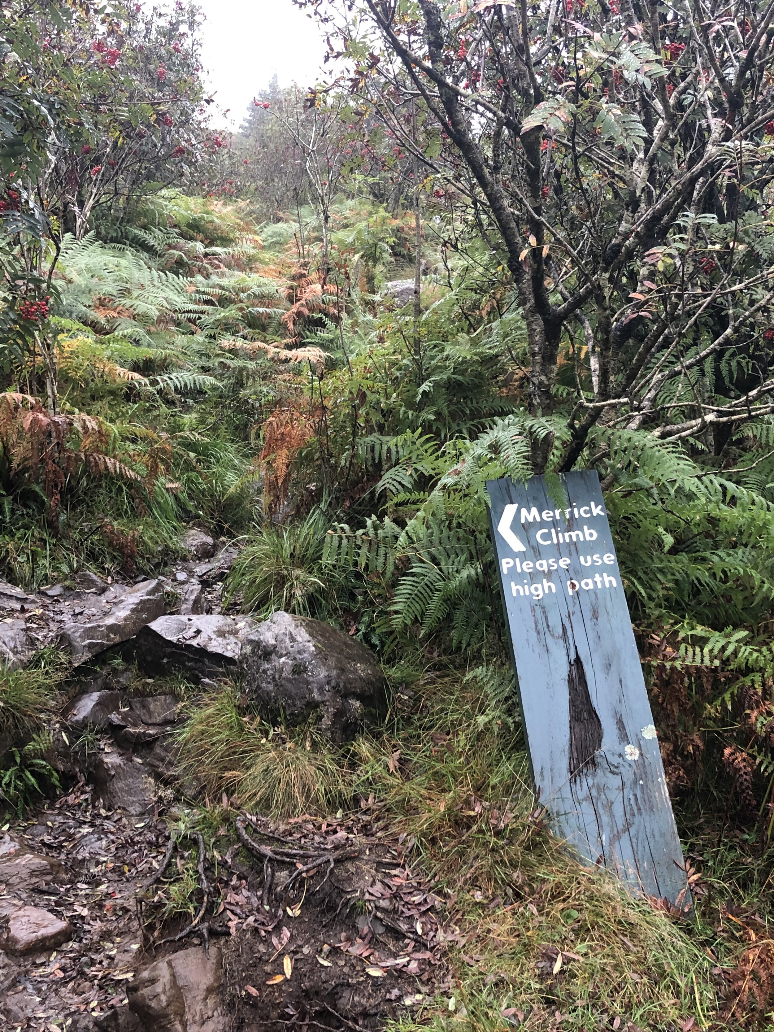
  11. Merrick. 843 metres. Completed. Historic County = Kirkcudbrightshire. Present Day County = Dumfries and Galloway.

  12. Broad Law. 840 metres. Completed. Historic Counties = Peeblesshire and Selkirkshire. Present Day County = Scottish Borders.

  13. White Coomb. 821 metres. Completed. Historic County = Dumfriesshire.

  14. Kirriereoch Hill-North West Slope. 782 metres. Completed. Historic County = Ayreshire. Present Day County = South Ayrshire.

  15. Mount Battock. 778 metres. Completed. Historic County = Kincardineshire.

  16. Culter Fell. 748 metres. Completed. Historic County = Lanarkshire. Present Day County = South Lanarkshire.

  17. Hangingstone Hill. 743 metres. Completed. Historic County = Roxburghshire.

  18. Ben Cleuch. 721 metres. Completed. Historic County = Clackmannanshire. Present Day County = Clackmannanshire.

  19. Carn a'Ghille Chearr. 710 metres. Historic County = Morayshire.

  20. Morven. 706 metres. Historic County = Caithness.

  21. Carn Glas-choire. 659 metres. Historic County = Nairnshire.

  22. Blackhope Scar. 651 metres. Completed. Historic County = Midlothian. Present Day County = Midlothian.

  23. Meikle Says Law. 535 metres. Completed. Historic County = East Lothian. Present Day County = East Lothian.

  24. Meikle Says Law (boundary). 532 metres. Completed. Historic County = Berwickshire.

  25. West Lomond. 522 metres. Completed. Historic County = Fife. Present Day County = Fife.

  26. Hill of Stake. 522 metres. Completed. Historic County = Renfrewshire. Present Day County = Renfrewshire.

  27. Innerdouny Hill. 497 metres. Completed. Historic County = Kinross-shire.

  28. Ward Hill. 481 metres. Historic County = Orkney. Present Day County = Orkney.

  29. Ronas Hill. 450 metres. Historic County = Shetland. Present Day County = Shetland.

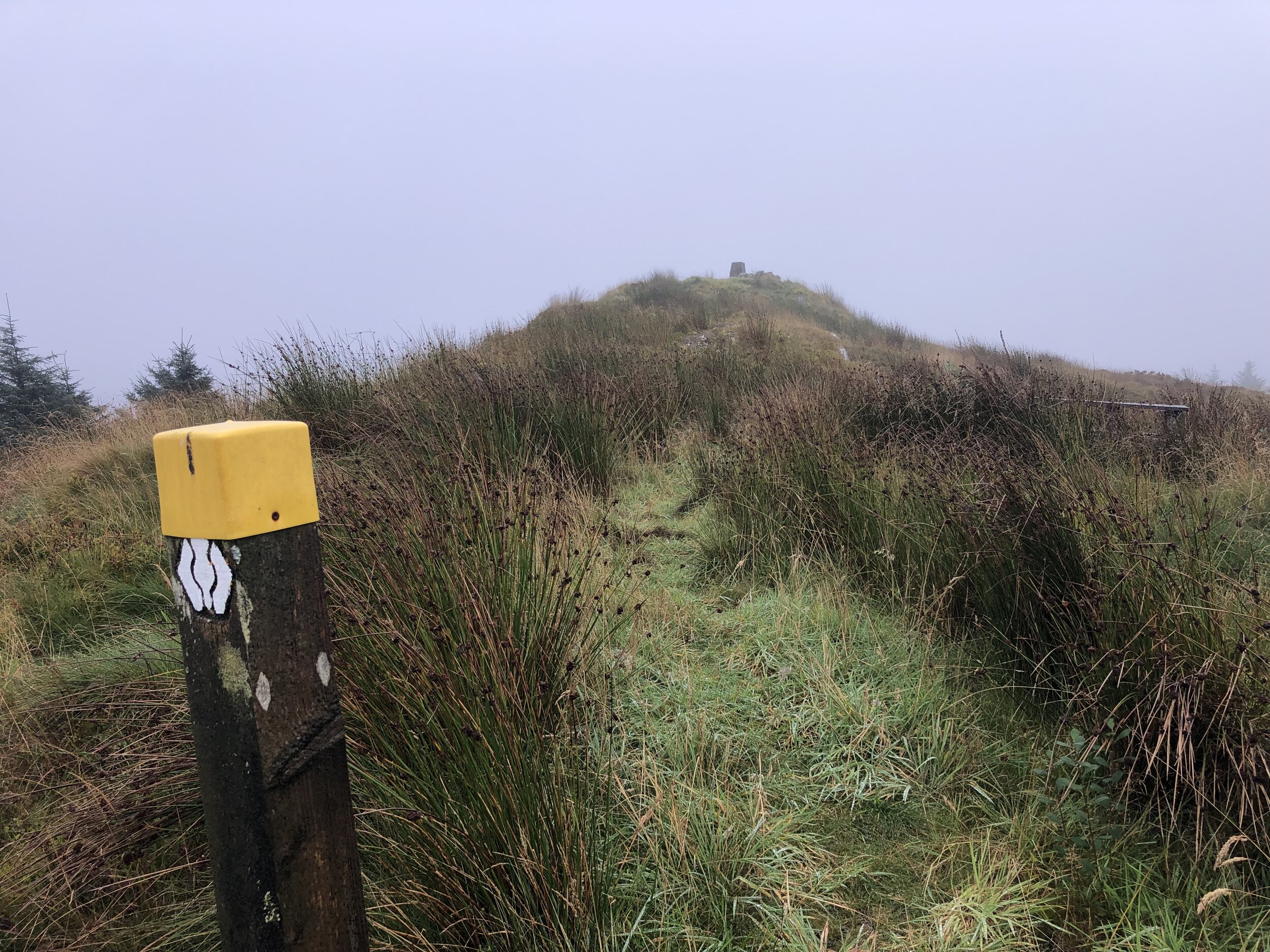
  30. Craigairie Fell. 321 metres. Completed. Historic County = Wigtownshire.

  31. Cairnpapple Hill. 312 metres. Completed. Historic County = West Lothian.


Scotland’s Present Day County Tops

Scotland has 32 Unitary Authorities that replaced the 33 County Councils that existed from 1890 to 1975. More details on Present Day counties of Scotland.

The list above shows where a peak is both an Historic and a Present Day County Top. The 14 peaks shown below are distinct from the Historic County Tops.

  1. Ben More. 1,174 metres, Stirling.

  2. Ben Cruachan. 1,132 metres, Argyll and Bute.

  3. An Cliseam / Clisham. 799 metres, Western Isles.

  4. Blackcraig Hill. 700 metres, East Ayrshire.

  5. East Cairn Hill. 567 metres, Edinburgh.

  6. West Cairn Hill. 562 metres, West Lothian.

  7. Cort-ma Law East Top. 527 metres, North Lanarkshire.

  8. Creuch Hill. 441 metres, Inverclyde.

  9. Duncolm. 407 metres, West Dunbartonshire.

  10. Corse Hill. 376 metres, East Renfrewshire.

  11. Darrach Hill. 357 metres, Falkirk.

  12. Brimmond Hill. 265 metres, Completed. Aberdeen.

  13. Cathkin Hill. 200 metres, Glasgow.

  14. Gallow Hill. 175 metres, Completed. Dundee.


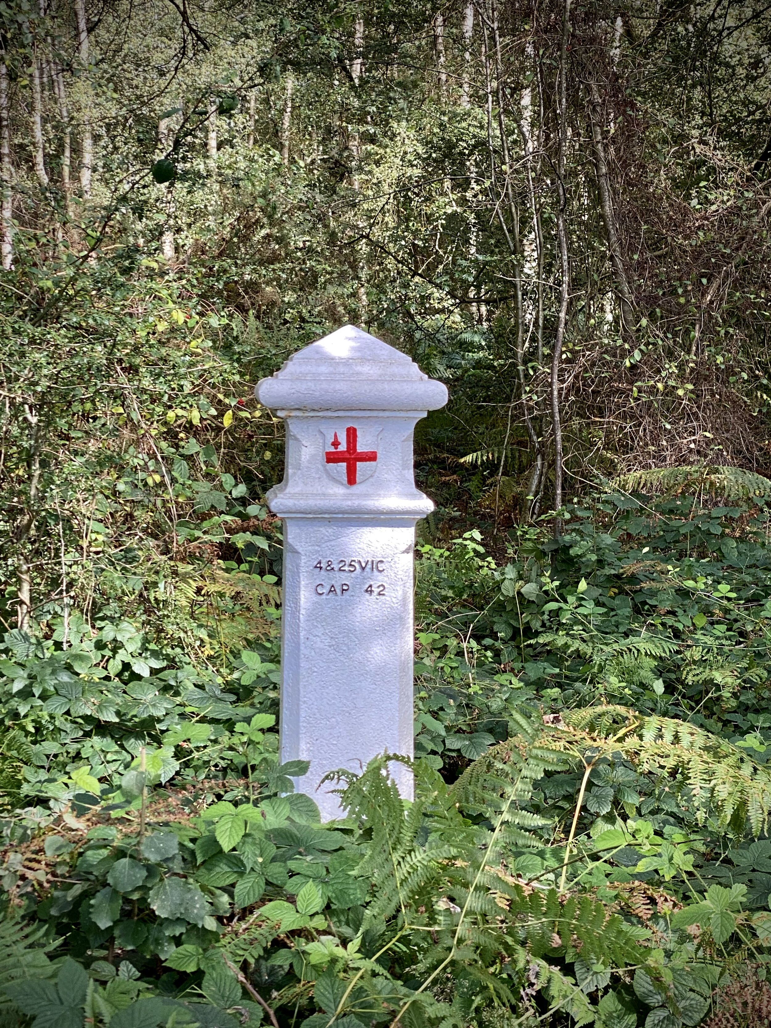
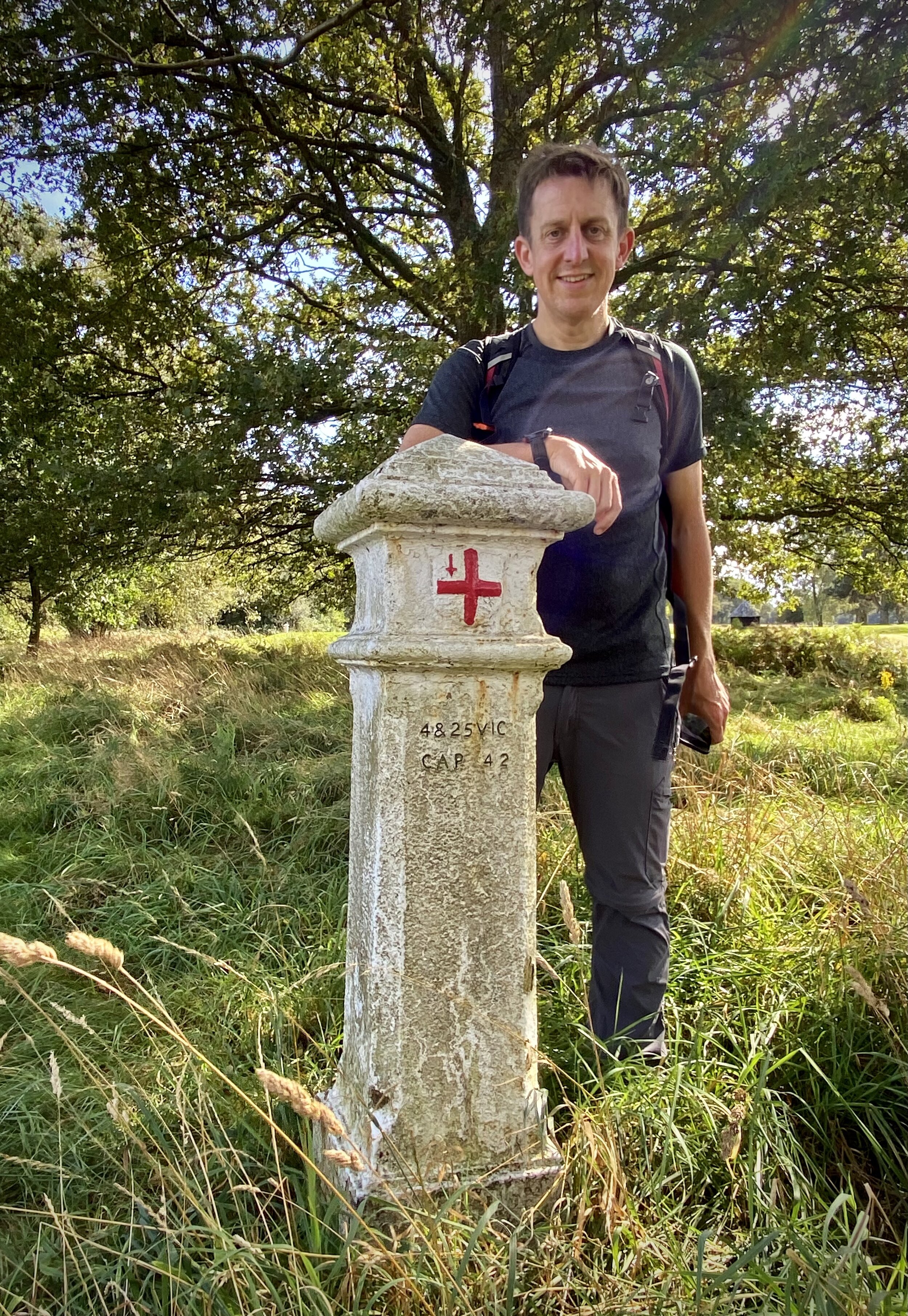
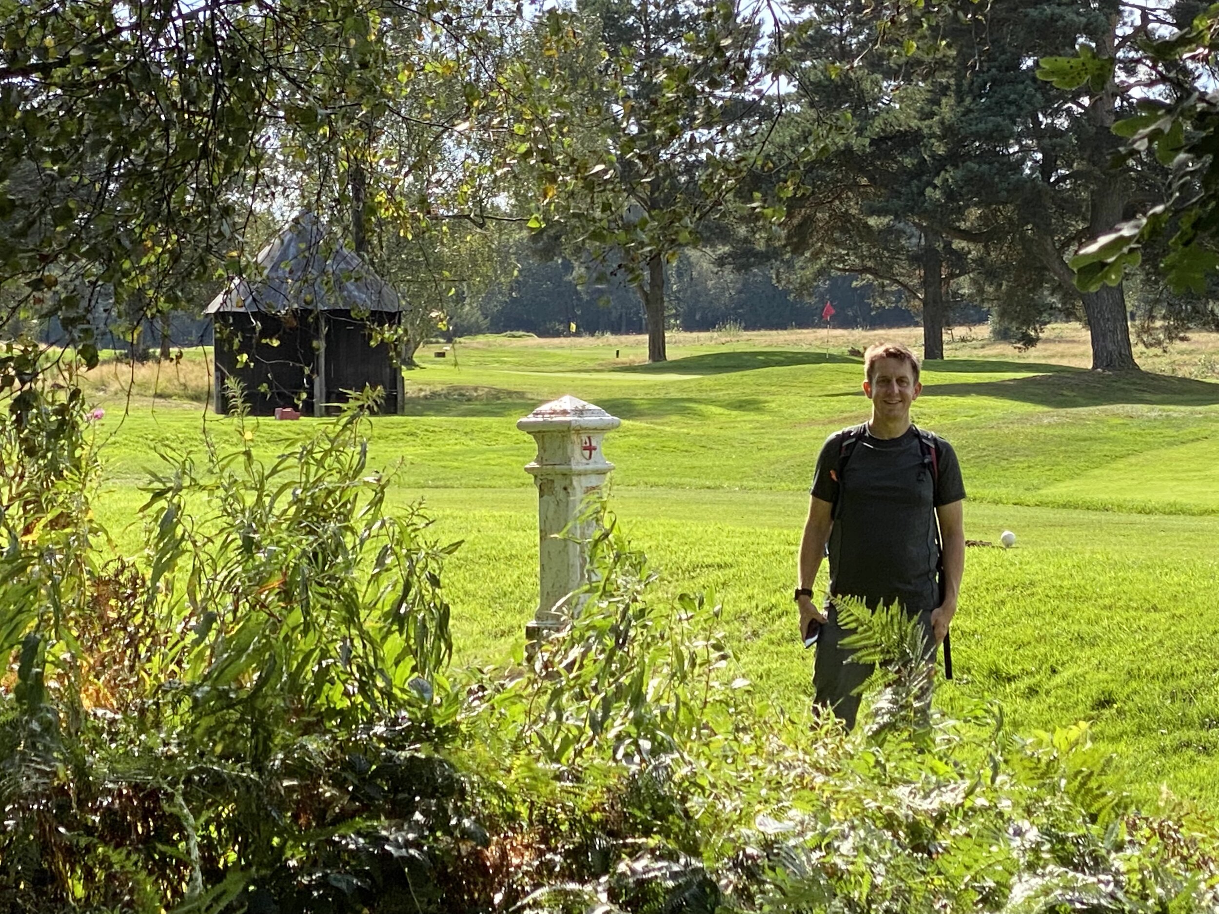
Scottish Counties Prior to 1890 (Shires)

The Shires were historic subdivisions of Scotland established in the Middle Ages and used as administrative divisions until 1975. More details on the Scottish Shires.

The mountains below are the high points of the Scottish Shires that are distinct from either Historic or Present Day County Tops.

  1. Sgurr Mor. Sgurr Mor 1003m, Cromartyshire.
    - Carn Eige is the Historic & Present Day County Top of Ross and Cromarty.

  2. Dun Rig. 774m, Selkirkshire.
    - Broad Law is the Historic County Top of Selkirkshire and the Present Day County Top of Scottish Borders.

  3. Carn nam Bain-tighearna. 634m, Nairnshire
    - Ben Nevis is the County Top of Present-Day Highland


More High Points


The Welsh County Tops

Compared to England, the Welsh Counties have had few changes over the years. There’s 3 main groupings of Welsh County:

  • Historic Counties. Also referred to as Traditional or Ancient Counties.

  • Principal Areas. Also referred to as Present-Day Counties. Established by the Local Government (Wales) Act 1994.

  • Preserved Counties. Established by the Local Government Act 1972 and used for local government and other purposes between 1974 and 1996.

This post shows the highest point in each of Wales’ counties based on the above groupings. As the Venn diagram shows there is a lot of overlap between the different types of county.

Contact me if you spot a mistake on this page or you have new information and I will make a donation to one of my causes.


Wales’ Historic County Tops

The 13 Historic Counties of Wales were used for administrative purposes for centuries with different times of origin. They were replaced by the Principal Areas which were established by the Local Government (Wales) Act 1994. More details on the Historic Counties of Wales

  1. Snowdon. 1,085 metres. Completed. Historic County = Caernarvonshire. Present Day County = Gwynedd.

  2. Aran Fawddwy. 905 metres. Completed. Historic County = Merionethshire.

  3. Pen y Fan. 886 metres. Completed. Historic County = Brecknockshire. Present Day County = Powys.

  4. Cadair Berwyn. 830 metres. Completed. Historic County = Denbighshire. Present Day County = Denbighshire.

  5. Moel Sych. 827 metres. Completed. Historic County = Montgomeryshire.

  6. Fan Foel. 781 metres. Completed. Historic County = Carmarthenshire. Present Day County = Carmarthenshire.

  7. Plynlimon. 752 metres. Completed. Historic County = Cardiganshire. Present Day County = Ceredigion.

  8. Chwarel y Fan. 679 metres. Completed. Historic County = Monmouthshire. Present Day County = Monmouthshire

  9. Great Rhos. 660 metres. Completed. Historic County = Radnorshire.

  10. Craig y Llyn. 600 metres. Completed. Historic County = Glamorganshire. Present Day County = Neath Port Talbot.

  11. Moel Famau. 555 metres. Completed. Historic County = Flintshire. Present Day County = Flintshire.

  12. Foel Cwmcerwyn. 536 metres. Completed. Historic County = Pembrokeshire. Present Day County = Pembrokeshire.

  13. Holyhead Mountain. 220 metres. Completed. Historic County = Anglesey. Present Day County = Isle of Anglesey.


Wales’ Present Day County Tops

These 22 Principal Areas, also referred to as the Present Day Counties, were established by the Local Government (Wales) Act 1994. Ten of these areas share a County Top with a Historic County that it replaced. These are shown in the list above. The list below shows the 12 high points of Present Day Counties that are distinct from the Historic County Tops. More details on the Present Day Counties of Wales

  1. Carnedd Llewelyn. 1,064 metres, Conwy

  2. Craig Berwyn. 790 metres, Wrexham

  3. Craig y Lynn Boundary. 590 metres, Rhondda Cynon Taff. Completed

  4. Coity Mountain. 581 metres, Blaenau Gwent

  5. Coity Mountain East Slope. 578 metres, Torfaen

  6. Mynydd Llangeinwyr /Werfa. 568 metres, Bridgend. Completed

  7. Pen March 535 metres. Caerphilly

  8. Merthyr Common. 530 metres, Merthyr Tydfill

  9. Mynydd y Betwys. 373 metres, Swansea

  10. Wentwood. 309 metres, Newport

  11. Garth Hill. 307 metres, Cardiff

  12. Tair Onnen. 137 metres, Vale of Glamorgan


Wales’ Preserved Counties

There are 8 preserved counties of wales, each fully containing between 1 and 5 of the Principal Areas (“Present Day Counties”). There are no high points that are unique to the Preserved Counties as all are County Tops of Principal Areas and some are also Historic County Tops. More details on the Preserved Counties of Wales

The high points of the Preserved Counties are:

  • Clwyd: Moel Famau

  • Dyfed: Plynlimon

  • Gwent: Coity Mountain

  • Gwynedd: Snowdon

  • Mid Glamorgan: Craig Y Lynn Boundary

  • Powys: Pen y Fan

  • South Glamorgan: Craig y Llyn

  • West Glamorgan: Myndydd y Betwys


More High Points


Windsor Great Park: Spittal Meadow & Queen Anne's Ride

Start & Finish: Long Walk Gate Car Park, Crown Cottages, Kings Road, Windsor, SL4 2BQ
Distance: 6.6 km (4.1 miles)
Elevation change: +/- 46m
GPX File: get via Buy Me a Coffee
Other routes touched (walk): None
Other routes touched (cycle): NCN 4
Pubs / Cafes on route: None
Map: OS Explorer Map (160) Windsor, Weybridge & Bracknell
Links: Windsor, Windsor Great Park


This is a nice short walk in the Great Park with easy access to Windsor Town Centre. Start at the Long Walk Gate Car Park and take the path that leads in a north-westerly direction along the edge of the field. After ~700m take a left, heading south-west between the football club and the raised flood defense. About halfway across the next field, cross over the Bourne Ditch and trace the edge of the field as it curves round to the south-east. Follow this boundary path until it connects with the A332 and the Ranger Gate Car Park.

Cross the A332 and enter the park through the Ranger’s Gate. Don’t follow the road, but take the sandy bridleway to the left. Continue until you pass Russell’s Pond and meet Queen Anne’s Drive. Take a left and follow Queen Anne’s Drive all the way back to the Long Walk Gate Car Park.


Woolwell Road: Plymouth High Point

Significance: Highest peak in the Unitary Authority of Plymouth
Member of: N/A
Parent Peak: High Willhays NHN = Sheeps Tor
Historic County: Hampshire (of which Pilot Hill is the County Top)
Elevation: 162m
Date “climbed”: 22nd October 2021
Coordinates: 50° 26' 6'' N, 4° 6' 25'' W
Map: Lower Tamar Valley & Plymouth Map | Tavistock & Callington | Ordnance Survey | OS Explorer Map 108
Links: Wikipedia (Plymouth), Peakbagger, Hillbagging

There’s not much to say about this one. The high point of Plymouth is in the middle of a grassy roundabout near the entrance to a large Tesco’s. Visit on the way to somewhere much more interesting.


Newlands Corner and Chilworth Gunpowder Mills Circular
Fields between Newlands Corner and Guildford Lane

Fields between Newlands Corner and Guildford Lane


Start & Finish: Newlands Corner Car Park, A25 Shere Road, Newland's Corner, Albury, GU4 8SF
Distance: 10.6 km (6.6 miles)
Elevation change: +/- 209m
GPX File: get via Buy Me a Coffee
Other routes touched (walk): North Downs Way, Scholar’s Trail, Tillingbourne at Work SCC
Other routes touched (cycle): none
OS Trig Pillar: TP4779 - Merrow Downs
Pubs / Cafes on route: Newlands Cafe or The Plucky Pheasant at the start/finish.
Map: Godalming & Farnborough | Ordnance Survey | OS Explorer Map 145
Links: Newlands Corner, Merrow Downs, St Martha’s Hill, Chilworth Gunpowder Mills


There’s a lot of options for circular walks from Newland’s Corner. This one is a variation on most as it takes in the Merrow Downs Trig Pillar and Chantries Wood. The route is a mix of large well-signed trails and cuts though woods with lots of similar looking paths. For these I’d recommend a GPX route or Explorer map to keep you on track.

From the Newland’s Corner Car Park take the path that heads north to the right of the Visitor's Centre. Follow paths to the edge of Merrow Downs Golf Course where you’ll find the OS Trig Pillar. From the pillar head west then south through the woods until you reach the North Downs Way. Follow the North Downs Way as it south-west past St Martha’s Church and down to Halfpenny Lane.

Cross over Halfpenny Lane and leave the North Downs Way, heading south-west through Chantries Wood. After the campsite, take a path heading steeply downhill to the south-west until you meet a path T-junction after a hedge. Take a left, heading east along the hedge until you get back to Halfpenny Lane. Take a right onto Halfpenny Lane, then a right immediately onto a footpath rather than following the Lane.

At the end of the footpath you’ll re-join Halfpenny Lane. Follow this south for 100m crossing the Tilling Bourne stream where you’ll see the entrance to the Gunpowder Mills on the left. Enter the Gunpowder Mills and follow the path through it for ~1km until you meet the Downs Link. Take some time here to see the remains of the old East India Company Mills. There’s information signs at the main entrances with leaflets explaining the different remains.

Once you reach the Downs Link you’ll need to leave the Mills and continue east though a field remaining parallel to the Tilling Bourne. Continue through an estate of some very nice houses set around Postford Lake and Waterloo Pond. You’ll emerge onto the A248 Chilworth Road. Follow the road east for 200m and take a left onto Guildford Lane. Follow Guildford Lane north-west for 500m then take a path on the right. Follow this path for just over 1km through woods, past a farm and then the final ascent to Newlands Corner.

For a shorter version of this you could save ~1km by heading directly west from Newlands Corner, missing out the Trig Pillar. Another 1k can be saved by walking south down Halfpenny Lane instead of the Chantries Wood section. I highly recommend the full route though as it takes in several of the main points of interest in the area.


route-37579369-map-full.png
elevation_profile (1).jpg

Walking The Three Castles Path Part 1: Windsor to Greywell
Windsor Castle and the start of the Three Castles Path

Windsor Castle and the start of the Three Castles Path


The Three Castles Path is a 60 mile trail from Windsor to Winchester, inspired by the travels of King John. The three castles that it refers to are Windsor Castle, Winchester Castle, and King John’s own Odiham castle at the half way point. The trail is very well described in the short guidebook The 3 Castles Path by Heron Maps.

Our journey along the path was a reunion of our small group that did the Caminos Ingles and Finisterre in 2019. The Covid lockdowns had thwarted many of our plans for long trips so we covered this first section of the path in sections around the Lockdowns. Our trip was based on roughly 10k sections with good parking options at either end. These are different sections to those described in the guidebook which also details public transport options.

We’ll get to the second half of the path another time. It’s further from home with fewer parking options on some sections so will need some more planning.


Section 1. Windsor Castle to Ascot

Start: Windsor Castle, Castle Hill, Windsor
Finish
: Free car parking, High Street, Ascot, SL5 7HS
Distance: 11.6 km (7.2 miles)
Elevation change: +128m / -90m. Net +38m
GPX File: get via Buy Me a Coffee
Other routes touched (walk): None
Other routes touched (cycle): NCN 4, Ascot To Windsor Cycle Route, Round Berkshire Cycle Route 52
Pubs / Cafes on route: None on route but several in Windsor and Ascot High Streets
Map: OS Explorer Map (160) Windsor, Weybridge & Bracknell
Links: Windsor, Windsor Castle, Windsor Great Park, Ascot, Ascot Racecourse

route-34711377-map-full.png
elevation_profile.jpg

Section 2. Ascot to Swinley Forest

Start: Free car parking, High Street, Ascot, SL5 7HS
Finish
: The Look Out Discovery Centre, Nine Mile Ride, Bracknell, RG12 7QW
Distance: 8.3 km (5.2 miles)
Elevation change: +68m / -41m. Net +27m
GPX File: get via Buy Me a Coffee
Other routes touched (walk): Ramblers’ Route
Other routes touched (cycle): NCN 422, Ascot To Windsor Cycle Route
Pubs / Cafes on route: None on route but The Look-out has a cafe and Horseshoe Lake has a kiosk.
Map: OS Explorer Map (160) Windsor, Weybridge & Bracknell
Links: Ascot, Ascot Racecourse, North Ascot, Swinley Forest, The Lookout Discovery Centre

route-34711580-map-full.png
elevation_profile.jpg

Section 3. Swinley Forest to Horeshoe Lake

Start: The Look Out Discovery Centre, Nine Mile Ride, Bracknell, RG12 7QW
Finish
: Horseshoe Lake Car Park, Sandhurst, GU47 8JW
Distance: 10 km (6.1 miles)
Elevation change: +74m / -127m. Net -53m
GPX File: get via Buy Me a Coffee
Other routes touched (walk): Ramblers’ Route, The Wokingham Way, Ambarrow Hill Circuit, Ambarrow Court Circuit
Other routes touched (cycle): Swinley Forest Mountain Bike Routes
Pubs / Cafes on route: None on route but The Look-out has a cafe and Horseshoe Lake has a kiosk.
Map: OS Explorer Map (160) Windsor, Weybridge & Bracknell and OS Explorer Map (159) Reading, Wokingham and Pangbourne
Links: Swinley Forest, The Lookout Discovery Centre, Broadmoor Hospital, Sandhurst, Horseshoe Lake

route-34755124-map-full.png
elevation_profile.jpg

Section 4. Horseshoe Lake to Hartley Wintney

Start: Horseshoe Lake Car Park, Sandhurst, GU47 8JW
Finish
: Cricket Green, Hartley Wintney, Hook RG27 8QB. Parking at Hartley Wintney Long Stay, 484 Monachus Lane, Hartley Wintney, RG27 8NN
Distance: 12 km (7.5 miles)
Elevation change: +103m / -91m. Net -12m
GPX File: get via Buy Me a Coffee
Other routes touched (walk): The Wokingham Way, Blackwater Valley Park
Other routes touched (cycle): None
Pubs / Cafes on route: None on route but several in Hartley Wintney and Horseshoe Lake has a kiosk.
Map: OS Explorer Map (159) Reading, Wokingham and Pangbourne and OS Explorer Map (144) Basingstoke, Alton and Whitchurch
Links: Horseshoe Lake, Blackwater Valley, River Blackwater, River Hart, Hartley Wintney

route-34755130-map-full.png
elevation_profile.jpg

Section 5. Hartley Wintney to Greywell

Start: Cricket Green, Hartley Wintney, Hook RG27 8QB. Parking at Hartley Wintney Long Stay, 484 Monachus Lane, Hartley Wintney, RG27 8NN
Finish
: Fox & Goose Pub, The Street, Hook, RG29 1BY
Distance: 11.9 km (7.5 miles)
Elevation change: +79m / -61m. Net -18m
GPX File: get via Buy Me a Coffee
Other routes touched (walk): Basingstoke Canal Towpath
Other routes touched (cycle): Odiham Circular
Pubs / Cafes on route: Several on Hartley Wintney High Street at start, the Waterwitch in Odiham and The Fox and Goose at the end.
Map: OS Explorer Map (144) Basingstoke, Alton and Whitchurch
Links: Hartley Wintney, Basingstoke Canal, Odiham, Odiham Castle, Greywell, Greywell Tunnel


Downs Link Ultra Marathon
Crossing The Old Shoreham Toll Bridge on the last mile

Crossing The Old Shoreham Toll Bridge on the last mile


When: October 10th 2021
Start
: Church of St Martha-on-the-Hill, Halfpenny Lane, Guildford, GU4 8PZ
Finish: 3rd Shoreham Sea Scouts, Shoreham-by-Sea, BN43 5LT
Distance: 61.3 km (38.1 miles)
Elevation change: +456m / -622m (Net -166m)
GPX File: get via Buy Me a Coffee
Other routes touched (walk): North Downs Way, Tillingbourne At Work (SCC), Wey South Path, The Fox Way, Greensand Way, Sussex Border Path, West Sussex Literary Trail, South Downs Way
Other routes touched (cycle): NCN 22, 223
Maps:
- OS Explorer Map (145) Guildford and Farnham
- OS Explorer OL34 Crawley & Horsham
- OS Explorer OL11 Brighton and Hove
Finish time: 8 hours 32 minutes
Links: Downs Link (Wikipedia), The Cranleigh Line, The Steyning Line, St Martha’s Hill, Surrey Hills AONB, Wey and Arun Canal, South Downs National Park


This was a return to familiar territory for Mark and I. We’d cycled the Downs Link in July and passed by St Martha’s church on the Hardest of Snails 10k shortly after. Running the whole of the 38 mile trail was an altogether bigger challenge. This was also Mark’s first Ultra and my first running one with a friend.

I had worked out a plan to get us through it at a steady pace with 30 minutes contingency for the 10 hour cut-off. I have a consistent pace for Ultras, but not knowing how Mark would get on I didn’t know whether we would be able to stick together or not.

The first 6.4k to the old railway path is steep and hilly. With a lot of runners packed tightly into narrow paths you have to go at the speed of the group. This was a comfortable pace for a short race but faster than I had planned for this. I couldn’t see Mark at all in this first section and was worried that I was getting a long way ahead. I needn’t have worried as he arrived at the first Aid Station 30 seconds behind me.

This was the pattern for the first half of the race. I was slightly ahead on each section and we met up at the Aid Stations. Somewhere between Henfield and Steyning we’d both slowed to a fast walk and kept together to the end. By the finish point at Shoreham-by-Sea we were a hour ahead of our planned time and well within the official cut-off.

This is billed as a great Ultra for first timers and I’d argue that it’s a great one all round. After the first 6.4k it’s mostly flat and on good ground. There’s a few long straight stretches that got a bit boring but made up for by the remains of the old stations along the way. See my post on the cycle trip for more about these.

Running and crossing the finishing line with a friend made it special for me. Well done Mark on joining the Ultra club and huge thanks for Mark’s family for supporting us along the way.


route-37749906-map-full.png
elevation_profile.jpg

Scottish Borders County Tops
View to Loch Trool from Bruce’s Stone at the start of the Merrick Trail

View to Loch Trool from Bruce’s Stone at the start of the Merrick Trail


With all of the County Tops in England, Wales and Northern Ireland in the bag, I “just” have Scotland to do. The problem is that they’re now a long way from home and getting taller. Before this trip I’d only done 3 of the 33 Historic County Tops of Scotland. I’d done Ben Nevis a couple of times, Goatfell once and, most recently Hangingstone Hill as an add-on to the Cheviot walk.

The remaining 30 would need to be grouped into longer weekends around natural groupings. With easy access from Glasgow Airport, the 6 summits of this trip was an obvious place to start. Broad Law covers 2 counties each giving a total of 7 historic counties over a 4-day trip.


Craigairie Fell

Significance: Highest peak in Wigtownshire (Historic County Top)
Member of: N/A
Parent Peak: Beneraird
Nearest Higher Neighbour: Beneraird
Elevation: 321m
Date climbed: 23rd September 2021
Coordinates: 55° 1' 34'' N, 4° 45' 40'' W

Route Start / End: Parking space at end of road west from Polbae (DG8 6RZ)
Route Distance: 7.5 km (4.6 miles)
Route Elevation Change: +/- 159m
Subsidiary tops on route: None
GPX File: get via Buy Me a Coffee
Other routes touched (walk): Southern Upland Way
Other routes touched (cycle): None
OS Trig Pillar: TP2507 - Craigairie Fell
Map: OS Explorer Map (310) Glenluce and Kirkcowan
Guidebook: The UK's County Tops (Jonny Muir)
Links: Wikipedia (Wigtownshire), Peakbagger, Hillbagging

Craigairie Fell was our warm-up peak for the trip. With a total elevation of 321m, it’s a hill rather than a mountain and can be bagged in less than 2 hours. We tackled this one first as we flew into Glasgow in the morning and it was a 2-hour drive to the start of the walk.

There’s a good parking spot about a mile west along the road from Polbae. It’s more of a track than a road so don’t attempt it in a car with low clearance. You’ll notice it soon after the Forestry Commission sign saying “No Unauthorized Vehicle Access”. It’s an odd place to have the sign as it’s on a random part of the road with no place to turn around. The first place to turn further along is a junction with a track to a farm where the obvious parking spot is.

From the parking spot, navigation is very easy as you follow the Southern Upland Way all the way to the Trig Pillar at the top. The actual route is slightly shorter than the one on the map as there’s a short-cut of the Southern Upland Way that cuts off the hairpin bend near the D of Derry on the map.

Although our views from the top were a little misty, it was significantly better than the other summits in the trip with no views at all.

route-36816521-map-full.png
elevation_profile.jpg

Merrick

Significance: Highest peak in Kirkcudbrightshire (Historic County Top), Highest peak in Dumfries and Galloway (Present Day County Top)
Member of: Marilyn, Corbett, Donald
Parent Peak: Helvellyn
Nearest Higher Neighbour: Goatfell
Elevation: 843m
Coordinates: 55° 8' 21'' N, 4° 28' 6'' W
OS Trig Pillar: TP4777 - Merrick
Links: Wikipedia Kirkcudbrightshire), Wikipedia (Dumfries and Galloway), Wikipedia (Merrick), Peakbagger, Hillbagging

Kirriereoch Hill-Northwest Slope

Significance: Highest peak in Ayrshire (Historic County Top), Highest peak in South Ayrshire (Present Day County Top)
Member of: N/A
Parent Peak: Kirriereoch Hill
Nearest Higher Neighbour: Kirriereoch Hill
Elevation: 782m
Coordinates: 55° 9' 11'' N, 4° 28' 53'' W
Links: Wikipedia (Ayrshire), Wikipedia (South Ayrshire), Wikipedia (Kirrieroch Hill), Peakbagger, Hillbagger

For both peaks:
Date climbed:
24th September 2021
Route Start / End:
Upper Bruce's Stone Car Park, Newton Stewart, DG8 6SU
Route Distance: 16.7 km (10.4 miles)
Route Elevation Change: +/- 1,114m
Subsidiary tops on route: Benyellary (719m), Kirriereoch Hill (786m)
GPX File: get via Buy Me a Coffee
Other routes touched (walk): Merrick Trail
Other routes touched (cycle): NCN 7 passes through Upper Bruce’s Stone Car Park
Map: OS Explorer Map (318) Galloway Forest Park North
Guidebook: The UK's County Tops (Jonny Muir)

After an overnight in nearby Newton Stewart we tackled the big climb of the trip. Merrick is the highest point in the Historic County of Kirkcudbrightshire, the Present-Day County of Dumfries and Galloway and both the highest peak in the Southern Uplands and Southern Scotland.

The Merrick Trail is a well marked path leading from Upper Bruce’s Stone Car Park to the summit. Before you start the walk, take 10 minutes to see the carved granite stone that commemorates victory over an English army during the Scottish Wars of Independence in 1307.

On a clear, warm day this would have been a wonderful walk. From the summit you can see Snowdon, 144 miles away on the longest line of sight in the British Isles. This wasn’t the day to see anything. After the bothy and the forest section, the mist turned to cloud and we only saw what was 10m in front of us. By the time we reached the Trig Pillar at the summit there was also strong wind and rain. This would have been a great time to turn back and head down to a warmer, clearer elevation.

There was no turning back though as we still had another County Top to visit. The high point of Ayrshire is just beyond the summit of Kirriereoch Hill approximately 2km from the summit of Merrick. We relied on the GPX track as the path was hard to make out in the fog. Kirriereoch Hill’s summit is well marked by a pile of stones. From here, the County Top of Ayrshire is 100m to the north just beyond the remains of an old stone wall. The map on my phone showed the county boundary about 20m beyond the wall. Although it wasn’t completely clear exactly where the County Top was, we at least stopped by several possibilities.

From Kirriereoch Hill, the path continues north to a series of other summits. We had already got what we came for and turned back to re-trace our steps back over Merrick and down to the Bruce’s Stone. With the big one done, we drove 2 hours north-east to Strathaven, our overnight stop before the next set of peaks.

elevation_profile (1).jpg

Culter Fell

Significance: Highest peak in Lanarkshire (Historic County Top), Highest peak in South Lanarkshire (Present Day County Top)
Member of: Marilyn, Graham, Donald
Parent Peak: Broad Law
Nearest Higher Neighbour: Broad Law
Elevation: 748m
Date climbed: 25th September 2021
Coordinates: 55° 32' 46'' N, 3° 30' 10'' W


Route Start / End: Layby on right hand side of minor road south of Culter Allers Farm
Route Distance: 7.1 km (4.4 miles)
Route Elevation Change: +/- 484m
Subsidiary tops on route: None
GPX File: get via Buy Me a Coffee
Other routes touched (walk): None
Other routes touched (cycle): None
OS Trig Pillar: TP2681 - Culter Fell
Map: OS Explorer Map 336 Biggar and Broughton
Guidebook: The UK's County Tops (Jonny Muir)
Links: Wikipedia (Lanarkshire), Wikipedia (South Lanarkshire), Wikipedia (Culter Fell), Peakbagger, Hillbagging

Culter Fell was our first of 3 peaks, covering 4 counties, located close together to the north-east of Moffat. It’s possible to do all three on a single day with an early start and enough light. It was a Saturday and we also needed to get in a parkrun, so we did a combination of Lanark Moor parkrun, with Culter Fell and Broad Law.

There’s enough parking for several cars on a large layby near Culter Allers Farm. From here you can follow the road south, crossing over Culter Water stream. You’re now on private land which is open to walkers but occasionally closed for shooting. You can call 01899 204010 to check access or to request permission for groups of over 4.

Approximately 1km from the layby leave the road and follow a track, then a path, ascending to the south-east. The path to the Trig Pillar at the summit is well marked and difficult to miss even in low visibility as we had. Options at the summit are to return the same way, as we did, or continue south, then south-west to Coulter Head Reservoir and return back along the road.

route-36816633-map-full.png
elevation_profile.jpg

Broad Law

Significance: Highest peak in Peeblesshire and Selkirkshire (Historic County Top), Upper Tweeddale NSA High Point
Member of: Marilyn, Corbett, Donald
Parent Peak: Merrick
Nearest Higher Neighbour: Merrick
Elevation: 840m
Date climbed: 25th September 2021
Coordinates: 55° 29' 53'' N, 3° 21' 10'' W


Route Start / End: Layby next to Megget Stone, Biggar, ML12 6QR
Route Distance: 7.4 km (4.6 miles)
Route Elevation Change: +/- 372m
Subsidiary tops on route: None
GPX File: get via Buy Me a Coffee
Other routes touched (walk): None
Other routes touched (cycle): None
OS Trig Pillar: TP1647 - Broad Law
Map: OS Explorer Map 330 Moffat and St Mary's Loch
Guidebook: The UK's County Tops (Jonny Muir)
Links: Wikipedia (Peeblesshire), Wikipedia (Selkirkshire), Wikipedia (Broad Law), Peakbagger, Hillbagging

Looking back on our Broad Law walk a week after we did it, it’s hard to distinguish it from our Culter Fell walk. With a similar distance, elevation change and exactly the same thick fog, both have blurred into one. With better visibility I’m sure the view from Broad Law would have been impressive given its height, just 3m lower than Merrick. We couldn’t even see the large air navigation beacon close to the Trig Pillar on the summit.

Navigation is very easy as the path follows the boundary fence all the way from the road to the summit. The fence is low at the top making it very easy to cross the border to make sure you’ve bagged both of the County Tops on this peak.

White Coomb, our next peak is less than 9km as the crow flies from the Broad Law summit or a 30 minute drive between each parking spot. We’d had enough adventure for one day so came back the following day for the final peak of the trip.

Note that Dun Rig is another contender for the Historic County Top of the former county of Selkirkshire. See the reference to this in the Wikipedia article for Broad Law for details. Although I might return to bag that one later for completeness, I’m happy to claim Selkirkshire for now based on following the list in Jonny Muir’s UK County Tops book.

route-36816705-map-full.png
elevation_profile (1).jpg

White Coomb

Significance: Highest peak in Dumfriesshire (Historic County Top)
Member of: Marilyn, Corbett, Donald
Parent Peak: Broad Law
Nearest Higher Neighbour:
Elevation: 821m
Date climbed: 26th September 2021
Coordinates: 55° 25' 21'' N, 3° 19' 25'' W


Route Start / End: National Trust for Scotland Car Park, Grey Mare's Tail Nature Reserve, Moffat Water Valley, DG10 9LP
Route Distance: 6.3 km (3.9 miles)
Route Elevation Change: +/- 575m
Subsidiary tops on route: None
GPX File: get via Buy Me a Coffee
Other routes touched (walk): None
Other routes touched (cycle): None
Map: OS Explorer Map 330 Moffat and St Mary's Loch
Guidebook: The UK's County Tops (Jonny Muir)
Links: Wikipedia (Dumfriesshire), Wikipedia (White Coomb), Peakbagger, Hillbagging

The walk to White Coomb starts at the busy National Trust Car Park at Grey Mare’s Tail. From here the steep path to the right hand side of Tail Burn stream takes most walkers up to Loch Skeen. Follow this for 1.25km to the top of the waterfall where you can cross the stream via some stepping stones. You’ll see a faint path leading down to the stepping stones and the stone dyke wall on the other side. Once crossed, follow the well marked path to the right of the wall to the flat grassy top of White Coomb. You’ll need to leave the path and cross the dyke for the final 20m to the summit which is marked by a pile of stones.

A return option from the summit would be to return to the path and continue on it in a clockwise direction around the loch then back to the car park. With only a few hours until our flight back from Glasgow we returned by the same route, completing the walk within 2 hours.

route-37614329-map-full.png


Other High Points in the Scottish Borders Area

Other High Point in the Historic County of Lanarkshire


Banstead Heath Coal Duty Post Circular Walk
Post 144 between Banstead Heath and the golf course

Post 144 between Banstead Heath and the golf course


Start & Finish: The Blue Ball, Deans Ln, Walton on the Hill, Tadworth KT20 7UE
Distance: 8.8 km (5.5 miles)
Elevation change: + / - 147 m
GPX File: get via Buy Me a Coffee
Other routes touched (walk): North Downs Way
Other routes touched (cycle): None
London Coal Duty Posts: 137, 138, 139, 140, 141, 142, 143, 144, 144a, 145, 146, 147, 148, 149, 150, 151, 152, 153, 154, 155
Pubs / Cafes on route:
Blue Ball Tadworth or The Sportsman, Mogador
Map: Dorking, Box Hill & Reigate Map | Leatherhead & Caterham | Ordnance Survey | OS Explorer Map 146
Links: Coal Duty Posts, Banstead Heath, Tadworth, Mogador


This walk follows the old boundary of the parish of Banstead, originally part of London. It’s a great trip for Coal Duty Post collectors as it has a very high concentration of them in such as short space. This one covers 20 in a walk of less than 9 km.

There’s a longer version of this walk on Martin Nail’s website that covers 26 posts over 13.5 km. His one starts at Tattenham Corner station and ends at Kingswood station, making it better for access via public transport. See Martin’s guide to the walk for more detailed descriptions of each post.

My walk starts at the Blue Ball pub at Walton On The Hill. Here you’ll find free road-side parking opposite the pub and the first post, 137. From the pub continue south down Dean’s Lane to Post 138. It’s in the garden of The Rise behind the brick wall facing the street. There’s a spot in the large bush above the wall that’s been cut back so you can see the post without entering the garden.

From Post 138 cross over the right onto the heath and take the Surrey CC Bridleway 87 in a south-easterly direction. This will pass over Dorking Road and along the boundary of Walton Heath Golf Course and the heath itself. You’ll find 11 posts on this path mostly right next to the path or just off.

The bridleway ends at Mogador Lane before a bridge over the M25. Cross over the bridge and follow Mogador Lane, passing 2 more posts (149 and 150) until you meet the North Downs Way. Here you’ll find Coal Post 151 which is both the most southerly Coal Post and has an OS Benchmark on it. Retrace your steps for a few metres and take the first path on the right to follow the North Downs Way to post 152. Retrace your steps again taking a path on the right towards Mogador Lane. Take a right onto the lane and follow it north, back over the M25 and past the bridleway where you previously joined it. Continue north to the junction of Mogador Road to post 153.

From post 153, follow Mogador Road north past The Sportsman Pub. This is a good place for a mid-way rest and a drink, especially in the summer in its busy beer garden. After the Sportsman you’ll re-enter the heath and follow the path in a north-easterly direction to post 154. Here you have a choice about visiting post 155. This post is on the eastern side of the very busy A217 Brighton Road. It’s a dual carriageway without any controlled crossing points at this part. We crossed it at the roundabout near post 154 and followed the pavement on the eastern side to the post which is by the bus stop. To return to the heath we continued north up the Brighton Road and crossed over to the first footpath entrance to the heath. There’s a grass verge between the 2 carriageways which helps the crossing. Be very careful if you do this though. An alternative would be to skip this post from the walk and do it as a drive-by, briefly pulling into the bus-stop.

Whether you include 155 or not, you’ll have visited your last post of the trip. There was another further north on the A217 at the junction with Mill Road and The Warren but is now missing. The final stretch of the walk is a pleasant crossing of the heath in a north-westerly direction back to the Blue Ball pub.


route-37448683-map-full.png
elevation_profile.jpg

Clock house: Sutton Borough High Point

Significance: Highest peak in London Borough of Sutton
Member of: N/A
Parent Peak: Botley Hill. NHN = Sanderstead Plantation
Historic County: Surrey (of which Leith Hill is the County Top)
Elevation: 147m
Date “climbed”: 11th September 2021
Coordinates: 51° 19' 25'' N, 0° 9' 39'' W
Nearest Station: Woodmansterne (Southern Rail): 1 km
On route of: N/A. The London Loop is 0.6 km to the north-east
Map: Dorking, Box Hill & Reigate Map | Leatherhead & Caterham | Ordnance Survey | OS Explorer Map 146
Links: Wikipedia (Sutton), Peakbagger, Hillbagging

Sutton’s High Point is another contender for least interesting Greater London Borough High Point. It’s in the southern corner of the Clock House Recreation Ground field. No marking, not much to see here.


Paddleboarding on The Jubilee River
IMG_8689.JPEG

The Jubilee River is an artificial channel built in the late 1990s and early 2000s to take overflow from the River Thames to prevent flooding around Maidenhead, Windsor, and Eton. I know it very well having ran, walked and cycled every part of the paths around it. It was the obvious place to try out our new SUPs. There’s a very gentle flow and no motorised boats allowed on it.

Here’s a guide to paddleboarding the Jubilee River in five short sections. We did full loops of each section for a total of 20km. The obvious alternative would be a 10km point-to-point trip but with a lot of portaging around the weirs.

The Jubilee River diverts from the River Thames just north of Ray Mill Island, Maidenhead. This first section isn’t accessible and the navigable part starts from Taplow Weir. For this section, the first access point is Amerden Lane. There’s not much in the way of parking here although you can park at nearby Engage Watersports only if you are renting equipment from them. Better parking is at the far end of this section at Marsh Lane Car Park.

For the other sections, there’s car parks at Marsh Lane, Lake End, The Riverside Centre and the Thames Valley Athletics Centre. Some have height restriction barriers so be careful if you are carrying your SUPs on a roof-rack. Each car-park has a good entry point to the river within a few minutes walk.

The final navigable section ends at Black Potts Weir just to the south of the Thames Valley Athletics Centre in Eton. Beyond this there’s a very short part of the Jubilee before it connects to the Thames at Home Park, Windsor. You can access this final part via the Thames but there was construction happening on this section during 2021. I’ll return another year to check this section out.


Paddleboarding The Jubilee River In 5 Sections

GPX Files: get via Buy Me a Coffee
Map: OS Explorer Map (172) Chiltern Hills East and OS Explorer Map (160) Windsor, Weybridge & Bracknell
Links: Jubilee River, Maidenhead, Taplow, Dorney, Eton Wick, Eton, Datchet, Engage Watersports, The Riverside Centre, Thames Valley Athletics Centre

Each colour below represents a different section described below. Top left is Taplow, bottom right is Black Potts Weir.

map source: Esri Topo via RideWithGPS

map source: Esri Topo via RideWithGPS


Section 1: Taplow Weir to Marsh Lane Weir

Entry and Exit Point: Marsh Lane Car Park, Taplow, SL6 0DH (SU 91412 80317) or on Amerden Lane (SU 90761 80915)
Section Length (one way): 2.1 km (1.3 miles)
Nearby pubs and Cafes: Lake House Cafe, Amerden Lane, Taplow, SL6 0EA

route-36285090-map-full.png

Section 2: Marsh Lane Weir to Lake End Car Park

Entry and Exit Point: Marsh Lane Car Park, Taplow, SL6 0DH (SU 91412 80317) or Lake End Car Park, Dorney, SL4 6QT (SU 92888 79519)
Section Length (one way): 2.1 km (1.3 miles)
Nearby pubs and Cafes: The Pineapple, Lake End Road, Dorney, SL4 6QS

route-36347623-map-full.png

Section 3: Lake End Car Park to Manor Farm Weir

Entry and Exit Point: Lake End Car Park, Dorney, SL4 6QT (SU 92888 79519)
Section Length (one way): 1.5 km (0.9 miles)
Nearby pubs and Cafes: The Pineapple, Lake End Road, Dorney, SL4 6QS

route-36450507-map-full.png

Section 4: Manor Farm Weir to Slough Weir

Entry and Exit Point: The Jubilee River Riverside Centre Car Park, Slough Road, Slough SL1 2BP (SU 97021 78863)
Section Length (one way): 2.7 km (1.6 miles)
Nearby pubs and Cafes: Several on Eton High Street

route-36402243-map-full.png

Section 5: Slough Weir to Black Potts Weir

Entry and Exit Point: Near Thames Valley Athletics Centre, Pococks Lane Eton, Windsor, SL4 6HN (OS Grid Ref: SU 97700 78264)
or Jubilee River Riverside Centre Car Park, Slough Road, Slough SL1 2BP (SU 97021 78863)
Section Length (one way): 1.75 km (1.1 miles)
Nearby pubs and Cafes: Several on Eton High Street

route-37412973-map-full.png

Henley-on-Thames, Remenham and Aston
Temple Island

Temple Island


Start & Finish: Henley Bridge, White Hill, Henley-on-Thames, RG9 3HG
Distance: 8.4 km (5.2 miles)
Elevation change: +/- 54m
GPX File: get via Buy Me a Coffee
Other routes touched (walk): Thames Path, The Wokingham Way, The Chiltern Way Berkshire Loop,
Other routes touched (cycle): None
Pubs / Cafes on route: The Flower Pot, Aston
Map: Chiltern Hills West Map | Henley-on-Thames & Wallingford | Ordnance Survey | OS Explorer Map 171
Links: Henley-on-Thames, Remenham and Aston


The latest of our series of short circular walks along the Thames Path starts and end in Henley-on-Thames. Navigation is especially easier as you’re following 2 well-signed trails for most of the route. The first 4.7km follows the Thames Path National Trail on the south side of the river. This is the venue for the Henley Regatta so it’s best to avoid it during the event.

When the Thames Path reaches Aston Ferry Lane, take a right onto the lane and continue for ~500m past the Flower Pot pub. Don’t take the left hand turn to continue on the Thames Path. Immediately after the last house in the village take a right hand turn onto the Chiltern Way Berkshire Extension. Follow this in a south-westerly direction all the way back to Henley Bridge.


route-37175930-map-full.png
elevation_profile.jpg


Completing all Gloucestershire parkruns
Gloucestershire Flag.jpg

There are 22 parkrun events in the Historic County of Gloucestershire, of which I have completed 4. Two of these events: Blaise Castle and Eastville are now in the Ceremonial County and Unitary Authority of Bristol. Three events: Thornbury, Chipping Sodbury and Pomphrey Hill are in the Unitary Authority of South Gloucestershire. The name for having completed all parkrun events in the county is “Glos’ed Over”.

Severn Bridge gets a special mention as most of the course is in Gloucestershire but the start and end are in Monmouthshire, Wales.

The county’s first parkrun event was Forest of Dean, whose inaugural was on April 24th 2010. The newest event is Blaise Castle which started on May 6th 2023.


The interactive maps below take you to the approximate location for the course, typically the centre of the park. See the course instructions in the parkrun page for each event for specific directions to the start. Course maps show the route at the time that I ran it and may have changed since then.


Berkeley Green


Blaise Castle


Cheltenham

  • I completed this event on: December 28th 2015 with a finish time of: 25:43

  • Other routes touched: none

  • Inaugural: February 16th 2013

  • Links: Event Home Page, Course Page

 
elevation_profile - Cheltenham.jpg
route-37413046-map-full - Cheltenham.png

Chipping Sodbury


Cirencester

  • I completed this event on: November 13th 2019 with a finish time of: 26:49

  • Other routes touched (walk): Monarch’s Way

  • Inaugural: February 3rd 2018

  • Links: Event Home Page, Course Page


Eastville


Forest of Dean


Gloucester City


Gloucester North


King George V Playing Field


Kingsway, Gloucester


Lydney


Mallards Pike


Newent


Pomphrey Hill


Severn Bridge

Most of the course is in Gloucestershire but the start and end are in Monmouthshire, Wales.

  • I completed this event on: November 3rd 2018 with a finish time of: 28:14

  • Other routes touched (walk): Wales Coast Path

  • Other routes touched (cycle): NCN4

  • Inaugural: August 11th 2018

  • Links: Event Home Page, Course Page

 
elevation_profile - Severn Bridge.jpg
route-37413027-map-full - Severn Bridge.png

Stonehouse


Stratford Park, Stroud


Tetbury Goods Shed

  • I completed this event on: August 17th 2019 with a finish time of: 28:54

  • Other routes touched (cycle): NCN 48

  • Inaugural: May 18th 2019

  • Links: Event Home Page, Course Page

 
elevation_profile - Tetbury Goods Shed.jpg
trip-38807540-map-full - Tetbury Goods Shed.png

Tewkesbury


Thornbury


Wotton


More parkrun posts

parkruns are free, weekly, community 5k events all around the world. I started in December 2012 and have been obsessive about it ever since. See my parkrun Collection page for details.

Featured and popular parkrun posts:


Walking The Colne Valley Trail and the Colne Valley Way
IMG_4007.jpg

The Colne Valley Trail runs the length of the Colne Valley Regional Park from Rickmansworth in the North to the River Thames at Staines at the Southern End. The Southern Sections are sign-posted the Colne Valley Way although it’s effectively one continuous trail. There’s also a spur connecting Langley Park to The Grand Union Canal at Cowley Lock.

We completed the first 2 sections from Rickmansworth to Yiewsley in Spring 2020. The bridge over the M4 was currently closed at the time due to roadworks and we completed the 3rd section in July 2021 when the bridge re-opened.

The guidance below will help you navigate but don’t use it as a fully accurate turn-by-turn guide. Always take a map and/or a GPX route and prepare well for the weather and terrain.


SECTION 1 - RICKMANSWORTH TO UXBRIDGE

Start: Rickmansworth Aquadrome, Frogmoor Lane, Rickmansworth WD3 1NB
Finish: The Swan and Bottle, Oxford Rd, Uxbridge UB8 1LZ
Distance: 11.5 km (7.1 miles)
Elevation change: +38m / -50m. Net -12m
GPX File: get via Buy Me a Coffee
Other routes touched (walk): Grand Union Canal Towpath, Hillingdon Trail, London Loop
Other routes touched (cycle): NCN 6, 61
London Coal Duty Posts: 60
Other Pubs / Cafes on route: The Cafe in the Park at Rickmansworth Aquadrome, The Coy Carp at Harefield Lock
Map: OS Explorer Map (172) Chiltern Hills East
Links: Colne Valley Regional Park, Rickmansworth, Uxbridge

If you’re arriving by public transport, Ricksmansworth Station is a short walk to the start of the trail. If you’re driving the Car Park at Rickmansworth Aquadrome is best. For either start option I recommend the Cafe in The Park at the Aquadrome for an amazing coffee and cake combo to get you going.

This first section of the walk is very easy to navigate as it pretty much sticks to the towpath of the Grand Union Canal. It’s also very well signposted so the minor diversions off the towpath are unlikely to get you lost.

The end of this section at Uxbridge also offers many parking options and the canal is a short walk from Uxbridge Station. Here you can connect back to Rickmansworth on the Metropolitan Line, changing at Harrow-on-the Hill.


SECTION 2 - UXBRIDGE TO Yiewsley

Start: The Swan and Bottle, Oxford Road, Uxbridge, UB8 1LZ
Finish: Trout Lane, Yiewsley, UB7 7FD
Distance: 6.1 km (3.8 miles)
Elevation change: +17m / -23m. Net -6m
GPX File: get via Buy Me a Coffee
Other routes touched (walk): Grand Union Canal Towpath, Hillingdon Trail, London Loop, Beeches Way, Shakespeare’s Way
Other routes touched (cycle): NCN 6, 61
London Coal Duty Posts: 65, 66
Other Pubs / Cafes on route: The General Eliott, 1 St John's Road, Uxbridge, UB8 2UR
Map: OS Explorer Map (172) Chiltern Hills East
Links: Colne Valley Regional Park, Uxbridge, Yiewsley

From the Swan and Bottle continue South along the canal towpath for ~1.25 km, looking out for signs diverting off the the right (East). The path will take you through a residential area and an unattractive industrial estate for ~500m. This is a minor inconvenience to get you to a much more pleasant narrow stretch of park running South next to the River Colne. After ~1 km you’ll reach the B470 Iver Lane Take a left onto the road then a right onto Old Mill Lane. Follow this for ~1 km to Little Britain Lake. Old Mill Lane runs parallel to the River Frays with a highlight being the Old Mill building which was once abandoned and is now apartments.

At the end of Old Mill Lane turn right, following Packet Boat Lane to the footpath that follows the River Colne. Take a left at the path junction and follow the River Colne South. After ~500m you’ll cross the Slough Arm of the Grand Union Canal and will join the Beeches Way. Continue for another ~500m watching out for the footpath junction. The Beeches Way continues onwards to Yiewsley but the Colne Valley Trail splits off the the right (South). Given the M4 Old Slade Lane bridge closure further South, this was the end of the trail for us for now. We’ll be back later to continue on to Staines.


SECTION 3 - YIEWSLEY TO STAINES

Start: Trout Lane, Yiewsley, UB7 7FD
Finish: Lammas Recreation Ground, 115 Wraysbury Road, Staines, TW18 4UA
Distance: 15.3 km (9.5 miles)
Elevation change: +44m / -55m. Net -11m
GPX File: get via Buy Me a Coffee
Other routes touched (walk): None
Other routes touched (cycle): None
Pubs / Cafes on route: Ye Olde George or The Ostrich in Colnbrook High Street
Map: OS Explorer Map (172) Chiltern Hills East and OS Explorer Map (160) Windsor, Weybridge & Bracknell
Links: Colne Valley Regional Park, Yiewsley, Colnbrook, Stanwell Moor, Staines Moor, Staines-upon-Thames

We were hoping to return to the Trail later in 2020, but the M4 Old Slade Lane bridge didn’t re-open until July 2021. As soon as we got confirmation that there was pedestrian access across it we headed back to Yiewsley. There’s good parking and public transport options in Yiewsley, all about 1 km from re-joining the Trail at Trout Lane.

This section has quite a different feel from the Grand-Union based sections 1 and 2. From Trout Lane you soon cross under the GWR mainline and into Thorney Park. Here you’ll find one of 3 motorway crossings as the Trail navigates around the unloved western end of Heathrow airport. After crossing the A4 you’ll reach Colnbrook, an old village that’s still pleasant in parts but stranded in an island surrounded by the motorways and airport. This is a good place for a drink and a rest or as an end point if you want to split this longer section in 2.

Leaving Colnbrook, you’re now following Colne Valley Way sign rather than the Colne Valley Trail. From Horton the route leaves the Colne Brook stream, heading east past the top end of the Wraysbury Reservoir and over the M25. Here you’ll join the River Colne, following its route through Stanwell Moor, Staines Moor and the western edge of Staines. Be careful after the M25 crossing as the Colne Valley Way signs disappear and you’ll need to rely on a map or GPX route.

The route ends at the Thames near the café at the Llamas recreation ground. From here it’s a 0.5 km walk along the river to Staines Town Centre.

route-36988979-map-full.png
elevation_profile.jpg

Next sections of the London Loop:

Risborough Run in The Park

When: August 1st 2021 (when I did it, but it’s on every Sunday)
Where: Wades Park, 50 Stratton Road, Princes Risborough, HP27 9AX
Course: 5 or 6 laps of Wades Park depending on what else is happening in the park
More Info: Risborough Run In The Park
Other routes touched (walk): None, but the Outer Aylesbury Ring runs along the north-east edge of the park
Other routes touched (cycle): None, but NCN 57 runs past the entrance to the park
Finish time: 24:31


route-36995964-map-full.png
IMG_4750.JPG
elevation_profile (1).jpg

Hardest of Snails 10k Trail

When: July 28th 2021
Where: Shalford Park, Guildford, GU4 8AA
Course: Hilly twisted loop course from Chantry Wood to Newlands Corner via St Martha’s Hill. 5k and 15k routes run concurrently.
Other routes touched (walk): North Downs Way, Tillingbourne at Work SCC, Scholar’s Trail
Other routes touched (cycle): Downs Link
Other routes touched (run): Downs Link Ultra
Finish time: 66:35


route-36956126-map-full.png

Photos with ATT logo by Epic Action Imagery (www.epicactionimagery.com). All other photos by Richard Gower and Mark Brace.

elevation_profile.jpg

Buscot Red Walk
Buscot Weir

Buscot Weir


Start & Finish: Buscot National Trust Car Park, Buscot, Faringdon, SN7 8BY
Distance: 5.8 km (3.6 miles)
Elevation change: +/- 23m
GPX File: get via Buy Me a Coffee
Other routes touched (walk): Thames Path
Other routes touched (cycle): None
Pubs / Cafes on route: Buscot National Trust Tea Room
Map: OS Explorer Map (169) Cirencester and Swindon, Fairford and Cricklade
Links: National Trust Buscot and Coleshill Estates, Buscot


This is a pleasant, easy to navigate walk on National Trust land near Lechlade.

Start at the NT Cark Park (free to members) and walk north to the weir. Cross over the weir to the north side of the Thames and follow the Thames Path east until you reach the next footbridge. Look out for the two WW2 Pill Boxes along the path. On the south side of the Thames you’ll pass a small white building that was once an Inn and now a boat club. From here follow the red NT roundels on paths through fields in a south/south-westerly direction back to the weir. Retrace your steps to the car park.

route-36902791-map-full.png
elevation_profile.jpg

Cycling The Downs Link
Old carriage at West Grinstead Station

Old carriage at West Grinstead Station


Start: St. Martha’s Hill Guildford Lane Car Park, Guildford Lane, Albury, Guildford, GU5 9BQ
Finish: Shoreham-by-Sea Station, Station Approach, Shoreham-by-Sea, BN43 5WX
Distance: 61 km (38 miles)
Elevation change: +344m / -457m (Net -113m)
GPX File: get via Buy Me a Coffee
Other routes touched (walk): North Downs Way, Tillingbourne At Work (SCC), Wey South Path, The Fox Way, Greensand Way, Sussex Border Path, West Sussex Literary Trail, South Downs Way
Other routes touched (cycle): NCN 22, 223
Other routes touched (run): Downs Link Ultra
Pubs / Cafes on route:
Wild & Green Kitchen (Cranleigh), The Little Teahouse (Southwater), The Old Railway (Henfield) …and others
Maps:
- OS Explorer Map (145) Guildford and Farnham
- OS Explorer OL34 Crawley & Horsham
- OS Explorer OL11 Brighton and Hove
Links: Downs Link (Wikipedia), The Cranleigh Line, The Steyning Line, St Martha’s Hill, Surrey Hills AONB, Wey and Arun Canal, South Downs National Park


The Downs Link is a ~59k trail linking the North Downs Way at St. Martha’s Hill and the South Downs Way near Shoreham-by-Sea. Having recently completed the similarly sounding Thames Down Link, this was an obvious next trip. The first 6k is a hilly route through countryside around Blackheath and Chilworth. Once it connects to the Wey and Arun Canal it follows the route of the disused Cranleigh and Steyning Lines.

There’s no practical public transport connection between the start and the end (maybe they should build a train line to connect them?) … so we did a 2-car shuffle. Our total route was a bit longer than the actual Downs Link as we started from the Guildford Lane Car Park and finished at Shoreham-by-Sea station.

Navigation is very easy, especially once you’re on the old rail line. There were a couple of path junctions on the first 6k that we may have missed if we’d not had a GPX route to guide us.

There’s remains of the former stations along the route, some better preserved than others. West Grinstead is a particular highlight as there’s a British Rail Mark 1 coach on site, now used as an information centre. Others, like Partridge Green and Bramber have been completely demolished with no remaining evidence.

Don’t miss stopping at Rudgwick Bridge over the River Arun. The previous gradient up to Rudgwick Station was too steep for trains so the embankments were raised and an iron bridge was built on top of the brick arch. There’s a viewpoint just off the path where you can see the two layers. The logo on the Down Link signs along the route are based on this bridge.

If you’re an OS Trig Pillar bagger, you can find TP1686 - Broomhall Copse 5 minutes off the path at the intersection with the Sussex Border path.


route-36643420-map-full.png
elevation_profile.jpg

Downs Link Disused Stations

Pictures above: top row, left to right:

Pictures above: bottom row, left to right:

  • Southwater: Wikipedia. Replica sign only, road now covers site of original station.

  • West Grinstead: Wikipedia. Station building and cottages now in private hands. Platform remains with a British Rail Mark 1 coach on display.

  • Partridge Green: Wikipedia. Station buildings have been removed and replaced by housing and the Star Road Industrial Estate

  • Henfield: Wikipedia. Station demolished. Only evidence is Beechings and Station Road sign where station used to be.

  • Steyning: Wikipedia. Station demolished but old warehouse building remains, now converted into townhouses.

  • Bramber: Wikipedia. Station demolished and replaced by a roundabout (photo). No other evidence.


More Disused Railway Posts